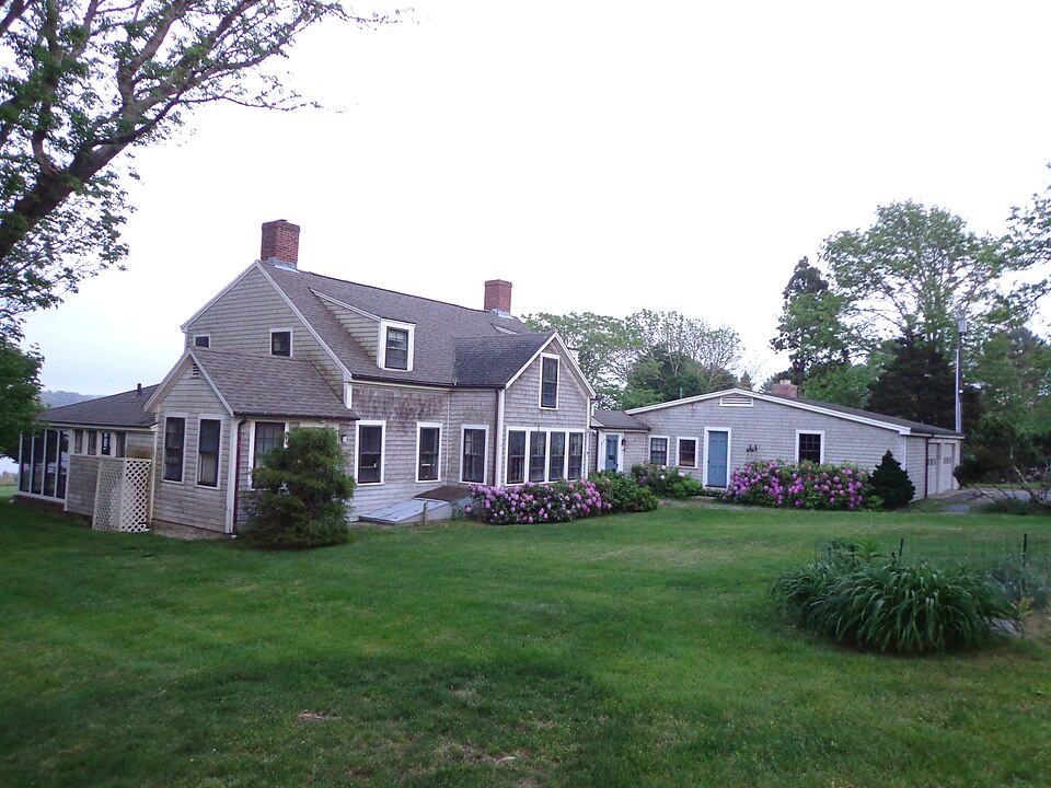
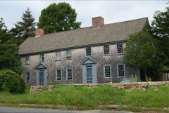
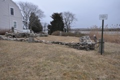
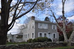
A National Historic Landmark. Built in 1780. Listed on the National Register of Historic Places in
1974. A historic map-sheet match is not published yet. The record needs a coordinate-quality review before it can be joined to a sheet boundary.
From the record
“The Paul Cuffe Farm is a National Historic Landmark on 1504 Drift Road in Westport, Massachusetts. The house was traditionally and incorrectly believed to be owned by Paul Cuffe (1759-1815), a prominent farmer and merchant of African American and Native American ancestry.”
Wikipedia article Paul Cuffe Farm, CC BY-SA 4.0.
one of 272 National Register listings in Bristol County · listed in 1974 · category: Building · built in 1780 · one of 8 National Historic Landmarks in Bristol County.
National Register reference number.74000394- the number the National Park Service assigned this property when it was listed, and the key its nomination file is catalogued under at the National Archives.
At the south end of the town of Westport lies a small harbor, at the mouth of Westport River, "fortunate in the natural position of its boundaries," and favorable for a good harbor, so situated that one of the boundaries of the harbor laps by the other so as to completely mislead one as to the entrance thereto. So complete is the deception that during the Revolutionary war it gained the name of the " Devil's Pocket-Hole," as vessels acquainted could enter, sail up the river a short distance, and drop their sails at the wharves of Westport Point, where only the masts could be seen, but no manner of admittance thereto; and such was the anger of the Britishers at being thus foiled of their prey that they, after cruising back and forth, in wrath would open fire upon the hamlets lying along the shore, and during one of these flurries the south side of the present dwelling of G. Frederic Davis was carried away by a shell from a vessel lying about half a mile off the shore, marks of which the ancient building carried till thoroughly renovated a few years since.
Militia. - From 1664 until 1787, a period of one hundred and twenty-three years, the local militia of that section of country now Westport formed a part of the military forces of Dartmouth, which forces were, in 1667, by the Colonial Court ordered to submit to the orders of Sergt. James Shaw and Arthur Hatherway, who by the authority of the said court were appointed to exercise the men in arms in the town of Dartmouth. About six years later, viz., March 4, 1673, John Smith was appointed and commissioned lieutenant commandant of all the local militia of Dartmouth, and consequently of those residing within the limits of what subsequently became Westport. Lieut. Smith's subordinate officer was Jacob Mitchell, who was commissioned ensign-bearer.
Regional context, not property-specific
evidence. The
federal wildfire occurrence database
lists 26 fires within 5 miles of Cuffe, Paul, Farm between
2005 and 2020, burning about 18 acres in total. None started naturally. 5 were recorded as arson.
Distance is straight-line from the map coordinates, so a fire counted
here may appear on a neighbouring settlement's page as well.
Reported cause
Fires
Missing data/not specified/undetermined
12
Arson/incendiarism
5
Debris and open burning
4
Recreation and ceremony
2
Power generation/transmission/distribution
1
Misuse of fire by a minor
1
Fireworks
1
The most recent of
them, most recent first, with the day each was reported and the service
that recorded it.
Regional context, not property-specific
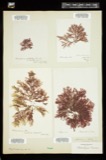
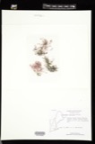
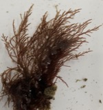
evidence. Museums hold 1,799 specimens
collected within 10 miles of Cuffe, Paul, Farm between 1824 and
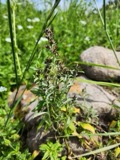
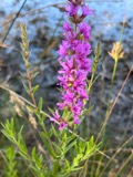
1975: 826 Animalia, 663 Plantae, 157 Fungi, 141 Chromista, 8 Bacteria, 4 Unrecorded. 12 distinct Species records are shown.
Collected by 99121, A. B. Gridley, A. B. Hervey and others. Each is a
physical object with a catalogue
number, and each entry opens the museum's record. This is what was
collected and kept, not a survey of what lives here - nothing can be
concluded from a species being absent.
Regional context, not property-specific
evidence. The federal mineral resources record lists
5 workings within 5 miles of Cuffe, Paul, Farm: 4 past producers, 1 producer.
1 still produces. What was taken out: Sand and Gravel, Construction, Stone. Distance is straight-line from the
map coordinates, so a quarry counted here may appear on a neighbouring
settlement's page as well.
No historic map-sheet match is published
for this property yet. That does not mean no map exists. This record needs
a coordinate-quality review before it can be joined to a sheet boundary.
Browse the county's mapped places while that work is
pending.
Listed places nearby
3 within 8 miles
Other National Register properties close
enough to walk or drive between, ordered by distance from this one. Both
positions come from the same geocoding pass that matched these properties
to their map sheets.
Listing record. National Park Service National Register of Historic Places, listed-properties dataset, current to 2026-05-22.
Map join. Address geocoded through the United States Census geocoder, then tested against the published boundary of every sheet in the USGS Historical Topographic Map Collection.
How this page is made. Listing fields come from federal records; map-sheet coverage is a labelled coordinate-to-boundary calculation, not a source-field claim.
Wildfire. Short, Karen C. 2022. Spatial wildfire occurrence data for the United States, 1992-2020 [FPA_FOD_20221014]. 6th Edition. Fort Collins, CO: Forest Service Research Data Archive. https://doi.org/10.2737/RDS-2013-0009.6 Collected with United States Government funding and usable without additional permissions or fees.
Specimens. Global Biodiversity Information Facility (GBIF), https://www.gbif.org/. Only records licensed CC0 or CC BY are used. Records licensed CC BY-NC are excluded because this site carries advertising. Images are checked individually and any whose licence is non-commercial, no-derivatives or unreadable is refused.
Mines and quarries. USGS Mineral Resources Data System (MRDS) https://mrdata.usgs.gov/mrds/ A work of the United States government, no copyright under 17 U.S.C. 105.
 Block
Block