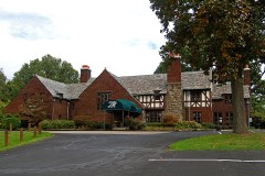
Listed on the National Register of Historic Places in
1974. A historic map-sheet match is not published yet. The record needs a coordinate-quality review before it can be joined to a sheet boundary.
From the record
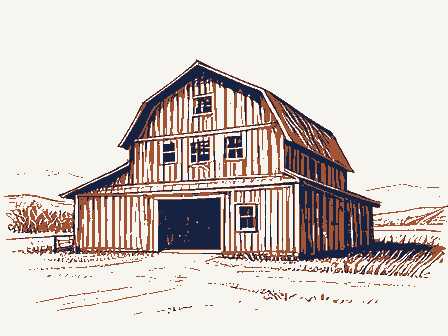
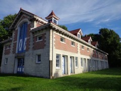
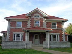
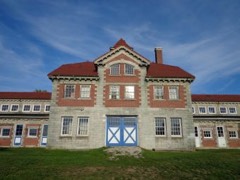
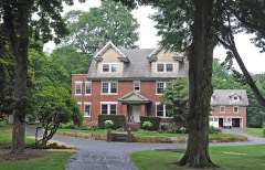
“Barber Machine Barn, also called the Implement House. built in 1911, is an historic farm building located on Austin Drive on the Anna-Dean Farm in Barberton, Ohio. It was built by American businessman and industrialist Ohio Columbus Barber, the developer of both Barberton, which he envisioned as a planned industrial community, and the nearby 3,500-acre (14 km2) Anna-Dean Farm, which he envisioned as a prototype for modern agricultural enterprise.”
Wikipedia article O. C. Barber Machine Barn, CC BY-SA 4.0.
one of 137 National Register listings in Summit County · listed in 1974 · category: Building · one of 1 National Historic Landmarks in Summit County.
National Register reference number.74001627- the number the National Park Service assigned this property when it was listed, and the key its nomination file is catalogued under at the National Archives.
Specimens collected near this property
12 of 696 shown
Regional context, not property-specific
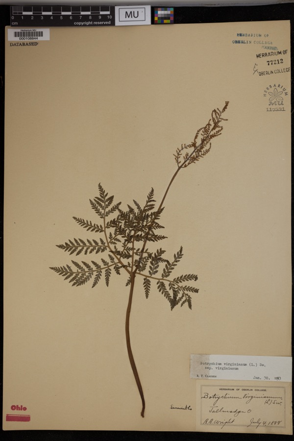
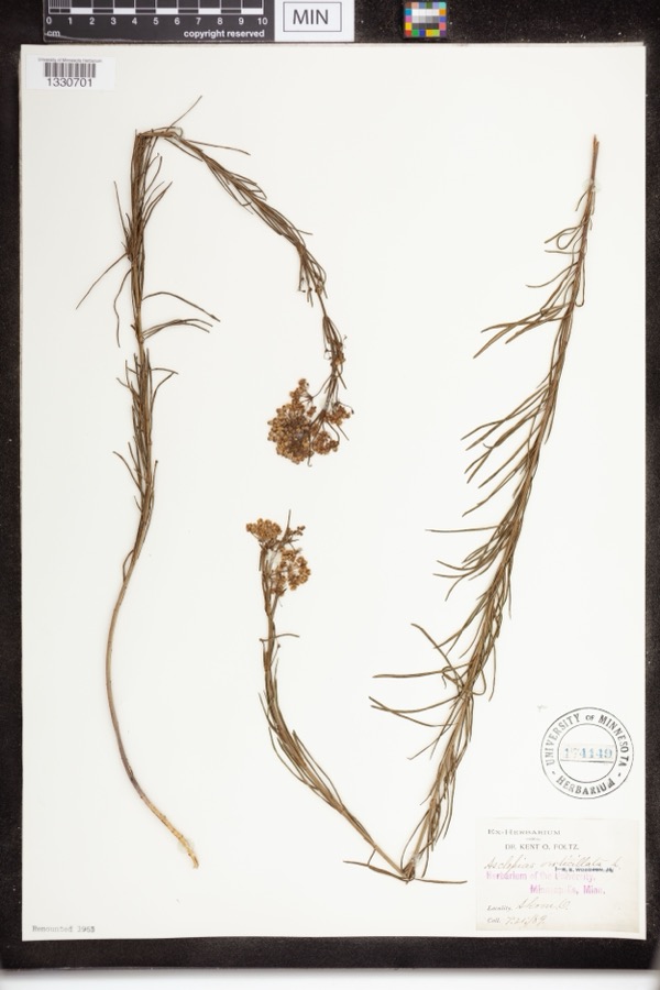
evidence. Museums hold 696 specimens
collected within 10 miles of Barber, O. C., Machine Barn between 1867 and
1975: 590 Animalia, 61 Plantae, 43 Fungi, 1 Unrecorded, 1 Bacteria. 12 distinct Species records are shown.
Collected by (no collector listed), A. W. Cusick, A. Woolman and others. Each is a
physical object with a catalogue
number, and each entry opens the museum's record. This is what was
collected and kept, not a survey of what lives here - nothing can be
concluded from a species being absent.
Regional context, not property-specific
evidence. The federal mineral resources record lists
11 workings within 5 miles of Barber, O. C., Machine Barn: 5 past producers, 5 producers, 1 plant.
6 still produce. What was taken out: Sand and Gravel, Construction, Stone, Crushed/Broken, Stone, Crushed/Broken, Clay, Coal, Limestone, General. Distance is straight-line from the
map coordinates, so a quarry counted here may appear on a neighbouring
settlement's page as well.
Regional context, not property-specific
evidence. The National Weather Service names
Barberton, the town this property stands in, in 29 storm reports between 1994 and 2019: 15 thunderstorm wind, 10 hail, 3 flash flood, 1 lightning.
No death or injury is recorded in these reports. Each account below is quoted exactly as the forecast office
filed it, from the NOAA Storm Events Database, and each date
opens the federal record of that event.
Torrential rainfall on July 10th ended the streek of 13 days of measurable rain in the Barberton-Norton region, and ending it with the highest rainfall amounts measuring during that time. Almost seven inches of rain fell in the two weeks prior, and on the 10th rainfall amounts in the basin measured between 2 to 3 inches which fell in the hour between 230 and 330 PM. This extreme rainfall rate fell over already saturated ground and swollen stream and creeks, resulting in rapid runoff and flooding. Heavy rainfall of this magnitude overwhelmed the existing stormwater systems with extensive street flooding throughout Barberton. In many areas of Barberton the flooded streets drained within a few hours leaving many flooded basements, garages and yards. After the flash flooding had stopped, the upstream routed water caused the flood waters to continue a slow rise in Barberton. These areas began flooding during the night of July 10 and by the morning of July 11th flooding was reaching into new areas. Flood waters in most areas receded by Sunday July 14th leaving behind large areas of the City needing clean-up operations. The City estimates that over 700 buildings suffered some form of water intrusion including sewage backups.||14TH, 15TH & 16TH STREETS NW WOLF CREEK|Flooding began during the intense rain on the afternoon of July 10th and the area remained underwater for three days. The flooding closed bridges across Wolf Creek at Wooster Road West, Brady Ave., Norton Ave., and Barber Road in the City of Norton leaving only the Hopocan Ave. bridge crossing Wolf Creek in Barberton accessible. Over sixty businesses and residences reported flooding issues.|||NORTON AVE. BARBER ROAD, MIAMI ST. - WOLF CREEK|Rising waters of Wolf Creek over the night of July 10-11 flooded the commercial area on Norton Ave. Residents of the Shamrock Motel were evacuated on July 11 and businesses along the north side of Norton Ave. experienced up to two feet of flooding. Over thirty business and residences experienced flooding problems.||30th and 31ST STREETS NW, SOUTH AVE. - HUDSON RUN |Hudson Run experienced a rapid rise in floodwaters during the heavy rainfall in northwest Barberton and Norton. Flood conditions developed rapidly and affected a large Senior Citizen Complex that required evacuation by Barberton Safety Forces on the evening of July 10th along with a number of residences on 31st St. NW and South Ave. Floodwaters overtopped the spillway at the Columbia Lake Dam, about three-quarters of a mile downstream from Wooster Road and closed Hudson Run Road for a short period of time until gates on the dam were opened. |||COVENTRY ROAD , EAGON STREET INDUSTRIAL AREAS MUD RUN|Six businesses and three residences were affect by the floodwaters of Mud Run.||5TH ST. NE INDUSTRIAL AREA TUSCARAWAS RIVER|Three large industries were affected by flooding of parts of their complexes.
Barberton is at the headwaters of the Tuscarawas watershed and receives water from 3 additional tributaries; the Wolf Creek, Mud Run, and Hudson Run. On the morning of the 17th these basins received an estimated 3 inches of. The heaviest rain fell after 4 AM with severe flooding starting by 5 AM. June was a particularly wet month with around 2 inches of rain having fallen on the 16th. This enhanced runoff and made already swollen creeks overrun their banks on the 17th. Barberton is in a low area, so in addition to the rain the city receives, rain from surrounding areas flows into it, slowly putting the small city underwater. Up to three feet of 04water submerged some streets and up to six feet flooded many basements. The most significant impacts were from the Wolf Creek which flows south through Barberton. Flooding on 14th Street Northwest had up to 6 feet of water in their basements. Barber Road off ramp from I-76 was closed due to flooding. Miller Road between Brecksville and Barr Road, another main thruway was closed due to flooding. Several home and business owners were evacuated.
Many trees, power lines and utility poles were downed in the southern part of the county. A wind gust of 74 miles per hour was reported in Barberton and an 84 mile per hour gust was reported at Akron Canton Airport. Roofs of buildings at the airport were damaged as well the nose gear of an airplane. At Portage Lakes, boats were ripped from their moorings and turned upside down.
No historic map-sheet match is published
for this property yet. That does not mean no map exists. This record needs
a coordinate-quality review before it can be joined to a sheet boundary.
Browse the county's mapped places while that work is
pending.
From the nomination file
1,343 words on record
When this property was proposed for the
National Register, someone wrote the case for it: what the building is,
and why it matters. That document is a federal record in the public domain.
It is quoted below word for word, never summarised. The text was read off the scanned case file by machine, so the
occasional stray character is the recogniser's and the 1970s
typewriter's.
Description of the property
Fair large second-story double door which is topped by stepped gable. buildings on the Anna Dean Farm that does not symmetrical facades. is steel.The building measures approximately 70'x 120': The PERIOD (Check One or More as Appropriate) - Pre-Columbian! * 20th Century - Political - Urban Planning - Science - Theater - Transportation in 1905 by Michael Alexander, who had been commissioned by Ohio The Anna Dean Farm, named for his daughter Anna and her husband Dean, was the fulfillment of Barber's dream to build the world's three buildings, including a forty-room mansion and twelve acres of greenhouse space.
Barber, a great advocate of scientific The Machine Barn, along with the Colt Barn, is one of the ten remaining Anna Dean Farm buildings, and one of the last two on the Piggery and the Creamery, have already been placed on the National Register. A nearby housing development, the Austin Estates, 1 7 1974 Conservation Commerce Architecture area. losophy Military
Statement of significance
accepted to the National Register. Sculpture Industry machinery could be driven up the ramp to the second story service sued for non-payment of taxes.He foundeda town near New Portage Social/Human- and called it Barberton. The 2oo0 acre estate containing the Anna Dean Farm was laid out in 19ll and was designed so that even the largest piece of Other (Specify) SPECIFIC DATE(S) (If Applicable and Known) Columbus Barber, a wealthy industrialist. Barber had moved his farming, invested in a great deal of farm machinery in the hope 1911 Art the owners might consider donating this area to the Barberton Parks Department for much needed park space if this building is greatest farm.When it was finished in 19l5,it contained twenty- RECEIVED
Quoted from the National Register nomination
for reference 74001627, 8 pages, held by the National Archives in Record
Group 79. See the
catalogue record.
Listed places nearby
6 within 8 miles
Other National Register properties close
enough to walk or drive between, ordered by distance from this one. Both
positions come from the same geocoding pass that matched these properties
to their map sheets.
Listing record. National Park Service National Register of Historic Places, listed-properties dataset, current to 2026-05-22.
Map join. Address geocoded through the United States Census geocoder, then tested against the published boundary of every sheet in the USGS Historical Topographic Map Collection.
How this page is made. Listing fields come from federal records; map-sheet coverage is a labelled coordinate-to-boundary calculation, not a source-field claim.
Specimens. Global Biodiversity Information Facility (GBIF), https://www.gbif.org/. Only records licensed CC0 or CC BY are used. Records licensed CC BY-NC are excluded because this site carries advertising. Images are checked individually and any whose licence is non-commercial, no-derivatives or unreadable is refused.
Mines and quarries. USGS Mineral Resources Data System (MRDS) https://mrdata.usgs.gov/mrds/ A work of the United States government, no copyright under 17 U.S.C. 105.
Storms. NOAA National Centers for Environmental Information, Storm Events Database https://www.ncei.noaa.gov/stormevents/ A work of the United States government, no copyright under 17 U.S.C. 105. Narratives are quoted verbatim from the National Weather Service report and are not edited or summarised.
 Block
Block