Listed on the National Register of Historic Places in
1974. A historic map-sheet match is not published yet. The record needs a coordinate-quality review before it can be joined to a sheet boundary.
From the record
“Battles, removed from Philadelphia to Cumberland county. Pa., where he sojourned for less than two years, thence directing his steps to what was then called the farther west, located in September, 1833, one and one-half miles north of what is now known as the village of Shreve.”
History of Wayne County, Ohio, from the Days of the Pioneers and the First Settlers to the Present Time (1878). Machine-read text.
one of 18 National Register listings in Wayne County · listed in 1974 · category: Building.
National Register reference number.74001647- the number the National Park Service assigned this property when it was listed, and the key its nomination file is catalogued under at the National Archives.
Thomas McConkey, was born in Washington county. Pa., in 1 78 1, and removed to Ohio about the beginning of the war of 1 8 12. He first stopped a short time in Wooster, purchased a farm near Millbrook, remained there a year, and then removed to the farm a short distance east of Shreve, where he lived until his death, Feburary 29, 1869, having in the meantime accumulated seven hundred acres of land. He was married to Elizabeth Hague, and had two sons and seven daughters. He was a member of the Disciple church, and served three years as Justice.
Thomas S., the father of Dr. Battles, removed from Philadelphia to Cumberland county. Pa., where he sojourned for less than two years, thence directing his steps to what was then called the farther west, located in September, 1833, one and one-half miles north of what is now known as the village of Shreve. His father being a farmer, young Battles had an agreeable future, such as we record of Firestone; plying the arts of husbandry and the tillage of the soil. Here he discovered the true alchemy of transforming a clod into a loaf of bread; and as he uprooted saplings with his mattock, and leveled the golden grain with his old-time cradle, we fancy that whatever was ideal in his nature became grossly realistic. There can be no doubt, however, but that the Doctor exalted the province of agriculture ; and he absolutely claims that whatever honor attaches to the profession of a rail-splitter he is entitled to a share of it, as well as Hanks, or Abe Lincoln. At the age of nineteen a change came over the spirit of his dream ; he resolved to abandon the farm. His first adventure in academic fields was at Hayesville, Ashland county, where in the skirmish of research and the battle of books, he concluded his course at the end of seventeen weeks. At the age of twenty he taught his first school. On the 6th of August, 1847, he entered the office of Dr. T. H. Baker, of Millbrook, with whom he remained for a term of four years, teaching school during all this time, with the exception of six months, both winter and summer.
Regional context, not property-specific
evidence. The
federal wildfire occurrence database
lists 2 fires within 5 miles of Kister Mill between
2004 and 2010, burning about 3 acres in total. None started naturally. None was recorded as arson.
Distance is straight-line from the map coordinates, so a fire counted
here may appear on a neighbouring settlement's page as well.
Reported cause
Fires
Debris and open burning
2
The most recent of
them, most recent first, with the day each was reported and the service
that recorded it.
Regional context, not property-specific
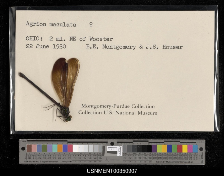
evidence. Museums hold 2,543 specimens
collected within 10 miles of Kister Mill between 1877 and
1975: 2,106 Animalia, 245 Plantae, 153 Fungi, 38 Chromista, 1 Unrecorded. 12 distinct Species records are shown.
Collected by A C ALLEN, A. D. Selby, A. E. Good and others. Each is a
physical object with a catalogue
number, and each entry opens the museum's record. This is what was
collected and kept, not a survey of what lives here - nothing can be
concluded from a species being absent.
No historic map-sheet match is published
for this property yet. That does not mean no map exists. This record needs
a coordinate-quality review before it can be joined to a sheet boundary.
Browse the county's mapped places while that work is
pending.
From the nomination file
1,455 words on record
When this property was proposed for the
National Register, someone wrote the case for it: what the building is,
and why it matters. That document is a federal record in the public domain.
It is quoted below word for word, never summarised. The text was read off the scanned case file by machine, so the
occasional stray character is the recogniser's and the 1970s
typewriter's.
Description of the property
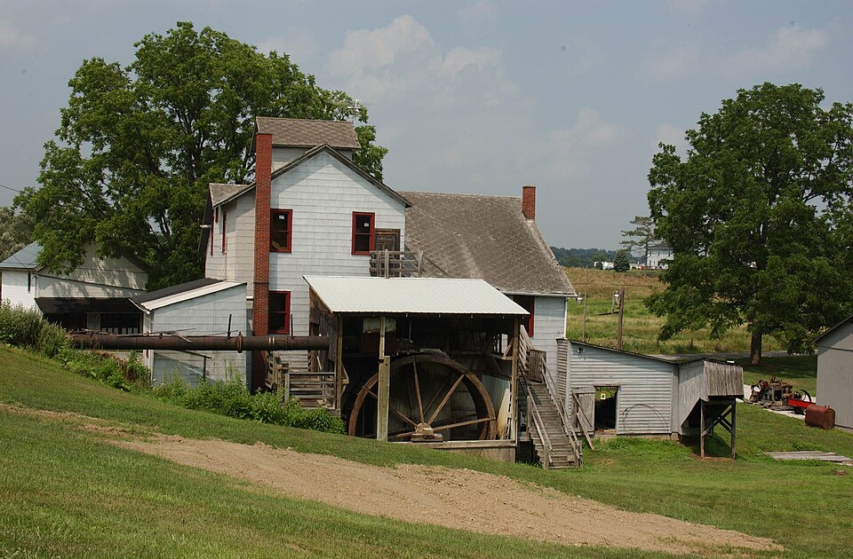
the village spreading along it, the Kister Mill at its end. installed in 1881. In 1894 the old mill structure was lower interior floor is a wood and metal shop: it also houses last member of the Kister family to own the site, removed the only mafor alteration to the mill since 1t was built in 1894. (The mill does have modern shingle siding.) For example, the present waterwheel, built in 1967, is the CONDITION REGISTER NATIONAL The entire The basic rectangular central structure is of braced-frame use. RECEIVED changes caused by continuing repairs. enclosed shed on the north houses a cider press. construction with numerous attached open and closed sheds.
never been idle since it was constructed; consequently, any The sawmill was installed at this time; soon after a The Kister Mill is located in the small village of Millbrook, - Good - Fair - Deteriorated for cereal grains. on the west side. the mill, in a separate structure, is the overshot waterwheel, waterwheel from the main structure about 40 years ago, the JUL2 purposes the mill is the same as it was in 1894 save for work on the structure should be considered Ruins The Kisters bought the mill site, a fulling mill, about 1850. roller mill replaced the grist stones.For all practical The eastern, open shed shelters a circular sawmill.
The dismantled and the present building was constructed from the The third floor contains storage bins which supported a large l9th century milling industry, Grist, The second floor is Saw, and Fulling.Only a half mile long mill race is left, the main pulleys and line shafts.
originally built grist mill equipment, including waterwheels, the services offered by the mill, and much of the equipment, It should be noted that the building, equipment, and site basic structure, and equipment configuration? The importance of this site will never diminish, only increase Commerce Communications Military Architecture Theater Conservation Transportation losophy Religion/Phi Aboriginal Industry Literature Engineering itarian Agriculture Music Political Landscape the present business. Invention Urban Planning remaining milling enterprise operated by a waterwheel. in the coming years. It is not a curiosity nor a restoration, but a practical its operation.
required;the present owners should be given all the encouragement possible to keep the mill in repair and in this shop.) the present owners hope to maintain and operate the mill as date to the early 188ois when Mr.Kister's father established Though the mill is no longer owned by the Kister family, Other (Specify) AREAS OF SIGNIFICANCE (Check One or More as Appropriate) a grist mill, and a cider press. Some finished lumber can in keeping the mill in repair, so different than the usual mill is of vast importance, for no costly restoration is shingles--it is doubtful other attempted, for what time period does one "restore" to when There is one full-time employee. Most of operating.
1894 Art (The Kister family are in excellent condition;obviously no pains were spared there is no break in the continuity of milling services, should be The Kister Mill is unique in Ohio:It is the last (1974),still lives near the mill and informally superintends
Quoted from the National Register nomination
for reference 74001647, 10 pages, held by the National Archives in Record
Group 79. See the
catalogue record.
Listed places nearby
6 within 8 miles
Other National Register properties close
enough to walk or drive between, ordered by distance from this one. Both
positions come from the same geocoding pass that matched these properties
to their map sheets.
Listing record. National Park Service National Register of Historic Places, listed-properties dataset, current to 2026-05-22.
Map join. Address geocoded through the United States Census geocoder, then tested against the published boundary of every sheet in the USGS Historical Topographic Map Collection.
How this page is made. Listing fields come from federal records; map-sheet coverage is a labelled coordinate-to-boundary calculation, not a source-field claim.
Wildfire. Short, Karen C. 2022. Spatial wildfire occurrence data for the United States, 1992-2020 [FPA_FOD_20221014]. 6th Edition. Fort Collins, CO: Forest Service Research Data Archive. https://doi.org/10.2737/RDS-2013-0009.6 Collected with United States Government funding and usable without additional permissions or fees.
Specimens. Global Biodiversity Information Facility (GBIF), https://www.gbif.org/. Only records licensed CC0 or CC BY are used. Records licensed CC BY-NC are excluded because this site carries advertising. Images are checked individually and any whose licence is non-commercial, no-derivatives or unreadable is refused.
 Block
Block