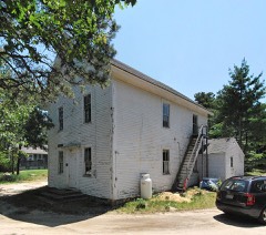
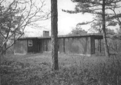
Built in 1901. Listed on the National Register of Historic Places in
1975. A historic map-sheet match is not published yet. The record needs a coordinate-quality review before it can be joined to a sheet boundary.
From the record
“The Marconi Wireless Station Site in South Wellfleet, Massachusetts, USA is the site of the first transatlantic wireless communication between the United States of America and Europe, on January 18, 1903. At this location, now part of the Cape Cod National Seashore, inventor Guglielmo Marconi erected a large antenna array on four 210-foot (64 m) wooden towers, and established a transmitting station powered by kerosene engines that produced the 25,000 volts of electricity needed to send signals to a similar station in Poldhu, Cornwall, United Kingdom.”
Wikipedia article South Wellfleet Marconi Station, CC BY-SA 4.0.
one of 145 National Register listings in Barnstable County · listed in 1975 · category: Site · built in 1901.
National Register reference number.75000158- the number the National Park Service assigned this property when it was listed, and the key its nomination file is catalogued under at the National Archives.
Fires near this property
72 since 1992
Regional context, not property-specific
evidence. The
federal wildfire occurrence database
lists 72 fires within 5 miles of Marconi Wireless Station Site between
1992 and 2020, burning about 28 acres in total. 2 started naturally. 2 were recorded as arson.
Distance is straight-line from the map coordinates, so a fire counted
here may appear on a neighbouring settlement's page as well.
Reported cause
Fires
Missing data/not specified/undetermined
26
Recreation and ceremony
11
Equipment and vehicle use
9
Debris and open burning
7
Smoking
5
Power generation/transmission/distribution
5
Fireworks
3
Arson/incendiarism
2
Natural
2
Misuse of fire by a minor
1
Other causes
1
The most recent of
them, most recent first, with the day each was reported and the service
that recorded it.
Regional context, not property-specific
evidence. Museums hold 2,218 specimens
collected within 10 miles of Marconi Wireless Station Site between 1819 and
1975: 1,280 Animalia, 699 Plantae, 68 Chromista, 63 Bacteria, 58 Unrecorded, 50 Fungi. 12 distinct Species records are shown.
Collected by A. R. Alan Hodgdon Hodgdon, A. R. Hodgdon, A. R. Hodgdon; G. B. Rossbach and others. Each is a
physical object with a catalogue
number, and each entry opens the museum's record. This is what was
collected and kept, not a survey of what lives here - nothing can be
concluded from a species being absent.
Regional context, not property-specific
evidence. The federal mineral resources record lists
1 working within 5 miles of Marconi Wireless Station Site: 1 past producer.
None of them still produces. What was taken out: Sand and Gravel, Construction. Distance is straight-line from the
map coordinates, so a quarry counted here may appear on a neighbouring
settlement's page as well.
No historic map-sheet match is published
for this property yet. That does not mean no map exists. This record needs
a coordinate-quality review before it can be joined to a sheet boundary.
Browse the county's mapped places while that work is
pending.
From the nomination file
2,764 words on record
When this property was proposed for the
National Register, someone wrote the case for it: what the building is,
and why it matters. That document is a federal record in the public domain.
It is quoted below word for word, never summarised. The text was read off the scanned case file by machine, so the
occasional stray character is the recogniser's and the 1970s
typewriter's.
Description of the property
-Moved - Ruins - Unexposed (Check One) X Original Site Remains of the station include: (1) the concrete base of the frame transmitter house--this base measures 26 feet, 7 inches (W to E), 27 feet (N to S). There are also 22 inch concrete strips on each side for wall support: This floor, as were all the others, is approximately 13 inches thick. Present on this floor are the heavy iron lugs which anchored the rotorgap disc and its motor. (2) part of the concrete corridor, 30 feet in length, 4 feet 2 inches wide plus 22 inch wall supports on each side. Ocean end has broken off. This corridor connected the transmitter house with the powerhouse (the latter's base slipped into the sea years ago). (3) A few fragments of the powerhouse walls are 5 brick layers thick (about 21 inches).
(4) the northwest tower concrete base has been exposed and measures 24 feet square--it is at least four feet thick as is testified by measurement of an easternmost base which lies on the beach 100 feet below its original site. The SW tower base still lies buried in the sand. These bases are made of rubble., pebbles and rocks (some measuring 4x8 inches in size) cemented together. The probably scant remains of the pile-supported frame administration building and quarters, which lay a short distance west of the tower, are entirely buried under the dunes. Original structures of the site included four towers and several buildings. Significance: 1st Order Longitude and Latitude: See Section 10 Acreage: 1 acre; surrounding dunelands owned by Federal Government.
Treatment Recommended: Preservation. Preliminary cost estimate for above: $150.00 annually Photograph enclosed. RECEIVED APR1 1975 NATIONAL REGISTER 9 INSTRUCTIONS
Statement of significance
] 18th Century - 19th Century [x 20th Century Political Urban Planning Religion/Phi- [X Other (Specify) losophySite of Marconi's Ist [X Science translantic American ]Sculpture Wireless Station. Social/Human- itarian Theater Transportation The Marconi wireless station, from which emanated the first message from the U.S. to Europe (Jan. 18, 1903), is the only nationally signi- ficant historic site within the Cape Cod National Seashore. In November 1901, the original Marconi Wireless Station, South Well- fleet, was nearly complete. A storm in that month destroyed the original masts, a circular arrangement of 20 poles, 200 feet high. No trace of this antenna remains.
The powerhouse, corridor and transmitter house were un- damaged, and four-210 foot high wooden latticed towers, 200 feet apart, replaced the original antenna poles in 1902. Using two big kerosene engines, a Tesla transformer, an alternator, and a spark-gap transmitter, the station produced 30,000 watts of power. Operating primarily as a news source to ships at sea, Marconi station ran successfully until 1917, when three unrelated factors resulted in the dis- mantling of the equipment in 1922: (1) censorship imposed by World War I, (2) encroachment of the cliffs by the ocean, and (3) De Forest's invention (or development) of the vacuum tube, making spark-gap transmission obsolete. Marconi invented few things himself, but he greatly improved every- thing he borrowed.
His taking of the wireless lab "toy" and making it practical was one of the greatest technical achievements of man. Were Marconi alive today, he would doubtless occupy the top world position in electronic communications. No man better deserves the title "Father of modern electronic communications." Marconi station site came under control of the Federal Government with the inclusion of the site within the boundaries of Cape Cod National Seashore.
Quoted from the National Register nomination
for reference 75000158, 15 pages, held by the National Archives in Record
Group 79. See the
catalogue record.
Listed places nearby
6 within 8 miles
Other National Register properties close
enough to walk or drive between, ordered by distance from this one. Both
positions come from the same geocoding pass that matched these properties
to their map sheets.
Listing record. National Park Service National Register of Historic Places, listed-properties dataset, current to 2026-05-22.
Map join. Address geocoded through the United States Census geocoder, then tested against the published boundary of every sheet in the USGS Historical Topographic Map Collection.
How this page is made. Listing fields come from federal records; map-sheet coverage is a labelled coordinate-to-boundary calculation, not a source-field claim.
Wildfire. Short, Karen C. 2022. Spatial wildfire occurrence data for the United States, 1992-2020 [FPA_FOD_20221014]. 6th Edition. Fort Collins, CO: Forest Service Research Data Archive. https://doi.org/10.2737/RDS-2013-0009.6 Collected with United States Government funding and usable without additional permissions or fees.
Specimens. Global Biodiversity Information Facility (GBIF), https://www.gbif.org/. Only records licensed CC0 or CC BY are used. Records licensed CC BY-NC are excluded because this site carries advertising. Images are checked individually and any whose licence is non-commercial, no-derivatives or unreadable is refused.
Mines and quarries. USGS Mineral Resources Data System (MRDS) https://mrdata.usgs.gov/mrds/ A work of the United States government, no copyright under 17 U.S.C. 105.
 Block
Block

_native_range.jpg)