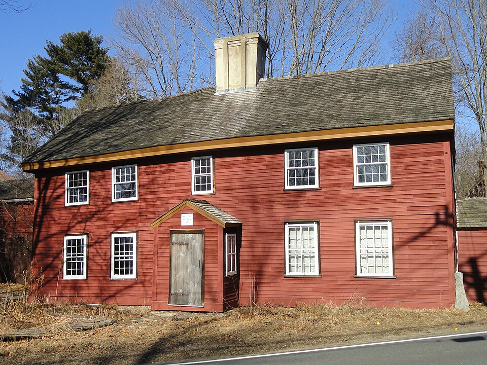
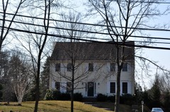
Built in 1685 in the First Period. Listed on the National Register of Historic Places in
1975. A historic map-sheet match is not published yet. The record needs a coordinate-quality review before it can be joined to a sheet boundary.
From the record
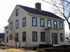
“The Benjamin Abbot House or Abbot Homestead is a historic house at 9 Andover Street in Andover, Massachusetts, USA. It was listed on the National Register of Historic Places in 1975.”
Wikipedia article Benjamin Abbot House, CC BY-SA 4.0.
one of 350 National Register listings in Essex County · listed in 1975 · category: Building · built in 1685, First Period · one of 2 National Historic Landmarks in Essex County.
National Register reference number.75000242- the number the National Park Service assigned this property when it was listed, and the key its nomination file is catalogued under at the National Archives.
To the scientific scholar who kindly prepared the geological introduction, not only the writer but the readers of these Sketches owe gratitude. His name is so well known that it does not need mention to friends of Andover, who will readily recognize the initials at the close of the chapter.
In regard to one or two points in the book a word may be added. Some repetitions of statement occur in regard to persons and events in the several chapters, for the reason that the subjectmatter is arranged topically rather than in the form of annals, and each chapter is intended to be sufficiently comprehensive to be in a measure independent of the other chapters. Many eminent names of Andover do not appear in these pages because the Sketches do not cover the departments of enterprise in which they were active, or the events in which they bore a conspicuous part.
Regional context, not property-specific
evidence. The
federal wildfire occurrence database
lists 74 fires within 5 miles of Abbot, Benjamin, House between
2007 and 2020, burning about 27 acres in total. 1 started naturally. 5 were recorded as arson.
Distance is straight-line from the map coordinates, so a fire counted
here may appear on a neighbouring settlement's page as well.
Reported cause
Fires
Debris and open burning
16
Smoking
16
Missing data/not specified/undetermined
12
Misuse of fire by a minor
8
Recreation and ceremony
7
Arson/incendiarism
5
Equipment and vehicle use
3
Railroad operations and maintenance
3
Power generation/transmission/distribution
3
Natural
1
The most recent of
them, most recent first, with the day each was reported and the service
that recorded it.
Regional context, not property-specific
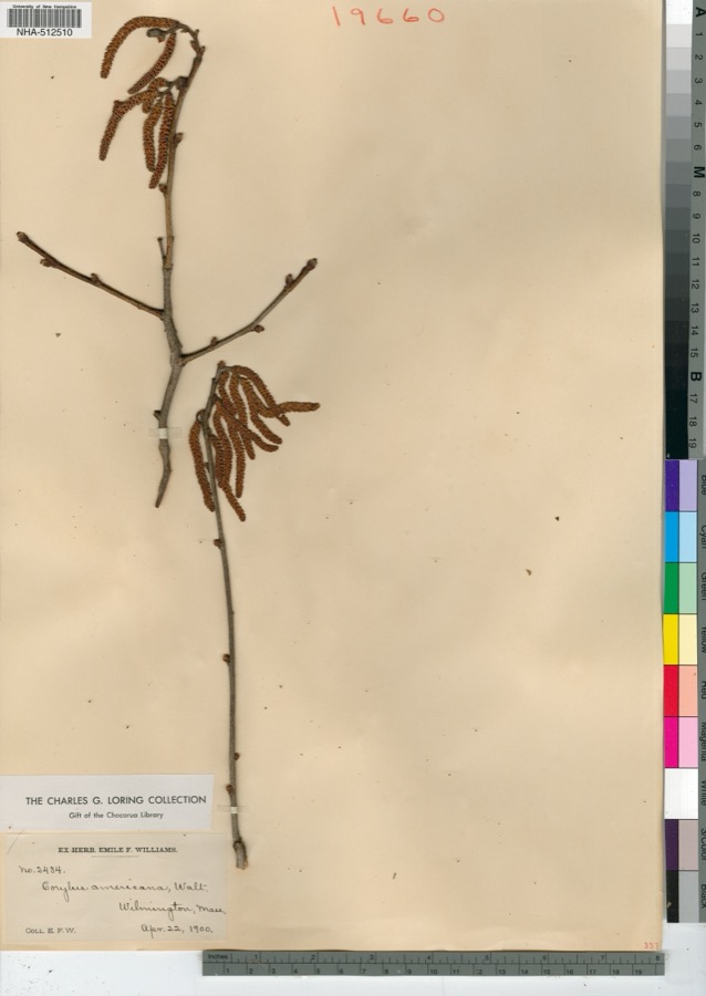
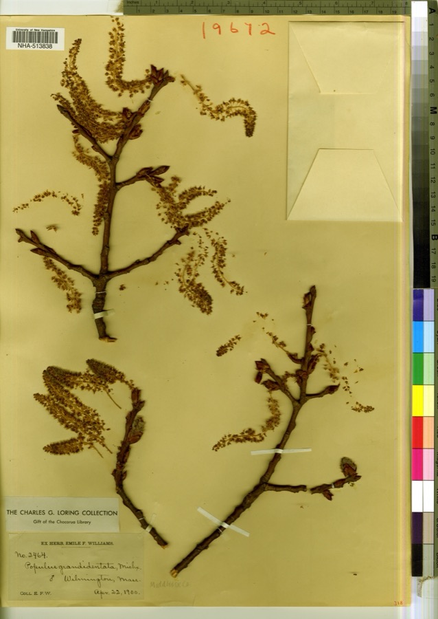
evidence. Museums hold 1,729 specimens
collected within 10 miles of Abbot, Benjamin, House between 1816 and
1975: 837 Animalia, 735 Plantae, 129 Fungi, 14 Bacteria, 5 Protozoa, 5 Chromista, 4 Unrecorded. 12 distinct Species records are shown.
Collected by A E Preble, A S Gaunt, A. C. Mathieson and others. Each is a
physical object with a catalogue
number, and each entry opens the museum's record. This is what was
collected and kept, not a survey of what lives here - nothing can be
concluded from a species being absent.
Regional context, not property-specific
evidence. The federal mineral resources record lists
12 workings within 5 miles of Abbot, Benjamin, House: 6 past producers, 3 producers, 2 unknowns, 1 plant.
4 still produce. What was taken out: Sand and Gravel, Construction, Titanium, Metal, Titanium, Stone, Crushed/Broken. Distance is straight-line from the
map coordinates, so a quarry counted here may appear on a neighbouring
settlement's page as well.
Regional context, not property-specific
evidence. The National Weather Service names
Andover, the town this property stands in, in 25 storm reports between 1994 and 2023: 12 thunderstorm wind, 5 flash flood, 3 lightning, 3 flood.
No death or injury is recorded in these reports. Each account below is quoted exactly as the forecast office
filed it, from the NOAA Storm Events Database, and each date
opens the federal record of that event.
Heavy rain fell across much of Lawrence and Andover, with the Automated Surface Observing System at Lawrence, MA (KLWM) recording 0.52 inches of rain in six minutes. This combined with a blocked culvert designed to drain runoff from Interstate 495 resulted in four to five feet of water inundating three homes on Binney Street in Andover. In addition, a large sinkhole formed on Shepard Street near the entrance of the Lawrence Industrial Park. Other reports of flooding included: motorists stuck in floodwaters on Route 133, flooding in the town hall basement, and minor street flooding.
Trees were downed in North Andover on Salem, Appleton, and Dale Streets in North Andover. A tree was downed onto a car on Abbot Street. In Andover, multiple trees were downed. In Georgetown, two trees and wires were downed on Route 133. Trees and power lines were downed on Baldpate Road in Boxford. One tree was downed on Route 110 in Merrimac and another on School Street.
No historic map-sheet match is published
for this property yet. That does not mean no map exists. This record needs
a coordinate-quality review before it can be joined to a sheet boundary.
Browse the county's mapped places while that work is
pending.
From the nomination file
3,873 words on record
When this property was proposed for the
National Register, someone wrote the case for it: what the building is,
and why it matters. That document is a federal record in the public domain.
It is quoted below word for word, never summarised. The text was read off the scanned case file by machine, so the
occasional stray character is the recogniser's and the 1970s
typewriter's.
Description of the property
The Benjamin Abbot House, c.1685, is situated in the Shawsheen River Valley,slightly southwest of the center of Andover. The structure faces due south and at one time commanded a view of the rolling farmland along the river's edge. Today the scene has changed. Progress has brought a widened road that literally curves around the southeast corner of the house. A graded and elevated section of the Boston and Maine Railroad blocks its northern view to the river. The roadway that was once a seldom travelled dirt path has been transformed into a busy thoroughfare connecting the center of Andover with the present interstate highway system.
The changes in its immediate vicinity bear witness to the fact that the Abbot House has seen its share of progress, yet the weathered clapboard facade with its garret overhang remains in a remarkably original state. (Figure 2). The house was built before 1720 and the traditional date of 1685 may be accurate. The building that remained in the Abbot family until 1933 grew to its present config- urations in four distinct stages (Figure 1). The first stage can be defined as a one-room house with end chimney built on the west side of the Shawsheen River in the Old South Parish of Andover (Figure 1,Sketch A). The exposed frame is heavy with simple flat chamfer and 'lamb's tongue' stops.
The ceilings are white washed and the chamber floor is supported by 3x5" joists at two-foot spacing and attached to a 14×11" pine summer beam by means of cog joints. Front and rear girts and plates measure 9" square and are also made of pine. The chimney and end girts measure 15%9" and are made of oak as are the shouldered corner posts.
/ARCHITECT The Benjamin Abbot House, 1685?, is significant as an extremely well preserved First Period house and as the earliest extant home of the locally important Abbot family. Standing on the west side of the Shawsheen River in the Old South Parish of Andover, the house is believed to have been built for Benjamin Abbot at the time of his marriage to Sarah Farnum in 1685. Benjamin Abbot was a farmer and fence surveyor in the town. He was also ane of a number of people who testified against Martha Carrier, who was hanged as a result.The building remained in the Abbot family until 1933 and today repre- sents the earliest standing house of the most prolific family of the settlement period of Andover (1646- early 1700's).
The Abbot family claimed more males on the town tax lists between 1705 and 1767 than any other family. Almost every family in town was related to the Abbots in some way. Because of its size, the Abbot family serves as a good example of the type of closely knit social world common to and necessary for the growth and development of an inland farming community in the 17th c. The house is architecturally significant because it retains most of its original fabric, which is extremely uncommon for a building nearly 300 years old. The framing techniques, particularly the garret overhang, the unusual early 18th c. panelling, the early mud and plaster walls and the great fireplaces and original flooring all present a complete and original picture of early Colonial architecture.
Quoted from the National Register nomination
for reference 75000242, 31 pages, held by the National Archives in Record
Group 79. See the
catalogue record.
Listed places nearby
6 within 8 miles
Other National Register properties close
enough to walk or drive between, ordered by distance from this one. Both
positions come from the same geocoding pass that matched these properties
to their map sheets.
Listing record. National Park Service National Register of Historic Places, listed-properties dataset, current to 2026-05-22.
Map join. Address geocoded through the United States Census geocoder, then tested against the published boundary of every sheet in the USGS Historical Topographic Map Collection.
How this page is made. Listing fields come from federal records; map-sheet coverage is a labelled coordinate-to-boundary calculation, not a source-field claim.
Wildfire. Short, Karen C. 2022. Spatial wildfire occurrence data for the United States, 1992-2020 [FPA_FOD_20221014]. 6th Edition. Fort Collins, CO: Forest Service Research Data Archive. https://doi.org/10.2737/RDS-2013-0009.6 Collected with United States Government funding and usable without additional permissions or fees.
Specimens. Global Biodiversity Information Facility (GBIF), https://www.gbif.org/. Only records licensed CC0 or CC BY are used. Records licensed CC BY-NC are excluded because this site carries advertising. Images are checked individually and any whose licence is non-commercial, no-derivatives or unreadable is refused.
Mines and quarries. USGS Mineral Resources Data System (MRDS) https://mrdata.usgs.gov/mrds/ A work of the United States government, no copyright under 17 U.S.C. 105.
Storms. NOAA National Centers for Environmental Information, Storm Events Database https://www.ncei.noaa.gov/stormevents/ A work of the United States government, no copyright under 17 U.S.C. 105. Narratives are quoted verbatim from the National Weather Service report and are not edited or summarised.
 Block
Block