BlockBefore
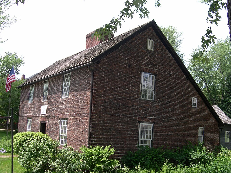
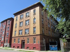
Photograph of Josiah Day House
Photograph by Thomas E Martin, Jr, CC BY-SA 4.0. Via Wikimedia Commons.

Day, Josiah, House

Listed on the National Register of Historic Places in 1975. A historic map-sheet match is not published yet. The record needs a coordinate-quality review before it can be joined to a sheet boundary.

From the record

“The Josiah Day House is a historic house museum at 70 Park Street in West Springfield, Massachusetts, United States. Built about 1754, it is believed to be the oldest known brick saltbox style house in the United States.”

Wikipedia article Josiah Day House, CC BY-SA 4.0.

one of 123 National Register listings in Hampden County · listed in 1975 · category: Building.

Sources: the Wikipedia article · the case file at the National Archives · the National Register database, National Park Service

The listing

  • What is counted as historic. The nomination lists 1 building as contributing to the listing.
  • Address. 70 Park St., West Springfield, 01089
  • When was it listed? 1975-04-16
  • Category. building
  • Township. West Springfield Town city
  • National Register reference number. 75000265 - the number the National Park Service assigned this property when it was listed, and the key its nomination file is catalogued under at the National Archives.

Fires near this property

478 since 2015

Regional context, not property-specific evidence. The federal wildfire occurrence database lists 478 fires within 5 miles of Day, Josiah, House between 2015 and 2020, burning about 160 acres in total. 18 started naturally. 3 were recorded as arson. Distance is straight-line from the map coordinates, so a fire counted here may appear on a neighbouring settlement's page as well.

Reported cause Fires
Missing data/not specified/undetermined262
Equipment and vehicle use121
Debris and open burning29
Recreation and ceremony27
Natural18
Smoking15
Misuse of fire by a minor3
Arson/incendiarism3

The most recent of them, most recent first, with the day each was reported and the service that recorded it.

DateCause SizeReported by Name on the report
8 September 2015Missing data/not specified/undeterminedunder an acreMassachusetts Bureau of Forest Fire Controlnot named
7 September 2015Missing data/not specified/undeterminedunder an acreMassachusetts Bureau of Forest Fire Controlnot named
6 September 2015Missing data/not specified/undeterminedunder an acreMassachusetts Bureau of Forest Fire Controlnot named
5 September 2015Missing data/not specified/undeterminedunder an acreMassachusetts Bureau of Forest Fire Controlnot named
4 September 2018Equipment and vehicle useunder an acreMassachusetts Bureau of Forest Fire Controlnot named
4 September 2016Equipment and vehicle useunder an acreMassachusetts Bureau of Forest Fire Controlnot named
3 September 2015Missing data/not specified/undeterminedunder an acreMassachusetts Bureau of Forest Fire Controlnot named

Every fire recorded in Hampden County

Specimens collected near this property

12 of 1,520 shown

Regional context, not property-specific evidence. Museums hold 1,520 specimens collected within 10 miles of Day, Josiah, House between 1844 and 1975: 596 Animalia, 521 Plantae, 360 Fungi, 32 Chromista, 11 Unrecorded. 12 distinct Species records are shown. Collected by A. B. Seymour, A. B. Seymour; S., A. E. Kirk and others. Each is a physical object with a catalogue number, and each entry opens the museum's record. This is what was collected and kept, not a survey of what lives here - nothing can be concluded from a species being absent.

Image SpeciesYear Collected by Where, as recorded
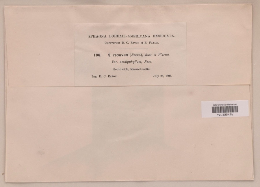
Specimen of Sphagnum recurvum P.Beauv.Sphagnum recurvum P.Beauv.1893Daniel C. Eaton
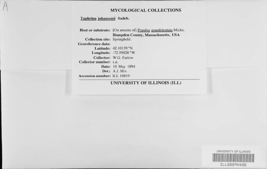
Specimen of Taphrina johansonii Sadeb.Taphrina johansonii Sadeb.1894W.G. Farlow
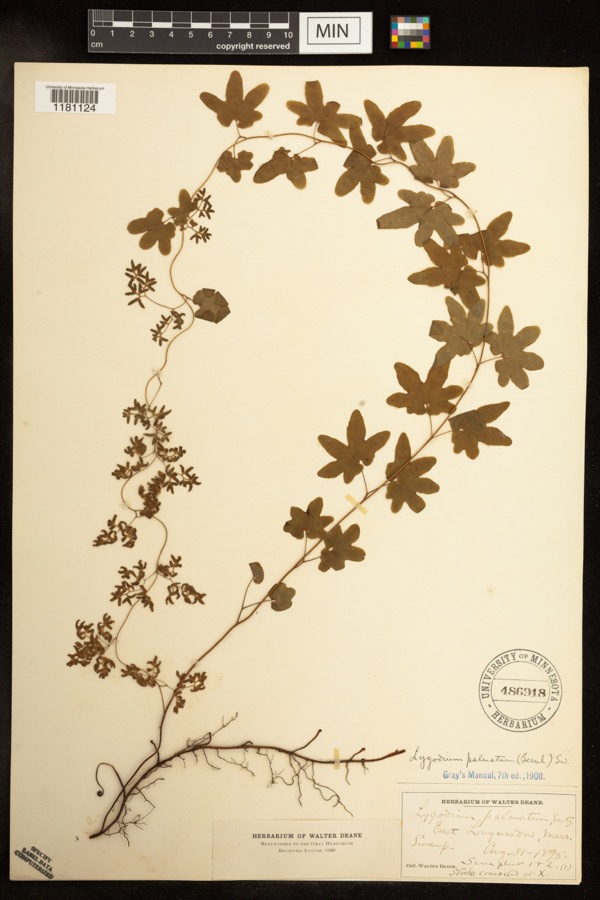
Specimen of Lygodium palmatum (Bernh.) Sw.Lygodium palmatum (Bernh.) Sw.1895Deane, WalterEast Longmeadow;;;;
A photograph of the species Carex siccata, not of this specimenCarex siccata Dewey1844Collector unknown
A photograph of the species Amphicarpaea bracteata, not of this specimenAmphicarpaea bracteata (L.) Fernald1845Collector unspecified
A photograph of the species Galeopsis tetrahit, not of this specimenGaleopsis tetrahit L.1845not recorded
A photograph of the species Alopecurus geniculatus, not of this specimenAlopecurus geniculatus L.1850not recorded
A photograph of the species Lactuca hirsuta, not of this specimenLactuca hirsuta Muhl. ex Nutt.1850Collector unspecified
A photograph of the species Carex canescens, not of this specimenCarex canescens L.1852Collector unknownWestfield.
A photograph of the species Carex pallescens, not of this specimenCarex pallescens L.1852Collector unknownWestfield
A photograph of the species Eurybia schreberi, not of this specimenEurybia schreberi (Nees) Nees1852C. A. Shurtleff
Alnus incana (L.) Moench1891unknownWoods Hall.

All 1,520 specimens within 10 miles, at the Global Biodiversity Information Facility.

Mines and quarries near this property

10 of 40 shown

Regional context, not property-specific evidence. The federal mineral resources record lists 40 workings within 5 miles of Day, Josiah, House: 20 past producers, 15 producers, 3 occurrences, 1 unknown. 16 still produce. What was taken out: Stone, Crushed/Broken, Sand and Gravel, Construction, Brick Clay, Clay. Distance is straight-line from the map coordinates, so a quarry counted here may appear on a neighbouring settlement's page as well.

Where SiteCommodity StatusRecorded
Construction Aggregates PitGranite, Stone, Crushed/BrokenProducer
Macia Emery MineEmeryOccurrenceEmery
W. New England Smelting Works IncCopperProducer
Bay State Refining Co--Chicopee, MaAluminumPlant
Chicopee PlantAluminumPast Producer
Sandstone QuarryStone, DimensionProducerSandstone
Sandstone QuarryFlagstonePast Producer
Sandstone QuarryStone, DimensionProducer
Sandstone QuarryStone, DimensionProducerSandstone
Sandstone QuarryFlagstonePast Producer

Every working recorded in Hampden County

Storms near this property

60 of 67 shown

Regional context, not property-specific evidence. The National Weather Service names West Springfield, the town this property stands in, in 67 storm reports between 1995 and 2022: 39 thunderstorm wind, 18 hail, 7 flood, 2 flash flood. The reports record 2 injuries. Each account below is quoted exactly as the forecast office filed it, from the NOAA Storm Events Database, and each date opens the federal record of that event.

WhenEvent Place namedHarm What the report says
July 2008Thunderstorm WindWest Springfield2 hurt, $10,000A tree on Interstate 91 near the Massachusetts Turnpike was downed by thunderstorm winds onto a car, puncturing the windshield. A 61 year old man and a 57 year old woman were injured. Rescuers had to cut through the tree before they could get to the people in the car. The man was able to climb out by himself once the tree was out of the way, but the woman had to be extricated. This also blocked both southbound lanes of Interstate 91 bringing traffic to a complete stop.
August 2013HailWest Springfield$3,000,000Quarter to half dollar size hail fell on Main Street, accumulating up to two inches in spots. A car on Fairview Avenue was damaged with numerous hail dents. There were also several reports of nickel size hail in the area of Riverdale Road. About 500 cars at the Balise family of car dealerships were damaged. Damage ranged from minimal to extensive. Further damage was found two weeks later, when heavy rain fell through small holes in the roof of Chestnut Middle School, resulting in water damage.
August 2006Thunderstorm WindWest Springfield$275,000no account filed
August 2011FloodWest Springfield$200,000After receiving three to eight inches of heavy rain from Tropical Storm Irene, flooding resulted in the closure of Route 20 in West Springfield at Sibley Avenue.
May 2010Thunderstorm WindWest Springfield$75,000Multiple utility poles and trees were downed across West Springfield and Agawam, including several utility poles along Route 5 in West Springfield.
May 2010Thunderstorm WindWest Springfield$50,000The Automated Surface Observing System at Barnes Municipal Airport (KBAF) recorded a wind gust of 58 mph. In addition, many trees and wires were downed by thunderstorm winds, including a four foot diameter oak tree on Morgan Road in West Springfield. On City View Avenue in West Springfield, a tree and utility pole were downed, blocking the road. Two power poles were downed near the intersection of East Elm Street and Riverdale Road.
May 2010Thunderstorm WindWest Springfield$30,000Trees and wires were downed along Route 20 in West Springfield and in Springfield. A large tree was downed onto a house on Forest Park Avenue in Springfield.
August 2004Thunderstorm WindWest Springfield$25,000no account filed
February 2016Thunderstorm WindWest Springfield$20,000Trees on Adrian Avenue, Craiwell Avenue, Upper Beverly Street, and Sibley Avenue in West Springfield were downed by thunderstorm winds.
June 2011Thunderstorm WindWest Springfield$20,000A tree on Cold Spring Avenue was downed onto a car by thunderstorm winds.
June 2010Thunderstorm WindWest Springfield$20,000Several trees were downed across West Springfield, including one down on a car on Route 5 near Memorial Bridge and one down on Circuit Avenue. Several large limbs were also downed on Fairview Avenue.
September 2008FloodWest Springfield$20,000Heavy rain associated with Tropical Storm Hanna ranged from three and a half to five and a half inches. This resulted in widespread street flooding across central Hampden County. The Union Street underpass in West Springfield was flooded. In Wilbraham, multiple roads were flooded, including Main Street and several locations on Route 20 and Route 32. Minor mudslides occurred on Route 32. Both Holyoke and Springfield experienced widespread street flooding. Route 32 and several other roads were rendered impassable by floodwaters in Monson. Several vehicles on these roads became disabled. In addition, three residences were flooded along a retention road.
July 2014Thunderstorm WindWest Springfield$15,000Trees were downed on several streets, including Park and Main. A tree was downed onto two cars on Amostown Road.
August 2005Thunderstorm WindWest Springfield$15,000no account filed
May 2006Thunderstorm WindWest Springfield$12,000no account filed
July 2014Thunderstorm WindWest Springfield$10,000Trees on Highland Avenue were downed by thunderstorm winds.
July 2014Thunderstorm WindWest Springfield$10,000A tree on High Street was downed by thunderstorm winds, blocking the road. Trees and wires along Prospect Avenue were downed as well.
August 2013Thunderstorm WindWest Springfield$10,000A tree was downed onto a car on Elm Street in West Springfield. In addition, a window was broken on Main Street, presumable from the windblown large hail.
May 2010Thunderstorm WindWest Springfield$10,000Trees on Cooper Street were downed by thunderstorm winds.
May 2006Thunderstorm WindWest Springfield$10,000no account filed
July 2002Thunderstorm WindWest Springfield$10,000no account filed
August 2021Thunderstorm WindWest Springfield$8,000In West Springfield, there were numerous trees downed by an isolated severe thunderstorm. On Elm Street there was a six-inch branch down. Trees were down on Woodmont Street and on Amostown Road at Fausey Drive. A large tree and wires were down on Piper Road. A large tree was down on a house on Churchill Street. Wires were down on on Vincent Drive, Morgan Road, and Smyrna Street.
July 2021Thunderstorm WindWest Springfield$6,000In West Springfield, a utility pole was down on Route 20 at Dewey Street. A tree was down on wires on Birnie Avenue.
July 2018Flash FloodWest Springfield$5,000At 2 PM EST, a thunderstorm moving over Westfield and West Springfield created downpours over the area. A car was trapped in flood waters on Old Westfield Road in West Springfield.
July 2018Flash FloodWest Springfield$5,000At 2:10 PM EST, heavy rain from a thunderstorm flooded and closed U.S.Route 20 in Westfield at the intersection with East Mountain Road. A car was trapped in the flood waters.
August 2016Thunderstorm WindWest Springfield$5,000A tree at the corner of Main Street and Burford Avenue was downed by thunderstorm winds.
August 2012FloodWest Springfield$5,000One car was stuck at a restaurant on Route 5. Water was up to the floor boards of another car on Prospect Street. The Automated Surface Observing System at Barnes Municipal Airport (KBAF) recorded 1.14 inches of rain in 20 minutes and a total of just under 1.50 inches.
August 2012FloodWest Springfield$5,000In West Springfield, West School Street was flooded and impassable. The River Street underpass also was flooded with a car stuck in the floodwaters. Meadow Street in Agawam was flooded and impassable.
August 2006Thunderstorm WindWest Springfield$5,000no account filed
August 2005Thunderstorm WindWest Springfield$5,000no account filed
August 2019Thunderstorm WindWest Springfield$1,500In West Springfield, trees were down on both Poplar Avenue and Park Avenue.
August 2019Thunderstorm WindWest Springfield$1,500In West Springfield, a tree fell down onto a house on Benedict Street.
August 2019Thunderstorm WindWest Springfield$1,000In West Springfield, trees and wires were down at Talcott Avenue and Wistaria Street.
June 2013Thunderstorm WindWest Springfield$1,000A large tree limb was downed by thunderstorm winds onto Rogers Avenue.
August 2012Thunderstorm WindWest Springfield$1,000Two large limbs were downed on West School and Norman Streets.
August 2012Thunderstorm WindWest Springfield$1,000Large tree limbs on Bear Hole Road and Prospect Streets were downed by thunderstorm winds.
July 2022Thunderstorm WindWest Springfield$500In West Springfield, a tree was reported down on wires at Butternut Hollow Road and Greystone Avenue.
July 2014Thunderstorm WindWest Springfield$500A large limb was downed onto Route 20.
July 2021Thunderstorm WindWest Springfield$300In the Feeding Hills section of Agawam, wires were down near 1004 North West Street.
July 2019HailWest Springfield-Penny sized hail was observed in West Springfield.
June 2018FloodWest Springfield-At 3:05 PM EST, street flooding was reported up to 1 foot deep at the intersection of Ely Avenue and Verdugo Street in West Springfield.
May 2017HailWest Springfield-At 7 PM EST, quarter size hail was reported in West Springfield.
June 2017HailWest Springfield-AT 152 PM EST, an amateur radio operator reported dime-size hail at West Springfield.
July 2014FloodWest Springfield-Portions of Route 20 were flooded and impassable.
June 2013FloodWest Springfield-In West Springfield, Morgan Road was flooded out.
February 2011HailWest Springfield-Dime sized hail was reported at 7:42 pm EST in West Springfield, MA.
June 2007HailWest Springfield-Nickel size hail.
August 2007Thunderstorm WindWest Springfield-Trees down.
July 1995Thunderstorm WindWest Springfield-Several trees, large limbs, and power lines were reported knocked down.
July 1995Thunderstorm WindWest Springfield-Trees and power lines were reported blown down in Bernardston and several trees were reported down on three streets in West Springfield with a small power outage in one section of town.
July 2014HailWest Springfield-no account filed
July 2011HailWest Springfield-no account filed
July 2001Thunderstorm WindWest Springfield-no account filed
May 2000HailWest Springfield-no account filed
August 2000Heavy RainWest Springfield-no account filed
June 1999Thunderstorm WindWest Springfield-no account filed
May 1998HailWest Springfield-no account filed
July 1998HailWest Springfield-no account filed

Every storm recorded in Hampden County

Map coverage status

No historic map-sheet match is published for this property yet. That does not mean no map exists. This record needs a coordinate-quality review before it can be joined to a sheet boundary. Browse the county's mapped places while that work is pending.

From the nomination file

5,602 words on record

When this property was proposed for the National Register, someone wrote the case for it: what the building is, and why it matters. That document is a federal record in the public domain. It is quoted below word for word, never summarised. The text was read off the scanned case file by machine, so the occasional stray character is the recogniser's and the 1970s typewriter's.

Description of the property

The West Springfield Common Historic District is comprised of the West Springfield Common and the properties numbered 70 through 200 on Park Street. The Common is bounded on the north by Park Street and on the south by Park Avenue, on the east by Route 5 and on the west by Western Avenue. The properties that flank it on the north are (east to west): the Day House, an early 20th c. Tudor house, the First Congregational Church, the Park Street Cemetery, the William A.Cowing School, and the West Springfield Library. The Common had its beginning more than three hundred years ago. Records indicate that roads were planned in 1657, one of which was to lead from the "Hay Place" to the Agawam River.

The "Hay Place", located on the east side of the Common, was used to store and transport hay across the Connecticut River to Springfield residents who owned farmland on the west side of the river. Undoubtedly, construction of roads soon followed after the olans for them were recorded. For over 200 years, the whole area now occupied by, Park Street, Park Avenue, and the Common, was a single broad thoroughfare called Broadway. In 1866 Colonel Edward Parsons, who lived on the south side of the Common, was instrumental in laying out the green in a park-like manner. It is now divided into four green areas of miscellaneous sizes, stretching approximately 5 blocks.

It is planted with a multitude of large shade trees, shrubs and flowers, and paved walkways run throughout.There are no structures on the Common, but there are five markers in different locations. The Josiah Day House, 1754, is a 2 story brick salt box. It is 2 bays wide and 1 bay deep with a 1 story ridge roof ell attached to the back.

Read the complete 5,602-word case file.

Statement of significance

The West Springfield Common Historic District is significant for 2 reasons: 1) the area has been the focal point in the historic develooment of the town, and 2) it provides an attractive and enjoyable open space in an otherwise dense commercial-residential area. The Common itself has served the town in many different capacities. During 1775 it was used as a training ground for the militia, and 53 men mustered there on April 20, 1775 to march to Boston, after word came of the Battle of Lexington. The Common also served as a drilling ground in 1787, when Iuke Day gathered his fellow townsmen to take part in Shay's Rebellion. In the first part of the 19th c., the Common hosted a bandstand, and summer evening concerts were a regular enjoyment for the townspeople.

Now the Common is used primarily as a leisure area for town visitors and residents. Its green lawns and shade trees provide a welcome refuge from the dense and heavily trafficed urban area that surrounds it. It is also the focal point of Christmas celebrations, a huge community Christmas tree being placed in its center every year. Also appearing regularly on the Common are thermometers or other suitable indications of the progress of various community charity drives. The Common and its markers and the properties flanking the Common on Park Street are all examples of significant eras in the town's development, from the 17th c. founding up to the early 20th c.

The five markers ackowledge: the location of the first school, the location of the first meetinghouse, the passing of General Henry Knox and his army in 1775, the Hessian encamp- ment of 1777, and the W.w.II dead. On Park Street, the Day House, in particular, is noteworthy.

Read the complete 5,602-word case file.

The whole case file for this property - 5,602 words, 26 pages, reproduced complete.

Quoted from the National Register nomination for reference 75000265, 26 pages, held by the National Archives in Record Group 79. See the catalogue record.

Listed places nearby

6 within 8 miles

Other National Register properties close enough to walk or drive between, ordered by distance from this one. Both positions come from the same geocoding pass that matched these properties to their map sheets.

Photograph PropertyDistance Listed
Verona, Apartments, The1.0 miles2009
Calhoun, Apartments, The1.0 miles2009
Ethel Apartment House1.0 miles1987
Laurel Hall1.0 miles1987
Sanderson, Julia, Theater1.2 miles1979
Downtown Springfield Railroad District1.2 miles1983

Sources for this property

National Archives recordThe nomination case file for reference 75000265 in Record Group 79.
Wikipedia articleCommunity-written account of this property, licensed CC BY-SA.
Hampden CountyAll 123 listed properties in this county.

Provenance

  • Listing record. National Park Service National Register of Historic Places, listed-properties dataset, current to 2026-05-22.
  • Map join. Address geocoded through the United States Census geocoder, then tested against the published boundary of every sheet in the USGS Historical Topographic Map Collection.
  • How this page is made. Listing fields come from federal records; map-sheet coverage is a labelled coordinate-to-boundary calculation, not a source-field claim.
  • Wildfire. Short, Karen C. 2022. Spatial wildfire occurrence data for the United States, 1992-2020 [FPA_FOD_20221014]. 6th Edition. Fort Collins, CO: Forest Service Research Data Archive. https://doi.org/10.2737/RDS-2013-0009.6 Collected with United States Government funding and usable without additional permissions or fees.
  • Specimens. Global Biodiversity Information Facility (GBIF), https://www.gbif.org/. Only records licensed CC0 or CC BY are used. Records licensed CC BY-NC are excluded because this site carries advertising. Images are checked individually and any whose licence is non-commercial, no-derivatives or unreadable is refused.
  • Mines and quarries. USGS Mineral Resources Data System (MRDS) https://mrdata.usgs.gov/mrds/ A work of the United States government, no copyright under 17 U.S.C. 105.
  • Storms. NOAA National Centers for Environmental Information, Storm Events Database https://www.ncei.noaa.gov/stormevents/ A work of the United States government, no copyright under 17 U.S.C. 105. Narratives are quoted verbatim from the National Weather Service report and are not edited or summarised.