Listed on the National Register of Historic Places in
1975. A historic map-sheet match is not published yet. The record needs a coordinate-quality review before it can be joined to a sheet boundary.
From the record
“public meeting held in response to a letter from the town of Boston, the town chose Benjamin Brown, Samuel Bancroft, Esq., Lieutenant John "Walton, Captain Thomas Flint, Deacon Amos Upton, Captain David Green, Mr. Andrew Beard, a committee to consider and report upon the public grievances recited in the letter.”
History of Middlesex County, Massachusetts : Containing Carefully Prepared Histories of Every City and Town in the County (1880). Machine-read text.
one of 1100 National Register listings in Middlesex County · listed in 1975 · category: Building · one of 3 National Historic Landmarks in Middlesex County.
National Register reference number.75000286- the number the National Park Service assigned this property when it was listed, and the key its nomination file is catalogued under at the National Archives.
HE town of Reading, which formerly included the present towns of Reading, Wakefield, and North Reading, was once the domain and hunting-ground of the Saugus tribe of Indians. They cultivated the lands bordering upon the Great Pond (now Lake Quaiiapowitt), and the proofs of their residence n ni the numerous implements of stone n the vicinity.^ The colonial records show that in September, 1639, the inhabitants of Lymi petitioned " for a place for an inland plantation at the head of their bounds." A tract of land four miles square was granted, with the condition " that the petitioners shall, within two years, make some good proceeding in planting, so as it may be a village fit to contain a convenient number of inhabitants, which may, in due time, have a cliurch there."
In 1640 the court ordered that "Lynn Village," the name first given to the new settlement, should be exempted from taxes " as soon as seven houses be built and seven families settled." The town was incorporated May 29, 1644', by the name of " Redding," in honor of Reading in England, whence, it is said, some of the first settlers of Lynn Village came. The four miles square included nearly the same territory now constituting Reading and Wakefield. The first settlements were made near the southern part of the Great Pond. The names of the earliest settlers are in doubt, the first records of Lynn and Reading being imperfect. It is believed that the following nanred persons, with their families, were residents about the time of incorporation : Nicholas Brown, Tiiomas Clark, Jolm Damon, William Cowdrey, George Davis, Robert and Samuel Dunton, Josiali Dustin, Jonas Eaton, William Eaton, Zachariah Fitch, Isaac
Regional context, not property-specific
evidence. The
federal wildfire occurrence database
lists 60 fires within 5 miles of Parker Tavern between
2003 and 2020, burning about 28 acres in total. None started naturally. 4 were recorded as arson.
Distance is straight-line from the map coordinates, so a fire counted
here may appear on a neighbouring settlement's page as well.
Reported cause
Fires
Debris and open burning
16
Recreation and ceremony
15
Missing data/not specified/undetermined
12
Arson/incendiarism
4
Misuse of fire by a minor
4
Equipment and vehicle use
3
Smoking
3
Power generation/transmission/distribution
2
Railroad operations and maintenance
1
The most recent of
them, most recent first, with the day each was reported and the service
that recorded it.
Regional context, not property-specific
evidence. Museums hold 1,061 specimens
collected within 10 miles of Parker Tavern between 1898 and
1975: 429 Plantae, 418 Animalia, 188 Fungi, 11 Bacteria, 7 Unrecorded, 5 Chromista, 3 Protozoa. 12 distinct Species records are shown.
Collected by ?, A B Seymour, A B. Proper and others. Each is a
physical object with a catalogue
number, and each entry opens the museum's record. This is what was
collected and kept, not a survey of what lives here - nothing can be
concluded from a species being absent.
Regional context, not property-specific
evidence. The federal mineral resources record lists
18 workings within 5 miles of Parker Tavern: 9 past producers, 5 producers, 3 plants, 1 unknown.
8 still produce. What was taken out: Sand and Gravel, Construction, Stone, Crushed/Broken, Titanium, Iron. Distance is straight-line from the
map coordinates, so a quarry counted here may appear on a neighbouring
settlement's page as well.
Regional context, not property-specific
evidence. The National Weather Service names
Reading, the town this property stands in, in 18 storm reports between 2001 and 2024: 15 thunderstorm wind, 2 hail, 1 flood.
No death or injury is recorded in these reports. Each account below is quoted exactly as the forecast office
filed it, from the NOAA Storm Events Database, and each date
opens the federal record of that event.
No historic map-sheet match is published
for this property yet. That does not mean no map exists. This record needs
a coordinate-quality review before it can be joined to a sheet boundary.
Browse the county's mapped places while that work is
pending.
From the nomination file
3,641 words on record
When this property was proposed for the
National Register, someone wrote the case for it: what the building is,
and why it matters. That document is a federal record in the public domain.
It is quoted below word for word, never summarised. The text was read off the scanned case file by machine, so the
occasional stray character is the recogniser's and the 1970s
typewriter's.
Description of the property
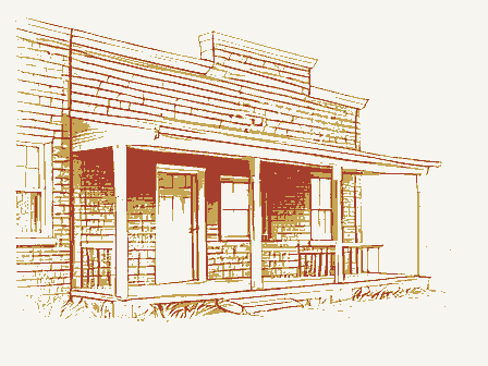
The Parker Tavern is located on Washington Street in a residential area near the center of Reading. The house is of typical 17th-century saltbox design and has two stories and an attic. The main portion of the Parker Tavern is built on a fieldstone founda- tion, which stands eight inches above ground. There is a window in the west cellar foundation for ventilation. Direct entrance to the cellar is only from the inside. The main house displays the Parker Tavern's 17th century character with its integral lean-to sloping to the east. The structure is sheathed in wooden shingles with corner boards and water table. The gable roof is covered with asphalt shingles. There is a central chimney of brick on the main house and smaller brick chimney on the 1964-65 custodian's ell.
The front facade of thehouse is characterized by a four-bay arrange- ment, with two windows to the right of the entrance and one to the left. The north elevation has five windows irregularly spaced, with three on the first floor, two on the second, and one in the attic story. The east elevation has a central doorway with one window to the right (north) and two on the left (south). The south side of the main house has three windows, one on each floor. The double- hung windows have predominately 12/8 sash with plain surrounds. In 1923 the Parker Tavern was acquired by the Reading Antiquarian Society which restored the building between 1923 and 1930. During the restoration several appendages were removed, the chimney replaced, and the barn moved.
In 1964-65 a custodian's ell was added to the south side of the house.It measures twenty-five by nineteen feet and is made of materials which match those of the main house.
Statement of significance
/ARCHITECT The Parker Tavern is the oldest documented house in Reading and is an outstanding local example of 17th century architectural building methods. It has also served as the home of a number of significant figures in Reading history. The house was built in 1694 by Abraham Bryant, Jr., a blacksmith. Bryant had received the land in 1693 as a gift from his father who had acquired it in 1687 as part of his share in town lands purchased from the Indians. Since Abraham's taxes doubled the second year he owned the property, it is assumed that the house was built in that period. Bryant lived in the house until his death in 1714, and in 1724 his son- in-law Nathaniel Stow purchased the house from the son of Abraham Bryant III.
Stow was also a blacksmith, and so the trade was continued at the homestead until he died in the 1730's. The next occupants of the house (from 1738 to 1757) were Ebenezer Nichols, a tanner, and his son who was a farmer. that time comprised 30 acres of land with an additional 40 acres in the meadow lots. Colonel Nichols (the elder) was the most distinguished owner of the house and was an influential and highly honored citizen. He served as town moderator, selectman, and a representative during the critical difficulties with England over the Stamp Act. In 1768 he was listed as the fifth highest tax payer in South Reading. From 1757 to 1804 Ephraim Parker, a cordwainer, lived on the property.
Parker fought during the French and Indian War and is credited with service during the alarm of April 19, 1775.
Quoted from the National Register nomination
for reference 75000286, 23 pages, held by the National Archives in Record
Group 79. See the
catalogue record.
Listed places nearby
6 within 8 miles
Other National Register properties close
enough to walk or drive between, ordered by distance from this one. Both
positions come from the same geocoding pass that matched these properties
to their map sheets.
Listing record. National Park Service National Register of Historic Places, listed-properties dataset, current to 2026-05-22.
Map join. Address geocoded through the United States Census geocoder, then tested against the published boundary of every sheet in the USGS Historical Topographic Map Collection.
How this page is made. Listing fields come from federal records; map-sheet coverage is a labelled coordinate-to-boundary calculation, not a source-field claim.
Wildfire. Short, Karen C. 2022. Spatial wildfire occurrence data for the United States, 1992-2020 [FPA_FOD_20221014]. 6th Edition. Fort Collins, CO: Forest Service Research Data Archive. https://doi.org/10.2737/RDS-2013-0009.6 Collected with United States Government funding and usable without additional permissions or fees.
Specimens. Global Biodiversity Information Facility (GBIF), https://www.gbif.org/. Only records licensed CC0 or CC BY are used. Records licensed CC BY-NC are excluded because this site carries advertising. Images are checked individually and any whose licence is non-commercial, no-derivatives or unreadable is refused.
Mines and quarries. USGS Mineral Resources Data System (MRDS) https://mrdata.usgs.gov/mrds/ A work of the United States government, no copyright under 17 U.S.C. 105.
Storms. NOAA National Centers for Environmental Information, Storm Events Database https://www.ncei.noaa.gov/stormevents/ A work of the United States government, no copyright under 17 U.S.C. 105. Narratives are quoted verbatim from the National Weather Service report and are not edited or summarised.
 Block
Block