Photographs from the nomination case file, National Park Service records.
Harnden Tavern
Listed on the National Register of Historic Places in
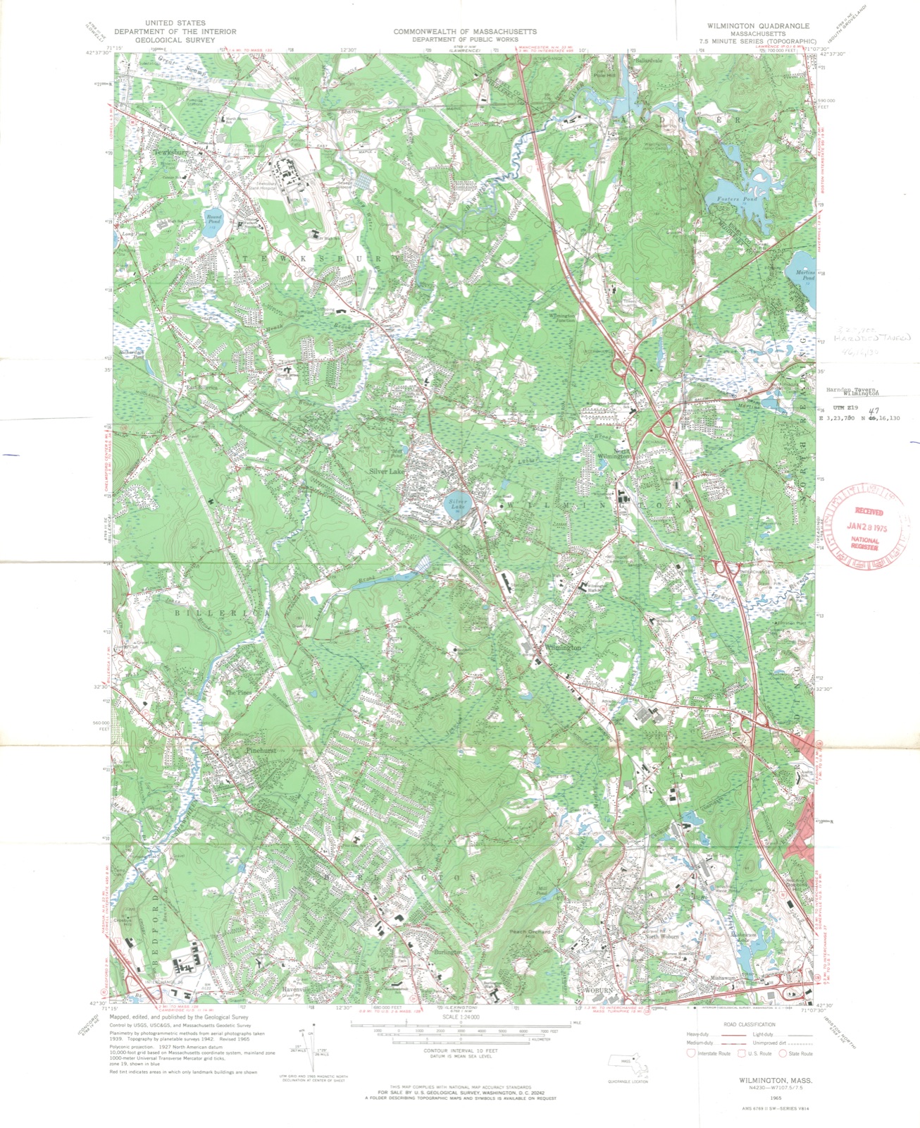
1975. A historic map-sheet match is not published yet. The record needs a coordinate-quality review before it can be joined to a sheet boundary.
From the record
“In compliance with the foregoing, the inhabitants of the new town erected their first meetinghouse in 1732. Tlie chureh was organized with seventeen male members, October 24, 1733, and Mr.”
History of Middlesex County, Massachusetts (1880). Machine-read text.
one of 1100 National Register listings in Middlesex County · listed in 1975 · category: Building · one of 3 National Historic Landmarks in Middlesex County.
National Register reference number.75000293- the number the National Park Service assigned this property when it was listed, and the key its nomination file is catalogued under at the National Archives.
The surface of Wilmington is not remarkably level, but presents several level plains which pleasantly contrast with some hills of prominence and bi'aiity. And tlie placid Silver Lake should not he passed liy. The stranger who visits it in summer cannot fail to admire its natural beauty. It is situated in the northwest part of the town, and contains some tliirty-five acres. The character of the soil is not very generally celebrated for its productions; yet a large portion will well reward judii-ious rulti\ation.
To tills territory was added a narrow strip of land lying on the westerly side of Reading, which was also early open to settlement. The names given to particular localities as earlv as 1()5S are still retaine.l. - as Coslieii, Xod, .Maple-meadow Brook, Lebanon, an,IJ.a(lder-l'ole. The two last are extcaisive cedar swamps which still maintain their early signilii'ai ion and value. JIaplc-meadow Brook is the main blanch of Ipswich River, wliich takes its rise iu Burlington, and after entering Wilmington takes a northeasterly course for about five miles, when it enters A'orth Reading. There are also li\c brooks whose waters flow into this one from the west side; four of which each operate a mill for a portion of the year.
Regional context, not property-specific
evidence. The
federal wildfire occurrence database
lists 36 fires within 5 miles of Harnden Tavern between
2003 and 2020, burning about 20 acres in total. 1 started naturally. None was recorded as arson.
Distance is straight-line from the map coordinates, so a fire counted
here may appear on a neighbouring settlement's page as well.
Reported cause
Fires
Debris and open burning
16
Missing data/not specified/undetermined
8
Recreation and ceremony
4
Smoking
3
Misuse of fire by a minor
2
Equipment and vehicle use
1
Railroad operations and maintenance
1
Natural
1
The most recent of
them, most recent first, with the day each was reported and the service
that recorded it.
Regional context, not property-specific
evidence. Museums hold 575 specimens
collected within 10 miles of Harnden Tavern between 1898 and
1975: 278 Animalia, 237 Plantae, 49 Fungi, 6 Unrecorded, 3 Bacteria, 2 Protozoa. 12 distinct Species records are shown.
Collected by A B. Proper, A. C. Mathieson, A. E. Sears and others. Each is a
physical object with a catalogue
number, and each entry opens the museum's record. This is what was
collected and kept, not a survey of what lives here - nothing can be
concluded from a species being absent.
Regional context, not property-specific
evidence. The federal mineral resources record lists
13 workings within 5 miles of Harnden Tavern: 8 past producers, 4 producers, 1 unknown.
4 still produce. What was taken out: Sand and Gravel, Construction, Stone, Crushed/Broken, Titanium, Metal, Titanium. Distance is straight-line from the
map coordinates, so a quarry counted here may appear on a neighbouring
settlement's page as well.
Regional context, not property-specific
evidence. The National Weather Service names
Wilmington, the town this property stands in, in 22 storm reports between 1996 and 2022: 9 thunderstorm wind, 4 hail, 4 lightning, 3 flash flood.
The reports record 1 injury. Each account below is quoted exactly as the forecast office
filed it, from the NOAA Storm Events Database, and each date
opens the federal record of that event.
Several trees across Wilmington were downed by thunderstorm winds. This includes a tree down on a house on Lawrence Street and a tree down across the railroad tracks.
No historic map-sheet match is published
for this property yet. That does not mean no map exists. This record needs
a coordinate-quality review before it can be joined to a sheet boundary.
Browse the county's mapped places while that work is
pending.
From the nomination file
1,864 words on record
When this property was proposed for the
National Register, someone wrote the case for it: what the building is,
and why it matters. That document is a federal record in the public domain.
It is quoted below word for word, never summarised. The text was read off the scanned case file by machine, so the
occasional stray character is the recogniser's and the 1970s
typewriter's.
Description of the property
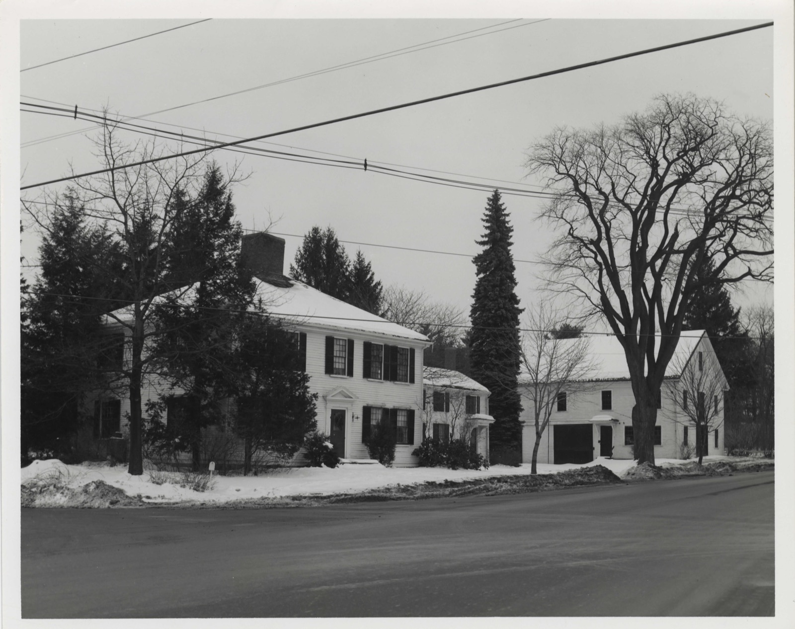
Built c. 1770, the Harnden Tavern faces south on a major residential road in Wilmington. The 2 story clapboard structure has a hip roof with a large central chimney and is two rooms wide and two deep, with a central hall. The focal point of the facade is the central doorway with its Doric pilasters, full classical entablature and dentiled triangular pediment. Like the pediment, the house cornice is also dentiled. A long 2 story clapboard ell, believed to have been built in the first half of the 19th c., extends east from the northeast corner of the house. The ell has a ridge roof and the four first floor windows are flanked by a small open porch at either end. The east elevation of the ell also has a small open porch.
A tall narrow chimney projects from the ridge peak in the center of the ell. A large 2½ story ridge roof barn is situated further to the east of the ell, with its axis north-south. Covered with clapboard, the barn has irregular window openings and a number of doors on its south and west sides. RECEIVED JAN2 8 1975 NATIONAL REGISTER 8
Statement of significance
/ARCHITECT c.1770 Ebenezer Jones STATEMENT OF SIGNIFICANCE Built c.1770, the Harnden Tavern is significant as the only example of late Georgian architecture in Wilmington and as the home of a family of important physicians. The house was built by Ebenezer Jones, a local contractor, probably for speculation. Sometime prior to 1795, the house was sold to Capt.Joshua Harnden, a Revolutionary War hero and a member of a committee which reported to the Cambridge Convention on the formation of the State Constitution in 1780. For thirty years thereafter it was known as the Harnden Tavern, a popular grog shop on the main road from Salem to Lowell. In 1818 the Inn was sold to Dr.Silas Brown.
Silas' father, Jonathan (1735-1822) was the physician who went to Saratoga in October 1777 to escort the British officers to Cambridge after Burgoyne's surrender. Dismayed by the doctrines of the established churches in the years before the Civil War, the Silas Browns embraced the doctrines of the Sweden- borgians, ardent abolitionists. It was at this time that the tavern is believed to have become a stop in the underground railway. The secret chamber located in the southwest bedroom next to the center chimney may have been used to harbor runaway slaves. There axe no substantiating documents, however, other than family letters whichrmake only indirect references because of the great need for secrecy at that time.
Silas Brown was a practicing physician in Wilmington for over 50 years and died in 1864. Silas's son,Jonathan, also served as a local and wartime physician. After having studied with his father and at Harvard Medical School, Jonathan was appointed resident physician of the new State Almshouse in Tewksbury in 1854. He served as superintendent there for 11 years.
Quoted from the National Register nomination
for reference 75000293, 9 pages, held by the National Archives in Record
Group 79. See the
catalogue record.
Listed places nearby
6 within 8 miles
Other National Register properties close
enough to walk or drive between, ordered by distance from this one. Both
positions come from the same geocoding pass that matched these properties
to their map sheets.
Listing record. National Park Service National Register of Historic Places, listed-properties dataset, current to 2026-05-22.
Map join. Address geocoded through the United States Census geocoder, then tested against the published boundary of every sheet in the USGS Historical Topographic Map Collection.
How this page is made. Listing fields come from federal records; map-sheet coverage is a labelled coordinate-to-boundary calculation, not a source-field claim.
Wildfire. Short, Karen C. 2022. Spatial wildfire occurrence data for the United States, 1992-2020 [FPA_FOD_20221014]. 6th Edition. Fort Collins, CO: Forest Service Research Data Archive. https://doi.org/10.2737/RDS-2013-0009.6 Collected with United States Government funding and usable without additional permissions or fees.
Specimens. Global Biodiversity Information Facility (GBIF), https://www.gbif.org/. Only records licensed CC0 or CC BY are used. Records licensed CC BY-NC are excluded because this site carries advertising. Images are checked individually and any whose licence is non-commercial, no-derivatives or unreadable is refused.
Mines and quarries. USGS Mineral Resources Data System (MRDS) https://mrdata.usgs.gov/mrds/ A work of the United States government, no copyright under 17 U.S.C. 105.
Storms. NOAA National Centers for Environmental Information, Storm Events Database https://www.ncei.noaa.gov/stormevents/ A work of the United States government, no copyright under 17 U.S.C. 105. Narratives are quoted verbatim from the National Weather Service report and are not edited or summarised.
 Block
Block