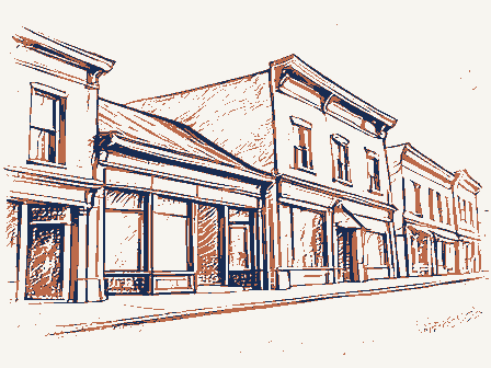
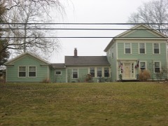
Listed on the National Register of Historic Places in
1975. A historic map-sheet match is not published yet. The record needs a coordinate-quality review before it can be joined to a sheet boundary.
From the record
one of 65 National Register listings in Lucas County · listed in 1975 · category: District · one of 2 National Historic Landmarks in Lucas County.
National Register reference number.75001467- the number the National Park Service assigned this property when it was listed, and the key its nomination file is catalogued under at the National Archives.
Fires near this property
1 since 2002
Regional context, not property-specific
evidence. The
federal wildfire occurrence database
lists 1 fire within 5 miles of Providence Historic District between
2002 and 2002, burning about 0 acres in total. None started naturally. None was recorded as arson.
Distance is straight-line from the map coordinates, so a fire counted
here may appear on a neighbouring settlement's page as well.
Reported cause
Fires
Recreation and ceremony
1
The most recent of
them, most recent first, with the day each was reported and the service
that recorded it.
Regional context, not property-specific
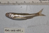
evidence. Museums hold 477 specimens
collected within 10 miles of Providence Historic District between 1860 and
1973: 423 Animalia, 49 Plantae, 3 Fungi, 1 Unrecorded, 1 Chromista. 12 distinct Species records are shown.
Collected by A. D. Selby, Auten, Campbell, L. W. (Louis W.) and others. Each is a
physical object with a catalogue
number, and each entry opens the museum's record. This is what was
collected and kept, not a survey of what lives here - nothing can be
concluded from a species being absent.
No historic map-sheet match is published
for this property yet. That does not mean no map exists. This record needs
a coordinate-quality review before it can be joined to a sheet boundary.
Browse the county's mapped places while that work is
pending.
From the nomination file
2,326 words on record
When this property was proposed for the
National Register, someone wrote the case for it: what the building is,
and why it matters. That document is a federal record in the public domain.
It is quoted below word for word, never summarised. The text was read off the scanned case file by machine, so the
occasional stray character is the recogniser's and the 1970s
typewriter's.
Description of the property
St.Patrick's Church has its gable facing Centre St. cross above.There are three lancet windows on each side of the building. To the rear there is a rectangular brick addition forming an L".A PERIOD (Check One or More as Appropriate) Pre-Columbian | - 20th Century 1845 - Manor House and Church - Urban Planning - Prehistoric - Other (Specify) - Agriculture - Science STATEMENT OF
Statement of significance
Peter Manor, founder of Providence, first began trade with the Ottawas Manor was the first white settler of Providence Township, locating in in 1809. He was a favorite of the Ottawa Indians, even during the War for this land, executed in 1827, reads..."There is granted by the United States unto Sawen-de-bans, or the Yellow Hair, or Peter Manor, an« adopted son of Tondogamie, and his heirs, out of the tract reserved de Boeuf, a section of land containing 643 acres, on the north side of the Maumee River, at Wolf Rapids." five hotels and four general stores, all owned and run by Manor.
The labor force for the canal turned Providence into a bawdy, rather rough the height of Providence's prosperity, did Manor erect his own home in Commerce Conservation Communications SIGNIFICANCE losophy Engineering Aboriginal Literature Theater Architecture Military Education Art lines disappeared.
Transportation Political Music Sculpture Religion/Phi Industry Social/Human- struck and Providence was abandoned.Eventually the streets and lot Wabash and Erie canals through its limits.Within a few years it had increasing western immigration and the building of the Miami and the Invention In 1846 fire had swept through the hastily built wooden structures and which supplied stone for the building of the canal locks, Manor also Landscape His friendship with the Chief resulted in a gift of 643 acres of land built St.Patrick's Catholic Church and donated it to the community.
Providence was laid out on this tract by Manor in 1835 and soon became of 18l2.He and his family sons) settled with the 0ttawas in their the Ottawas)by the Treaty of Detroit in 1807,above the Roche SPECIFIC DATE(S) (If Applicable and Known) In 1839 Manor's wife died, leaving seven children. Not until 1845, at along the Maumee River while employed by the Northwest Fur Trade Co.
Quoted from the National Register nomination
for reference 75001467, 23 pages, held by the National Archives in Record
Group 79. See the
catalogue record.
Listed places nearby
2 within 8 miles
Other National Register properties close
enough to walk or drive between, ordered by distance from this one. Both
positions come from the same geocoding pass that matched these properties
to their map sheets.
Listing record. National Park Service National Register of Historic Places, listed-properties dataset, current to 2026-05-22.
Map join. Address geocoded through the United States Census geocoder, then tested against the published boundary of every sheet in the USGS Historical Topographic Map Collection.
How this page is made. Listing fields come from federal records; map-sheet coverage is a labelled coordinate-to-boundary calculation, not a source-field claim.
Wildfire. Short, Karen C. 2022. Spatial wildfire occurrence data for the United States, 1992-2020 [FPA_FOD_20221014]. 6th Edition. Fort Collins, CO: Forest Service Research Data Archive. https://doi.org/10.2737/RDS-2013-0009.6 Collected with United States Government funding and usable without additional permissions or fees.
Specimens. Global Biodiversity Information Facility (GBIF), https://www.gbif.org/. Only records licensed CC0 or CC BY are used. Records licensed CC BY-NC are excluded because this site carries advertising. Images are checked individually and any whose licence is non-commercial, no-derivatives or unreadable is refused.
 Block
Block