Listed on the National Register of Historic Places in
1975. A historic map-sheet match is not published yet. The record needs a coordinate-quality review before it can be joined to a sheet boundary.
From the record
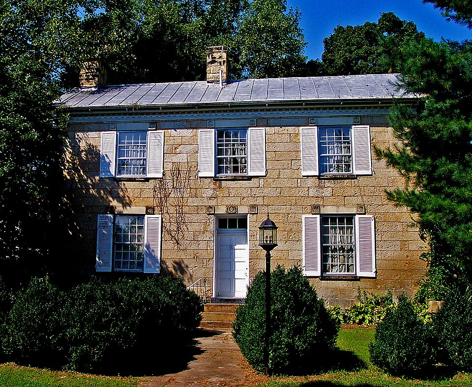
“The Vanmeter Stone House and Outbuildings are a historic farmstead located near Piketon in rural Pike County, Ohio, United States. Established in the early 19th century, the farm has been operated for nearly two centuries by the same family, including a prominent politician.”
Wikipedia article Vanmeter Stone House and Outbuildings, CC BY-SA 4.0.
one of 4 National Register listings in Pike County · listed in 1975 · category: Building.
National Register reference number.75001519- the number the National Park Service assigned this property when it was listed, and the key its nomination file is catalogued under at the National Archives.
Fires near this property
69 since 2004
Regional context, not property-specific
evidence. The
federal wildfire occurrence database
lists 69 fires within 5 miles of Vanmeter Stone House and Outbuildings between
2004 and 2020, burning about 279 acres in total. None started naturally. 1 was recorded as arson.
Distance is straight-line from the map coordinates, so a fire counted
here may appear on a neighbouring settlement's page as well.
Reported cause
Fires
Debris and open burning
37
Missing data/not specified/undetermined
22
Smoking
4
Misuse of fire by a minor
2
Power generation/transmission/distribution
1
Railroad operations and maintenance
1
Arson/incendiarism
1
Recreation and ceremony
1
The most recent of
them, most recent first, with the day each was reported and the service
that recorded it.
Regional context, not property-specific
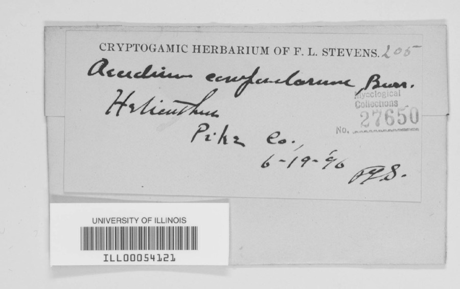
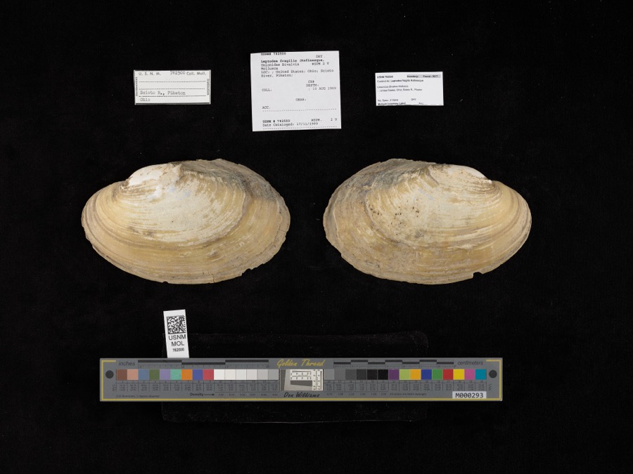
evidence. Museums hold 1,712 specimens
collected within 10 miles of Vanmeter Stone House and Outbuildings between 1889 and
1975: 1,546 Animalia, 118 Fungi, 46 Plantae, 2 Protozoa. 12 distinct Species records are shown.
Collected by Adams, W.; Adams, S., Allen, E. (Ed), B. W. Evermann and others. Each is a
physical object with a catalogue
number, and each entry opens the museum's record. This is what was
collected and kept, not a survey of what lives here - nothing can be
concluded from a species being absent.
Regional context, not property-specific
evidence. The federal mineral resources record lists
6 workings within 5 miles of Vanmeter Stone House and Outbuildings: 2 producers, 2 past producers, 2 plants.
4 still produce. What was taken out: Sand and Gravel, Construction. Distance is straight-line from the
map coordinates, so a quarry counted here may appear on a neighbouring
settlement's page as well.
Regional context, not property-specific
evidence. The National Weather Service names
Piketon, the town this property stands in, in 33 storm reports between 1994 and 2024: 19 thunderstorm wind, 6 hail, 4 flood, 3 flash flood.
No death or injury is recorded in these reports. Each account below is quoted exactly as the forecast office
filed it, from the NOAA Storm Events Database, and each date
opens the federal record of that event.
Several homes were flooded along State Route 32 with two people evacuated in Jackson Township. Numerous roads were flooded and closed across the southern part of the county.
A tornado touched down at the Pike County Fairgrounds where a storage shed was destroyed. Metal debris was strewn about the property. Another building on the property sustained roof damage. The maximum wind speed based on damage is around 80 miles per hour.
No historic map-sheet match is published
for this property yet. That does not mean no map exists. This record needs
a coordinate-quality review before it can be joined to a sheet boundary.
Browse the county's mapped places while that work is
pending.
From the nomination file
2,562 words on record
When this property was proposed for the
National Register, someone wrote the case for it: what the building is,
and why it matters. That document is a federal record in the public domain.
It is quoted below word for word, never summarised. The text was read off the scanned case file by machine, so the
occasional stray character is the recogniser's and the 1970s
typewriter's.
Description of the property
The east facade (front) has a central entryway, flanked by windows on the windows on this facade are 12/12, shuttered, and have stone lintels The north end has no fenestration ; the south end has two small opening onto the patio toward the center of this facade. The second level has three windows on this facade, but they are not symmetrically placed as they are on the east side. All windows are shuttered and Interior: There are two steep stairways, closed at the bottom by doors, located at either end of the house. The interior is plastered. for the farm from the 1860's to 1940. At that time it was used by the Vanmeter family for a summer home. Behind the stone house, and to the south are three structures: a smokehouse, an overflow house, and a schoolhouse.
The buildings stand in arow with their main facades facing north. The smokehouse is rectangular, gable-roofed, and is built of rough-cut underground. This was probably built in the early 1820's when the The overflow house is brick, two-story, with gable roof. There are CONDITION only.) and sills.The lintels have carved stone corner blocks.The entry the door is a three-pane glass transom.The lintel above the entry The original floor is in place.Mantels and chair rails are carved. has carved stone corner blocks and a more elaborate carving in the shuttered windowsplaced toward either end and two single doors the lower level and has three windows on the second level.All The Vanmeter Stone House is beautifully situated amid terraced gardens have stone lintels with carved corner blocks.
in 1801 by Isaac Vanmeter from a Mr. Guthrie, one of the founders of Piketon. After the purchase, Vanmeter returned to his native Virginia. He gave the land to his son, John Inskeep Vanmeter who moved to Ohio after graduating from Harvard (around 1821). It is thought that the overflow house was built first, then the was a private one, with a schoolmaster brought from Virginia to school in the county. DEC31 1974 Commerce Aboriginal Architecture REGISTER Communications SIGNIFICANCE Conservation NATIONAL Engineering Agriculture Prehistoric RECEIVED itarian Art Literature Industry The school stone architecture.
Music Invention purchased form this farm.Cattle and produce were shipped to The land on which the Vanmeter Stone House stands was purchased Sculpture Education Urban Planning Political Landscape The Vanmeter family raised both agricultural products and livestock.
both eastern and southern markets.The Vanmeter farm was one instruct the Vanmeter children.Itis thought to be the first Social/Human- of the first to implement selective cutting of timber and had one the Vanmeter family and is presently managed by John Inskeep The Vanmeter Stone House is important as the home of any early John Inskeep Vanmeter lived in the house until 1856.He became a Religion/Phi- Some of the first Short Horn cattle brought from England were Ohio settler and farmer and is a fine example of southern Ohio of the earliest tree farms in the state. Vanmeter Ill,the 6th generation to operate the farm. house (begun in 1823) and the smokehouse and school. Military Pre-Columbian! Other (Specify) losophy member of the United States Congress. The land is still owned by
Quoted from the National Register nomination
for reference 75001519, 16 pages, held by the National Archives in Record
Group 79. See the
catalogue record.
Listed places nearby
2 within 8 miles
Other National Register properties close
enough to walk or drive between, ordered by distance from this one. Both
positions come from the same geocoding pass that matched these properties
to their map sheets.
Listing record. National Park Service National Register of Historic Places, listed-properties dataset, current to 2026-05-22.
Map join. Address geocoded through the United States Census geocoder, then tested against the published boundary of every sheet in the USGS Historical Topographic Map Collection.
How this page is made. Listing fields come from federal records; map-sheet coverage is a labelled coordinate-to-boundary calculation, not a source-field claim.
Wildfire. Short, Karen C. 2022. Spatial wildfire occurrence data for the United States, 1992-2020 [FPA_FOD_20221014]. 6th Edition. Fort Collins, CO: Forest Service Research Data Archive. https://doi.org/10.2737/RDS-2013-0009.6 Collected with United States Government funding and usable without additional permissions or fees.
Specimens. Global Biodiversity Information Facility (GBIF), https://www.gbif.org/. Only records licensed CC0 or CC BY are used. Records licensed CC BY-NC are excluded because this site carries advertising. Images are checked individually and any whose licence is non-commercial, no-derivatives or unreadable is refused.
Mines and quarries. USGS Mineral Resources Data System (MRDS) https://mrdata.usgs.gov/mrds/ A work of the United States government, no copyright under 17 U.S.C. 105.
Storms. NOAA National Centers for Environmental Information, Storm Events Database https://www.ncei.noaa.gov/stormevents/ A work of the United States government, no copyright under 17 U.S.C. 105. Narratives are quoted verbatim from the National Weather Service report and are not edited or summarised.
 Block
Block