BlockBefore
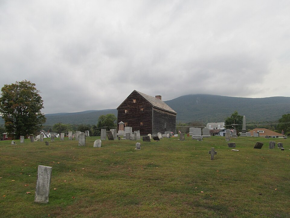
Photograph of Quaker Meetinghouse
Photograph by John Phelan, CC BY-SA 3.0. Via Wikimedia Commons.

Quaker Meetinghouse

Listed on the National Register of Historic Places in 1976. A historic map-sheet match is not published yet. The record needs a coordinate-quality review before it can be joined to a sheet boundary.

From the record

“The East Hoosac Quaker Meetinghouse is a historic Quaker meeting house in Adams, Berkshire County, Massachusetts. The meetinghouse's construction dates to the early 1780s.”

Wikipedia article Quaker Meetinghouse (Adams, Massachusetts), CC BY-SA 4.0.

one of 94 National Register listings in Berkshire County · listed in 1976 · category: Building · one of 1 National Historic Landmarks in Berkshire County.

Sources: the Wikipedia article · the case file at the National Archives · the National Register database, National Park Service · the Wikipedia article

The listing

  • What is counted as historic. The nomination lists 1 building as contributing to the listing.
  • Address. Maple Street Cemetery, Adams, 01220
  • When was it listed? 1976-08-17
  • Category. building
  • Township. Adams town
  • National Register reference number. 76000236 - the number the National Park Service assigned this property when it was listed, and the key its nomination file is catalogued under at the National Archives.

Fires near this property

32 since 2015

Regional context, not property-specific evidence. The federal wildfire occurrence database lists 32 fires within 5 miles of Quaker Meetinghouse between 2015 and 2018, burning about 14 acres in total. 3 started naturally. None was recorded as arson. Distance is straight-line from the map coordinates, so a fire counted here may appear on a neighbouring settlement's page as well.

Reported cause Fires
Debris and open burning14
Equipment and vehicle use6
Recreation and ceremony6
Natural3
Missing data/not specified/undetermined2
Smoking1

The most recent of them, most recent first, with the day each was reported and the service that recorded it.

DateCause SizeReported by Name on the report
25 September 2016Equipment and vehicle use1.0 acresMassachusetts Bureau of Forest Fire Controlnot named
4 August 2017Naturalunder an acreMassachusetts Bureau of Forest Fire Controlnot named
2 August 2017Naturalunder an acreMassachusetts Bureau of Forest Fire Controlnot named
28 July 2018Naturalunder an acreMassachusetts Bureau of Forest Fire Controlnot named
8 May 2016Recreation and ceremony2.0 acresMassachusetts Bureau of Forest Fire Controlnot named
25 May 2015Missing data/not specified/undeterminedunder an acreMassachusetts Bureau of Forest Fire Controlnot named
25 May 2015Debris and open burningunder an acreMassachusetts Bureau of Forest Fire Controlnot named
28 April 2016Debris and open burningunder an acreMassachusetts Bureau of Forest Fire Controlnot named

Every fire recorded in Berkshire County

Specimens collected near this property

12 of 1,072 shown

Regional context, not property-specific evidence. Museums hold 1,072 specimens collected within 10 miles of Quaker Meetinghouse between 1828 and 1975: 556 Plantae, 281 Animalia, 214 Fungi, 11 Protozoa, 7 Unrecorded, 3 Chromista. 12 distinct Species records are shown. Collected by A K Harrison, A Schwartz, A. H. Gustafson and others. Each is a physical object with a catalogue number, and each entry opens the museum's record. This is what was collected and kept, not a survey of what lives here - nothing can be concluded from a species being absent.

Image SpeciesYear Collected by Where, as recorded
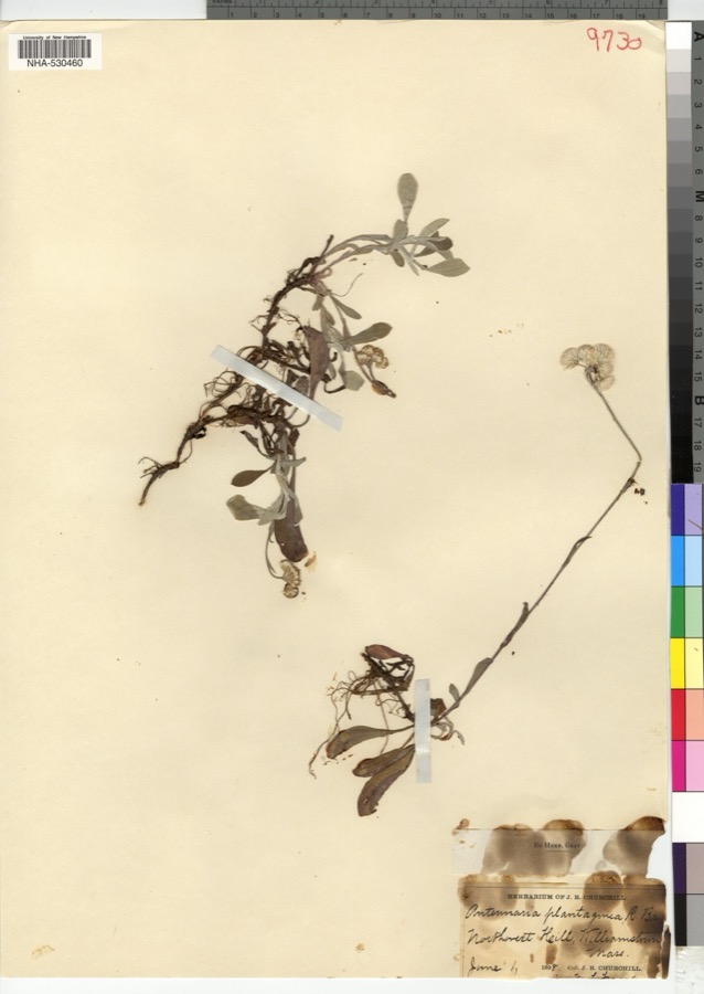
Specimen of Antennaria plantaginifolia (L.) Richardson, 1823Antennaria plantaginifolia (L.) Richardson, 18231898J. R. Churchill
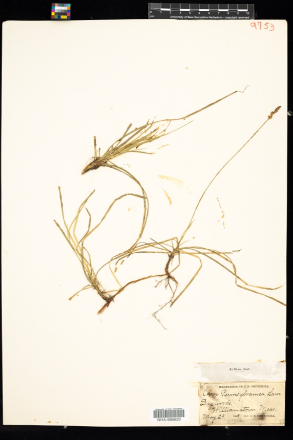
Specimen of Carex pensylvanica Lam.Carex pensylvanica Lam.1898J. R. Churchill
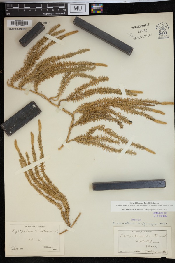
Specimen of Lycopodium annotinum var. pungens (Desv.) La Pylaie ex Desv.Lycopodium annotinum var. pungens (Desv.) La Pylaie ex Desv.1898Kofoid, C.A.North Adams.
A photograph of the species Carex aestivalis, not of this specimenCarex aestivalis M.A.Curtis ex A.Gray1828Collector unknownSaddle Mountain, near Williamstown.
A photograph of the species Carex emmonsii, not of this specimenCarex emmonsii var. muhlenbergii (A.Gray ex Torrey) Rettig1828Collector unspecifiedWilliamstown. [Inferred locality from precise loc.]
A photograph of the species Cystopteris bulbifera, not of this specimenCystopteris bulbifera (L.) Bernh.1828Collector unspecified
A photograph of the species Dryopteris goldiana, not of this specimenDryopteris goldiana (Hook. ex Goldie) A.Gray1828Collector unspecified
A photograph of the species Fraxinus americana, not of this specimenFraxinus americana L.1828J. Torrey
Jamesoniella autumnalis (DC.) Steph.1828Ebenezer Emmons
A photograph of the species Tilia americana, not of this specimenTilia americana L.1828Collector unspecified
A photograph of the species Scorzoneroides autumnalis, not of this specimenScorzoneroides autumnalis (L.) Moench1850not recorded
A photograph of the species Spiraea tomentosa, not of this specimenSpiraea tomentosa L.1850not recorded

All 1,072 specimens within 10 miles, at the Global Biodiversity Information Facility.

Mines and quarries near this property

10 of 18 shown

Regional context, not property-specific evidence. The federal mineral resources record lists 18 workings within 5 miles of Quaker Meetinghouse: 8 past producers, 5 producers, 2 occurrences, 1 prospect. 6 still produce. What was taken out: Iron, Sand and Gravel, Construction, Stone, Crushed/Broken, Limestone, General. Distance is straight-line from the map coordinates, so a quarry counted here may appear on a neighbouring settlement's page as well.

Where SiteCommodity StatusRecorded
Pfizer IncCalciumPast ProducerCalcite
New England Lime Company QuarryLimestone, GeneralProducerSedimentary
North Adams Lime QuarryLimestone, GeneralProducerStratabound
Adams Quarry & Plant Pfizer IncStone, Crushed/BrokenProducer
New England Lime Company QuarryStone, Crushed/BrokenOccurrence
North Adams Lime QuarryStone, Crushed/BrokenPast Producer
Adams PitSand and Gravel, ConstructionPast Producer
Adams PlantSand and Gravel, ConstructionPlant
Bennett ProspectIronOccurrenceLimonite
Bennett ProspectIronPast ProducerResidual

Every working recorded in Berkshire County

Storms near this property

60 of 70 shown

Regional context, not property-specific evidence. The National Weather Service names Adams, the town this property stands in, in 70 storm reports between 1994 and 2024: 37 thunderstorm wind, 16 hail, 7 flash flood, 6 lightning. The reports record 1 injury. Each account below is quoted exactly as the forecast office filed it, from the NOAA Storm Events Database, and each date opens the federal record of that event.

WhenEvent Place namedHarm What the report says
August 2004LightningNorth Adams1 hurtWoman struck by lightning on North Adams golf course.
September 2007Thunderstorm WindNorth Adams$180,000A National Weather Service Storm Survey Team found straight line wind damage in North Adams. Most of the damage was confined to a one half mile, by two block area on the campus of the Massachusetts College of Liberal Arts.||Significant roof damage occurred to three college dormitories, mostly from tin flashing that was torn off due to the strong winds. In addition, several trees and large tree limbs were also downed, one of which smashed a car in the parking lot near the alumni office on Montana Street. Approximately 400 students were evacuated due to the damage.||The damage was consistent with maximum wind speeds of near 100 MPH.
July 2001Thunderstorm WindAdams$90,000no account filed
June 2000Flash FloodAdams$75,000no account filed
May 1998Thunderstorm WindNorth Adams$35,000no account filed
July 2023FloodNorth Adams$20,000Clarksburg Town Administrator Carl McKinney reported Millard Avenue suffering serious damage from heavy rainfall. In addition, the Clarksburg Town Hall basement was taking on water.
August 2000LightningNorth Adams$20,000Early on August 16, lightning from a thunderstorm struck a house in North Adams, narrowly missing a man. Lightning produced a hole inside a bedroom and damaged a peak in the house. A small fire, started by the same lightning bolt, briefly flared up. Firemen were also deployed to the house, but the fire had been extinguished before they arrived.
July 2010Thunderstorm WindNorth Adams$10,000A large tree was reported down on a house in North Adams due to strong thunderstorm winds.
September 1998Thunderstorm WindAdams$10,000A derecho ahead of a strong cold front, which had moved east from southern Ontario across New York, weakened considerably as it moved into western Massachusetts during the predawn hours. The derecho still produced wind strong enough to down large limbs in Adams.
July 2001Thunderstorm WindNorth Adams$10,000no account filed
June 2002Thunderstorm WindNorth Adams$6,000no account filed
June 2023Thunderstorm WindNorth Adams$5,000Trees were reported down across the City of North Adams, one of which occurred along Ashland Street near the intersection of Washington Avenue.
July 2007LightningNorth Adams$5,000Lightning struck a utility pole outside the back of the North Adams Regional Hospital around 13:37 EST, which sent an electrical surge throughout the hospital. This melted a wire in the electrical panel inside the hospital that controlled an elevator, making the elevator unserviceable.
May 2002Thunderstorm WindNorth Adams$5,000no account filed
June 2000HailAdams$5,000no account filed
April 1996HailNorth Adams$5,000no account filed
July 1997HailNorth Adams$4,000no account filed
July 2010LightningNorth Adams$3,000A transformer was hit by lightning at the corner of Liberty Street and Orchard Terrace in North Adams.
August 2002Flash FloodAdams$2,000no account filed
July 2024Thunderstorm WindNorth Adams-An amateur radio operator reported multiple trees down in the town of North Adams.
March 2022Thunderstorm WindAdams-A trained spotter reported two broken trees.
March 2022Thunderstorm WindAdams-Wires were reported down.
March 2022Thunderstorm WindAdams-The public reported that the wind broke two trees in their yards.
June 2021Thunderstorm WindNorth Adams-Several large trees were downed.
October 2020Thunderstorm WindAdams-A tree was downed on a car.
October 2020Thunderstorm WindNorth Adams-Multiple trees were downed.
December 2020Debris FlowNorth Adams-A routine inspection during the morning of Saturday, December 26th resulted in the discovery of a landslide outside the west portal of the Hoosac Tunnel near North Adams. Eight inches of mud and stone had to be cleared from the rails, resulting in two freight trains being delayed. The cause was likely due to the heavy rains on Friday, December 25th.
February 2017Thunderstorm WindAdams-The roof of the Bounty Fair Restaurant was damaged by high winds.
February 2017Thunderstorm WindAdams-Wires were down in a parking lot.
June 2017Thunderstorm WindNorth Adams-Multiple trees were reported down in North Adams due to thunderstorm winds.
September 2016Thunderstorm WindAdams-A tree and wires were downed in Adams due to thunderstorm winds.
May 2013Flash FloodNorth Adams-Flash flooding was reported in North Adams as a result of heavy rainfall from thunderstorms. State Street was impassable due to flooding and was temporarily closed.
May 2013Flash FloodNorth Adams-Flash flooding was reported on Church Street north of Adams as a result of heavy rainfall from thunderstorms. The force of flooding removed manhole covers off the road.
September 2012Thunderstorm WindNorth Adams-Trees were reported down approximately 1 mile northeast of North Adams due to thunderstorm winds.
August 2012Flash FloodNorth Adams-Flash flooding was reported in North Adams due to heavy rainfall from repeated thunderstorms. Several roads in the downtown portion of the city were closed due to the flooding.
August 2012Flash FloodNorth Adams-Flash flooding was reported along Route 8 in North Adams due to heavy rainfall from repeated thunderstorms. Route 8 was closed due to the flooding.
May 2012Thunderstorm WindNorth Adams-Three trees were reported down due to strong thunderstorm winds in North Adams.
June 2011HailAdams-Hail 2 inches in diameter was reported during a thunderstorm in Adams.
August 2011Flash FloodNorth Adams-A landslide and gas line explosion were reported on Miner Street in North Adams.
July 2010HailNorth Adams-Penny size hail was reported during a thunderstorm in North Adams.
May 2010Thunderstorm WindNorth Adams-Trees and wires were reported down near North Adams due to strong thunderstorm winds.
May 2010Thunderstorm WindNorth Adams-Trees were reported down in North Adams due to strong thunderstorm winds.
October 2010FloodNorth Adams-Poor drainage flooding was reported in North Adams due to heavy rainfall.
May 2009Thunderstorm WindNorth Adams-Wires were reported down near North Adams apparently due to strong thunderstorm winds.
June 2008HailNorth Adams-Nickel size hail was reported near North Adams during a thunderstorm.
April 2008Thunderstorm WindNorth Adams-Several trees were reportedly blocking a road near North Adams, which were blown down due to strong thunderstorm winds.
August 2007Thunderstorm WindNorth Adams-A measured wind gust of 60 knots was recorded at the ASOS in North Adams at 1808 EST.
September 2007FloodNorth Adams-Persistent moderate to heavy rainfall led to isolated flooding in portions of Berkshire County during the late morning and early afternoon hours of Tuesday September 11th. Flooding closed a portion of Massachusetts Route 2 in the town of Florida from 1143 LST to 1400 LST. In addition, several roads were closed in and around North Adams due to high water, including a portion of River Street, from Houghton Street to Brown Street, as well as a portion of Beaver Street and Mohawk Forest Boulevard. North Adams City firefighters also pumped water out of several private residences on Pleasant Street and State Road.||
June 2007HailNorth Adams-Nickel size hail was reported in North Adams.
August 2007HailNorth Adams-Quarter size hail was reported in North Adams.
August 2007HailAdams-Quarter size hail was reported in Adams.
August 2007Thunderstorm WindNorth Adams-Numerous large tree limbs and wires were reported down in and near North Adams due to strong thunderstorm winds. One downed large tree limb on Massachusetts Avenue in North Adams between Roberts Drive and Demond Avenue obstructed the road, reducing traffic to one lane.
July 2006Thunderstorm WindNorth Adams-A trained spotter reported that two trees were blown down along Lark and Barton Streets, in North Adams.
July 2006Thunderstorm WindAdams-A trained spotter reported that several tree limbs were blown down in Adams.
December 2006Thunderstorm WindNorth Adams-A measured wind gust of 50 KT was recorded during a thunderstorm at the North Adams ASOS (KAQW).
June 2005Thunderstorm WindNorth Adams-Trees were blown down and power lines were knocked down.
May 2004LightningNorth Adams-Lightning strike along Route 2 caused power outages.
May 2004Thunderstorm WindNorth Adams-Large tree branches down.
May 1997HailAdams-A cold front crossed western New England during the afternoon of May 1. The front produced an isolated severe thunderstorm with hail at Adams in Berkshire County.

Every storm recorded in Berkshire County

Map coverage status

No historic map-sheet match is published for this property yet. That does not mean no map exists. This record needs a coordinate-quality review before it can be joined to a sheet boundary. Browse the county's mapped places while that work is pending.

From the nomination file

2,252 words on record

When this property was proposed for the National Register, someone wrote the case for it: what the building is, and why it matters. That document is a federal record in the public domain. It is quoted below word for word, never summarised. The text was read off the scanned case file by machine, so the occasional stray character is the recogniser's and the 1970s typewriter's.

Description of the property

The Quaker Meeting House is located within the Maple Street Cemetery in the western part of the town of Adams. According to town records, it was constructed sometime between 1781 and 1784. The simple two-story clapboard building measures 36% feet by 28% feet and has a ridge roof and brick chimney on the west end. The facade (south) facing Maple Street has double doors for separate entry by men and women. On either side of the doors are single windows with twelve-over-twelve lights and wooden shutters. Directly above these windows are corresponding windows on the second floor, these having nine lights. The frame of the Meeting House is mostly oak and original, but the exterior clapboards have been replaced over the centuries. Photographs taken c. 1900, c. 1955, and c.

1970 indicate that replacement has been an ongoing process. Judging from the type of clap- boards (butt-joined) and nails used, it is likely that some portions date from the mid to late 19th century, while the remainder are of mixed recent dates. The roof is slate and appears to date from the late 19th century or early 20th century. The original roof was probably covered with wood shingles. The foundation of the Meeting House was of field stone and existing evidence indicates that it was shallow, as there is no basement or excavated area beneath the structure. Some time in the 1930's, however, the remains of the stone foundation were removed and a concrete foundation poured around the structure.

, The interior of the building has been essentially untouched, and the interior wooden sur- faces show no major deterioration after 200 years. The plan of the Meeting House is divided for separation of men and women.

Read the complete 2,252-word case file.

Statement of significance

/ARCHITECT The Quaker Meeting House in Adams is significant as one of the few remaining examples of eighteenth century Friends meeting house architecture and is important for its associa- tions with the early settlement and history of Adams. The town of Adams (originally East Hoosuc) was settled soon after 1769 by a group of Quakers, most of whom were from Smithfield, Rhode Island and nearby Dartmouth, Massachu- The Friends soon owned nearly all the farms in the valley. They worshipped for a time in their homes, usually in that of Isaac Killey, and in the early 1780's built the present meeting house.

The adjacent cemetery was used by the Friends for a considerable period before the Meeting House was built, and not until 1797 was the land formally deeded by Isaac Killey, John and Patience Lapham, John Russell and James Lapham, to John Lapham and John Wells who held it for a brief period before turning it over to the So- ciety of Friends. The Quaker Meeting House was constructed so that men and women could hold separate meet- ings. There were two outer doors for separate entrances and movable partitions allowed for privacy during the separate meetings. In the religious service the partitions were raised. Women sat on the left (west) side where they received the benefit of the fire- place.

On the elevated seats were seated visiting preachers and leaders, including Hannah Hoxie, a talented preacher who occupied the high seat on the women's side for many years. Since there were no evening meetings, there was no provision for lighting the building. On Sundays, when there were two services, those coming from a distance brought their lunch and stayed to both services.

Read the complete 2,252-word case file.

The whole case file for this property - 2,252 words, 11 pages, reproduced complete.

Quoted from the National Register nomination for reference 76000236, 11 pages, held by the National Archives in Record Group 79. See the catalogue record.

Listed places nearby

6 within 8 miles

Other National Register properties close enough to walk or drive between, ordered by distance from this one. Both positions come from the same geocoding pass that matched these properties to their map sheets.

Photograph PropertyDistance Listed
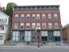
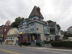
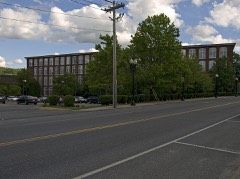
Barrett, P. J., Block0.4 miles1982
Simmons Block0.4 miles1982
Berkshie Mill No. 10.4 miles1982
Jones Block0.4 miles1982
Park Street Firehouse0.4 miles1982
Armory Block0.4 miles1982

Sources for this property

National Archives recordThe nomination case file for reference 76000236 in Record Group 79.
Wikipedia articleCommunity-written account of this property, licensed CC BY-SA.
Berkshire CountyAll 94 listed properties in this county.

Provenance

  • Listing record. National Park Service National Register of Historic Places, listed-properties dataset, current to 2026-05-22.
  • Map join. Address geocoded through the United States Census geocoder, then tested against the published boundary of every sheet in the USGS Historical Topographic Map Collection.
  • How this page is made. Listing fields come from federal records; map-sheet coverage is a labelled coordinate-to-boundary calculation, not a source-field claim.
  • Wildfire. Short, Karen C. 2022. Spatial wildfire occurrence data for the United States, 1992-2020 [FPA_FOD_20221014]. 6th Edition. Fort Collins, CO: Forest Service Research Data Archive. https://doi.org/10.2737/RDS-2013-0009.6 Collected with United States Government funding and usable without additional permissions or fees.
  • Specimens. Global Biodiversity Information Facility (GBIF), https://www.gbif.org/. Only records licensed CC0 or CC BY are used. Records licensed CC BY-NC are excluded because this site carries advertising. Images are checked individually and any whose licence is non-commercial, no-derivatives or unreadable is refused.
  • Mines and quarries. USGS Mineral Resources Data System (MRDS) https://mrdata.usgs.gov/mrds/ A work of the United States government, no copyright under 17 U.S.C. 105.
  • Storms. NOAA National Centers for Environmental Information, Storm Events Database https://www.ncei.noaa.gov/stormevents/ A work of the United States government, no copyright under 17 U.S.C. 105. Narratives are quoted verbatim from the National Weather Service report and are not edited or summarised.