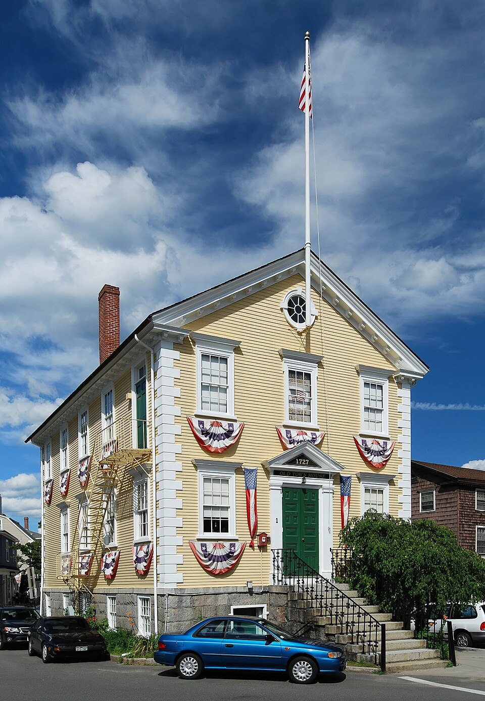
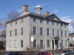
Photograph by Marcbela (Marc N. Belanger), Public domain. Via
Wikimedia Commons.
Old Town House
Listed on the National Register of Historic Places in
1976. A historic map-sheet match is not published yet. The record needs a coordinate-quality review before it can be joined to a sheet boundary.
From the record
“The Old Town House is in the heart of the Marblehead Historic District at One Market Square in Marblehead, Massachusetts, at the intersection of Washington, State, and Mugford Streets.”
Wikipedia article Old Town House (Marblehead, Massachusetts), CC BY-SA 4.0.
one of 350 National Register listings in Essex County · listed in 1976 · category: Building · one of 2 National Historic Landmarks in Essex County.
National Register reference number.76000265- the number the National Park Service assigned this property when it was listed, and the key its nomination file is catalogued under at the National Archives.
Fires near this property
29 since 2014
Regional context, not property-specific
evidence. The
federal wildfire occurrence database
lists 29 fires within 5 miles of Old Town House between
2014 and 2020, burning about 154 acres in total. None started naturally. None was recorded as arson.
Distance is straight-line from the map coordinates, so a fire counted
here may appear on a neighbouring settlement's page as well.
Reported cause
Fires
Recreation and ceremony
11
Smoking
5
Equipment and vehicle use
5
Debris and open burning
3
Misuse of fire by a minor
2
Fireworks
1
Missing data/not specified/undetermined
1
Railroad operations and maintenance
1
The most recent of
them, most recent first, with the day each was reported and the service
that recorded it.
Regional context, not property-specific
evidence. Museums hold 8,232 specimens
collected within 10 miles of Old Town House between 1800 and
1975: 3,275 Plantae, 2,211 Animalia, 1,139 Fungi, 924 Chromista, 483 Unrecorded, 138 Bacteria, 62 Protozoa. 12 distinct Species records are shown.
Collected by A H HIGGINSON, A. A. Eaton, A. B. Hervey and others. Each is a
physical object with a catalogue
number, and each entry opens the museum's record. This is what was
collected and kept, not a survey of what lives here - nothing can be
concluded from a species being absent.
Regional context, not property-specific
evidence. The federal mineral resources record lists
6 workings within 5 miles of Old Town House: 3 plants, 1 unknown, 1 producer, 1 past producer.
4 still produce. What was taken out: Stone, Crushed/Broken, Zirconium, Mercury, Silver, Gold, REE. Distance is straight-line from the
map coordinates, so a quarry counted here may appear on a neighbouring
settlement's page as well.
Regional context, not property-specific
evidence. The National Weather Service names
Marblehead, the town this property stands in, in 12 storm reports between 1998 and 2016: 6 thunderstorm wind, 4 lightning, 1 heavy rain, 1 flash flood.
No death or injury is recorded in these reports. Each account below is quoted exactly as the forecast office
filed it, from the NOAA Storm Events Database, and each date
opens the federal record of that event.
Numerous streets were closed due to flooding. Approximately 500 houses experienced some sort of flooding, 100 of these houses had to have the electricity cut off to prevent further problems related to basement flooding. Water levels in houses were reported to be between 4 and 9 feet deep. Six houses on Elmwood Road had at least 8 feet of water on the 1st floor. On Paradise Road between the 300 block and 1000 block, 90 percent of the businesses had water damage. Orchard, Bradley, and Elmwood Roads, Humphrey, Burrill, New Ocean, and Columbia Streets, Shepard and Atlantic Avenues, and Sculpin Way were still closed around 2pm because of flooding, several hours after rain had stopped. One elementary school was closed, while other schools in the area delayed opening because of the flooding. In Lynn, Chatham Street was closed due to flooding and approximately 180 homes experienced severe flooding in the basements. Seven city buildings sustained water damage, the worst being Harrington Elementary and Marshall Middle School with water coming in from below and through the roof.
No historic map-sheet match is published
for this property yet. That does not mean no map exists. This record needs
a coordinate-quality review before it can be joined to a sheet boundary.
Browse the county's mapped places while that work is
pending.
From the nomination file
2,905 words on record
When this property was proposed for the
National Register, someone wrote the case for it: what the building is,
and why it matters. That document is a federal record in the public domain.
It is quoted below word for word, never summarised. The text was read off the scanned case file by machine, so the
occasional stray character is the recogniser's and the 1970s
typewriter's.
Description of the property
The Marblehead Town House is located in the actual center of Market Square, the square formed by the intersection of Mugford, State, and Washington Streets. Market Square is - in the southeastern part of Marblehead, the site of the original settlement, and also known as Old Marblehead. The Town Meeting of Marblehead voted, in 1727, to build a Town House, 30' x 50' in the center of the "Square." The Committee established for this purpose was directed to "deal with some workmen. . ." The handsome Georgian design is the product of the skills of local Master Carpenters, and an assumed influence of Nathan Bowen, a member of the building committee, and a noted teacher and author of almanacs. The two-story gabled structure is three bays wide and five bays deep.
It is sheathed in four inch clapboards, and the corners are quoined. Fenestration is six-over-six sash, framed by an architrave, and capped by a projecting, flat, molded pediment. At the attic level of the narrow ends are round windows on center line. The entrances are in the center bay of the narrow gabled sides, (north and south eleva- tions), and are framed by single fluted pilasters and topped by a triangular pediment. The original interior consisted of a half basement, a meeting hall on the first floor, and one or two meeting rooms on the second floor. The first floor was occasionally tempor- arily partitioned for a constable's office, clerk of the Market, or a schoolroom. In 1755 the chimney at the northwest corner was added for a stove.
The building was raised 5'4" in 1836 to create a new ground floor which was built with granite from Rockport. This new space was used to house the police and cells.
/ARCHITECT STATEMENT OF SIGNIFICANCE The Marblehead Town House is significant as the first government building in the town and as the scene of a number of important events in local history. By the early 18th century, Marblehead had grown from a backwater fishing village to one of the most affluent and influential seaports in the colonies. This new wealth and the increasing secularization of government led to the decision of the Town Meeting of 1728: "...That Thare Shall Be a Town Hous Beultt in Said Town This Year . . .
on Ye Land Whare the Gale and Cagge Now Stand..." Iocated at the intersection of the three major "hyways": Main Hyway (Washington Street), Way to Ferry (Mugford Street), and Wharf Street (State Street), it was the center of activity in the town and in close proximity to the Salem Ferry, the Wharfs, and the Boston Road. As the first government building in the Town, it was here that "... the freeholders and other inhabitants of this Town qualified to vote in Town affairs as the law directs: are hereby notified to assemble and convene..." Town matters, such as elections, appointments of Fish Cullers or Jury members, setting the rate, or providing for widows of lost seamen, were settled here.
The Town House was later the gathering place to protest the Stamp Act and the Boston Port Bill, and where the citizens signed the anti-tea and non-impor- tation agreements. The Committees of Grievances, Correspondence, and Safety were organized here. The Sons of Liberty also met in the Town House. Delegates were selected here for the Ipswich Convention, and Provincial Congress. Later townspeople met in this building to approve the Articles of Confederation, Massachusetts Constitution and later the United States Constitution.
Quoted from the National Register nomination
for reference 76000265, 19 pages, held by the National Archives in Record
Group 79. See the
catalogue record.
Listed places nearby
6 within 8 miles
Other National Register properties close
enough to walk or drive between, ordered by distance from this one. Both
positions come from the same geocoding pass that matched these properties
to their map sheets.
Listing record. National Park Service National Register of Historic Places, listed-properties dataset, current to 2026-05-22.
Map join. Address geocoded through the United States Census geocoder, then tested against the published boundary of every sheet in the USGS Historical Topographic Map Collection.
How this page is made. Listing fields come from federal records; map-sheet coverage is a labelled coordinate-to-boundary calculation, not a source-field claim.
Wildfire. Short, Karen C. 2022. Spatial wildfire occurrence data for the United States, 1992-2020 [FPA_FOD_20221014]. 6th Edition. Fort Collins, CO: Forest Service Research Data Archive. https://doi.org/10.2737/RDS-2013-0009.6 Collected with United States Government funding and usable without additional permissions or fees.
Specimens. Global Biodiversity Information Facility (GBIF), https://www.gbif.org/. Only records licensed CC0 or CC BY are used. Records licensed CC BY-NC are excluded because this site carries advertising. Images are checked individually and any whose licence is non-commercial, no-derivatives or unreadable is refused.
Mines and quarries. USGS Mineral Resources Data System (MRDS) https://mrdata.usgs.gov/mrds/ A work of the United States government, no copyright under 17 U.S.C. 105.
Storms. NOAA National Centers for Environmental Information, Storm Events Database https://www.ncei.noaa.gov/stormevents/ A work of the United States government, no copyright under 17 U.S.C. 105. Narratives are quoted verbatim from the National Weather Service report and are not edited or summarised.
 Block
Block