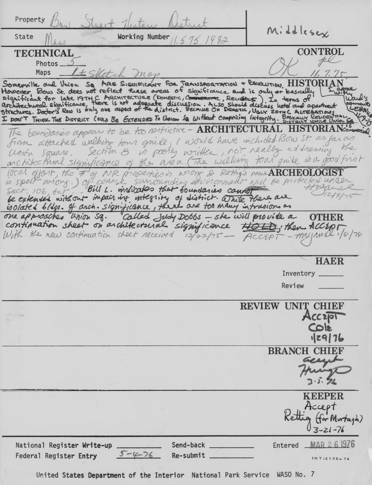
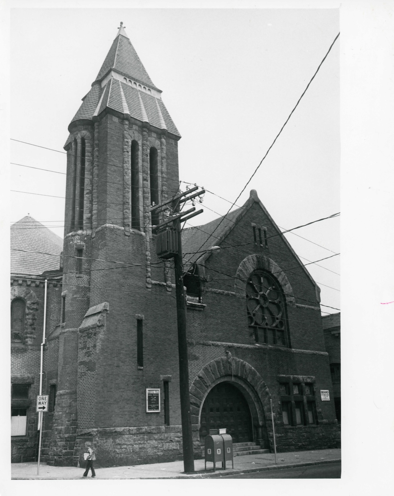
Photographs from the nomination case file, National Park Service records.
Bow Street Historic District
Listed on the National Register of Historic Places in
1976. A historic map-sheet match is not published yet. The record needs a coordinate-quality review before it can be joined to a sheet boundary.
From the record
“The citizens now began to awaken to a sense of the importance of this appendage of Charlestown. They felt that their territory was neglected by the town government, and their wishes disregarded; that they were taxed for supporting institutions, and making improvements in the benefits of which they did not participate, and that they did not receive returns at all commensurate with the amount of money they contributed.”
History of Middlesex County, Massachusetts : Containing Carefully Prepared Histories of Every City and Town in the County (1880). Machine-read text.
one of 1100 National Register listings in Middlesex County · listed in 1976 · category: District · one of 3 National Historic Landmarks in Middlesex County.
National Register reference number.76000274- the number the National Park Service assigned this property when it was listed, and the key its nomination file is catalogued under at the National Archives.
The surface is uneven, and rises into no less than eight considerable elevations, of which Prospect, Winter, Spring, and Central hills, and Mount Benedict are the principal. The soil is various, and in many places excellent for cultivation. Good sand for building purposes is abundant, and a vein of clay, suitable for brickmaking, underlies much of the surface. The only stratified rock to be found in Somerville is slate. The intrusive rocks, cropping out in numerous ledges, in which occur an unusual variety of minerals, are entirely diabase. The formation is particularly rich in dikes.
At the founding of Charlestown in 1628, and for the first ten years, the area of the peninsula generally sufficed for the wants of the settlers; but when, in 1637, land became so scarce within the neck tiiat new-comers were rarely granted more than a citizensliip, purchases were made of the Indians, and settlements began to extend upon the mainland. Tiie territory north and east of the Charles River was then owned by the Pawtucket Indians ; and by payment of thirty-six shillings in 16-37, and twenty-one coats, nineteen fathoms of wampum, and three bushels of corn, two years later to Squa Sachem and Webcowit, rulers of the tribe, the latter were well satisfied to relinquish to the town of Charlestown all the territory that is now Somerville. A few settlers had established themselves on the mainland from the earliest period.
Regional context, not property-specific
evidence. The
federal wildfire occurrence database
lists 79 fires within 5 miles of Bow Street Historic District between
2015 and 2020, burning about 108 acres in total. None started naturally. 28 were recorded as arson.
Distance is straight-line from the map coordinates, so a fire counted
here may appear on a neighbouring settlement's page as well.
Reported cause
Fires
Arson/incendiarism
28
Missing data/not specified/undetermined
20
Recreation and ceremony
12
Debris and open burning
11
Smoking
6
Equipment and vehicle use
1
Misuse of fire by a minor
1
The most recent of
them, most recent first, with the day each was reported and the service
that recorded it.
Regional context, not property-specific
evidence. Museums hold 1,925 specimens
collected within 10 miles of Bow Street Historic District between 1898 and
1975: 830 Animalia, 592 Plantae, 439 Fungi, 27 Protozoa, 17 Bacteria, 12 Chromista, 8 Unrecorded. 12 distinct Species records are shown.
Collected by ?, A B Seymour, A B. Proper and others. Each is a
physical object with a catalogue
number, and each entry opens the museum's record. This is what was
collected and kept, not a survey of what lives here - nothing can be
concluded from a species being absent.
Regional context, not property-specific
evidence. The federal mineral resources record lists
12 workings within 5 miles of Bow Street Historic District: 9 plants, 2 past producers, 1 producer.
10 still produce. What was taken out: Iron, Lead, Gypsum-Anhydrite, Sand and Gravel, Construction. Distance is straight-line from the
map coordinates, so a quarry counted here may appear on a neighbouring
settlement's page as well.
Regional context, not property-specific
evidence. The National Weather Service names
Somerville, the town this property stands in, in 7 storm reports between 2006 and 2021: 5 thunderstorm wind, 2 flood.
No death or injury is recorded in these reports. Each account below is quoted exactly as the forecast office
filed it, from the NOAA Storm Events Database, and each date
opens the federal record of that event.
Water flooded Medford Street up to the roof of a vehicle. Two vehicles were stuck in flood waters on Medford Street. In addition, a large sinkhole opened up as a result of the flooding. This resulted in the street closing through Wednesday, December 10 while crews figured out how to repair the sinkhole.
No historic map-sheet match is published
for this property yet. That does not mean no map exists. This record needs
a coordinate-quality review before it can be joined to a sheet boundary.
Browse the county's mapped places while that work is
pending.
From the nomination file
11,363 words on record
When this property was proposed for the
National Register, someone wrote the case for it: what the building is,
and why it matters. That document is a federal record in the public domain.
It is quoted below word for word, never summarised. The text was read off the scanned case file by machine, so the
occasional stray character is the recogniser's and the 1970s
typewriter's.
Description of the property
The Bow Street District is comprised ofseventeen buildings in a densely settled, older section of the City of Somerville. The district is a mixture of religious, municipal, commercial, and residential buildings which exemplify the atmosphere and character of Somerville's most prosperous era of economic development, the late nineteenth century. The structures in the district include both brick buildings with granite trim and clapboard buildings with brackets and other details typical of the late nineteenth century. One of the highlights of the district is the Prospect Hill Congregational Church, designed by Henry S. McKay in 1887. Responsible for having the church built were H. P.
Hood, whose original dairy was situated in Somerville, and John North, owner of the North Packing Company in Cambridge (the largest meat packing operation east of Chicago). Completed the year after architect H. H. Richardson died, the church shows the characteristic features of the Richardsonian Romanesque style: rounded arches and semi-circular forms, the use of polychromy, and a square tower at one corner. The bric building is trimmed with rusticated granite which is used along the ground level and for the arches, lintels, sills, string course, and transoms. The arched entranceway contains short, stylized Doric columns on either side which support a slightly recessed arch within the larger arch.
The windows are primarily leaded glass (with some stained glass) The square bell tower to the left of the entrance rises to a pyramidal roof. The tower has embedded in it a turret and granite pilasters which continue visually as undulations in the tower roof. On the interior, the main auditorium situated on the second floor has an open, mahogany trussed ceiling and a circular seating arrangement.
/ARCHITECT STATEMENT OF SIGNIFICANCE The Bow Street Historic District is significant for its strong community of nineteenth century mixed-use buildings, its remaining early thoroughfare, its role in the American Revolution, and its ensuing importance as a center of Somerville's development. Somerville's settlement began in 1630 when a branch highway (cart track) was built, extending from Union Square "along the southerly side of the town and curving around across the westerly portion til it joined the road to Menotomy." (This is now Bow Street, Somerville Avenue, and Elm Street.) A 1740 map shows that the few buildings in the area were clustered around Bow Street, thus indi- cating its early importance as the center of the community's development.
"Charlestown Lane" (Bow Street and Somerville Avenue) was well-traveled during Revolutionary times, and the district played a national role in 1775. On April 18, 1775, Paul Revere "started out across Charlestown neck - - . and up Cambridge Road (Washington Street) bent on skirting Somerville's hills to the south, heading up Milk Row (Somerville Avenue) and over Lexington Road." Somerville was also the first town traversed by the British on their way to Lex- ington and Concord. They stopped at the house of Henry Adams on Bow Street for water (at the site of the present Methodist Church), then proceeded up Charlestown Lane on to Iexington.
Union Square near Bow Street was the site of their retreat and of several small skirmishes with the colonists, now known as the "skirmish of Milk Row." Bow Street took its "bowed" form by skirting marshland to its south. Between 1830 and 1850, Milk Street continued straight through into Union Square, replacing Bow Street as the main thoroughfare.
Quoted from the National Register nomination
for reference 76000274, 57 pages, held by the National Archives in Record
Group 79. See the
catalogue record.
Listed places nearby
6 within 8 miles
Other National Register properties close
enough to walk or drive between, ordered by distance from this one. Both
positions come from the same geocoding pass that matched these properties
to their map sheets.
Listing record. National Park Service National Register of Historic Places, listed-properties dataset, current to 2026-05-22.
Map join. Address geocoded through the United States Census geocoder, then tested against the published boundary of every sheet in the USGS Historical Topographic Map Collection.
How this page is made. Listing fields come from federal records; map-sheet coverage is a labelled coordinate-to-boundary calculation, not a source-field claim.
Wildfire. Short, Karen C. 2022. Spatial wildfire occurrence data for the United States, 1992-2020 [FPA_FOD_20221014]. 6th Edition. Fort Collins, CO: Forest Service Research Data Archive. https://doi.org/10.2737/RDS-2013-0009.6 Collected with United States Government funding and usable without additional permissions or fees.
Specimens. Global Biodiversity Information Facility (GBIF), https://www.gbif.org/. Only records licensed CC0 or CC BY are used. Records licensed CC BY-NC are excluded because this site carries advertising. Images are checked individually and any whose licence is non-commercial, no-derivatives or unreadable is refused.
Mines and quarries. USGS Mineral Resources Data System (MRDS) https://mrdata.usgs.gov/mrds/ A work of the United States government, no copyright under 17 U.S.C. 105.
Storms. NOAA National Centers for Environmental Information, Storm Events Database https://www.ncei.noaa.gov/stormevents/ A work of the United States government, no copyright under 17 U.S.C. 105. Narratives are quoted verbatim from the National Weather Service report and are not edited or summarised.
 Block
Block