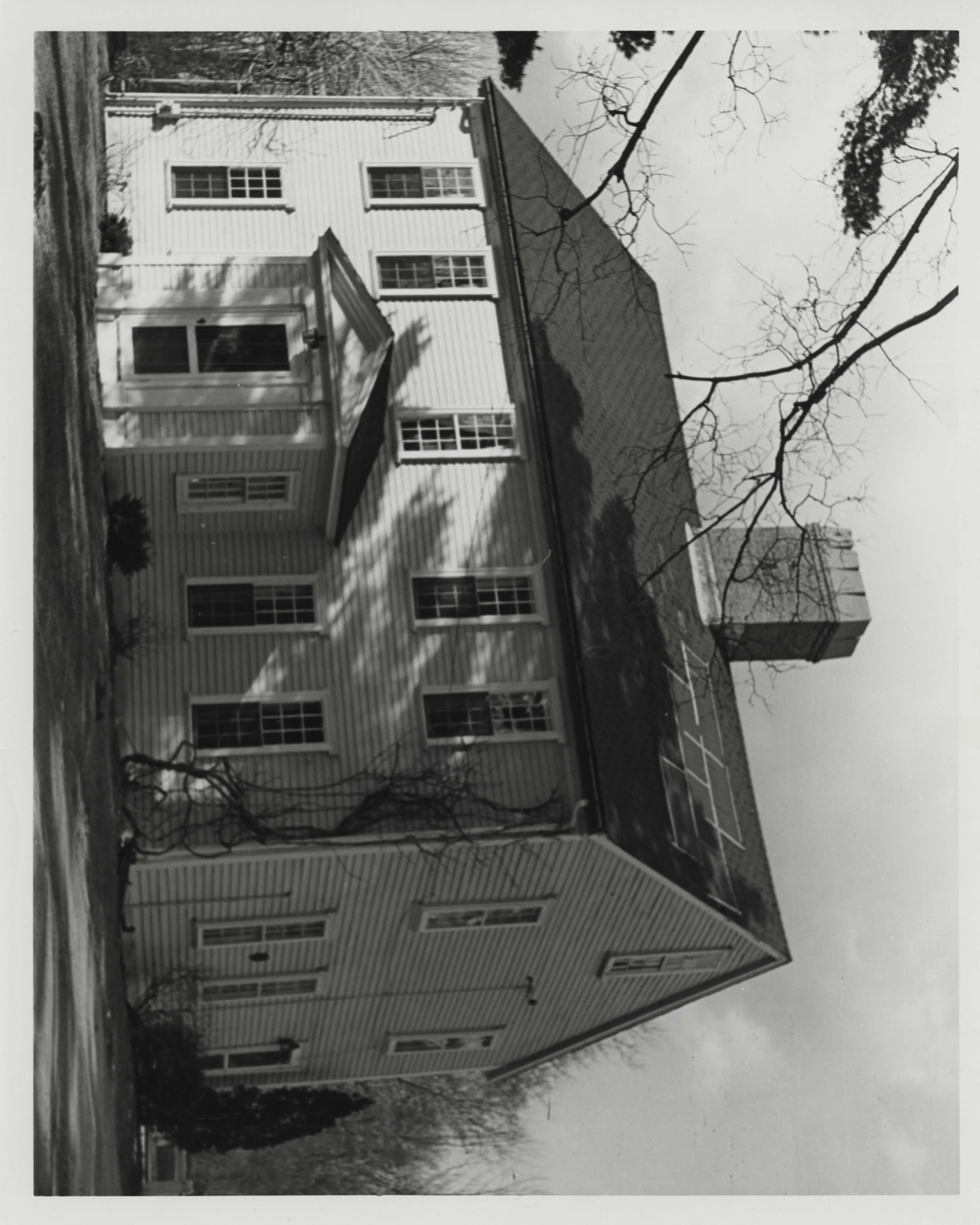
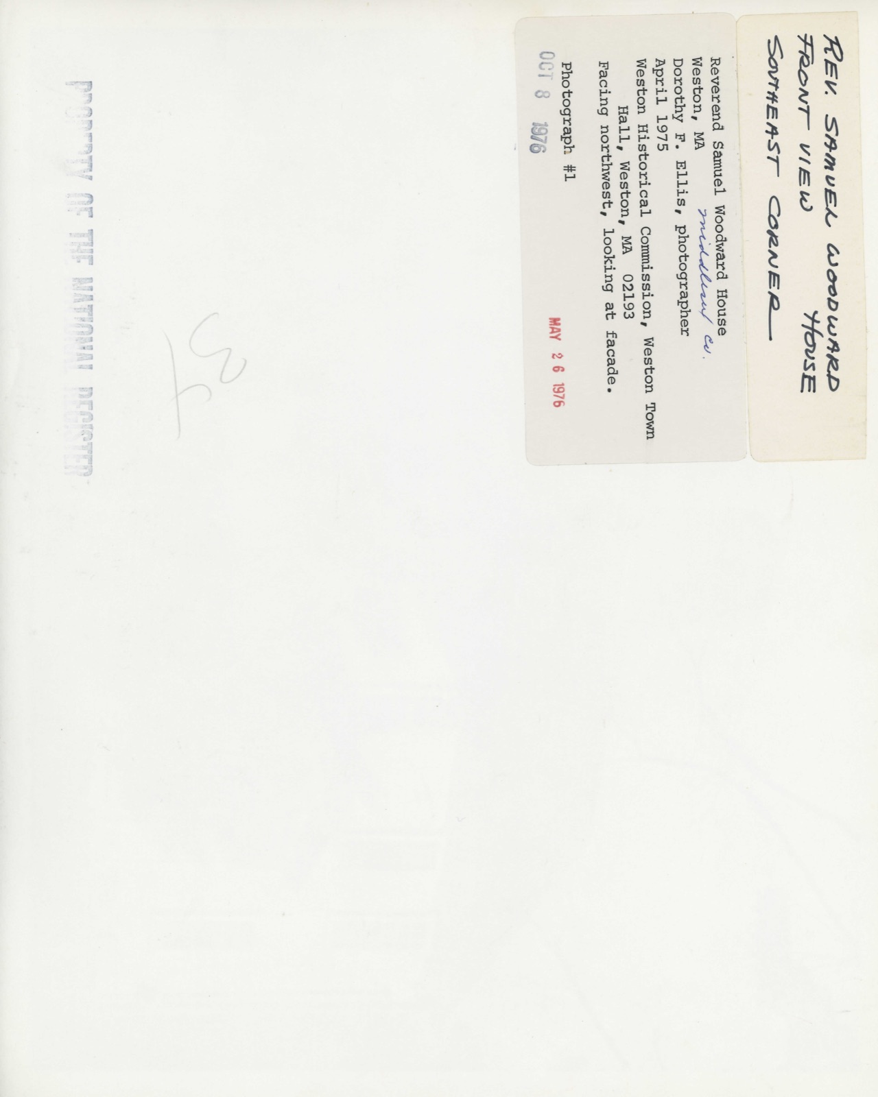
Photographs from the nomination case file, National Park Service records.
Woodward, Rev. Samuel, House
Listed on the National Register of Historic Places in
1976. A historic map-sheet match is not published yet. The record needs a coordinate-quality review before it can be joined to a sheet boundary.
From the record
“At the famous Lovewell's Fight with the Pigwacket tribe of Indians, which took place at Pigwacket (Fryeburg), May 8, 1725, Jacob Fulham, who was a sergeant in Captain Lovewell's company, was killed. He lived to an advanced age, and as "Colonel Francis Fulhnm " was moderator of a town-meeting, Marcli £5, 1751.”
History of Middlesex County, Massachusetts (1880). Machine-read text.
one of 1100 National Register listings in Middlesex County · listed in 1976 · category: Building · one of 3 National Historic Landmarks in Middlesex County.
National Register reference number.76000283- the number the National Park Service assigned this property when it was listed, and the key its nomination file is catalogued under at the National Archives.
The territory of the original town of Watertown was so extensive that its several parts were very early known by distinct and peculiar names. The lands next west of Beaver Brook were called " the lots in the Further Plain," or the Great Plain (and later Waltham Plain). The Remote or West Pine Meadows were probably in the southern or southeastern parts of Weston. The Lieu of Township Lots, or lots beyond the Further Plain, were west of Waltham Plain, south of the Great Dividends, and extended beyond Stony Brook. The Farms, or Farm Lands, included what remained as far as the Sudbury and Dedham bounds, comprising the main portion of Weston.
In the files of the County Court, is a schedule dated May 10, 1642, containing a list of names of persons to whom ninety-two farms, containing 7,674 acres, were allotted, and mention is made of " farms laid out formerly." The names of the committee do not appear on this schedule, but they do appear, with some half-dozen others, in connection with a range of lots on the south side of the highway. " The first lot in the range, adjoining the Sudbury Line, was that of Bryan Pendleton, by him sold to Peter Noyes, and very early purcJiased by George Munning." Adjoining this on the east were tlie lots of Daniel Pattrick, Simon Eire, Jolm Stowers, Abraham Browne, Jolm Whitney, Edward How, Jeremiah A'orcross, and Thomas Mayhew, who thus appear to have been the earliest proprietors of lands in Weston. The allotment committee seem to have provided farms for themselves and a few friends in advance of the general allotment of May, 1643.
Regional context, not property-specific
evidence. The
federal wildfire occurrence database
lists 81 fires within 5 miles of Woodward, Rev. Samuel, House between
1995 and 2020, burning about 53 acres in total. 1 started naturally. 5 were recorded as arson.
Distance is straight-line from the map coordinates, so a fire counted
here may appear on a neighbouring settlement's page as well.
Reported cause
Fires
Missing data/not specified/undetermined
30
Debris and open burning
24
Recreation and ceremony
10
Arson/incendiarism
5
Power generation/transmission/distribution
5
Railroad operations and maintenance
3
Smoking
1
Natural
1
Equipment and vehicle use
1
Other causes
1
The most recent of
them, most recent first, with the day each was reported and the service
that recorded it.
Regional context, not property-specific
evidence. Museums hold 1,986 specimens
collected within 10 miles of Woodward, Rev. Samuel, House between 1898 and
1975: 1,111 Animalia, 474 Plantae, 364 Fungi, 16 Protozoa, 10 Bacteria, 9 Chromista, 2 Unrecorded. 12 distinct Species records are shown.
Collected by ?, A. B. Seymour, A. B. Seymour & M. D. Feigley and others. Each is a
physical object with a catalogue
number, and each entry opens the museum's record. This is what was
collected and kept, not a survey of what lives here - nothing can be
concluded from a species being absent.
Regional context, not property-specific
evidence. The federal mineral resources record lists
9 workings within 5 miles of Woodward, Rev. Samuel, House: 8 past producers, 1 producer.
1 still produces. What was taken out: Sand and Gravel, Construction, Stone, Crushed/Broken. Distance is straight-line from the
map coordinates, so a quarry counted here may appear on a neighbouring
settlement's page as well.
Regional context, not property-specific
evidence. The National Weather Service names
Weston, the town this property stands in, in 14 storm reports between 1994 and 2025: 9 thunderstorm wind, 2 hail, 1 flash flood, 1 lightning.
No death or injury is recorded in these reports. Each account below is quoted exactly as the forecast office
filed it, from the NOAA Storm Events Database, and each date
opens the federal record of that event.
A microburst with winds estimated near 65 mph caused damage in Weston (as well as Waltham and Wellesley). In Weston, multiple large trees and wires were down on Meadowbrook Road. Three large 2-foot oak trees were downed on Summer Street. Large branches were down on North Avenue, Pine Street, and South Street. A big tree was down on Rolling Lane. A 10-inch diameter tree was down on Doublet Hill Road. Two power poles were broken and Eversource, the utility company, was there all night.
A microburst with winds of approximately 65 mph caused damage in Waltham (as well as Weston and Wellesley). In Waltham, three trees were downed and leaning on a house on Florence Road, causing minor damage. A large tree was down on Lincoln Street. Tree branches were down on a house and deck on Keach Terrace. A tree fell onto a vehicle on Vernon Street. Numerous trees were down in the vicinity of Brandeis University.
In Waltham, a car was stuck in flooding on Second Avenue...no water inside the vehicle. At 440 PM EST (540 PM EDT), a portion of Route 128 Southbound at Route 20 was flooded and impassable. Six to twelve inches of water was observed on South Street at Charlesbank Way.
An early morning thunderstorm with unusually frequent cloud to ground lightning moved eastward across the western suburbs of Boston and then directly across the city. In Weston and Newton, several trees and power lines were knocked down by strong winds. Lightning strikes blew out transformers and knocked out power to an estimated 20,000 customers from Sudbury to Boston. Small hail was reported by the National Weather Service at Logan International Airport in Boston. The Boston Fire Department reported its busiest two hours on record as lightning strikes cut off power, triggered alarm systems and heavy rain flooded roads. Lightning detection systems recorded around 20 cloud to ground strikes per minute or around 1,200 strikes per hour, continuing for more than an hour.
No historic map-sheet match is published
for this property yet. That does not mean no map exists. This record needs
a coordinate-quality review before it can be joined to a sheet boundary.
Browse the county's mapped places while that work is
pending.
From the nomination file
3,844 words on record
When this property was proposed for the
National Register, someone wrote the case for it: what the building is,
and why it matters. That document is a federal record in the public domain.
It is quoted below word for word, never summarised. The text was read off the scanned case file by machine, so the
occasional stray character is the recogniser's and the 1970s
typewriter's.
Description of the property
The Reverend Samuel Woodward House sits on a knoll facing south onto Concord Road. It is situated on two acres of land, and as yet has not been encroached upon by the nearby business center of town. Records indicate that Reverend Samuel Woodward purchased a parcel of land in Weston from William Smith in 1752. The following year Woodward married Abigail Williams and took his bride to their new home. There is evidence that he incorporated into his house an older structure formerly owned by William Smith. An examination by Abbott Lowell Cum- mings, Director of the Society for the Preservation of New England Antiquities, has shown that the rear portion of the house has summer beams not found after 1750 and that the older house was probably of the central chimney type.
Although the Woodward House has undergone several changes, its present appearance remains relatively the same as when Reverend Woodward occupied it. The two-story, clapboard building is five bays wide and has a central projecting enclosed entrance. The house sits on a low fieldstone foundation, and its ridge roof is pierced in the center by a brick chimney. According to an early account of the house, an east ell was added to the house some time during the occupancy of Dr. Amos Bancroft (1797-1810). In the late nineteenth century it appears that Mrs. Augustus Fiske had this wing moved to 83 Concord Road, and built the present west ell in which there was a large ballroom. Although an atlas of 1875 does not show this ell, a sketch of 1882 does include the addition.
In 1915 the west ell was moved about ten feet farther west during repairs being made on the house. A one- story kitchen ell was built next to it in the 1960's..
/ARCHITECT The Reverend Samuel Woodward House is significant as a relatively unspoiled example of eighteenth century architecture and as the home of a number of families significant in the history of Weston. Reverend Samuel Woodward, who built the house in 1753, was the second minister of the First Parish Church in Weston. A graduate of Harvard in 1748, he was ordained in 1751 when he was only twenty-four years of age. In 1753 Woodward married Abigail Williams and the two moved into the house on Concord Road, which is said to be a copy of the Samuel Har- rington House on South Street in Waltham. Not long after their marriage, the minister and his wife began to take in young students as boarders and from time to time kept the schoolmaster as well.
This increased their income which was a necessity as the parsonage was not furnished by the Town. On April 19%, 1775, Reverend Samuel Woodward led the Weston militia in prayer and set out with the company for Concord. On the Lancaster Road the men were told to go to the lex- ington Turnpike where they followed the British retreat to Charlestown. In Weston it was from the pulpit that the Declaration of Independence was read by Reverend Woodward in 1776. After Woodward's death in 1782, his wife continued to occupy the house until 1795 when she married Colonel Thomas Marshall. At this time she conveyed the estate of Reverend Woodward to her son-in-law Samuel Kendal, husband of her daughter Abigail.
Reverend Kendal had come to Weston in 1783 as Reverend Woodward's successor and in 1786 he married Abigail Woodward. After their own house burned down in 1791, the couple moved into the Woodward House. In 1794, a year after Abigail's death, Kendal married her sister Miranda.
Quoted from the National Register nomination
for reference 76000283, 15 pages, held by the National Archives in Record
Group 79. See the
catalogue record.
Listed places nearby
6 within 8 miles
Other National Register properties close
enough to walk or drive between, ordered by distance from this one. Both
positions come from the same geocoding pass that matched these properties
to their map sheets.
Listing record. National Park Service National Register of Historic Places, listed-properties dataset, current to 2026-05-22.
Map join. Address geocoded through the United States Census geocoder, then tested against the published boundary of every sheet in the USGS Historical Topographic Map Collection.
How this page is made. Listing fields come from federal records; map-sheet coverage is a labelled coordinate-to-boundary calculation, not a source-field claim.
Wildfire. Short, Karen C. 2022. Spatial wildfire occurrence data for the United States, 1992-2020 [FPA_FOD_20221014]. 6th Edition. Fort Collins, CO: Forest Service Research Data Archive. https://doi.org/10.2737/RDS-2013-0009.6 Collected with United States Government funding and usable without additional permissions or fees.
Specimens. Global Biodiversity Information Facility (GBIF), https://www.gbif.org/. Only records licensed CC0 or CC BY are used. Records licensed CC BY-NC are excluded because this site carries advertising. Images are checked individually and any whose licence is non-commercial, no-derivatives or unreadable is refused.
Mines and quarries. USGS Mineral Resources Data System (MRDS) https://mrdata.usgs.gov/mrds/ A work of the United States government, no copyright under 17 U.S.C. 105.
Storms. NOAA National Centers for Environmental Information, Storm Events Database https://www.ncei.noaa.gov/stormevents/ A work of the United States government, no copyright under 17 U.S.C. 105. Narratives are quoted verbatim from the National Weather Service report and are not edited or summarised.
 Block
Block