Listed on the National Register of Historic Places in
1976. A historic map-sheet match is not published yet. The record needs a coordinate-quality review before it can be joined to a sheet boundary.
From the record
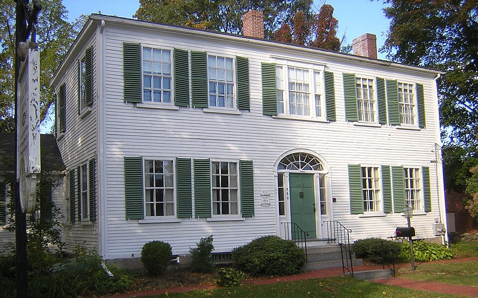
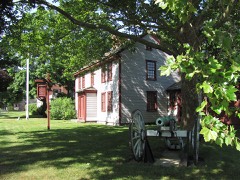
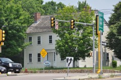
“The Jonathan Belcher House is a historic house located at 360 North Main Street in Randolph, Massachusetts.”
Wikipedia article Jonathan Belcher House, CC BY-SA 4.0.
one of 249 National Register listings in Norfolk County · listed in 1976 · category: Building · one of 2 National Historic Landmarks in Norfolk County.
National Register reference number.76000291- the number the National Park Service assigned this property when it was listed, and the key its nomination file is catalogued under at the National Archives.
Fires near this property
243 since 2015
Regional context, not property-specific
evidence. The
federal wildfire occurrence database
lists 243 fires within 5 miles of Belcher, Jonathan, House between
2015 and 2020, burning about 125 acres in total. None started naturally. None was recorded as arson.
Distance is straight-line from the map coordinates, so a fire counted
here may appear on a neighbouring settlement's page as well.
Reported cause
Fires
Recreation and ceremony
130
Missing data/not specified/undetermined
44
Smoking
33
Debris and open burning
30
Misuse of fire by a minor
3
Fireworks
1
Railroad operations and maintenance
1
Equipment and vehicle use
1
The most recent of
them, most recent first, with the day each was reported and the service
that recorded it.
Regional context, not property-specific
evidence. Museums hold 7,240 specimens
collected within 10 miles of Belcher, Jonathan, House between 1832 and
1975: 3,108 Plantae, 2,050 Animalia, 1,875 Fungi, 150 Protozoa, 31 Chromista, 22 Unrecorded, 4 Bacteria. 12 distinct Species records are shown.
Collected by (MARSDEN, H W), A W Cheever, A. A. Eaton and others. Each is a
physical object with a catalogue
number, and each entry opens the museum's record. This is what was
collected and kept, not a survey of what lives here - nothing can be
concluded from a species being absent.
Regional context, not property-specific
evidence. The federal mineral resources record lists
16 workings within 5 miles of Belcher, Jonathan, House: 9 past producers, 5 producers, 1 unknown, 1 plant.
6 still produce. What was taken out: Sand and Gravel, Construction, Stone, Crushed/Broken, Granite. Distance is straight-line from the
map coordinates, so a quarry counted here may appear on a neighbouring
settlement's page as well.
Regional context, not property-specific
evidence. The National Weather Service names
Randolph, the town this property stands in, in 15 storm reports between 2000 and 2025: 5 thunderstorm wind, 3 hail, 3 flash flood, 2 flood.
No death or injury is recorded in these reports. Each account below is quoted exactly as the forecast office
filed it, from the NOAA Storm Events Database, and each date
opens the federal record of that event.
Lightning struck a detached garage on Bonnie Avenue, igniting a fire. There were no vehicles in the garage but there was damage to other household possessions and belongings.
At 11:26 AM EST, heavy rain caused street flooding in Randolph at the intersection of Warren Street and Highland Avenue. Multiple cars were trapped in the flooding. Rainfall of 1.90 inches was reported in nearby Stoughton Massachusetts.
In Randolph, a large limb was down at the intersection of Dorr Street and Vinton Street. |Power lines were down at Dorr and Russ Street. Time approximate based on radar.
In Randolph, Highland Glen Drive at Gloversbrook Road was flooded and impassable. Flooding on Highland Glen Drive extended westward to Birchwood Road and Bittersweet Lane. A car was stuck on Leavitt Brook Road at Highland Glen. Four cars were stranded at Highland Avenue at Warren Street, due to two feet of standing water from torrential rains. Another car was stuck on Plain Street at Howard Street.
No historic map-sheet match is published
for this property yet. That does not mean no map exists. This record needs
a coordinate-quality review before it can be joined to a sheet boundary.
Browse the county's mapped places while that work is
pending.
From the nomination file
3,038 words on record
When this property was proposed for the
National Register, someone wrote the case for it: what the building is,
and why it matters. That document is a federal record in the public domain.
It is quoted below word for word, never summarised. The text was read off the scanned case file by machine, so the
occasional stray character is the recogniser's and the 1970s
typewriter's.
Description of the property
The Jonathan Belcher House is located on a 3/4 of an acre lot on North Main Street in a residential section of Randolph. The house is surrounded by a few later nineteenth century houses and many twentieth century buildings. The area is being encroached on by commercial development moving north up North Main Street from the town center, but the streets are still tree lined, and the Belcher property is set off by low stone walls. The Federal period house, constructed in 1806, is two stories high, with a hip roof and several one story additions. The building is covered with clapboards and rests on a granite foundation with a full basement. The east facade, looking out over North Main Street, is five bays wide with regularly spaced 6/6 sash windows and a central doorway.
The door is flanked by half length sidelights and topped by a half circle fanlight. Granite steps quarried in Randolph lead up to the door. The center window on the second floor repeats the sidelight motif of the front door; it is flanked by narrow 2/2 windows, one light in width, and has a heavy wooden lintel. All of the windows of the main block of the house have louvered shutters. A one story addition constructed to the south in 1838 is four bays wide and has its own entrance and chimney. A kitchen addition to the west and north was added in this cen- tury. This addition has a granite foundation and a crawl space, with a dry fieldstone wall for support in the center of the space.
An original cistern or well, approximately eight feet in circumference and thirty-five feet deep is located under the addition.
/ARCHITECT Jonathan Belcher The Jonathan Belcher House issignificant for its associations with the Belcher family, original settlers in what is now Randolph, and for its use by the Ladies' Libraxy Asso- ciation, founded in 1855. The house is also one of the most architecturally signifi- cant Federal period buildings in Randolph. Gregory Belcher came to this country around 1639, and settled in the area that is now known as Quincy. His son Samuel (1637-1679) built the house now called the John Quincy Adams Birthplace (NHL) in Quincy. Samuel III, the great great grandson of Gregory, relocated to another part of Braintree, the portion now called Randolph. In 1762 he built a house on North Main Street which was demolished in the early twentieth century.
In 1788 Jonathan Belcher (1767-1839), Samuel III's second son, married Abigäil Thayer of Braintree, and after eighteen years of married life in the old family homestead, finally built his own house in 1806. The new house was built just across the street from the old homestead, but since Jonathan was a builder and architect and the family was wealthier than it had been, the house was constructed on a much grander scale.
The house was lived in by the Belcher family until 7917 when Annie, Tower Tarbe11, Jonathan's great grand daghter, gave the house and the furnishings to the Ladies' Library Association The Ladies' Library Association of Randolph was formed in 1855 by nine Randolph ladies "to consider the expediency of uniting ourselves together for the purpose of mutual in- tercourse, social entertainment, and attainment of some benevolent object." The library was begun with fifty books, and the collection, while not large, is still used by mem- bers of the Association.
Quoted from the National Register nomination
for reference 76000291, 16 pages, held by the National Archives in Record
Group 79. See the
catalogue record.
Listed places nearby
6 within 8 miles
Other National Register properties close
enough to walk or drive between, ordered by distance from this one. Both
positions come from the same geocoding pass that matched these properties
to their map sheets.
Listing record. National Park Service National Register of Historic Places, listed-properties dataset, current to 2026-05-22.
Map join. Address geocoded through the United States Census geocoder, then tested against the published boundary of every sheet in the USGS Historical Topographic Map Collection.
How this page is made. Listing fields come from federal records; map-sheet coverage is a labelled coordinate-to-boundary calculation, not a source-field claim.
Wildfire. Short, Karen C. 2022. Spatial wildfire occurrence data for the United States, 1992-2020 [FPA_FOD_20221014]. 6th Edition. Fort Collins, CO: Forest Service Research Data Archive. https://doi.org/10.2737/RDS-2013-0009.6 Collected with United States Government funding and usable without additional permissions or fees.
Specimens. Global Biodiversity Information Facility (GBIF), https://www.gbif.org/. Only records licensed CC0 or CC BY are used. Records licensed CC BY-NC are excluded because this site carries advertising. Images are checked individually and any whose licence is non-commercial, no-derivatives or unreadable is refused.
Mines and quarries. USGS Mineral Resources Data System (MRDS) https://mrdata.usgs.gov/mrds/ A work of the United States government, no copyright under 17 U.S.C. 105.
Storms. NOAA National Centers for Environmental Information, Storm Events Database https://www.ncei.noaa.gov/stormevents/ A work of the United States government, no copyright under 17 U.S.C. 105. Narratives are quoted verbatim from the National Weather Service report and are not edited or summarised.
 Block
Block