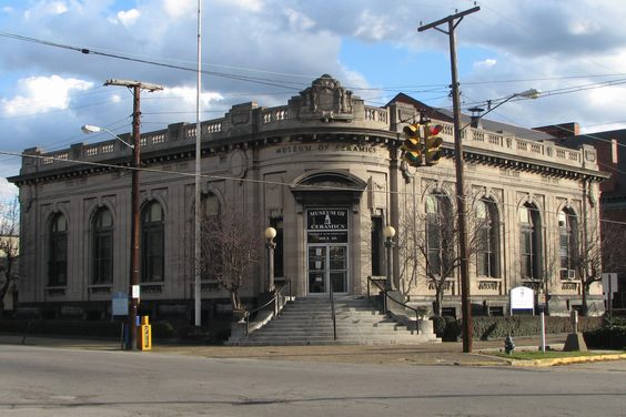
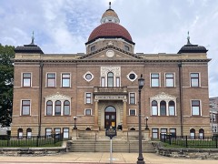
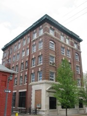
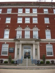
Built in 1909 in the Beaux-Arts. Listed on the National Register of Historic Places in
1976. A historic map-sheet match is not published yet. The record needs a coordinate-quality review before it can be joined to a sheet boundary.
From the record
“The Museum of Ceramics, housed in the former East Liverpool Post Office, is a ceramics museum that contains an extensive collection of ceramic wares produced in and around East Liverpool, Ohio, United States. The museum is operated by a Museum of Ceramics Foundation and by the Ohio History Connection in a city long known as "America's Crockery City" and "The Pottery Capital of the Nation."”
Wikipedia article Museum of Ceramics (East Liverpool, Ohio), CC BY-SA 4.0.
one of 35 National Register listings in Columbiana County · listed in 1976 · category: Building · built in 1909, Beaux-Arts · one of 1 National Historic Landmarks in Columbiana County.
National Register reference number.76001384- the number the National Park Service assigned this property when it was listed, and the key its nomination file is catalogued under at the National Archives.
Fires near this property
32 since 1993
Regional context, not property-specific
evidence. The
federal wildfire occurrence database
lists 32 fires within 5 miles of East Liverpool Post Office between
1993 and 2020, burning about 48 acres in total. None started naturally. 5 were recorded as arson.
Distance is straight-line from the map coordinates, so a fire counted
here may appear on a neighbouring settlement's page as well.
Reported cause
Fires
Debris and open burning
13
Arson/incendiarism
5
Equipment and vehicle use
5
Misuse of fire by a minor
3
Missing data/not specified/undetermined
3
Smoking
1
Railroad operations and maintenance
1
Other causes
1
The most recent of
them, most recent first, with the day each was reported and the service
that recorded it.
Regional context, not property-specific
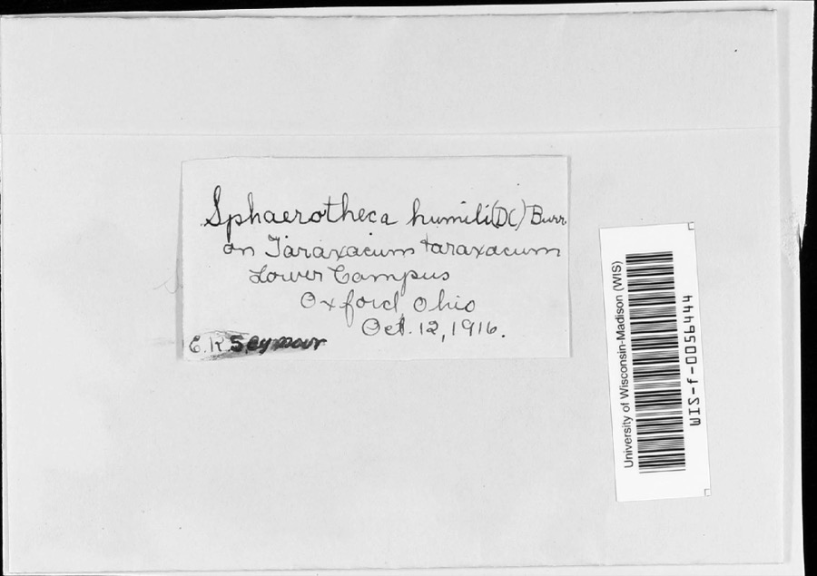
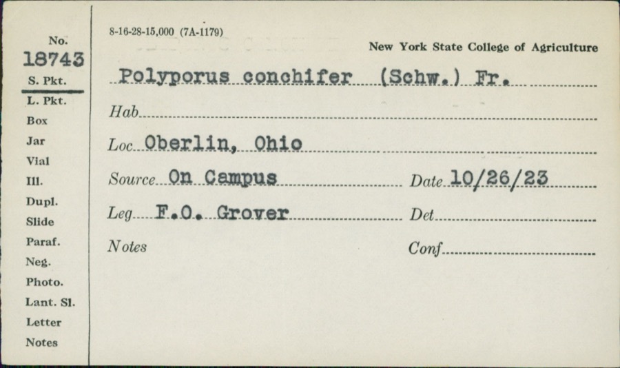
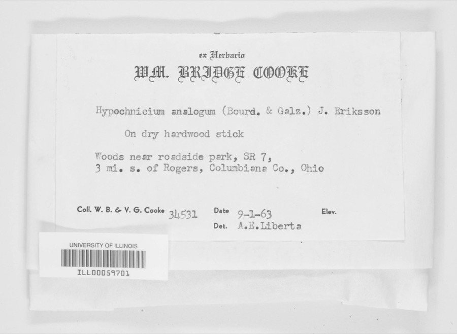
evidence. Museums hold 377 specimens
collected within 10 miles of East Liverpool Post Office between 1895 and
1975: 257 Animalia, 105 Plantae, 15 Fungi. 12 distinct Species records are shown.
Collected by Athearn, Herbert D., Beer, F.H., Bright, J. and others. Each is a
physical object with a catalogue
number, and each entry opens the museum's record. This is what was
collected and kept, not a survey of what lives here - nothing can be
concluded from a species being absent.
Regional context, not property-specific
evidence. The federal mineral resources record lists
4 workings within 5 miles of East Liverpool Post Office: 2 past producers, 1 producer, 1 unknown.
1 still produces. What was taken out: Clay, Fire Clay (Refractory), Sand and Gravel, Construction. Distance is straight-line from the
map coordinates, so a quarry counted here may appear on a neighbouring
settlement's page as well.
Regional context, not property-specific
evidence. The National Weather Service names
East Liverpool, the town this property stands in, in 51 storm reports between 1995 and 2025: 34 thunderstorm wind, 8 hail, 7 flash flood, 1 funnel cloud.
The reports record 1 injury. Each account below is quoted exactly as the forecast office
filed it, from the NOAA Storm Events Database, and each date
opens the federal record of that event.
An NWS storm survey found a downburst occurred in Thompson Park in East Liverpool. Widespread wind damage was found with trees snapped or uprooted, some falling on houses. Maximum wind gusts were estimated at 80-90 MPH. Two minor injuries were reported, one when a tree fell on a car, and another when a vehicle drove into a downed tree.
Local media reported flash flooding on West 8th Street and surrounding streets in East Liverpool with 2 vehicles swamped and a mudslide on State Route 11.
Thunderstorm winds downed numerous trees and power lines. One pickup truck was damaged in the Wellsville area when large tree limbs fell on it and crushed the roof.
Trees and power lines were downed throughout the county. Fifteen miles north of East Liverpool several trees were downed and pea size hail was also reported. Three miles northwest of Georgetown, in the northwest part of the county, some large highway signs were blown down.
1 paper published in this town,
digitised by the Library of Congress and free to read: 0 issues,
0 pages. Every page is searchable, so a name or a street can be
looked for directly in what the town printed about itself at the time.
No historic map-sheet match is published
for this property yet. That does not mean no map exists. This record needs
a coordinate-quality review before it can be joined to a sheet boundary.
Browse the county's mapped places while that work is
pending.
Named in the fire insurance atlases
Sanborn surveyors printed an index of the
town's establishments at the front of each atlas. This property is named in
one, read straight off the scanned sheet.
When this property was proposed for the
National Register, someone wrote the case for it: what the building is,
and why it matters. That document is a federal record in the public domain.
It is quoted below word for word, never summarised. The text was read off the scanned case file by machine, so the
occasional stray character is the recogniser's and the 1970s
typewriter's.
Description of the property
elevation is a square entryway of stone block protected by a large flat- The interior employs round-arched and pedimented openings, cartouches and CONDITION UNEXPOSED DETERIORATED UNALTERED FAIR RUINS EXCELLENT recessed panel below each window.There are fret bands in the frieze.At balusters and railing which alternate with stone panels.Above the entrance CHECK ONE symmetrical building is the main entrance in the rounded NW corner of the beneath the cornice overhang is dentiled.Above the cornice is a parapet of stone recessed windows with carved lintels.The areas surrounding the entrance and The south side is plain with rectangular windows.At the SE side of this will beadapted for museum use but the exterior will have no alterations. is a massive cartouche which joins the parapet.
the corners of the building a large cartouche interupts the frieze.The area roofed overhang once used for the delivery of mail. between the windows are paneled.The east, north, and west sides have lights are larger than the side 1ights.The spandrel is careved in a stylized plant X-GOOD a bracketed segmental DATE XALTERED large round-arched windows. building.A flight of graduated curved stone steps accents the entry. The entry has design.Stone sills are supported by brackets.There isa carved garland in the In cross section the voussoirs are concave. vaulted ceilings. Of special note is the fine terrazzo floor. The interior pediment.To either side of the entrance are l/l pane AREAS OF
Statement of significance
The lot was purchased by the U.S. Government from William Bront, Jr. in 1908 1908 1400-1499 1700-1799 COMMERCE INVENTION EDUCATION RELIGION PERIOD SIGNIFICANCE BUILDER/ARCHITECT MILITARY EXPLORATION/SETTLEMENT CONSERVATION LAW ARCHEOLOGY-PREHISTORIC ART SCULPTURE AGRICULTURE THEATER _POLITICS/GOVERNMENT XARCHITECTURE LITERATURE _TRANSPORTATION _COMMUNICATIONS -1800-1899 _PHILOSOPHY a fitting dedication to this important Ohio industry. Classicism adapted for use in a local public building.The building is in _SOCIAL/HUMANITARIAN -1500-1599 The East Liverpool Post Office building is a good example of Beaux Arts _ENGINEERING _ECONOMICS _INDUSTRY X1900 - MUSIC structure was completed and occupied in 1909. In the 1940's the square stone established by English potters.
By 1925 there were 285 kilns, employing 7,000 workers. The museum to be installed in this fine building will be house the Ohio Historical Society's East Liverpool Pottery Museum. The entry was added on the south side. The building is presently being refurbished to building was purchased by the Ohio Historical Society in 197l.The area around 1925 had become a center of the ceramic industry in Ohio.The first kiln,
Quoted from the National Register nomination
for reference 76001384, 14 pages, held by the National Archives in Record
Group 79. See the
catalogue record.
Listed places nearby
6 within 8 miles
Other National Register properties close
enough to walk or drive between, ordered by distance from this one. Both
positions come from the same geocoding pass that matched these properties
to their map sheets.
Listing record. National Park Service National Register of Historic Places, listed-properties dataset, current to 2026-05-22.
Map join. Address geocoded through the United States Census geocoder, then tested against the published boundary of every sheet in the USGS Historical Topographic Map Collection.
How this page is made. Listing fields come from federal records; map-sheet coverage is a labelled coordinate-to-boundary calculation, not a source-field claim.
Wildfire. Short, Karen C. 2022. Spatial wildfire occurrence data for the United States, 1992-2020 [FPA_FOD_20221014]. 6th Edition. Fort Collins, CO: Forest Service Research Data Archive. https://doi.org/10.2737/RDS-2013-0009.6 Collected with United States Government funding and usable without additional permissions or fees.
Specimens. Global Biodiversity Information Facility (GBIF), https://www.gbif.org/. Only records licensed CC0 or CC BY are used. Records licensed CC BY-NC are excluded because this site carries advertising. Images are checked individually and any whose licence is non-commercial, no-derivatives or unreadable is refused.
Mines and quarries. USGS Mineral Resources Data System (MRDS) https://mrdata.usgs.gov/mrds/ A work of the United States government, no copyright under 17 U.S.C. 105.
Storms. NOAA National Centers for Environmental Information, Storm Events Database https://www.ncei.noaa.gov/stormevents/ A work of the United States government, no copyright under 17 U.S.C. 105. Narratives are quoted verbatim from the National Weather Service report and are not edited or summarised.
 Block
Block