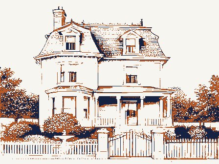
Listed on the National Register of Historic Places in
1976. A historic map-sheet match is not published yet. The record needs a coordinate-quality review before it can be joined to a sheet boundary.
From the record
one of 338 National Register listings in Cuyahoga County · listed in 1976 · category: Building · one of 3 National Historic Landmarks in Cuyahoga County.
National Register reference number.76001408- the number the National Park Service assigned this property when it was listed, and the key its nomination file is catalogued under at the National Archives.
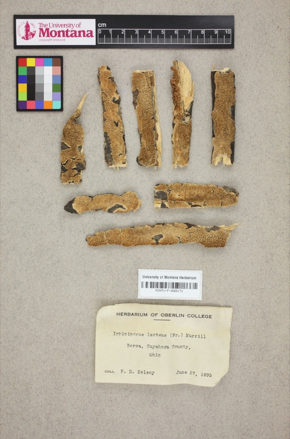
Specimens collected near this property
12 of 2,197 shown
Regional context, not property-specific
evidence. Museums hold 2,197 specimens
collected within 10 miles of Clague House between 1849 and
1975: 1,824 Animalia, 223 Fungi, 121 Plantae, 23 Protozoa, 5 Unrecorded, 1 Chromista. 12 distinct Species records are shown.
Collected by A. D. Huryn, A. G. Newhall, A. Hall and others. Each is a
physical object with a catalogue
number, and each entry opens the museum's record. This is what was
collected and kept, not a survey of what lives here - nothing can be
concluded from a species being absent.
Regional context, not property-specific
evidence. The National Weather Service names
Westlake, the town this property stands in, in 30 storm reports between 1997 and 2023: 19 thunderstorm wind, 8 hail, 3 flash flood.
No death or injury is recorded in these reports. Each account below is quoted exactly as the forecast office
filed it, from the NOAA Storm Events Database, and each date
opens the federal record of that event.
Between 800 and 1000 pm on the evening of May 12th rainfall observations in Olmsted Falls show 2.5-4.44 inches of rain. The rainfall rates were measured at 2.52 inches per hour. A dozen water rescues were conducted however no significant injuries were reported. In all nearly 1,000 homes were inundated in the towns of Olmsted Falls, North Olmsted, and Westlake. The City Hall in Olmsted Falls sustained significant flood damage to their basement. At the Great Northern Mall in North Olmsted 15 cars were submerged and a department store sustained significant damage. Dozens of roads and intersections were closed due to flooding with several feet of water. The major thruway Interstate 480 was closed around 1019 PM. Lewis Road in Olmsted Falls was damaged due to embankment failures.
Flash flooding across the western suburbs of Cleveland, including Bay Village, North Olmsted, Fairview Park, Rocky River and Lakewood. Notable road closures due to flooding include I-90 East near McKinley Avenue and West 117th Avenue between Berea Road and Detroit Avenue in Lakewood, West 130th Street and Bellaire Road and West 150th Street north of Brookpark Road in Cleveland. Great Northern Avenue north of Brookpark Road was flooded with several feet of standing water in North Olmsted. Extensive basement flooding reported, including between 1 to 2 dozen basements in Bay Village and 175 basements in Fairview Park.
A trained weather spotter estimated winds gusts of 60-70 MPH in Westlake with trees down on Bradley Road. The ASOS at Cleveland Hopkins Airport reported a 50 knot gust at the same time. Dispatch also reported six trees down in Berea with one tree down on a house on Buckeye Drive. First Energy reported 15000 customers lost power.
Lake enhanced storms moved off Lake Erie dropping 2 to 3 inches within 90 minutes over Cuyahoga County. Radar estimated as much as 4 inches over a stretch from southern Westlake into Olmsted Falls and east into Berea. As a result drainage systems were overwhelmed and roads rapidly filled with over 3 feet of water. A water rescue was conducted in North Olmsted near the mall.
Trained spotters, broadcast media, and social media all report trees down in the western suburbs of Cleveland, including Westlake, North Olmsted, and Rocky River.
Thunderstorms produced a swath of nickel to quarter size hail as they tracked across the county. Locations impacted by the hail included Westlake, Rocky River, and Lakewood.
No historic map-sheet match is published
for this property yet. That does not mean no map exists. This record needs
a coordinate-quality review before it can be joined to a sheet boundary.
Browse the county's mapped places while that work is
pending.
From the nomination file
1,722 words on record
When this property was proposed for the
National Register, someone wrote the case for it: what the building is,
and why it matters. That document is a federal record in the public domain.
It is quoted below word for word, never summarised. The text was read off the scanned case file by machine, so the
occasional stray character is the recogniser's and the 1970s
typewriter's.
Description of the property
hipped, with a wide double-bracketed cornice and a frieze with inset indicated by the different treatment of the foundation stones (more dressed, less rough-hewn), and the fact that it covers a former cellar small stoop whose columns were replaced at an unknown date, but side stairwell has a handsome Victorian staircase, a long flight with a sharp turn at the top. The front parlor is small and contains the woodwork has been painted, but is capable of restoration. There which occupies the barn to the rear of the house, for rehearsal CONDITION UNEXPOSED DESCRIPTION FAIR bearing walls which continue up through the house. doors are surmounted by a large semi-ellptical fanlight.
On the southeast its arched architraves and cornice are original.The paneled double XGOOD and property storage.The nomination does not include the barn. On the second floor there are five bedrooms.Most of the attic windows.The foundation, sills, and hood molding of the segmental Westlake Historical Society and operated as a house museum.Parts arched windows are of sandstone.The small wing was added later, as XORIGINAL SITE Italianate brick residence. Its basic form is a long rectangular block On the interior most of the original woodwork is intact. The corner there is another porch whose architraves and bracketed cornice storage and utility purposes.The main partition walls are masonry A restoration program for the house is projected for the future.
_UNALTERED with a two-story bay on each side elevation(one rectangular and one is a full attic with finished floors.The house is leased by the CHECK ONE XALTERED entrance which can be seen in the basement. of the basement and first floor are used by the Clague Playhouse, LRUINS are original, but whose posts and railing have been replaced.
in the Cleveland area, 1825-1975. continued to work the farm. One, Sophronia, was a school teacher, and 1879 1700-1799 ARCHEOLOGY-HISTORIC INVENTION RELIGION ART PERIOD BUILDER/ARCHITECT PHILOSOPHY 1900- TRANSPORTATION THEATER PREHISTORIC ARCHITECTURE This handsome Italianate house is a local landmark which has been recog- MILITARY SIGNIFICANCE INDUSTRY LITERATURE be seen on the accompanying map to the west of the house. The park has grape-producing district before the turn of the century. MUSIC LAW SCULPTURE family, deeded the property to the city as a public park. Clague Park may Charles was an attorney.The close-knit family cultivated apple orchards been improved over the years by the people of Westlake. contracted in the war. and vineyards, and according to W. G.
Rose, the Clague vineyards contrib- In 1975, the Clague house was depicted on an eight-pence postage stamp, XEXPLORATION/SETTLEMENT log cabin was soon replaced by a frame house. The two eldest sons, John _COMMERCE _CONSERVATION Margaret and their first child, Ruth Ann, in 1837.They subsequently had nized as commemorating pioneers in Ohio from the Isle of Man, and the _COMMUNICATIONS and Thomas, served in the Civil War. John died as a result of an illness In 1926, Walter and Sophronia, the last surviving members of the -1600-1699 eight more children in Ohio. The farm consisted of 78-l/2 acres.
Quoted from the National Register nomination
for reference 76001408, 12 pages, held by the National Archives in Record
Group 79. See the
catalogue record.
Listed places nearby
6 within 8 miles
Other National Register properties close
enough to walk or drive between, ordered by distance from this one. Both
positions come from the same geocoding pass that matched these properties
to their map sheets.
Listing record. National Park Service National Register of Historic Places, listed-properties dataset, current to 2026-05-22.
Map join. Address geocoded through the United States Census geocoder, then tested against the published boundary of every sheet in the USGS Historical Topographic Map Collection.
How this page is made. Listing fields come from federal records; map-sheet coverage is a labelled coordinate-to-boundary calculation, not a source-field claim.
Specimens. Global Biodiversity Information Facility (GBIF), https://www.gbif.org/. Only records licensed CC0 or CC BY are used. Records licensed CC BY-NC are excluded because this site carries advertising. Images are checked individually and any whose licence is non-commercial, no-derivatives or unreadable is refused.
Storms. NOAA National Centers for Environmental Information, Storm Events Database https://www.ncei.noaa.gov/stormevents/ A work of the United States government, no copyright under 17 U.S.C. 105. Narratives are quoted verbatim from the National Weather Service report and are not edited or summarised.
 Block
Block