Listed on the National Register of Historic Places in
1976. A historic map-sheet match is not published yet. The record needs a coordinate-quality review before it can be joined to a sheet boundary.
From the record
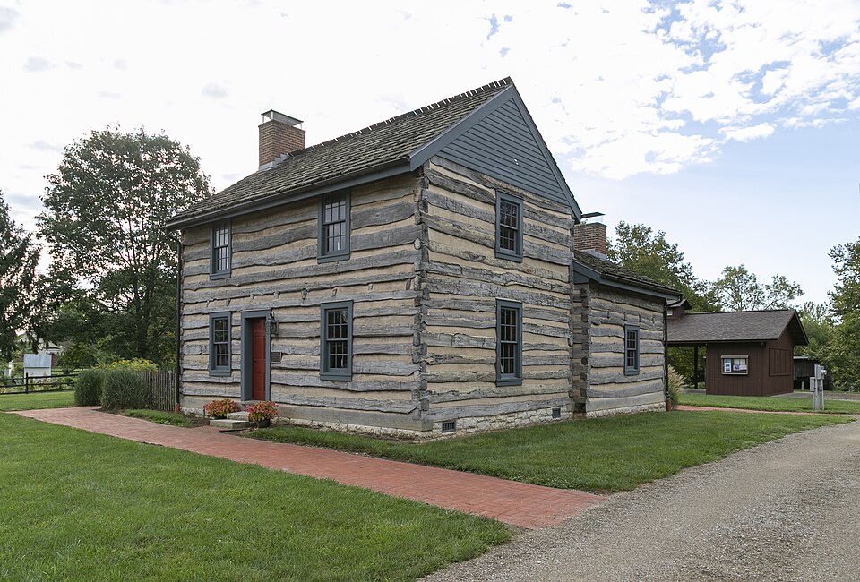
“The Groveport Log House is a historic building located in Groveport, Ohio. Originally constructed in 1815, it was relocated to Heritage Park in 1974 to make way for Groveport's post office.”
Wikipedia article Groveport Log House, CC BY-SA 4.0.
one of 295 National Register listings in Franklin County · listed in 1976 · category: Building · one of 3 National Historic Landmarks in Franklin County.
National Register reference number.76001428- the number the National Park Service assigned this property when it was listed, and the key its nomination file is catalogued under at the National Archives.
The ground it stands on
792 words
The chapter on Madison Township in History of Franklin County [Ohio]:, published 1858 names Groveport. This is what it says, exactly as the scans read.
In February, 1844, Wm. II. Rarey laid out the eastern part of the present town, adjoining the canal, and named it " Rarey's-Port." Mr. Rarey was also a resident of the place at the time. The village improved as fast as either of the proprietors could reasonably expect, but each end of it bearing a different name. The propriety of a common name for the whole, soon became manifest to all. Each proprietor would doubtless have preferred his own chosen name. The citizens finally, willing to treat both proprietors alike, concluded to drop the prefix, or personal name of both, and retain the latter part of each name, and thus the name of " Groveport " was agreed upon ; and by that name it was incorporated at the session of 1846-7.
Groveport is quite a business place, well supplied with stores of dry goods and groceries, one drug store, three physicians, four churches, one Baptist, one Methodist, one Presbyterian, and one United Brethren, and a large and commodious school house. In 1850, the population was 483.
Regional context, not property-specific
evidence. The
federal wildfire occurrence database
lists 1 fire within 5 miles of Groveport Log Houses between
2010 and 2010, burning about 1 acres in total. None started naturally. None was recorded as arson.
Distance is straight-line from the map coordinates, so a fire counted
here may appear on a neighbouring settlement's page as well.
Reported cause
Fires
Debris and open burning
1
The most recent of
them, most recent first, with the day each was reported and the service
that recorded it.
Regional context, not property-specific
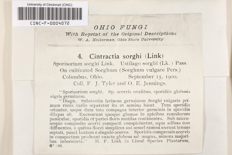
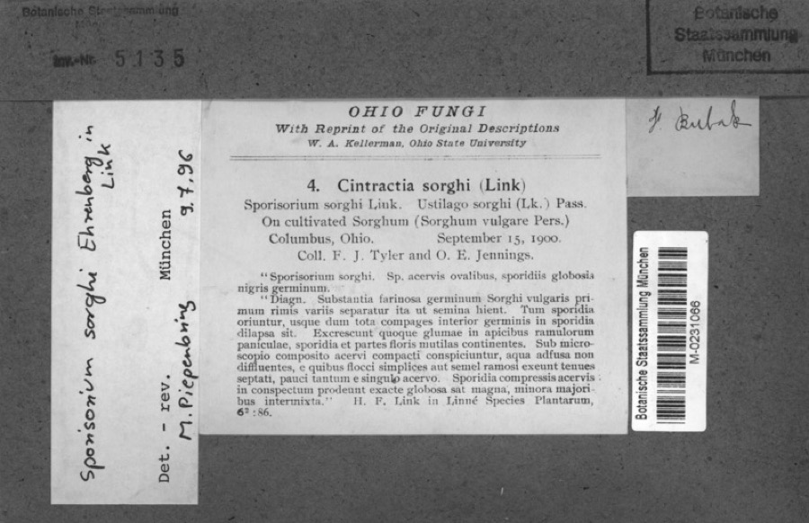
evidence. Museums hold 5,801 specimens
collected within 10 miles of Groveport Log Houses between 1821 and
1975: 4,166 Animalia, 1,178 Fungi, 342 Plantae, 84 Chromista, 30 Unrecorded, 1 Protozoa. 12 distinct Species records are shown.
Collected by 19 V 1938 in original publication, Knull, =, ? and others. Each is a
physical object with a catalogue
number, and each entry opens the museum's record. This is what was
collected and kept, not a survey of what lives here - nothing can be
concluded from a species being absent.
Regional context, not property-specific
evidence. The federal mineral resources record lists
6 workings within 5 miles of Groveport Log Houses: 3 past producers, 3 producers.
3 still produce. What was taken out: Sand and Gravel, Construction. Distance is straight-line from the
map coordinates, so a quarry counted here may appear on a neighbouring
settlement's page as well.
Regional context, not property-specific
evidence. The National Weather Service names
Groveport, the town this property stands in, in 19 storm reports between 2002 and 2025: 7 hail, 6 thunderstorm wind, 3 tornado, 2 flood.
The reports record 2 injuries. Each account below is quoted exactly as the forecast office
filed it, from the NOAA Storm Events Database, and each date
opens the federal record of that event.
Two men were injured when lightning struck a tree that they were standing under. The men, aged 22 and 24, had been fishing at a nearby pond and were waiting out the storm underneath the tree.
Half of a roof was blown off of a pole barn, a shed was destroyed, a garage was blown in and lifted off of its foundation, a roof was blown off of a house, and other homes in the area were damaged due to thunderstorm winds.
The tornado began within or near the Walnut Woods Metro Park area, more specifically west of Richardson Road. Numerous pine trees were snapped and uprooted, likely indicating the strongest period of the tornado. The tornado continued eastward over Lithopolis Road where more tree damage was observed. In the Canal Winchester area, additional tree damage and light structure damage was observed throughout the city, with the damage centered on West Waterloo Street on the north side of town. The tornado then moved into Fairfield County as it crossed U.S. Route 33 at 0552EST. The tornado ended at 0554EST, about 1.5 miles north of Waterloo.
A brief tornado touched down near Bixby Road between Walden Trace and Hickory Grove Circle. The tornado struck two barns. Both barns were totally destroyed with damage blown into a nearby field. Another nearby barn lost almost all of the roof. Damage is indicative of wind speeds around 70 miles per hour.
Twelve greenhouses constructed of metal poles overlaid with a plastic material were damaged to various degrees. The greenhouse farthest west was hit first by the circulation and was almost completely destroyed. Many of the plants inside the greenhouses were low to the ground and therefore sustained very little damage. A metal door on a small warehouse attached to the greenhouses was bent. Balled and bur-lapped trees were pulled toward the center of the path. Additional damage at this location included plant transport carts pulled from a loading dock into a small pond. A small metal storage shed toward the end of the observed path was also heavily distorted. Trees west of the damage path and a house immediately east of the path were not damaged. Estimated maximum wind speed based on damage is around 83 miles per hour.
No historic map-sheet match is published
for this property yet. That does not mean no map exists. This record needs
a coordinate-quality review before it can be joined to a sheet boundary.
Browse the county's mapped places while that work is
pending.
From the nomination file
2,475 words on record
When this property was proposed for the
National Register, someone wrote the case for it: what the building is,
and why it matters. That document is a federal record in the public domain.
It is quoted below word for word, never summarised. The text was read off the scanned case file by machine, so the
occasional stray character is the recogniser's and the 1970s
typewriter's.
Description of the property
The two log houses under consideration were offered to the Groveport Heritage and Southeast corner of Madison and Main Sts. before commencement of construction of the new postal station. It was either remove it, or see it demolished. The structure at first appeared to be one house. However, upon removing the wood siding, it became evident that the rear, one and one-half story portion is an independent structure, added as a kitchen, with its own log wall separate from the two-story house. house, 17x28 ft., dates 1815-1825, with remodeling of the two between 1840-1850. The construction where the logs intersect. The larger house is built with the steeple notch style joint which was used primarily between 1815-1825.
The smaller house was built with a half dovetail style corner which dates between 1825-1835. As one enters the front door of the large house there is a wall to the immediate right which forms one side of a large room which is about 2/3 of the area of the first ceiling of the room opposite the chimney. Both log houses were initially whitewashed on the interior, then lathed and plastered. The darkened logs on the second floor between windows indicate a probable inside placement of the original fireplace and chimney which were later removed in favor in its existence, perhaps made possible by the presence of the Canal which brought style indicating the use of box or rim locks. To accommodate the moving of the log houses intact, the roofs, windows, and doors were removed.
The houses are presently on their new permanent location. CONDITION EXCELLENT UNALTERED DETERIORATED FAIR The ceiling joists were originally exposed, then plastered.
The Groveport log houses, circa 1815-1825, embody the distinctive characteristics Since settlers first came to the Groveport area around 1806, the log houses in question were built soon after their arrival and before the major development of the town , a period of time and a method of house construction which are unfamiliar to many, and in Groveport which are visibly constructed of logs and which are in good condition. All other such structures have.been removed or destroyed or are obscured by.*... broad patterns of our history.
For ours to have been moved rather than destroyed c2 The log houses, when accurately restored in a dignified manner as part of our master plan, will serve as a lasting reminder of Groveport's celebration of our houses are now immediately adjacent to the route of the old Ohio and Erie Canal which was completed through Groveport in 1834 and which accounts for much of the town's John S. Rarey, Internationally known horse tamer of the 1850 s, is buried. During its early as well as later existence, the log house served as a residence to several families in the community.
Now it will again have the opportunity to serve, 1700-1799 1400-1499 1600-1699 ECONOMICS COMMUNICATIONS ENGINEERING PERIOD ARCHEOLOGY-HISTORIC PHILOSOPHY RELIGION INVENTION BUILDER/ARCHITECT CONSERVATION AGRICULTURE SIGNIFICANCE SCULPTURE THEATER MILITARY 1900- XARCHITECTURE LITERATURE INDUSTRY X_EXPLORATION/SETTLEMENT _POLITICS/GOVERNMENT -TRANSPORTATION Nations Bicentennial.Their new location has special significance because the log -1500-1599 _COMMERCE which represent one of a few remaining structures associated with the early settling _EDUCATION of our community. insures that their significance as a link to our cultural and architectural past will be early development.They are also adjacent to the early town cemetery in which of the richness of our heritage.
Quoted from the National Register nomination
for reference 76001428, 21 pages, held by the National Archives in Record
Group 79. See the
catalogue record.
Listed places nearby
6 within 8 miles
Other National Register properties close
enough to walk or drive between, ordered by distance from this one. Both
positions come from the same geocoding pass that matched these properties
to their map sheets.
Listing record. National Park Service National Register of Historic Places, listed-properties dataset, current to 2026-05-22.
Map join. Address geocoded through the United States Census geocoder, then tested against the published boundary of every sheet in the USGS Historical Topographic Map Collection.
How this page is made. Listing fields come from federal records; map-sheet coverage is a labelled coordinate-to-boundary calculation, not a source-field claim.
Wildfire. Short, Karen C. 2022. Spatial wildfire occurrence data for the United States, 1992-2020 [FPA_FOD_20221014]. 6th Edition. Fort Collins, CO: Forest Service Research Data Archive. https://doi.org/10.2737/RDS-2013-0009.6 Collected with United States Government funding and usable without additional permissions or fees.
Specimens. Global Biodiversity Information Facility (GBIF), https://www.gbif.org/. Only records licensed CC0 or CC BY are used. Records licensed CC BY-NC are excluded because this site carries advertising. Images are checked individually and any whose licence is non-commercial, no-derivatives or unreadable is refused.
Mines and quarries. USGS Mineral Resources Data System (MRDS) https://mrdata.usgs.gov/mrds/ A work of the United States government, no copyright under 17 U.S.C. 105.
Storms. NOAA National Centers for Environmental Information, Storm Events Database https://www.ncei.noaa.gov/stormevents/ A work of the United States government, no copyright under 17 U.S.C. 105. Narratives are quoted verbatim from the National Weather Service report and are not edited or summarised.
 Block
Block