BlockBefore
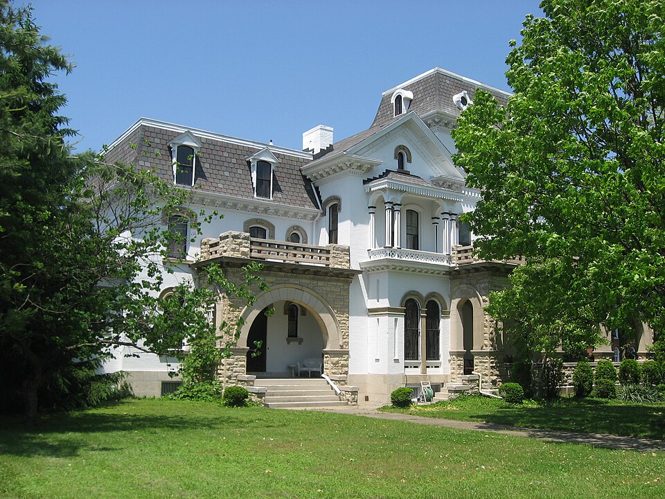
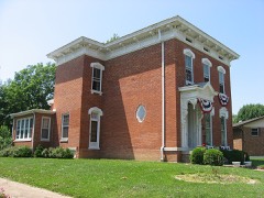
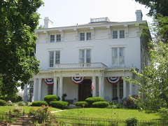
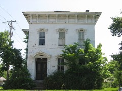
Photograph of Millen-Schmidt House
Photograph by Nyttend, Public domain. Via Wikimedia Commons.

Millen-Schmidt House

Listed on the National Register of Historic Places in 1976. A historic map-sheet match is not published yet. The record needs a coordinate-quality review before it can be joined to a sheet boundary.

From the record

“The Millen-Schmidt House is a historic residence in Xenia, Ohio, United States. Built in the late nineteenth century, it was named a historic site after surviving a massive tornado.”

Wikipedia article Millen-Schmidt House, CC BY-SA 4.0.

one of 30 National Register listings in Greene County · listed in 1976 · category: Building · one of 1 National Historic Landmarks in Greene County.

Sources: the Wikipedia article · the case file at the National Archives · the National Register database, National Park Service

The listing

  • What is counted as historic. The nomination lists 1 building as contributing to the listing.
  • Address. 184 N. King St., Xenia, 45385
  • When was it listed? 1976-11-07
  • Category. building
  • Township. Xenia city
  • Architectural style. Italianate architecture, Renaissance Revival architecture
  • National Register reference number. 76001432 - the number the National Park Service assigned this property when it was listed, and the key its nomination file is catalogued under at the National Archives.

Specimens collected near this property

12 of 958 shown

Regional context, not property-specific evidence. Museums hold 958 specimens collected within 10 miles of Millen-Schmidt House between 1870 and 1975: 713 Animalia, 142 Plantae, 100 Fungi, 2 Protozoa, 1 Unrecorded. 12 distinct Species records are shown. Collected by ?, A JOHN, A. H. Bauer and others. Each is a physical object with a catalogue number, and each entry opens the museum's record. This is what was collected and kept, not a survey of what lives here - nothing can be concluded from a species being absent.

Image SpeciesYear Collected by Where, as recorded
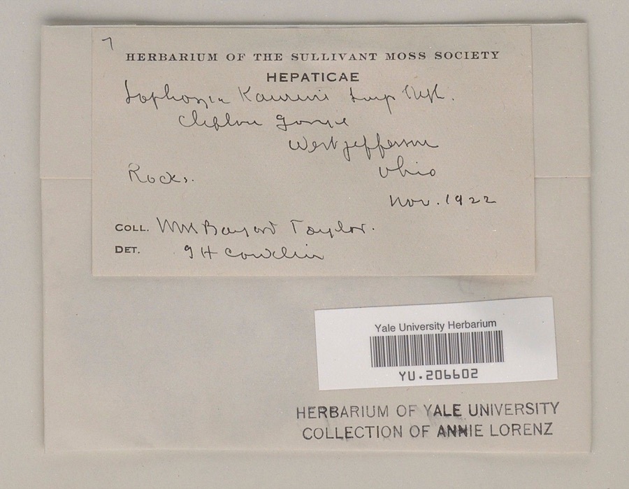
Specimen of Leiocolea gillmanii (Austin) A.EvansLeiocolea gillmanii (Austin) A.Evans1922William Bayard Taylor; G. H. ConklinClifbore[sp?] Gorge
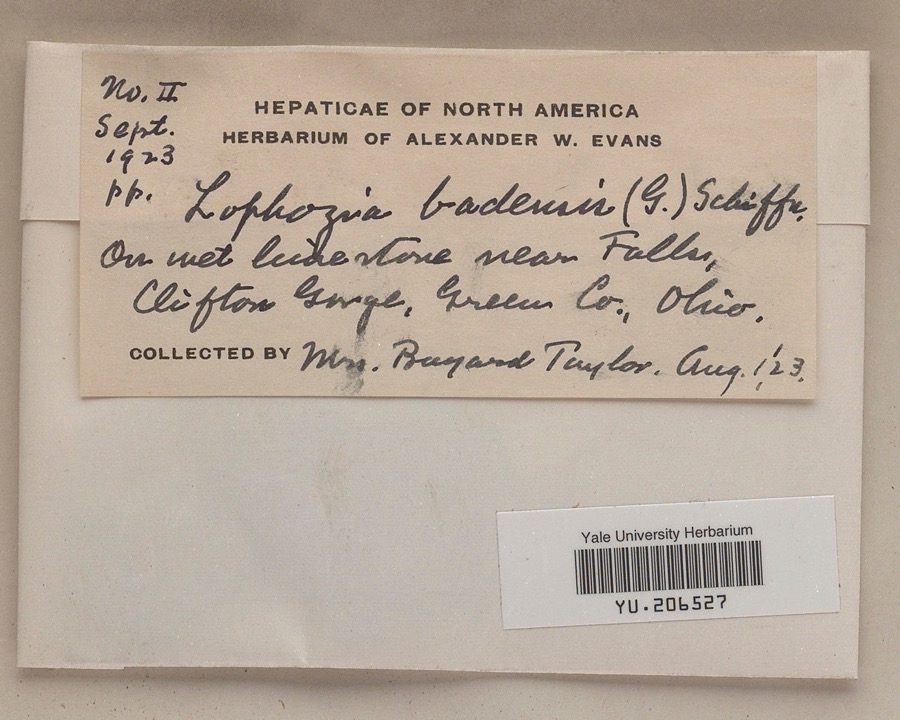
Specimen of Leiocolea badensis (Gottsche ex Rabenh.) Jørg.Leiocolea badensis (Gottsche ex Rabenh.) Jørg.1923Mrs. Bayard R. TaylorClifton Gorge
A photograph of the species Bidens bipinnata, not of this specimenBidens bipinnata L.1870J Y Bergen; T L BergenYellow Springs
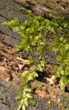
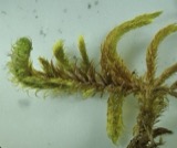
A photograph of the species Rhynchostegium serrulatum, not of this specimenRhynchostegium serrulatum (Hedw.) A.Jaeger1873Collector unspecifiedClifton
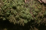
A photograph of the species Rhytidium rugosum, not of this specimenRhytidium rugosum (Hedw.) Kindb.1873not recordedClifton
A photograph of the species Thamnobryum alleghaniense, not of this specimenThamnobryum alleghaniense (Müll.Hal.) Nieuwl.1875H. J. BiddlecomeClifton
Brachythecium laetum (Brid.) Schimp.1876not recordedClifton
Brachythecium oxycladon (Brid.) A.Jaeger1876Mrs. Spence
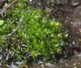
A photograph of the species Bryum affine, not of this specimenBryum affine (Blandow ex Funck) Brid.1876Collector unspecifiedClifton
A photograph of the species Eurhynchium hians, not of this specimenEurhynchium hians (Hedw.) Sande Lac.1876H. J. BiddlecomeClifton
A photograph of the species Geocalyx graveolens, not of this specimenGeocalyx graveolens (Schrad.) Nees1876not recordedClifton
Plagiochila asplenioides (L.) Dumort.1876H. J. BiddlecomeClifton

All 958 specimens within 10 miles, at the Global Biodiversity Information Facility.

Mines and quarries near this property

10 within 5 miles

Regional context, not property-specific evidence. The federal mineral resources record lists 10 workings within 5 miles of Millen-Schmidt House: 6 past producers, 3 producers, 1 plant. 4 still produce. What was taken out: Sand and Gravel, Construction. Distance is straight-line from the map coordinates, so a quarry counted here may appear on a neighbouring settlement's page as well.

Where SiteCommodity StatusRecorded
Armentrout Sand and Gravel PitSand and Gravel, ConstructionPast ProducerSedimentary
Armentrout Sand and Gravel PitSand and Gravel, ConstructionPast Producer
Haines Road #419Sand and Gravel, ConstructionPast Producer
Phillips PitSand and Gravel, ConstructionPast ProducerSedimentary
Phillips Sand and Gravel CompanySand and Gravel, ConstructionProducer
Richards and Son Gravel PitSand and Gravel, ConstructionProducer
Xenia PitSand and Gravel, ConstructionPast ProducerSedimentary
Xenia Plant No. 414 & PitSand and Gravel, ConstructionPlant
Xenia Sand and Gravel PitSand and Gravel, ConstructionPast ProducerSedimentary
Xenia Sand and Gravel PitSand and Gravel, ConstructionProducer

Every working recorded in Greene County

Storms near this property

60 of 80 shown

Regional context, not property-specific evidence. The National Weather Service names Xenia, the town this property stands in, in 80 storm reports between 1994 and 2025: 42 thunderstorm wind, 25 hail, 7 flood, 4 flash flood. The reports record 1 death and 100 injuries. Each account below is quoted exactly as the forecast office filed it, from the NOAA Storm Events Database, and each date opens the federal record of that event.

WhenEvent Place namedHarm What the report says
September 2000Tornado (F4)Xenia1 killed, 100 hurt, $15,000,000A violent tornado that moved at 65 mph hit the town of Xenia for the second time in 26 years damaging some of the same areas that were hit in 1974. Along the path of the tornado, around 250 homes were either damaged or destroyed, over 40 businesses were damaged or destroyed including the local Wal Mart, Kroger, and Tire Discounters, and 6 churches were damaged. A strip mall was nearly destroyed, cars were thrown from the Highway 35 bypass into ditches, 4 semi-trailers were thrown up to 400 yards, and most of the buildings were damaged or destroyed at the Greene county fairgrounds. In Sugarcreek Township, which is to the southwest of Xenia, an additional 14 houses and 3 barns were damaged and some crops were destroyed on a narrow path. Over 10,000 residents were without power for at least 1 day.
May 2004HailXenia$30,000Seven trees were also downed along Home Avenue on the south side of town.
March 2002Thunderstorm WindXenia$12,000Thunderstorm winds knocked down trees and powerlines, and tore part of the roof off of a multi-unit apartment building.
May 2003Thunderstorm WindXenia$10,000Several trees were knocked down, including one that fell on a parked car.
October 2001Thunderstorm WindXenia$10,000Several trees were knocked down across the county, and one in town landed on a house.
May 1998Tornado (F0)Xenia$10,000A tornado briefly touched down ripping a roof off a home and knocking down numerous trees.
July 2020Thunderstorm WindXenia$6,000Numerous trees were downed in the Xenia area.
August 2003Thunderstorm WindXenia$6,000Numerous trees and large limbs were downed.
August 2022Thunderstorm WindXenia$5,000Several trees were uprooted and damaged near the Greene County Fish and Game Association.
June 2020Thunderstorm WindXenia$5,000Trees and power lines were knocked down.
July 1999Thunderstorm WindXenia$5,000Trees and power lines downed.
April 1994Thunderstorm WindXenia$5,000Trees downed.
June 2000Thunderstorm WindXenia$4,000Numerous trees were blown down.
October 1999Thunderstorm WindXenia$4,000Trees were knocked down in town along with several trees downed in the eastern third of the county.
June 2022Thunderstorm WindXenia$3,000A tree was downed onto some power lines on McDowell Street.
April 2015Thunderstorm WindXenia$3,000A large tree fell on a house on Chestnut Street.
May 2014Thunderstorm WindXenia$3,000A tree was downed near Highway 68 and another tree was downed on power lines and a shed near Parnell Park due to thunderstorm winds.
June 2008Thunderstorm WindXenia$3,000Several trees were downed.
May 2007Thunderstorm WindXenia$3,000Several trees were downed.
March 2007FloodXenia$3,000Numerous roads were flooded and closed across the county.
June 2005Thunderstorm WindXenia$3,000Trees were knocked down.
May 2004Thunderstorm WindXenia$3,000Trees were downed.
July 2004Thunderstorm WindXenia$3,000Trees and powerlines were downed.
July 2003Thunderstorm WindXenia$3,000Large tree limbs were downed on South Detroit Street.
November 2002Thunderstorm WindXenia$3,000Two trees were knocked down on a house.
September 2002Thunderstorm WindXenia$3,000Numerous trees were downed across the southeast part of the county.
June 2000Flash FloodXenia$3,000Roads had to be closed due to high water.
May 1999Thunderstorm WindXenia$3,000Large tree limbs and power lines were reported down.
July 1999Thunderstorm WindXenia$3,000Trees knocked down.
November 1998Thunderstorm WindXenia$3,000Numerous trees down across the county.
June 2008HailXenia$3,000no account filed
June 2020Thunderstorm WindXenia$2,000Trees were reported down between McDowell Street and Home Avenue.
August 2007Thunderstorm WindXenia$2,000Large tree limbs were downed.
May 2004Thunderstorm WindXenia$2,000Large limbs were knocked down.
June 2025Thunderstorm WindXenia$1,000A tree was downed.
June 2022Thunderstorm WindXenia$1,000A spruce tree was downed.
July 2015Thunderstorm WindXenia$1,000A tree was downed at the intersection of Ledbetter Road and State Route 380.
July 2013Thunderstorm WindXenia$1,000A large tree was snapped in Xenia due to thunderstorm winds.
June 2012Thunderstorm WindXenia$1,000Large tree branches were reported down due to damaging thunderstorm winds.
April 2011Thunderstorm WindXenia$1,000Trees were reported down due to damaging thunderstorm winds.
May 2011Thunderstorm WindXenia$1,000A tree was reported down due to damaging thunderstorm winds.
June 2010Thunderstorm WindXenia$1,000One tree was reported down due to damaging thunderstorm winds.
June 2000Flash FloodXenia$1,000Streets were closed due to 2.3 inches of rain in under 2 hours.
June 2020FloodXenia$500A basement was flooded in Xenia.
July 2024Thunderstorm WindXenia$200A large tree branch was downed along Walnut Street.
July 2020Thunderstorm WindXenia$100One 3 inch diameter branch was downed.
March 2020Flash FloodXenia-Several roads remained closed across the county due to high flowing water.
March 2020FloodXenia-Several roads remained closed due to high water from earlier heavy rainfall.
June 2020FloodXenia-Flooding was reported on Antrim Road.
August 2018FloodXenia-Some high water was reported on a few streets.
June 2018FloodXenia-High water was reported over Route 380 near Washington Road.
November 2017FloodXenia-A few roads were closed due to high water.
August 2016Flash FloodXenia-There were reports of flooded streets in Xenia. The depth of the water was ten inches.
June 2012Thunderstorm WindXenia-The spotter estimated the speed of the wind gust.
August 2009Thunderstorm WindXenia-Trees were reported down on roads due to damaging thunderstorm winds.
June 2009HailXenia-Hail covered the ground in Xenia.
July 1998Thunderstorm WindXenia-Winds gusted to 70 mph.
July 2024HailXenia-no account filed
June 2021HailXenia-no account filed
April 2016HailXenia-no account filed

Every storm recorded in Greene County

Newspapers printed here

0 digitised pages

1 paper published in this town, digitised by the Library of Congress and free to read: 0 issues, 0 pages. Every page is searchable, so a name or a street can be looked for directly in what the town printed about itself at the time.

NewspaperPublished
Ohio Standard and Observer1897 to 19??

Map coverage status

No historic map-sheet match is published for this property yet. That does not mean no map exists. This record needs a coordinate-quality review before it can be joined to a sheet boundary. Browse the county's mapped places while that work is pending.

Named in the fire insurance atlases

Sanborn surveyors printed an index of the town's establishments at the front of each atlas. This property is named in one, read straight off the scanned sheet.

From the nomination file

4,080 words on record

When this property was proposed for the National Register, someone wrote the case for it: what the building is, and why it matters. That document is a federal record in the public domain. It is quoted below word for word, never summarised. The text was read off the scanned case file by machine, so the occasional stray character is the recogniser's and the 1970s typewriter's.

Description of the property

One, a veranda, wraps around the tower from the main entrance to the rear cross block. Another, a drive-through entrance gallery, curb, semi-circular dormers front and rear and two bays of round CONDITION foundation. angle. FAIR XEXCELLENT CHECK ONE joined semi-circular transomed entrance with elaborate patterns The massive three story two bay tower has the overall scheme tower in the left reentrant angle.A large mansarded wing is See Continuation Sheet The well preserved interior is high ceilinged and spacious. polygonal bay.The eaves are box cornice with consoles and porches in rockfaced stone with sandstone trim sitting on high of segmental above semi-circular windows with l/l double hung excellent.Several of the ceilings have retained their decorative frieze, and returns.

gable roofed blocks form a lopsided T with a three story rectangular extends north from the reentrant angle behind the cross block.On dormers north and south. balanced behind the cross block and a relatively small one story arch with low hip roof.There is a semi-circular gable window. The facade of the right block and the south front of the is a recessed gallery with a semi-circular arch. The main entrance is sheltered by the veranda in a flat roofed The two story brick mansion has an Italian Villa plan.Two the south side the entrance in the reentrant - UNALTERED -RUINS - GOOD The third story has semi-circular windows paired on The box cornice has consoles and frieze.Above the cornice isa plaster work.The moulded composition wainscotting is well preserved.

with consoles and dentiled frieze supporting a concave mansard with The north end of the cross block forms a pavilion with a one story The porches have decks with a stone balustrade.ne belt course.

Read the complete 4,080-word case file.

Statement of significance

INVENTION Prosperous merchant Henry E. Schmidt bought the house in l9l2. Eli Millen saw its parent on a trip to Europe and was greatly INDUSTRY impressed.A friend reported seeing a copy in New York.Miilen _SOCIAL/HUMANITARIAN X1800-1899 damaged in the Xenia tornado of April,1974,that engineers -LITERATURE the 1870's in Xenia. -MUSIC -COMMUNITY PLANNING SPECIFIC DATES c.1871 - porch, 1912 Becoming splendor. recommended its demolition.

ARCHEOLOGY-PREHISTORIC immigrant father's prosperous store and further developed the Since most of Xenia's fine homes were destroyed by the tornado, partnership with James C.McMillan in a dry goods store.Millen charitable causes.It is felt he built the house for his second a Second Empire roof and a Romanesque porch.It is reported that later added butchering and pork packing to his ventures. apartment to a single family dwelling. The house was so badly The William Schmidts, proud of hired the New York architect, whose name we do not know, to plan "comings and goings."Henry Schmidt (b. 1858) bought out his

The whole case file for this property - 4,080 words, 35 pages, reproduced complete.

Quoted from the National Register nomination for reference 76001432, 35 pages, held by the National Archives in Record Group 79. See the catalogue record.

Listed places nearby

6 within 8 miles

Other National Register properties close enough to walk or drive between, ordered by distance from this one. Both positions come from the same geocoding pass that matched these properties to their map sheets.

Photograph PropertyDistance Listed
Patterson, Samuel N., House0.2 miles1976
Bank Of Xenia0.3 miles1973
Conner, Alexander, House0.3 miles1987
Xenia Carnegie Library0.3 miles2015
East Second Street District0.4 miles1973
Hollencamp House0.5 miles1980

Sources for this property

National Archives recordThe nomination case file for reference 76001432 in Record Group 79.
Wikipedia articleCommunity-written account of this property, licensed CC BY-SA.
Greene CountyAll 30 listed properties in this county.

Provenance

  • Listing record. National Park Service National Register of Historic Places, listed-properties dataset, current to 2026-05-22.
  • Map join. Address geocoded through the United States Census geocoder, then tested against the published boundary of every sheet in the USGS Historical Topographic Map Collection.
  • How this page is made. Listing fields come from federal records; map-sheet coverage is a labelled coordinate-to-boundary calculation, not a source-field claim.
  • Specimens. Global Biodiversity Information Facility (GBIF), https://www.gbif.org/. Only records licensed CC0 or CC BY are used. Records licensed CC BY-NC are excluded because this site carries advertising. Images are checked individually and any whose licence is non-commercial, no-derivatives or unreadable is refused.
  • Mines and quarries. USGS Mineral Resources Data System (MRDS) https://mrdata.usgs.gov/mrds/ A work of the United States government, no copyright under 17 U.S.C. 105.
  • Storms. NOAA National Centers for Environmental Information, Storm Events Database https://www.ncei.noaa.gov/stormevents/ A work of the United States government, no copyright under 17 U.S.C. 105. Narratives are quoted verbatim from the National Weather Service report and are not edited or summarised.