USS MASSACHUSETTS (BB-59) National Historic Landmark
A National Historic Landmark. Listed on the National Register of Historic Places in
1976. A historic map-sheet match is not published yet. The record needs a coordinate-quality review before it can be joined to a sheet boundary.
From the record
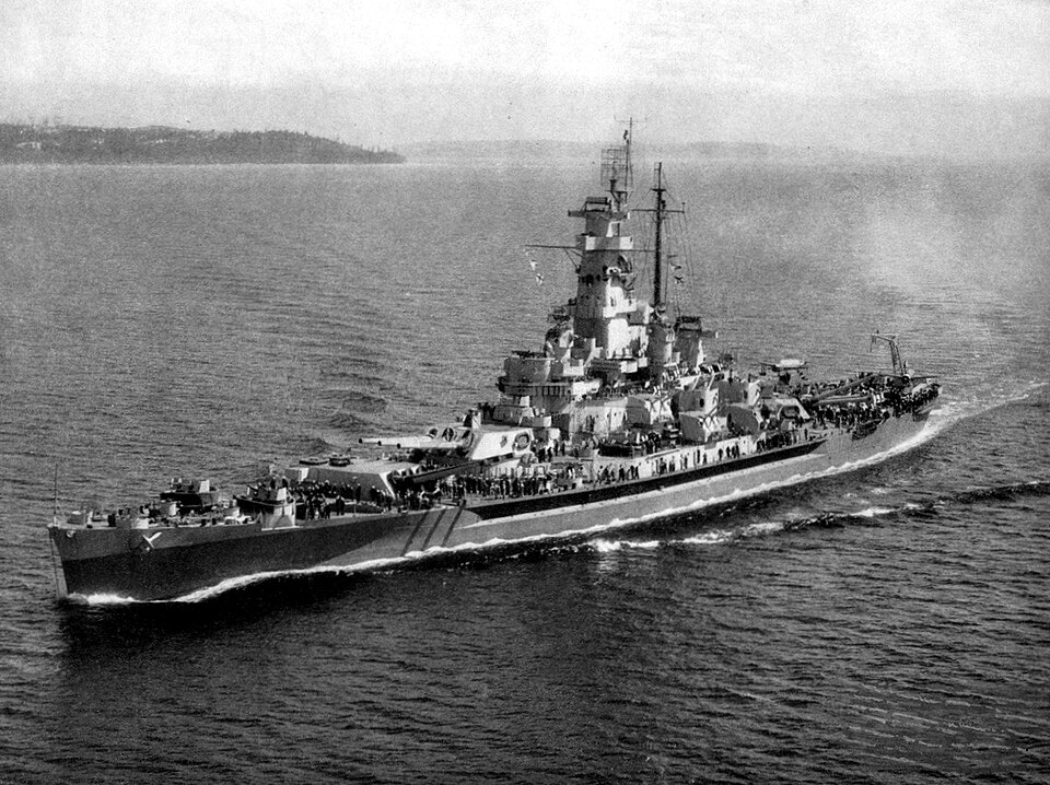
“USS Massachusetts, hull number BB-59, is the third of four South Dakota-class fast battleships built for the United States Navy in the late 1930s. The first American battleships designed after the Washington treaty system began to break down in the mid-1930s, they took advantage of an escalator clause that allowed increasing the main battery to 16-inch (406 mm) guns, but refusal to authorize larger battleships kept their displacement close to the Washington limit of 35,000 long tons (36,000 t).”
Wikipedia article USS Massachusetts (BB-59), CC BY-SA 4.0.
one of 272 National Register listings in Bristol County · listed in 1976 · category: Structure · one of 8 National Historic Landmarks in Bristol County.
National Register reference number.76002269- the number the National Park Service assigned this property when it was listed, and the key its nomination file is catalogued under at the National Archives.
Fires near this property
24 since 2002
Regional context, not property-specific
evidence. The
federal wildfire occurrence database
lists 24 fires within 5 miles of USS MASSACHUSETTS (BB-59) National Historic Landmark between
2002 and 2020, burning about 54 acres in total. None started naturally. 4 were recorded as arson.
Distance is straight-line from the map coordinates, so a fire counted
here may appear on a neighbouring settlement's page as well.
Reported cause
Fires
Missing data/not specified/undetermined
11
Arson/incendiarism
4
Debris and open burning
4
Misuse of fire by a minor
2
Recreation and ceremony
1
Power generation/transmission/distribution
1
Equipment and vehicle use
1
The most recent of
them, most recent first, with the day each was reported and the service
that recorded it.
Regional context, not property-specific
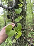
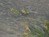
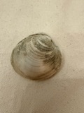
evidence. Museums hold 1,060 specimens
collected within 10 miles of USS MASSACHUSETTS (BB-59) National Historic Landmark between 1844 and
1975: 582 Animalia, 368 Plantae, 77 Fungi, 29 Chromista, 4 Unrecorded. 12 distinct Species records are shown.
Collected by A E Schuyler, A. B. Hervey, A. Macrae and others. Each is a
physical object with a catalogue
number, and each entry opens the museum's record. This is what was
collected and kept, not a survey of what lives here - nothing can be
concluded from a species being absent.
Regional context, not property-specific
evidence. The federal mineral resources record lists
2 workings within 5 miles of USS MASSACHUSETTS (BB-59) National Historic Landmark: 1 unknown, 1 plant.
1 still produces. What was taken out: Stone, Crushed/Broken, Sand and Gravel, Construction. Distance is straight-line from the
map coordinates, so a quarry counted here may appear on a neighbouring
settlement's page as well.
Regional context, not property-specific
evidence. The National Weather Service names
Fall River, the town this property stands in, in 24 storm reports between 1997 and 2025: 10 flood, 5 thunderstorm wind, 5 flash flood, 2 hail.
No death or injury is recorded in these reports. Each account below is quoted exactly as the forecast office
filed it, from the NOAA Storm Events Database, and each date
opens the federal record of that event.
At 1:25 PM EST, several cars were trapped in flood waters on Quequechan Street and Warren Street, near a Walmart store. The two streets were closed due to flooding.
Warren Street was flooded and impassable. A car was stuck in flood waters on Pleasant Street at the intersection with Quarry Street. Manhole covers popped off due to flooding on Globe Street.
No historic map-sheet match is published
for this property yet. That does not mean no map exists. This record needs
a coordinate-quality review before it can be joined to a sheet boundary.
Browse the county's mapped places while that work is
pending.
From the nomination file
6,784 words on record
When this property was proposed for the
National Register, someone wrote the case for it: what the building is,
and why it matters. That document is a federal record in the public domain.
It is quoted below word for word, never summarised. The text was read off the scanned case file by machine, so the
occasional stray character is the recogniser's and the 1970s
typewriter's.
Description of the property
The U.S.S. Massachusetts (BB 59) is semi-permanently moored in Battleship Cove on the Taunton River, just north of the Braga Bridge. It is protected to the east by filled land and a high embankment, and faces the open water of the River to the north andwest. The Massachusetts, a battleship, is about 680 feet in length, 108 feet wide at its extreme beam, and has a draft of 29 feet 3 inches. The ship, haze gray in color, is constructed of steel throughout, with a deck of marine teakwood. The maximum thickness of the ship is 18 inches on the conning tower. The ship's original armaments included nine 16 inch 45 caliber guns, twenty 5 inch 38 caliber guns, fifteen quadruple 40 mm. anti-aircraft guns, two catapults and two kingfisher spotting planes.
The ship carried a crew of 2,316 people and housed complete facilities for commmity life, including a 50 bed hospital, 3 dentists chairs, a large galley, a shoe repair shop, a tailoring area, and a soda stand, all of which are still intact. The Massachusetts is currently being restored to its original World War II physical appearance.
Statement of significance
/ARCHITECT The U.S.S. Massachusetts, built in Quincy in 1939, is significant for its associations with the American World War II war effort, and is a reminder of the era, not too long distant, when control of the seas was vital to a country's military power. The Massachusetts, designed and constructed to conform to the guidelines of the dis- armament treaty in force at the time which specifically regulated all elements of offensive firepower, is representative of the best efforts of Massachusetts ship- builders. The ship was launched on September 23, 1941. In November, 1942, the Massachusetts served as the flagship of the covering group of allied ships involved in Operation Torch, the invasion of North Africa.
During this engagement the ship became the first American ship to fire on the opposing forces when it returned a salvo from the Jean Bart, the newest battleship in the Vichy French Navy, and put her out of action with five direct hits. The Massachusetts sustained several hits, but no casualties were reported. Operation Torch is now regarded as a successful rehearsal for the later D-Day invasion at Normandy. Subsequent to this action the Massachusetts was assigned to the Pacific theater of war. The battleship participated in many operations and raids between 1943 and 1945, and fired the last recorded 16 inch shell of World War II at the Japanese island of Honshu.
The Massachusetts made her last voyage in June 1965 when she sailed to Battleship Cove to take up permanent residence as the official World War II memorial of the Commonwealth of Massachusetts. The ship now serves as an educational resource and is open to the public. The Massachusetts does not meet the age limit established by the National Register eligibility criteria because the ship is not yet 50 years old.
Quoted from the National Register nomination
for reference 76002269, 45 pages, held by the National Archives in Record
Group 79. See the
catalogue record.
Listed places nearby
6 within 8 miles
Other National Register properties close
enough to walk or drive between, ordered by distance from this one. Both
positions come from the same geocoding pass that matched these properties
to their map sheets.
Listing record. National Park Service National Register of Historic Places, listed-properties dataset, current to 2026-05-22.
Map join. Address geocoded through the United States Census geocoder, then tested against the published boundary of every sheet in the USGS Historical Topographic Map Collection.
How this page is made. Listing fields come from federal records; map-sheet coverage is a labelled coordinate-to-boundary calculation, not a source-field claim.
Wildfire. Short, Karen C. 2022. Spatial wildfire occurrence data for the United States, 1992-2020 [FPA_FOD_20221014]. 6th Edition. Fort Collins, CO: Forest Service Research Data Archive. https://doi.org/10.2737/RDS-2013-0009.6 Collected with United States Government funding and usable without additional permissions or fees.
Specimens. Global Biodiversity Information Facility (GBIF), https://www.gbif.org/. Only records licensed CC0 or CC BY are used. Records licensed CC BY-NC are excluded because this site carries advertising. Images are checked individually and any whose licence is non-commercial, no-derivatives or unreadable is refused.
Mines and quarries. USGS Mineral Resources Data System (MRDS) https://mrdata.usgs.gov/mrds/ A work of the United States government, no copyright under 17 U.S.C. 105.
Storms. NOAA National Centers for Environmental Information, Storm Events Database https://www.ncei.noaa.gov/stormevents/ A work of the United States government, no copyright under 17 U.S.C. 105. Narratives are quoted verbatim from the National Weather Service report and are not edited or summarised.
 Block
Block