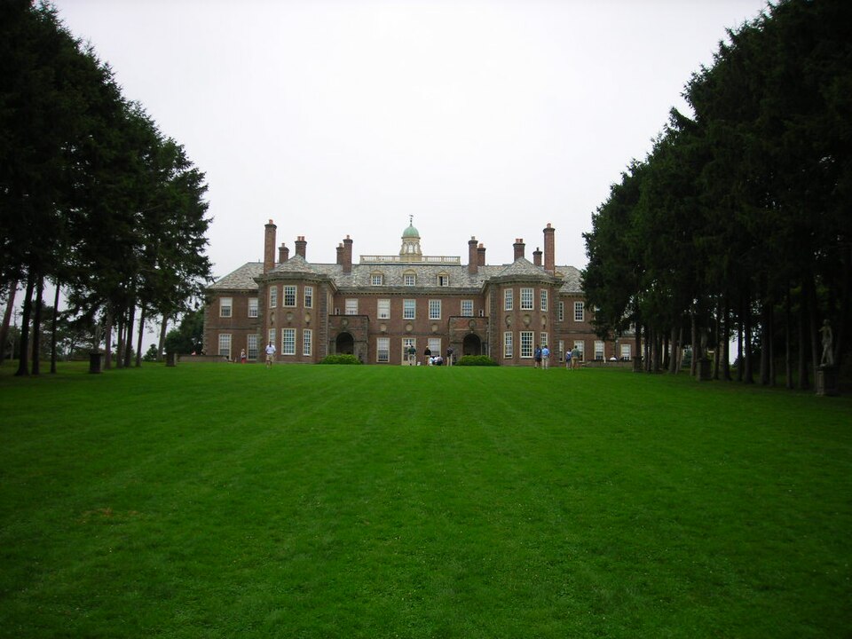
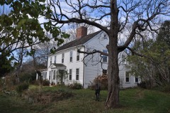
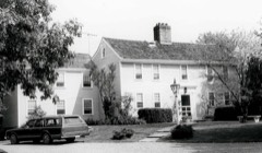
A National Historic Landmark. Listed on the National Register of Historic Places in
1977. A historic map-sheet match is not published yet. The record needs a coordinate-quality review before it can be joined to a sheet boundary.
From the record
“Castle Hill is a 56,881 sq ft (5,284.4 m2) mansion in Ipswich, Massachusetts, which was completed in 1928 as a summer home for Mr. and Mrs. It is also the name of the 165-acre (67 ha) drumlin surrounded by sea and salt marsh that the home was built atop.”
Wikipedia article Castle Hill (Ipswich, Massachusetts), CC BY-SA 4.0.
one of 350 National Register listings in Essex County · listed in 1977 · category: Building · one of 2 National Historic Landmarks in Essex County.
National Register reference number.77000183- the number the National Park Service assigned this property when it was listed, and the key its nomination file is catalogued under at the National Archives.
I have tried to tell, accurately but in readable fashion, the story of the builders of our Town: their homes and home life, their employments, their Sabbath keeping, their love of learning, their administration of Town affairs, their stern delusions, and their heroism, in War and in resistance to Tyranny. The seventeenth century was a brilliant and thrilling period in Ipswich history, and it seemed best to me to consider it somewhat at length, and to close my historical study with the end of that century rather than to attempt a briefer summary of the complete history of the Town. If this work finds favor, I shall begin at once to gather material for another volume, in which the historical and topographical studies will be carried on to completion.
Regional context, not property-specific
evidence. The
federal wildfire occurrence database
lists 26 fires within 5 miles of Great House between
2015 and 2020, burning about 34 acres in total. None started naturally. None was recorded as arson.
Distance is straight-line from the map coordinates, so a fire counted
here may appear on a neighbouring settlement's page as well.
Reported cause
Fires
Debris and open burning
10
Smoking
6
Railroad operations and maintenance
3
Missing data/not specified/undetermined
2
Power generation/transmission/distribution
2
Equipment and vehicle use
2
Recreation and ceremony
1
The most recent of
them, most recent first, with the day each was reported and the service
that recorded it.
Regional context, not property-specific
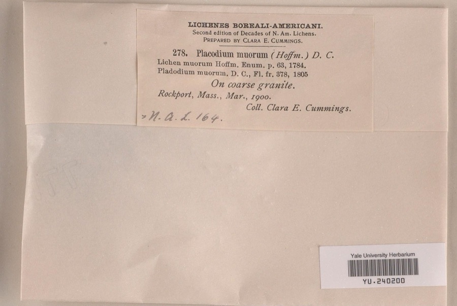
evidence. Museums hold 5,236 specimens
collected within 10 miles of Great House between 1817 and
1975: 2,116 Plantae, 1,328 Animalia, 1,224 Fungi, 354 Chromista, 97 Unrecorded, 95 Protozoa, 22 Bacteria. 12 distinct Species records are shown.
Collected by A H HIGGINSON, A Perlmutter, A. A. Eaton and others. Each is a
physical object with a catalogue
number, and each entry opens the museum's record. This is what was
collected and kept, not a survey of what lives here - nothing can be
concluded from a species being absent.
Regional context, not property-specific
evidence. The federal mineral resources record lists
4 workings within 5 miles of Great House: 3 past producers, 1 producer.
1 still produces. What was taken out: Sand and Gravel, Construction. Distance is straight-line from the
map coordinates, so a quarry counted here may appear on a neighbouring
settlement's page as well.
Regional context, not property-specific
evidence. The National Weather Service names
Ipswich, the town this property stands in, in 18 storm reports between 1996 and 2019: 8 thunderstorm wind, 3 flash flood, 3 lightning, 3 hail.
No death or injury is recorded in these reports. Each account below is quoted exactly as the forecast office
filed it, from the NOAA Storm Events Database, and each date
opens the federal record of that event.
Over 100 trees were downed, snapped, or lost large limbs. This included hardwood and softwood trees such as oaks and pines. Power was out for a majority of the town since many utility lines were brought down. Damage from this microburst began at Mile Lane and Linebrook Road where tops of a large pine tree and oak tree were snapped off and ended on Argilla Road where large tree limbs and power lines were downed.||The most significant damage was on Topsfield Road where a large pine tree was downed and multiple utility lines were downed, including a transformer. Damage was also significant on South Main Street at County Road where large oak trees had limbs snapped off and numerous power and utility lines were downed. On Waldingfield Road, a large tree and limbs were downed onto the commuter rail tracks, resulting in delays until the debris could be cleared.
Trees, wires, and four telephone poles were blown down on Nabby's Point Road in Ipswich. A large limb was downed onto Broadway Avenue. A tree was downed onto the MBTA tracks for the Newburyport commuter rail line.
No historic map-sheet match is published
for this property yet. That does not mean no map exists. This record needs
a coordinate-quality review before it can be joined to a sheet boundary.
Browse the county's mapped places while that work is
pending.
From the nomination file
3,496 words on record
When this property was proposed for the
National Register, someone wrote the case for it: what the building is,
and why it matters. That document is a federal record in the public domain.
It is quoted below word for word, never summarised. The text was read off the scanned case file by machine, so the
occasional stray character is the recogniser's and the 1970s
typewriter's.
Description of the property
The Castle Hill property, consisting of approximately 165 acres covering three drumlins overlooking the Atlantic, is bounded by the ocean to the north, Castle Neck and Cranes Beach to the east, and marshes to the south and west. The grand landscape scheme which covers the entire area was started in 1910 by the Olmsted Brothers and was designed to take advantage of the magnificent views the drumlins command. The house is located on the highest drumlin at the center of four formal landscaped axes. The Spruce Allee extends northeast from the house, past the casino and pool, over Steep Hill, and down to the sea. To the northwest are the Italian gardens, including formal hedge plantings, a grotto, a grape arbor, and a rose garden.
A bowling green (later used as a tennis court) extends from the south east. A maze, once situated beyond the bowling green, is no longer extant. To the rear of the house lie the vegetable and flower gardens, the greenhouse, and the caretaker's house; at the level of the marsh are the stables, barns and garage. The wrought iron entrance gates and the Gate House are located east of the outbuildings. A winding road which branches out at intervals to connect with the outbuildings leads from the entrance gate, around Castle Hill and Steep Hill, up to the Great House. The main house, designed by David Adler in 1925, was built in 1926-27. The massing and detail of the house were copied from several English houses of the transitional Elizabethan/English Renaissance period.
The main influences appear to be Belton House in Lincolnshire (1684) and Eagle House in Surrey (1705). The two story structure, constructed of small pink-red Holland bricks, consists of eleven bays arranged in tive parts.
/ARCHITECT David Adler Castle Hill in Ipswich is significant primarily for its architecture, landscape architecture, and its associations with Richard I. Crane, Jr., the early twentieth century plumbing magnate. The house, designed in 1925, is considered to be David Adler's greatest work. Adler, educated at Princeton, the Polytechnickum in Munich, and the Ecole Des Beaux-Arts in Paris, worked mainly in Chicago designing large homes for the wealthy. Adler drew on historical procedents in his designs, and Castle Hill is perhaps his most skillful blending of plans and architectural features from existing buildings.
The house is not merely a copy of the late seventeenth century English buildings which served as a model for Castle Hill; his combination of features has produced something quite original. The scale, massing, architectural detailing and siting of Castle Hill make it one of the most significant early twentieth century houses in the state. The landscaping of the site contributes to its significance. The formal landscaped scheme covering 165 acres was originally designed by the 01msted Brothers to com- plement the Italianate house designed by Shepley, Rutan and Coolidge and built in 1911 on the present site of the great house. The landscape plan consisted of the Spruce Allee extending down to the casino and pool, and the Italian gardens to the northwest of the house.
Shortly after the Italianate house was completed, Crane hired his neighbor, Arthur Shurtleff (later changed to Shurcliff) to finish the landscape design started by the Olmsted Brothers. Shurtleff extended the allee down to the sea and and designed the rose garden, maze, bowling green, and vegetable garden. Shurtleff's work continued the formality and extended the scale of the 01msteds' designs. When the Italianate house was demolished in 1925 because Mrs.
Quoted from the National Register nomination
for reference 77000183, 18 pages, held by the National Archives in Record
Group 79. See the
catalogue record.
Listed places nearby
6 within 8 miles
Other National Register properties close
enough to walk or drive between, ordered by distance from this one. Both
positions come from the same geocoding pass that matched these properties
to their map sheets.
Listing record. National Park Service National Register of Historic Places, listed-properties dataset, current to 2026-05-22.
Map join. Address geocoded through the United States Census geocoder, then tested against the published boundary of every sheet in the USGS Historical Topographic Map Collection.
How this page is made. Listing fields come from federal records; map-sheet coverage is a labelled coordinate-to-boundary calculation, not a source-field claim.
Wildfire. Short, Karen C. 2022. Spatial wildfire occurrence data for the United States, 1992-2020 [FPA_FOD_20221014]. 6th Edition. Fort Collins, CO: Forest Service Research Data Archive. https://doi.org/10.2737/RDS-2013-0009.6 Collected with United States Government funding and usable without additional permissions or fees.
Specimens. Global Biodiversity Information Facility (GBIF), https://www.gbif.org/. Only records licensed CC0 or CC BY are used. Records licensed CC BY-NC are excluded because this site carries advertising. Images are checked individually and any whose licence is non-commercial, no-derivatives or unreadable is refused.
Mines and quarries. USGS Mineral Resources Data System (MRDS) https://mrdata.usgs.gov/mrds/ A work of the United States government, no copyright under 17 U.S.C. 105.
Storms. NOAA National Centers for Environmental Information, Storm Events Database https://www.ncei.noaa.gov/stormevents/ A work of the United States government, no copyright under 17 U.S.C. 105. Narratives are quoted verbatim from the National Weather Service report and are not edited or summarised.
 Block
Block