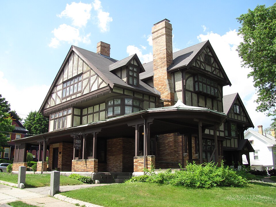
Built in 1892 in the Tudor Revival architecture. Listed on the National Register of Historic Places in
1977. A historic map-sheet match is not published yet. The record needs a coordinate-quality review before it can be joined to a sheet boundary.
From the record
“The Fred Holland Day House is a historic house located at 93 Day Street in Norwood, Massachusetts.”
Wikipedia article Fred Holland Day House, CC BY-SA 4.0.
one of 249 National Register listings in Norfolk County · listed in 1977 · category: Building · built in 1892, Tudor Revival architecture, by J. Williams Beal · one of 2 National Historic Landmarks in Norfolk County.
National Register reference number.77000191- the number the National Park Service assigned this property when it was listed, and the key its nomination file is catalogued under at the National Archives.
Fires near this property
163 since 2015
Regional context, not property-specific
evidence. The
federal wildfire occurrence database
lists 163 fires within 5 miles of Day, Fred Holland, House between
2015 and 2020, burning about 64 acres in total. None started naturally. None was recorded as arson.
Distance is straight-line from the map coordinates, so a fire counted
here may appear on a neighbouring settlement's page as well.
Reported cause
Fires
Missing data/not specified/undetermined
55
Recreation and ceremony
49
Smoking
43
Debris and open burning
10
Equipment and vehicle use
4
Railroad operations and maintenance
2
The most recent of
them, most recent first, with the day each was reported and the service
that recorded it.
Regional context, not property-specific
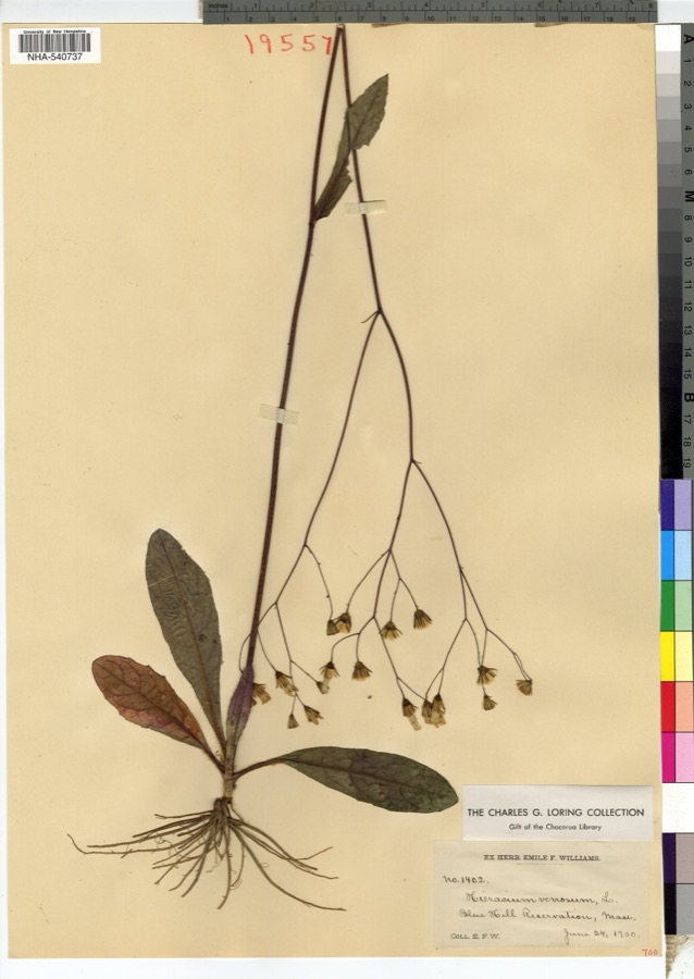
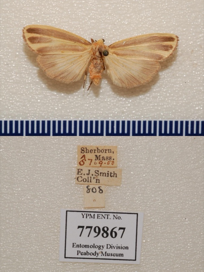
evidence. Museums hold 12,667 specimens
collected within 10 miles of Day, Fred Holland, House between 1815 and
1975: 4,699 Animalia, 4,368 Plantae, 3,232 Fungi, 206 Protozoa, 92 Chromista, 46 Unrecorded, 24 Bacteria. 12 distinct Species records are shown.
Collected by ?, ? ex Herb. W.G. Farlow, A C Gibson and others. Each is a
physical object with a catalogue
number, and each entry opens the museum's record. This is what was
collected and kept, not a survey of what lives here - nothing can be
concluded from a species being absent.
Regional context, not property-specific
evidence. The federal mineral resources record lists
11 workings within 5 miles of Day, Fred Holland, House: 4 past producers, 4 producers, 2 unknowns, 1 occurrence.
4 still produce. What was taken out: Sand and Gravel, Construction, Iron, Granite, Stone. Distance is straight-line from the
map coordinates, so a quarry counted here may appear on a neighbouring
settlement's page as well.
Regional context, not property-specific
evidence. The National Weather Service names
Norwood, the town this property stands in, in 7 storm reports between 1999 and 2020: 3 flood, 2 lightning, 1 heavy rain, 1 flash flood.
No death or injury is recorded in these reports. Each account below is quoted exactly as the forecast office
filed it, from the NOAA Storm Events Database, and each date
opens the federal record of that event.
A Flash Flood emergency occurred, with considerable damage in the vicinity of Norwood Hospital. Severe flooding, more than 4 feet deep, occurred in the basement of the hospital. The entire pharmacy inventory was destroyed. One hundred patients had to be evacuated. Numerous cars were submerged in the parking lot, which, albeit, is in a 'bowl' not designed with flooding in mind. Damage to the hospital was estimated at $20,000,000. In addition, emergency management officials said that approximately 250 homes suffered flood damage.
In Norwood, several streets were flooded. West street in Walpole was flooded underneath the railroad bridge. Also, The Bird Park area was flooded. In Weymouth, Old Swamp River was out of its banks. In Quincy, the Wollaston T Station was shut down due to flooding.
At 340 PM EST (440 PM EDT) a section of Route 1 was flooded with up to 1 foot of water. At 346 PM EST, Broadway was reported to be flooded and impassable. At 402 PM EST, four feet of water was reported in the basement of Norwood Hospital.
No historic map-sheet match is published
for this property yet. That does not mean no map exists. This record needs
a coordinate-quality review before it can be joined to a sheet boundary.
Browse the county's mapped places while that work is
pending.
From the nomination file
7,308 words on record
When this property was proposed for the
National Register, someone wrote the case for it: what the building is,
and why it matters. That document is a federal record in the public domain.
It is quoted below word for word, never summarised. The text was read off the scanned case file by machine, so the
occasional stray character is the recogniser's and the 1970s
typewriter's.
Description of the property
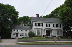
The Fred Holland Day House is located on a half-acre lot at the corner of Day and Bullard Streets, on a hill above the center of Norwood. The house is sited close to the Street in a mixed neighborhood of 19th and 20th century houses. The house was built in 1859.as a 2½ story Italianate style house with a mansard roof and cupola. It was extensively rebuilt during the years 1890-93. to its present appearance. The Fred Holland Day House is 2½ stories and the plan is roughly cross-axial. The central mass of the house is a 2½ story ridge roof section with the gable parallel to the street. On either side are 3½ story gabled wings which intersect asymmetrically. To the rear is a lower 2½ gabled wing. The first floor is a multi-toned beige brick with elongated stretchers.
The second and third floor elevations and gabled ends are stucco with rectilinear and curvilinear half timbering ornamentation. Fenestration throughout the house is varying case- ment and sash windows almost exclusively leaded. Across the facade is a low projecting porch that extends into port cochere on the south-east elevation. The main entrance is on the western end of the facade and on the eastern end of the the facade is a rectangular bay set with two sash windows. Above the entrance on the second floor is a projecting rectangular oriel. On the corner of the facade and southeast elevation are two three sided oriels that in combination give an impression of wrapping around the corner. The gabled end attic floor extends over the rectangular oriel of the second floor.
The wide angle of the gable is complimented by the simple linear barge boards and small pendant at the apex.
/ARCHITECT J. Williams Beal STATEMENT OF SIGNIFICANCE The Fred Holland Day House is significant for its unique architectural styling, of the incredible reconstruction, and for its associations with the remarkable Mr. Day. The architect of the house, J. William Beal, worked principally in the Boston area. Among his other commissions were: the Plymouth County Hospital and Jail, the Repertory Theatre, Huntington Avenue, Boston, and the Walnut Street Congregational Church of Boston. Architecturally the house is a blend of several movements popular at the time of its reconstruction. While the stucco and half timbering ornamentation is obviously Tudor Revival, the plan of the house is pure Shingle Style. This is particularly evident in the "Great Hall".
Apparent too, is a definite influence from Wright's work of the period. This can be seen in the long low front porch and port cochere as well as the masonry. Fred Holland Day was renowned for his collection of materials on Keats, his photography, literary associations, and work in publishing. At the age of 26, Mr. Day traveled to Europe to study and write on the life of Balzac. Much of this was published in the Boston Transcript, the gentleman's newspaper. While in Europe, he became interested in keats. He traveled throughout England with Louise imogen Guiney searching for material on the life of keats. Mr. Day and Miss Guiney, with the aid of Charles Eliot Norton, Thomas Bailey Aldrich and others established a Keats museum in Hampstead, England. Because of his knowledge of Keats, Mr.
Day met Amy Lowell, who spent many hours at Day House researching her biography of Keats. When Mr. Day returned to America he undertook the re-building of his grandfather's house. Mr. Day established the publishing firm of Day and Copland in conjunction with Herbert Copland.
Quoted from the National Register nomination
for reference 77000191, 24 pages, held by the National Archives in Record
Group 79. See the
catalogue record.
Listed places nearby
6 within 8 miles
Other National Register properties close
enough to walk or drive between, ordered by distance from this one. Both
positions come from the same geocoding pass that matched these properties
to their map sheets.
Listing record. National Park Service National Register of Historic Places, listed-properties dataset, current to 2026-05-22.
Map join. Address geocoded through the United States Census geocoder, then tested against the published boundary of every sheet in the USGS Historical Topographic Map Collection.
How this page is made. Listing fields come from federal records; map-sheet coverage is a labelled coordinate-to-boundary calculation, not a source-field claim.
Wildfire. Short, Karen C. 2022. Spatial wildfire occurrence data for the United States, 1992-2020 [FPA_FOD_20221014]. 6th Edition. Fort Collins, CO: Forest Service Research Data Archive. https://doi.org/10.2737/RDS-2013-0009.6 Collected with United States Government funding and usable without additional permissions or fees.
Specimens. Global Biodiversity Information Facility (GBIF), https://www.gbif.org/. Only records licensed CC0 or CC BY are used. Records licensed CC BY-NC are excluded because this site carries advertising. Images are checked individually and any whose licence is non-commercial, no-derivatives or unreadable is refused.
Mines and quarries. USGS Mineral Resources Data System (MRDS) https://mrdata.usgs.gov/mrds/ A work of the United States government, no copyright under 17 U.S.C. 105.
Storms. NOAA National Centers for Environmental Information, Storm Events Database https://www.ncei.noaa.gov/stormevents/ A work of the United States government, no copyright under 17 U.S.C. 105. Narratives are quoted verbatim from the National Weather Service report and are not edited or summarised.
 Block
Block