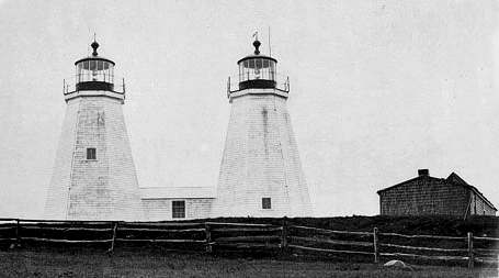
Photograph by U.S. Coast Guard, Public domain. Via
Wikimedia Commons.
Plymouth Light Station
Built in 1768. Listed on the National Register of Historic Places in
1977. A historic map-sheet match is not published yet. The record needs a coordinate-quality review before it can be joined to a sheet boundary.
From the record
“Plymouth Light, also known as Gurnet Light, is a historic lighthouse located on Gurnet Point at the entrance to Plymouth Bay in the town of Plymouth, Massachusetts. The light is accessible only by passing through the town of Duxbury, which lies to the north.”
Wikipedia article Plymouth Light, CC BY-SA 4.0.
one of 93 National Register listings in Plymouth County · listed in 1977 · category: Structure · built in 1768 · one of 1 National Historic Landmarks in Plymouth County.
Also known as. Lighthouses of Massachusetts TR (AD); Lighthouses of Massachusetts TR
Township. Plymouth town
When was it built? 1768
National Register reference number.77000655- the number the National Park Service assigned this property when it was listed, and the key its nomination file is catalogued under at the National Archives.
In preparing the work the records of the town of Bridgewater, and of its several parishes and churches, have been the first and principal sources, whence the materials have been derived. The old Colony and Plymouth county records have furnished also valuable information. Judge Davis' improved edition of Morton's, New England Memorial, Farmer's Register, the Collections of the Mass. Hist. Society, and various local histories have also been advantageously consulted. But so many and so various have been the sources, both public and private, from which information and facts have been obtained, that it would be difficult, if recollected, to enumerate them. The loss of all the early records of Duxbury previous to 1G54, which are said to have been burnt, is greatly to be regretted, as it was the parent town of Bridgewater, the first home and residence in this country of most of our fathers and original settlers in this then Plantation. It may well be supposed those records would have furnished us with much valuable information. The Colony records of births and deaths previous to 1CI7 are also lost, some of the first leaves by time or accident having been destroyed, which to the antiquarian is a deprivation much to be deplored.
Bridgewater was originally a plantation granted to Duxbury. When the township of Marshfield became a separate and distinct corporation, Duxbury, from which Marshfield had been principally taken, applied to the Old Colony court, at Plymouth, for a grant of common land, or, as they expressed it, " an extension to the westward," as a compensation for the great loss of territory they had thus sustained. We find in the records the following order of court relating to it : -
Regional context, not property-specific
evidence. The
federal wildfire occurrence database
lists 71 fires within 5 miles of Plymouth Light Station between
2015 and 2020, burning about 18 acres in total. None started naturally. None was recorded as arson.
Distance is straight-line from the map coordinates, so a fire counted
here may appear on a neighbouring settlement's page as well.
Reported cause
Fires
Debris and open burning
46
Missing data/not specified/undetermined
17
Misuse of fire by a minor
7
Recreation and ceremony
1
The most recent of
them, most recent first, with the day each was reported and the service
that recorded it.
Regional context, not property-specific
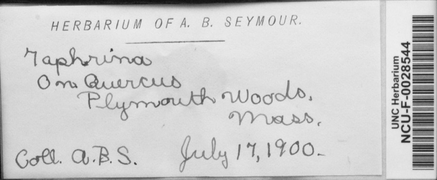
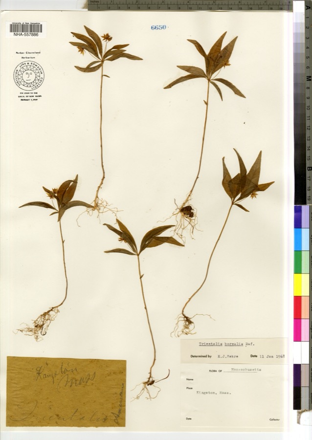
evidence. Museums hold 2,911 specimens
collected within 10 miles of Plymouth Light Station between 1816 and
1975: 2,261 Animalia, 384 Plantae, 133 Fungi, 67 Chromista, 66 Unrecorded. 12 distinct Species records are shown.
Collected by -- Russell, A., A. C. Mathieson and others. Each is a
physical object with a catalogue
number, and each entry opens the museum's record. This is what was
collected and kept, not a survey of what lives here - nothing can be
concluded from a species being absent.
Regional context, not property-specific
evidence. The National Weather Service names
Duxbury, the town this property stands in, in 14 storm reports between 1997 and 2024: 8 thunderstorm wind, 4 hail, 2 lightning.
No death or injury is recorded in these reports. Each account below is quoted exactly as the forecast office
filed it, from the NOAA Storm Events Database, and each date
opens the federal record of that event.
No historic map-sheet match is published
for this property yet. That does not mean no map exists. This record needs
a coordinate-quality review before it can be joined to a sheet boundary.
Browse the county's mapped places while that work is
pending.
From the nomination file
6,284 words on record
When this property was proposed for the
National Register, someone wrote the case for it: what the building is,
and why it matters. That document is a federal record in the public domain.
It is quoted below word for word, never summarised. The text was read off the scanned case file by machine, so the
occasional stray character is the recogniser's and the 1970s
typewriter's.
Description of the property
The records describe Plymouth (Gurnet) Light Station as of 1910. Situated on the Southeasterly part of Gurnet Point, Seacoast of Massachusetts, and on the Northerly side of the entrance to the harbors of Plymouth, Kingston and Duxbury. Characteristic of light was fixed white, two separate lights first built or established in 1769, rebuilt in 1803. Tower was octagonal in shape, pyramidal in form, 39 feet in height, 102 1/4 feet above mean high water, painted white, wood construction, diameter at base 20 feet. Both lanterns were 4th order, polygonal, 35 mm. Fog signal was a First Class Daboll Trumpet Ist class, 6' in length, blasts for 3 seconds, silent interval 12 seconds.
The keepers were housed in a double dwelling, 6 rooms to each keeper, wood construction, painted white with three outhouses. Water was supplied by rainwater from roofs of dwelling and engine house placed into two cisterns in cellar of dwelling and two in whistle house. Drinking water was supplied from a 60' well, housed over, obtained by 2 buckets on a roller pulley. The nearest public road was 4 1/2 miles from the station and 7 miles by team to Duxbury Railroad Station. Living conditions have improved since 1910; Plymouth (Gurnet) Light Station in 1976 consists of: Dwelling- 1 story with basement and attic, woodframe con- struction 55' X 35' built in 1960. -It includes 4 bedrooms, 2 indoor bathrooms and 12'g" x 20' garage and storage room. CONTINUE) Form No. 10-300a (Rev.
10-74) UNITED STATES DEPARTMENT OF THE INTERIOR NATIONAL PARK SERVICE NATIONAL REGISTER OF HISTORIC PLACES INVENTORY -- NOMINATION FORM FOR NPS USE ONLY RECEIVED AUG 24 1976 DATE ENTERED MAR 8 1977 CONTI NUATION SHEET ITEM NUMBER 7 PAGE 2 Oilhouse-brick construction, 10' x 12' built approxi- mately 1900.
/ARCHITECT STATEMENT OF SIGNIFICANCE The Plymouth (Gurnet) Light Station was established in 1768 by the Massachusetts Legislature, to guide ships, the lifeline of industry and commerce, into harbor in the of Plymouth, Duxbury and Kingston. feet long, twenty feet high and fifteen feet wide with a lan- tern at each end of the building, each holding two lamps. During the Revolution the three towns of Plymouth, Dux- bury and Kingston had erected a fort on Gurnet. In the midst of an engagement between the fort and the British Frigate Niger, which had gone aground on Brown's bank, a wild shot from the ship pierced the lighthouse itself. The armed brigantine General Arnold was caught in a blizzard during the last week of 1778.
Captain Magee anchored his vessel rather than risk the treacherous waters of Plymouth's inner harbor without a pilot. The ship drag- ged and finally hit on White Flats. Seventy two of the crew died freezing to death in the below-zero temperature. The keeper of the Gurnet Light was uanble to go to their aid because of the ice blocked harbor. A causeway was built over the ice from Plymouth and the few survivors were rescued. Massachusetts ceded the Gurnet Light to the Federal Govern- ment in 1790. On July 2, 1801 the Gurnet Light was completely destroyed by fire but a temporary beacon was erected by the Merchants of Plymouth and Duxbury. Congress reimbursed the merchants in April 1802 and appropriated $2500 for a new lighthouse.
The new light became operational in 1803 but due to expo- sure to the elements had to be rebuilt in 1843. CONTINVED
Quoted from the National Register nomination
for reference 77000655, 38 pages, held by the National Archives in Record
Group 79. See the
catalogue record.
Listed places nearby
6 within 8 miles
Other National Register properties close
enough to walk or drive between, ordered by distance from this one. Both
positions come from the same geocoding pass that matched these properties
to their map sheets.
Listing record. National Park Service National Register of Historic Places, listed-properties dataset, current to 2026-05-22.
Map join. Address geocoded through the United States Census geocoder, then tested against the published boundary of every sheet in the USGS Historical Topographic Map Collection.
How this page is made. Listing fields come from federal records; map-sheet coverage is a labelled coordinate-to-boundary calculation, not a source-field claim.
Wildfire. Short, Karen C. 2022. Spatial wildfire occurrence data for the United States, 1992-2020 [FPA_FOD_20221014]. 6th Edition. Fort Collins, CO: Forest Service Research Data Archive. https://doi.org/10.2737/RDS-2013-0009.6 Collected with United States Government funding and usable without additional permissions or fees.
Specimens. Global Biodiversity Information Facility (GBIF), https://www.gbif.org/. Only records licensed CC0 or CC BY are used. Records licensed CC BY-NC are excluded because this site carries advertising. Images are checked individually and any whose licence is non-commercial, no-derivatives or unreadable is refused.
Storms. NOAA National Centers for Environmental Information, Storm Events Database https://www.ncei.noaa.gov/stormevents/ A work of the United States government, no copyright under 17 U.S.C. 105. Narratives are quoted verbatim from the National Weather Service report and are not edited or summarised.
 Block
Block