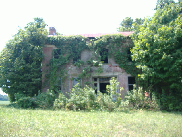
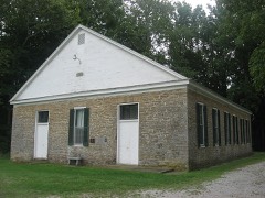
Built in 1840 in the Federal architecture. Listed on the National Register of Historic Places in
1977. A historic map-sheet match is not published yet. The record needs a coordinate-quality review before it can be joined to a sheet boundary.
From the record
“The Sutton House, in Byrd Township, Ohio near Decatur, Ohio, was a historic house built around 1840. Also known as Wilke House, it was listed on the National Register of Historic Places in 1977.”
Wikipedia article Sutton House (Decatur, Ohio), CC BY-SA 4.0.
one of 21 National Register listings in Brown County · listed in 1977 · category: Building · built in 1840, Federal architecture · one of 3 National Historic Landmarks in Brown County.
National Register reference number.77001043- the number the National Park Service assigned this property when it was listed, and the key its nomination file is catalogued under at the National Archives.
Fires near this property
9 since 2003
Regional context, not property-specific
evidence. The
federal wildfire occurrence database
lists 9 fires within 5 miles of Sutton House between
2003 and 2020, burning about 59 acres in total. None started naturally. None was recorded as arson.
Distance is straight-line from the map coordinates, so a fire counted
here may appear on a neighbouring settlement's page as well.
Reported cause
Fires
Debris and open burning
5
Missing data/not specified/undetermined
4
The most recent of
them, most recent first, with the day each was reported and the service
that recorded it.
Regional context, not property-specific
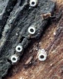
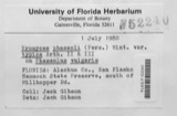
evidence. Museums hold 142 specimens
collected within 10 miles of Sutton House between 1883 and
1974: 120 Animalia, 21 Fungi, 1 Plantae. 12 distinct Species records are shown.
Collected by A JOHN, ANSEL JOHN, C CROFT AND D LADD and others. Each is a
physical object with a catalogue
number, and each entry opens the museum's record. This is what was
collected and kept, not a survey of what lives here - nothing can be
concluded from a species being absent.
Regional context, not property-specific
evidence. The National Weather Service names
Decatur, the town this property stands in, in 3 storm reports between 1995 and 2017: 2 thunderstorm wind, 1 hail.
No death or injury is recorded in these reports. Each account below is quoted exactly as the forecast office
filed it, from the NOAA Storm Events Database, and each date
opens the federal record of that event.
No historic map-sheet match is published
for this property yet. That does not mean no map exists. This record needs
a coordinate-quality review before it can be joined to a sheet boundary.
Browse the county's mapped places while that work is
pending.
From the nomination file
1,298 words on record
When this property was proposed for the
National Register, someone wrote the case for it: what the building is,
and why it matters. That document is a federal record in the public domain.
It is quoted below word for word, never summarised. The text was read off the scanned case file by machine, so the
occasional stray character is the recogniser's and the 1970s
typewriter's.
Description of the property
CONDITION GOOD DESCRIPTION DETERIORATED EXCELLENT shutters have been removed. XALTERED The late Nineteenth Century The front of the house has two distinctive stone belt courses which sixteen feet in width. a stone foundation.It has a tin gabled roof with inset end chimneys CHECK ONE XORIGINAL SITE the ell of the house in the Nineteenth Century. The Sutton House is a two and one half story Federal house in -UNEXPOSED LRUINS in width. The long side is forty two feet three inches, while the other Nineteenth Century. A small room, ten by twenty five feet was built in extend across the entire facade. Lintels extend into the belt courses. Victorian, East Lake style porch has bracketed posts and spindled frieze.
Alterations:The original window sash on the facade was removed The wood frieze under the roof line remains in good condition. The main stairway has rich wood paneling. side is twenty one feet eleven inches.The back of the rear wing is XFAIR AREAS OF
Statement of significance
The original builder, Otho Sutton, was the son of. one of Brown County's earliest and most prominent settlers, Benjamin Sutton, who Brown County records reveal that shortly after it was built, the 1600-1699 1500-1599 ART ECONOMICS INVENTION ARCHEOLOGY-HISTORIC RELIGION SIGNIFICANCE AGRICULTURE SCIENCE BUILDER/ARCHITECT PERIOD POLITICS/GOVERNMENT MILITARY THEATER INDUSTRY LITERATURE _EXPLORATION/SETTLEMENT X1800-1899 _COMMUNICATIONS executed by the master builder Jonathan Goldsmith in the Western Reserve Otho Sutton _1700-1799 area of Northeastern Ohio in the early Nineteenth Century.
Of the most unique features of the house are the stone belt courses which The Sutton-Wilke house is one of the finest examples of brick farm _SOCIAL/HUMANITARIAN Sutton House was the fifth highest rural home in value in the county. Ohio, the doorway bears an unmistakable resemblance to renown doorways over each window whereas in the Sutton house the lintels extend into the operated a large stock farm on the site. -1400-1499 owner,served with the 9ist Ohio Volunteer Infantry in the Civil War and houses built in Southern Ohio in the first half of the Nineteenth Century.
-ENGINEERING - CONSERVATION _EDUCATION XARCHITECTURE Federal or Greek-Revival houses in Ohio have individual stone lintels _COMMERCE -1900- -LAW MUSIC 2_COMMUNITY PLANNING SPECIFIC DATES 1840-1844 ARCHEOLOGY-PREHISTORIC served in the American Revolution and was a local justice of the peace 9
Quoted from the National Register nomination
for reference 77001043, 12 pages, held by the National Archives in Record
Group 79. See the
catalogue record.
Listed places nearby
2 within 8 miles
Other National Register properties close
enough to walk or drive between, ordered by distance from this one. Both
positions come from the same geocoding pass that matched these properties
to their map sheets.
Listing record. National Park Service National Register of Historic Places, listed-properties dataset, current to 2026-05-22.
Map join. Address geocoded through the United States Census geocoder, then tested against the published boundary of every sheet in the USGS Historical Topographic Map Collection.
How this page is made. Listing fields come from federal records; map-sheet coverage is a labelled coordinate-to-boundary calculation, not a source-field claim.
Wildfire. Short, Karen C. 2022. Spatial wildfire occurrence data for the United States, 1992-2020 [FPA_FOD_20221014]. 6th Edition. Fort Collins, CO: Forest Service Research Data Archive. https://doi.org/10.2737/RDS-2013-0009.6 Collected with United States Government funding and usable without additional permissions or fees.
Specimens. Global Biodiversity Information Facility (GBIF), https://www.gbif.org/. Only records licensed CC0 or CC BY are used. Records licensed CC BY-NC are excluded because this site carries advertising. Images are checked individually and any whose licence is non-commercial, no-derivatives or unreadable is refused.
Storms. NOAA National Centers for Environmental Information, Storm Events Database https://www.ncei.noaa.gov/stormevents/ A work of the United States government, no copyright under 17 U.S.C. 105. Narratives are quoted verbatim from the National Weather Service report and are not edited or summarised.
 Block
Block