Listed on the National Register of Historic Places in
1977. A historic map-sheet match is not published yet. The record needs a coordinate-quality review before it can be joined to a sheet boundary.
From the record
“The first schools in Independence were established east of the river. In 1850 the condition of the schools was as follows: school age, of which number one hundred and seventysix were between the ages of sixteen and twenty-one years.”
History of Cuyahoga County Ohio (1870). Machine-read text.
one of 338 National Register listings in Cuyahoga County · listed in 1977 · category: Building · one of 3 National Historic Landmarks in Cuyahoga County.
National Register reference number.77001053- the number the National Park Service assigned this property when it was listed, and the key its nomination file is catalogued under at the National Archives.
The ground it stands on
4,214 words
The chapter on Independence City in History of Cuyahoga County Ohio, published 1870 names Independence. This is what it says, exactly as the scans read.
In 1810 John I., Archibald and William Harper, sons of Colonel John Harper a celebrated Revolutionary soldier who lived in Delaware county, New York, ca'ie to Ashtabula county, in this State, and in 1816 John I. emigrated from there to Independence, settling on tract two, near where the canal now runs, where he died in August, 1849. He reared two sons, Erastus R., who yet lives on the homestead; De Witt C., who moved to Michigan; and three daughters, one of whom married H. G. Edwards, of Newburg. John Maxwell, a boy indentured to J. I. Harper, moved to Galena, Illinois, after he had attained manhood, and while discharging his duties as sheriff was killed by a man whom he attempted to arrest.
Colonel Rial McArthur became a resident of the township in 1833, but returned to Portage county in 1844. He was the surveyor of the eastern part of Independence in 1808, and attained the rank of colonel in the war of 1812. In 1810 John Wightman became a resident of Cleveland, living there until his death, in 1837. His daughter, Deborah L., became the wife of William H. Knapp, who settled in Independence in 1833, and both are yet living on the place they then occupied.
Regional context, not property-specific
evidence. The
federal wildfire occurrence database
lists 3 fires within 5 miles of Independence Presbyterian Church between
1993 and 2018, burning about 8 acres in total. 1 started naturally. 1 was recorded as arson.
Distance is straight-line from the map coordinates, so a fire counted
here may appear on a neighbouring settlement's page as well.
Reported cause
Fires
Arson/incendiarism
1
Missing data/not specified/undetermined
1
Natural
1
The most recent of
them, most recent first, with the day each was reported and the service
that recorded it.
Regional context, not property-specific
evidence. Museums hold 2,857 specimens
collected within 10 miles of Independence Presbyterian Church between 1850 and
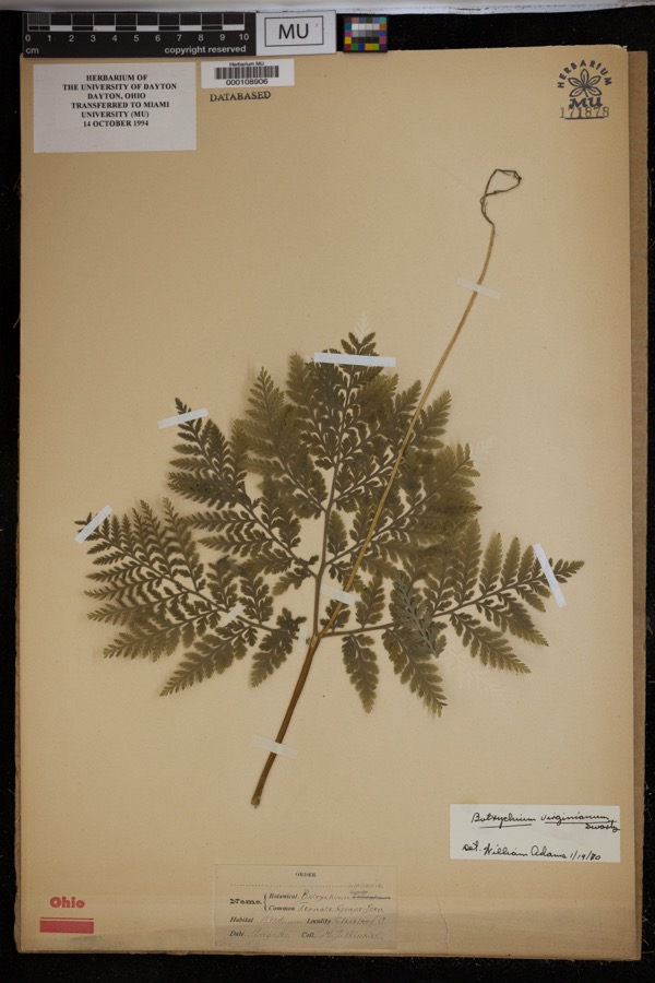
1975: 2,462 Animalia, 209 Fungi, 107 Plantae, 73 Protozoa, 4 Unrecorded, 1 Chromista, 1 incertae sedis. 12 distinct Species records are shown.
Collected by A. D. Huryn, A. D. Selby, A. Hall and others. Each is a
physical object with a catalogue
number, and each entry opens the museum's record. This is what was
collected and kept, not a survey of what lives here - nothing can be
concluded from a species being absent.
Regional context, not property-specific
evidence. The federal mineral resources record lists
8 workings within 5 miles of Independence Presbyterian Church: 4 producers, 4 past producers.
4 still produce. What was taken out: Clay, Sand and Gravel, Construction, Bloating Material, Stone, Crushed/Broken. Distance is straight-line from the
map coordinates, so a quarry counted here may appear on a neighbouring
settlement's page as well.
Regional context, not property-specific
evidence. The National Weather Service names
Independence, the town this property stands in, in 6 storm reports between 1996 and 2017: 3 thunderstorm wind, 2 hail, 1 flood.
No death or injury is recorded in these reports. Each account below is quoted exactly as the forecast office
filed it, from the NOAA Storm Events Database, and each date
opens the federal record of that event.
Runoff from heavy rains on January 5th caused the Cuyahoga River at Independence to quickly rise. The river went above the flood stage of 16 feet during the evening hours of the 5th. The river crested at 20.64 feet around 4 a.m on the 6th and went back below flood stage during the late afternoon hours of the 6th. Significant flooding occurred in the Valley View area. Many homes and businesses along Canal Road and Gleeson, Charles, Frances and Stone Streets were damaged by flooding.
No historic map-sheet match is published
for this property yet. That does not mean no map exists. This record needs
a coordinate-quality review before it can be joined to a sheet boundary.
Browse the county's mapped places while that work is
pending.
From the nomination file
1,785 words on record
When this property was proposed for the
National Register, someone wrote the case for it: what the building is,
and why it matters. That document is a federal record in the public domain.
It is quoted below word for word, never summarised. The text was read off the scanned case file by machine, so the
occasional stray character is the recogniser's and the 1970s
typewriter's.
Description of the property
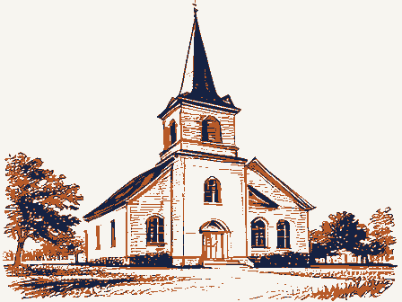
at entry level, have a single, double-hung, round-arched window capped with top portion of the tower rises above the gable roof and has a single, round- rear of the church, next to it is a petroglyph found during the quarrying of the center of each side of the roof. church is connected to it by a one-story, brick, enclosed walkway. Still CONDITION MOVED RUINS toit. UNALTERED XEXCELLENT Independence Presbyterian Church is a simple, one-story, gable-roofed structure. the cornice.
Along the sides of the church there are four double-hung, round-arched, mullioned this band are stone dentils which continue along the sides of the church under - DETERIORATED stone form a decorative molding along the gabled ends at the roofiine.Beneath roof is covered with slate tiles which form a fish-scale pattern band in the To the rear of the church an education building was completed in 1954.The CHECK ONE intersecting gable roofs.A double course of stone blocks and bandsof darker - UNEXPOSED _FAIR -GOOD block with small, rectangular windows. There is an entry to the left of the later a new church was built to the left of the old one, but is not attached portion of the tower has a small, round window with quatrefoil cut out.
The windows capped with stone molding.The partially raised basement is also stone stone for the church.There is an interior end chimney at the ridgeline.The stone molding. The entrance is reached by three stone steps. The sides of the tower, Built of hand cut stone blocks, the rectangular building faces east. The three- stage central entrance tower has a simple paneled door with mullioned fan and AREAS OF
Statement of significance
In October 1853 the nineteen member congregation began building the Old Stone The church served the community for the next 43 years. By 1905 the local quarries 1600-1699 1400-1499 ARCHEOLOGY-HISTORIC ECONOMICS CONSERVATION ART EDUCATION TRANSPORTATION PREHISTORIC COMMUNICATIONS 1900- ARCHITECTURE PERIOD the congregation. SIGNIFICANCE AGRICULTURE BUILDER/ARCHITECT MILITARY _EXPLORATION/SETTLEMENT INDUSTRY SCULPTURE _POLITICS/GOVERNMENT Jacob Merkle _COMMERCE MUSIC _ENGINEERING X1800-1899 was saved and placed in the rear, exterior wall of the church.
Petroglyphs are old church is now used for weddings and special services and is being preserved by Independence Presbyterian Church is a fine example of early stone architecture had outgrown the old church and a new church was built just to the west of it.The the building, adds to its historic interest. _1500-1599 In 1954 an education building was built behind the church.By 1963 the congregation _1700-1799 Some interior work and the completion of the basement for a furnace were done and the church was rededicated in November of 1925. community which came into being because of the fine quality of the local stone - RELIGION - LITERATURE -LAW building and stone blocks were particularly suitable for a church in this in northern Ohio and is very little altered.
The simple, clean lines of the Sharp was the first minister. Designed by Jacob Merkle, the church was constructed the finding in this unique manner. INVENTION large example.It is fortunate and unusual that these early masons preserved group of interested parishioners banded together to raise funds to re-open the church. were closing down and so did the church.In August 1925 funds were gathered and a petroglyph was destroyed before anyone realized what it was.The remaining portion not common to northern Ohio.This one is believed to bea relatively rare and 9
Quoted from the National Register nomination
for reference 77001053, 16 pages, held by the National Archives in Record
Group 79. See the
catalogue record.
Listed places nearby
6 within 8 miles
Other National Register properties close
enough to walk or drive between, ordered by distance from this one. Both
positions come from the same geocoding pass that matched these properties
to their map sheets.
Listing record. National Park Service National Register of Historic Places, listed-properties dataset, current to 2026-05-22.
Map join. Address geocoded through the United States Census geocoder, then tested against the published boundary of every sheet in the USGS Historical Topographic Map Collection.
How this page is made. Listing fields come from federal records; map-sheet coverage is a labelled coordinate-to-boundary calculation, not a source-field claim.
Wildfire. Short, Karen C. 2022. Spatial wildfire occurrence data for the United States, 1992-2020 [FPA_FOD_20221014]. 6th Edition. Fort Collins, CO: Forest Service Research Data Archive. https://doi.org/10.2737/RDS-2013-0009.6 Collected with United States Government funding and usable without additional permissions or fees.
Specimens. Global Biodiversity Information Facility (GBIF), https://www.gbif.org/. Only records licensed CC0 or CC BY are used. Records licensed CC BY-NC are excluded because this site carries advertising. Images are checked individually and any whose licence is non-commercial, no-derivatives or unreadable is refused.
Mines and quarries. USGS Mineral Resources Data System (MRDS) https://mrdata.usgs.gov/mrds/ A work of the United States government, no copyright under 17 U.S.C. 105.
Storms. NOAA National Centers for Environmental Information, Storm Events Database https://www.ncei.noaa.gov/stormevents/ A work of the United States government, no copyright under 17 U.S.C. 105. Narratives are quoted verbatim from the National Weather Service report and are not edited or summarised.
 Block
Block