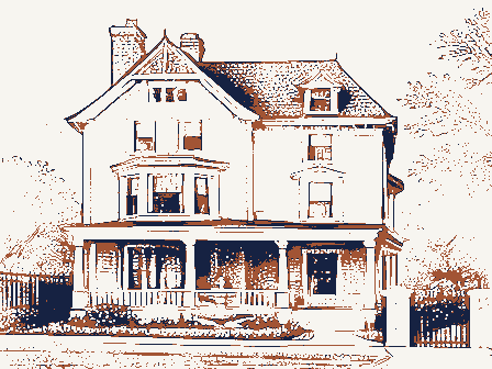
Listed on the National Register of Historic Places in
1977. A historic map-sheet match is not published yet. The record needs a coordinate-quality review before it can be joined to a sheet boundary.
From the record
one of 338 National Register listings in Cuyahoga County · listed in 1977 · category: Building · one of 3 National Historic Landmarks in Cuyahoga County.
National Register reference number.77001054- the number the National Park Service assigned this property when it was listed, and the key its nomination file is catalogued under at the National Archives.
Specimens collected near this property
12 of 2,932 shown
Regional context, not property-specific
evidence. Museums hold 2,932 specimens
collected within 10 miles of Honam, John, House between 1849 and
1975: 2,489 Animalia, 225 Fungi, 135 Plantae, 77 Protozoa, 5 Unrecorded, 1 Chromista. 12 distinct Species records are shown.
Collected by A. D. Huryn, A. D. Selby, A. G. Newhall and others. Each is a
physical object with a catalogue
number, and each entry opens the museum's record. This is what was
collected and kept, not a survey of what lives here - nothing can be
concluded from a species being absent.
Regional context, not property-specific
evidence. The federal mineral resources record lists
4 workings within 5 miles of Honam, John, House: 2 past producers, 2 producers.
2 still produce. What was taken out: Halite, Sand and Gravel, Construction, Salt, Silica. Distance is straight-line from the
map coordinates, so a quarry counted here may appear on a neighbouring
settlement's page as well.
Regional context, not property-specific
evidence. The National Weather Service names
Lakewood, the town this property stands in, in 29 storm reports between 1998 and 2024: 18 thunderstorm wind, 7 hail, 2 waterspout, 2 flash flood.
The reports record 1 death. Each account below is quoted exactly as the forecast office
filed it, from the NOAA Storm Events Database, and each date
opens the federal record of that event.
Police in Rocky River reported an ice jam on the Rocky River near the Metropark marina. The ice jam broke free around 1 pm and travelled about 2 miles to the mouth of the river into Lake Erie. The lake had been frozen over, but strong southwest gales were able to break up the mouth of the Rocky River sufficiently to allow the ice jam to move out of the river. Numerous docks and boats were damaged along the river, including a marina in the Metropark.
Thunderstorm winds downed several trees from Lakewood to the west side of Cleveland. A truck was crushed by one of the trees in Lakewood. At least 23,500 utility customers lost power during this event.
A snapped tree fell onto a garage in Lakewood and a tree fell onto a truck about three-miles NNE of Linndale. Farther east along the same straight-line wind damage path, multiple trees were snapped and the roof was torn off a warehouse in the Gordon Square District of Cleveland.
No historic map-sheet match is published
for this property yet. That does not mean no map exists. This record needs
a coordinate-quality review before it can be joined to a sheet boundary.
Browse the county's mapped places while that work is
pending.
From the nomination file
1,784 words on record
When this property was proposed for the
National Register, someone wrote the case for it: what the building is,
and why it matters. That document is a federal record in the public domain.
It is quoted below word for word, never summarised. The text was read off the scanned case file by machine, so the
occasional stray character is the recogniser's and the 1970s
typewriter's.
Description of the property
are located a classroom, office, storage and restroom facilities. CONDITION DESCRIPTION windows of the same construction on the other three sides including second story _UNALTERED lows the outline recorded in the 1935 drawings). CHECK ONE replacement of a similar structure recalled by turn of the century residents of windows.There is also a side entrance to the building through the summer kitchen. The interior features a stairway leading to the second floor facing the front door. hearth.and dining area.The second floor contains two bedrooms.In the basement and furnishings are largely from the 1830's and 1840's.
attempted to recreate the era in which the building was constructed in order that The building was moved from its original location in 1952 in order to rescue it west corner of Lakewood Park.
A wooden front door is centrally located on the south side flanked on either side the building and removed some time prior to 1935,when the HABs drawings were the building might serve its purpose as an historical museum of the period.Decor sandstone blocks with a wooden summer kitchen attached.The front of the house -UNEXPOSED made showing only the outline of the attached structure addition fol- -GOOD X EXCELLENT This building is a one and a half story dwelling constructed of long rectangular To the right of the front door is the main parlor and to the left the fireplace, The cornices are wooden with returns.The roof is shingle The building has been restored on both the exterior and interior and most modern All of the sandstone used in construction was quarried locally.
where he was a weaver by trade, to settle with his wife first in Maine and then in Tax records indicate that he constructed the Old Stone House in 1838, six years af- served as a dwelling, a doctor's office and various retail purposes. Lakewood took title to it and it was moved to Lakewood Park, which was included in faithful to the period of origin than its original site, which today is a commercial 1500-1599 1838 1700-1799 ARCHEOLOGY-HISTORIC COMMERCE EDUCATION ART ENGINEERING PHILOSOPHY LAW RELIGION SIGNIFICANCE 1900- BUILDER/ARCHITECT PERIOD XARCHITECTURE POLITICS/GOVERNMENT AGRICULTURE THEATER INDUSTRY INVENTION MILITARY district of multi-story buildings.
LITERATURE XEXPLORATION/SETTLEMENT SOCIAL/HUMANITARIAN Detroit Avenue),a corduroy road serving as the principal east-west artery.John The Old Stone House is significant as a surviving example of the sturdy stone dwell- CONSERVATION It is the oldest stone building in Lakewood and perhaps Cuyahoga County. _PREHISTORIC _COMMUNICATIONS In 1952 the building was scheduled for demolition by a commercial developer until the building and an herb garden enclosed by a split-rail fence in the rear is more which provided planks for the covering of the Detroit Post Road in 1850.
The Old Stone House is currently operated by the Lakewood Historical Society as a The Old Stone House was occupied as a dwelling by the Honam family and their descendants until at least the late nineteenth century.Thereafter the building6J Rockport (Lakewood),where he purchased a 97 1/2 acre tract and turned to farming. necticut Land Company and laid out farms and orchards. _1600-1699 - TRANSPORTATION The present City of Lakewood was known as East Rockport when it was first settled in Homan's son-in-laws(who lived in the Old Stone House) later operated a saw mill -1400-1499 -SCULPTURE -ECONOMICS -SCIENCE -MUSIC ARCHEOLOGY-PREHISTORIC _COMMUNITY PLANNING the Lakewood Historical Society engineered its rescue and moving.
Quoted from the National Register nomination
for reference 77001054, 12 pages, held by the National Archives in Record
Group 79. See the
catalogue record.
Listed places nearby
6 within 8 miles
Other National Register properties close
enough to walk or drive between, ordered by distance from this one. Both
positions come from the same geocoding pass that matched these properties
to their map sheets.
Listing record. National Park Service National Register of Historic Places, listed-properties dataset, current to 2026-05-22.
Map join. Address geocoded through the United States Census geocoder, then tested against the published boundary of every sheet in the USGS Historical Topographic Map Collection.
How this page is made. Listing fields come from federal records; map-sheet coverage is a labelled coordinate-to-boundary calculation, not a source-field claim.
Specimens. Global Biodiversity Information Facility (GBIF), https://www.gbif.org/. Only records licensed CC0 or CC BY are used. Records licensed CC BY-NC are excluded because this site carries advertising. Images are checked individually and any whose licence is non-commercial, no-derivatives or unreadable is refused.
Mines and quarries. USGS Mineral Resources Data System (MRDS) https://mrdata.usgs.gov/mrds/ A work of the United States government, no copyright under 17 U.S.C. 105.
Storms. NOAA National Centers for Environmental Information, Storm Events Database https://www.ncei.noaa.gov/stormevents/ A work of the United States government, no copyright under 17 U.S.C. 105. Narratives are quoted verbatim from the National Weather Service report and are not edited or summarised.
 Block
Block