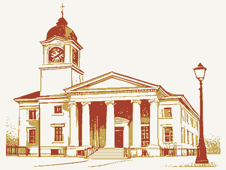
Listed on the National Register of Historic Places in
1986. A historic map-sheet match is not published yet. The record needs a coordinate-quality review before it can be joined to a sheet boundary.
From the record
one of 338 National Register listings in Cuyahoga County · listed in 1986 · category: Building · one of 3 National Historic Landmarks in Cuyahoga County.
National Register reference number.86001055- the number the National Park Service assigned this property when it was listed, and the key its nomination file is catalogued under at the National Archives.
Specimens collected near this property
12 of 3,012 shown
Regional context, not property-specific
evidence. Museums hold 3,012 specimens
collected within 10 miles of Detroit--Warren Building between 1849 and
1975: 2,569 Animalia, 225 Fungi, 135 Plantae, 77 Protozoa, 5 Unrecorded, 1 Chromista. 12 distinct Species records are shown.
Collected by A. D. Huryn, A. D. Selby, A. G. Newhall and others. Each is a
physical object with a catalogue
number, and each entry opens the museum's record. This is what was
collected and kept, not a survey of what lives here - nothing can be
concluded from a species being absent.
Regional context, not property-specific
evidence. The federal mineral resources record lists
4 workings within 5 miles of Detroit--Warren Building: 2 past producers, 2 producers.
2 still produce. What was taken out: Halite, Sand and Gravel, Construction, Salt, Silica. Distance is straight-line from the
map coordinates, so a quarry counted here may appear on a neighbouring
settlement's page as well.
Regional context, not property-specific
evidence. The National Weather Service names
Lakewood, the town this property stands in, in 29 storm reports between 1998 and 2024: 18 thunderstorm wind, 7 hail, 2 waterspout, 2 flash flood.
The reports record 1 death. Each account below is quoted exactly as the forecast office
filed it, from the NOAA Storm Events Database, and each date
opens the federal record of that event.
Police in Rocky River reported an ice jam on the Rocky River near the Metropark marina. The ice jam broke free around 1 pm and travelled about 2 miles to the mouth of the river into Lake Erie. The lake had been frozen over, but strong southwest gales were able to break up the mouth of the Rocky River sufficiently to allow the ice jam to move out of the river. Numerous docks and boats were damaged along the river, including a marina in the Metropark.
Thunderstorm winds downed several trees from Lakewood to the west side of Cleveland. A truck was crushed by one of the trees in Lakewood. At least 23,500 utility customers lost power during this event.
A snapped tree fell onto a garage in Lakewood and a tree fell onto a truck about three-miles NNE of Linndale. Farther east along the same straight-line wind damage path, multiple trees were snapped and the roof was torn off a warehouse in the Gordon Square District of Cleveland.
No historic map-sheet match is published
for this property yet. That does not mean no map exists. This record needs
a coordinate-quality review before it can be joined to a sheet boundary.
Browse the county's mapped places while that work is
pending.
From the nomination file
2,352 words on record
When this property was proposed for the
National Register, someone wrote the case for it: what the building is,
and why it matters. That document is a federal record in the public domain.
It is quoted below word for word, never summarised. The text was read off the scanned case file by machine, so the
occasional stray character is the recogniser's and the 1970s
typewriter's.
Description of the property
The Detroit-Warren Building is an eclectic, five-story commercial style building with west facades of unadorned commercial grade brick, red in color. variants of the cornice rosettes, a different variant per story. All details are repeated Detroit Avenue, a major mixed-use strip running from one end of Lakewood to the other, contain- ment, the Detroit-Warren Building is distinguished, its carefully crafted features giving it Condition ruins deteriorated 7. Description unexposed fair excellent neo-classical cornice and pilasters and enriched spandrels.Its two street-facing painted wooden frames and meeting rails. The building stands on the southwest corner of a commercial district featuring buildings stature as the most impressive building in this portion of Lakewood.
ever, are not as disfiguring as those found on other buildings in the area of the same nine paired window bays extends across the length of the facade, each rank framed by spandrels above the storefronts are blank, some of the storefront windows have been infilled Check one In contrast to the upper story enrichment,the first story is virtually unadorned.The facades are of light grey brick with white glazed terra cotta detailing; the rear and with brick, and others have been replaced with new glazing. The changes to this story, how- date This district is similar to others found along vintage.
(in one paragraph) The building is a late and accomplished piece of work by two architects whose firm was, school building in Lakewood (now the Board of Education Building),a post office and an western edge.Lakewood grew out of a 19th century fruit farming community(Rockport") along Courthouse(1912),part of the Burnham/Carrere/Brunner Group Plan of civic structures (NR Sheriff Street gothic and castellated Central Armory fourth mayor Lakewood's incorporation as a city in 1911,the Tegardine family military in Cleveland. Born in the 1860's,Israel Lehman and Theodore Schmitt were the sons of ×-1900- community planning employees in architect George Smith's office, they formed their partnership in 1884.
Their some of the Cleveland area's most distinctive buildings. It is also an important structural Community of worker housing and one Garden City development (Clifton Park) on Cleveland's along Detroit, a tendency towards decentralization. One critical step was the removal of archeology-prehistoric religion hall. landscape architecture Warren property had by then been purchased and passed down to Mars Wagar's granddaughter, Warren intersection in the 1870's.Jacob served as Lakewood's postmaster, councilman and adapted the grander themes of their larger projects to more modest purposes. Lakewood in 1885,the Wagar family had multiplied in both numbers and holdings.
Quoted from the National Register nomination
for reference 86001055, 14 pages, held by the National Archives in Record
Group 79. See the
catalogue record.
Listed places nearby
6 within 8 miles
Other National Register properties close
enough to walk or drive between, ordered by distance from this one. Both
positions come from the same geocoding pass that matched these properties
to their map sheets.
Listing record. National Park Service National Register of Historic Places, listed-properties dataset, current to 2026-05-22.
Map join. Address geocoded through the United States Census geocoder, then tested against the published boundary of every sheet in the USGS Historical Topographic Map Collection.
How this page is made. Listing fields come from federal records; map-sheet coverage is a labelled coordinate-to-boundary calculation, not a source-field claim.
Specimens. Global Biodiversity Information Facility (GBIF), https://www.gbif.org/. Only records licensed CC0 or CC BY are used. Records licensed CC BY-NC are excluded because this site carries advertising. Images are checked individually and any whose licence is non-commercial, no-derivatives or unreadable is refused.
Mines and quarries. USGS Mineral Resources Data System (MRDS) https://mrdata.usgs.gov/mrds/ A work of the United States government, no copyright under 17 U.S.C. 105.
Storms. NOAA National Centers for Environmental Information, Storm Events Database https://www.ncei.noaa.gov/stormevents/ A work of the United States government, no copyright under 17 U.S.C. 105. Narratives are quoted verbatim from the National Weather Service report and are not edited or summarised.
 Block
Block