BlockBefore
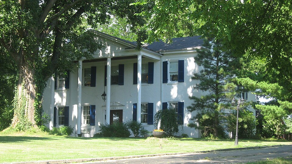
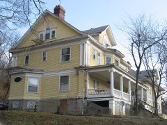
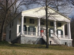
Photograph of W. L. Williams House
Photograph by Nyttend, Public domain. Via Wikimedia Commons.

Williams, W. L., House

Listed on the National Register of Historic Places in 1977. A historic map-sheet match is not published yet. The record needs a coordinate-quality review before it can be joined to a sheet boundary.

From the record

“Williams House is a registered historic building near Cincinnati, Ohio, listed in the National Register on March 25, 1977.”

Wikipedia article W. L. Williams House, CC BY-SA 4.0.

one of 314 National Register listings in Hamilton County · listed in 1977 · category: Building · one of 9 National Historic Landmarks in Hamilton County.

Sources: the Wikipedia article · the case file at the National Archives · the National Register database, National Park Service

The listing

  • What is counted as historic. The nomination lists 1 building as contributing to the listing.
  • Address. 280 Anderson Ferry Rd., Cincinnati, 45238
  • When was it listed? 1977-03-25
  • Category. building
  • Township. Delhi township
  • National Register reference number. 77001066 - the number the National Park Service assigned this property when it was listed, and the key its nomination file is catalogued under at the National Archives.

The ground it stands on

17,786 words

The chapter on Delhi Township in History of Hamilton County, Ohio, with Illustrations and Biographical Sketches, published 1881 names Cincinnati. This is what it says, exactly as the scans read.

The original organization, including the territory now covered by Delhi township, was the now long extinct South Bend township, planted by the court of general quarter sessions of the peace between Cincinnati and Miami townships. It was erected in 1795, among the earliest in the county, and was named from the settlement already made under the auspices of Judge Symmes, at the southernmost point on the river in the Miami Purchase, which in turn took its name from the great bend in the Ohio, within which it had been settled. The boundaries of the new township were defined about as follows :

Passage source: History of Hamilton County, Ohio, with Illustrations and Biographical Sketches, published 1881.

This township, as now constituted (erected between 1810 and 1815), is the smallest in the county, except Spencer on the opposite side of Cincinnati. It has but eight thousand seven hundred and eighty-six acres, or less than fourteen square miles, is bounded on the east by the city; on the south and west by theOhio river, which divides it from Kentucky; and on the north by the entire breadth of Green township, nearly one mile of Miami, and about as much of the city on the other side. Its lines begin at the mouth of Bold Face creek, on the Ohio, almost a mile above the "second meridian line" mentioned among the boundaries of South Bend township; and run thence down the river to a point about a mile below the mouth of Muddy creek, where the old south line of Mill Creek and north Hne of Cincinnati townships (in part now Liberty street, Cincinnati) and present south line of Green township, extended westward, intersects the Ohio, thence eastward to the second meridian line aforesaid; thence south to the second parallel, the south line of sections five and thirty-five; and eastward again to the place of beginning. The breadth of the township on its north line is seven miles, very nearly; on its first section line next south, six miles; upon the next, which extends east of the general line of the township, four miles and twothirds; with a very short southernmost parallel deeper in the bend. The greatest breadth of the township is a little more than three miles; whence it dwindles, by the flow of the river to both sides of the township to a point at each end. The average width is only about two miles. It has eleven full sections and eight fractional sections, lying in fractional range one, township two; and the duplicate section six, at the northwest corner of the township, in fractional range one, of township one.

Passage source: History of Hamilton County, Ohio, with Illustrations and Biographical Sketches, published 1881.

Machine-read from a century-old scan, so expect the errors a machine makes: misspelled names, dropped words, stray characters.

Read the whole chapter on Delhi Township - 17,786 words on its settlement, mills, schools and churches.

Specimens collected near this property

12 of 3,433 shown

Regional context, not property-specific evidence. Museums hold 3,433 specimens collected within 10 miles of Williams, W. L., House between 1819 and 1975: 1,306 Fungi, 1,237 Animalia, 760 Plantae, 103 Protozoa, 14 Chromista, 12 Unrecorded, 1 Bacteria. 12 distinct Species records are shown. Collected by A Schwartz, A. Braun, A. F. Braun and others. Each is a physical object with a catalogue number, and each entry opens the museum's record. This is what was collected and kept, not a survey of what lives here - nothing can be concluded from a species being absent.

Image SpeciesYear Collected by Where, as recorded
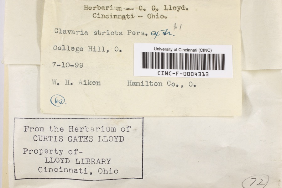
Specimen of Clavaria striata Pers.Clavaria striata Pers.1899Aiken, Walter H.College Hill
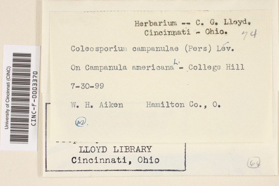
Specimen of Coleosporium campanulae (Pers.) Tul.Coleosporium campanulae (Pers.) Tul.1899Aiken, Walter H.College Hill
Specimen of Corticium polyporoideum Berk. & M.A.CurtisCorticium polyporoideum Berk. & M.A.Curtis1899C.G. LloydCincinnati
A photograph of the species Quercus leana, not of this specimenQuercus × leana Nutt.1819Thomas Nuttall3 miles North of Cincinnati
A photograph of the species Atrichum angustatum, not of this specimenAtrichum angustatum (Brid.) Bruch & Schimp.1820T. G. Leaprobably Cincinnatti
A photograph of the species Barbula unguiculata, not of this specimenBarbula unguiculata Hedw.1820T. G. Leaprobably Cincinnatti
A photograph of the species Equisetum arvense, not of this specimenEquisetum arvense L.1834Short, Charles Wilkins; Lea, Thomas G.Cincinnati
A photograph of the species Carex comosa, not of this specimenCarex comosa Boott1835FrankIn paludibus prope Cincinnati civ. Ohio rarissime
A photograph of the species Carex davisii, not of this specimenCarex davisii Schwein. & Torr.1835Frankin ditione Miami civitatis Ohio
A photograph of the species Carex lupulina, not of this specimenCarex lupulina Muhl. ex Willd.1835Joseph C. FrankCincinnati.
A photograph of the species Carex shortiana, not of this specimenCarex shortiana Dewey & Torr.1835FrankIn pratis aquosis prope Cincinnati civ. Ohio communis.
A photograph of the species Chaerophyllum procumbens, not of this specimenChaerophyllum procumbens (L.) Crantz1835Joseph C. FrankCincinnati

All 3,433 specimens within 10 miles, at the Global Biodiversity Information Facility.

Mines and quarries near this property

5 within 5 miles

Regional context, not property-specific evidence. The federal mineral resources record lists 5 workings within 5 miles of Williams, W. L., House: 3 past producers, 2 producers. 2 still produce. What was taken out: Salt, Stone, Crushed/Broken, Sand and Gravel, Construction. Distance is straight-line from the map coordinates, so a quarry counted here may appear on a neighbouring settlement's page as well.

Where SiteCommodity StatusRecorded
Constance YardStone, Crushed/BrokenProducer
Taylorsport MineSand and Gravel, ConstructionProducer
Cargill Salt TerminalSaltPast Producer
Cincinnati Salt ServiceSaltPast Producer
Cincinnati WarehouseSaltPast Producer

Every working recorded in Hamilton County

Storms near this property

60 of 70 shown

Regional context, not property-specific evidence. The National Weather Service names Cincinnati, the town this property stands in, in 70 storm reports between 1994 and 2025: 25 thunderstorm wind, 17 hail, 14 flash flood, 7 flood. The reports record 1 injury. Each account below is quoted exactly as the forecast office filed it, from the NOAA Storm Events Database, and each date opens the federal record of that event.

WhenEvent Place namedHarm What the report says
March 2001LightningCincinnati1 hurtA woman was injured when lightning struck the building and went through electronic equipment into her phone headset.
March 2017FloodCincinnati$100,000Dozens of basements were flooding across Hamilton County due to high water.
November 2017Flash FloodCincinnati$100,000Numerous roads were flooded throughout the Cincinnati area and some basements were flooded. Flooding also caused some damage at Reading High School and Whitaker Elementary School.
February 2000LightningCincinnati$100,000Lightning struck a home causing a fire in the attic, which spread toward the second floor before being extinguished. Significant fire and water damage occurred to the home.
August 2000LightningCincinnati$80,000Lightning struck a home causing a fire on the second floor.
January 1997Thunderstorm WindCincinnati$70,000no account filed
July 1994Thunderstorm WindCincinnati$50,000Trees were downed. Ceiling tiles were ripped from a parking garage and at least one car was damaged.
January 1997LightningCincinnati$50,000no account filed
July 1996LightningCincinnati$50,000no account filed
July 1998LightningCincinnati$40,000Lightning struck a home causing a fire, which caused significant damage.
April 2024Flash FloodCincinnati$30,000Three units of apartments along MLK Drive had to be evacuated due to high water. Rushing water also caused damage to some roads in Columbia Township.
September 2018Flash FloodCincinnati$30,000High water was reported on several roads in the downtown Cincinnati area and the near West Side. A retaining wall collapsed onto a roadway near the intersection of State Avenue and Ernst Street and a building was flooded on Poplar Street. Also, an apartment basement flooded on Linn Street and one resident needed to be rescued.
November 2013Thunderstorm WindCincinnati$20,000Two trees fell on two cars due to thunderstorm winds.
June 2019Flash FloodCincinnati$15,000High water was reported at I-471 and I-71.
December 2006Thunderstorm WindCincinnati$15,000Trees and power lines were knocked down across the Cincinnati metro area.
June 2017FloodCincinnati$10,000There were reports of lingering high water on roadways and some roads remained closed.|Also, there were reports of some basement flooding in homes.
July 2015Thunderstorm WindCincinnati$10,000Numerous trees and power lines were downed throughout downtown Cincinnati.
July 2012Flash FloodCincinnati$10,000Vehicles were reported trapped in high water due to heavy rainfall near Gest Street and Dalton Avenue.
September 2000Thunderstorm WindCincinnati$10,000Trees downed across Cincinnati.
June 2008Thunderstorm WindCincinnati$8,000Trees were knocked down across the county.
July 2020Thunderstorm WindCincinnati$7,000A large tree fell onto a carport and a garage on Considine Lane.
May 2020Flash FloodCincinnati$5,000A person had to be rescued from their car due to swift moving high water.
October 2010Thunderstorm WindCincinnati$5,000A roof was partially torn off of an apartment building due to damaging thunderstorm winds.
April 2002Thunderstorm WindCincinnati$5,000Several trees were knocked down throughout the Clifton area.
July 2001Thunderstorm WindCincinnati$5,000Thunderstorm winds knocked down trees.
April 2000Thunderstorm WindCincinnati$5,000Trees and power lines downed. One tree fell across a car.
June 1997Flash FloodCincinnati$5,000Numerous roads flooded due to persistent heavy rainfall.
May 1996Thunderstorm WindCincinnati$5,000no account filed
June 1996Thunderstorm WindCincinnati$5,000no account filed
July 2006Thunderstorm WindCincinnati$4,000Trees and powerlines were downed just north of downtown.
May 2002Flash FloodCincinnati$4,000High water occurred on River Road near the Krohn Conservancy.
February 2011Thunderstorm WindCincinnati$3,000Numerous trees were reported down due to damaging thunderstorm winds.
January 2008Thunderstorm WindCincinnati$3,000Large trees were knocked down.
March 2007FloodCincinnati$3,000Several roads were flooded and closed throughout the Cincinnati metro area.
October 2007HailCincinnati$3,000Hail ranging from penny to quarter sized occurred from downtown Cincinnati north and east into the Norwood area.
July 2001Thunderstorm WindCincinnati$3,000Large limbs were knocked down.
July 1997Thunderstorm WindCincinnati$3,000Trees downed.
June 2010Flash FloodCincinnati$2,000Some neighborhoods had flooded streets due to heavy rainfall.
June 2010Flash FloodCincinnati$2,000High water was reported over Interstate 74 and Interstate 75.
August 2010Thunderstorm WindCincinnati$2,000A couple of trees and some power lines were reported down across the northern part of the city.
July 2017Thunderstorm WindCincinnati$1,000A tree was downed between Sycamore and Main Streets.
July 2015Thunderstorm WindCincinnati$1,000A large tree was downed.
March 2012Flash FloodCincinnati$1,000The second report of flash flooding due to heavy rain in Hamilton County was water rushing across roads in and around the downtown area.
April 2011Thunderstorm WindCincinnati$1,000Large tree branches were broken due to damaging thunderstorm winds.
April 2011Heavy RainCincinnati$1,000A portion of Interstate 471 had high water on it due to heavy rainfall.
December 2011FloodCincinnati$1,000Several roads were reported closed across the county due to flooding caused by heavy rain.
August 2025FloodCincinnati-Water was flowing down the Elsinore Place Steps.
March 2023HailCincinnati-Nickel sized hail was reported in Mt. Auburn.
March 2019FloodCincinnati-Part of eastbound U.S. 50 was closed due to high water at the Freeman Avenue exit.
September 2018FloodCincinnati-Central Parkway was closed due to high water.
April 2015HailCincinnati-Dime size hail fell at the intersection of Lehmann and Radcliffe Roads.
June 2009HailCincinnati-Several reports were received from in and around Cincinnati of three quarters to one inch hail.
May 2002Flash FloodCincinnati-Heavy rain caused street flooding through the city.
May 2002Flash FloodCincinnati-High water deposited debris at the intersection of Glenview and Kirby Roads.
October 1999HailCincinnati-Report taken from the Spring Grove section of Cincinnati.
July 1998Flash FloodCincinnati-Several hours of heavy rainfall caused water to flood across many of the city roads.
June 2016HailCincinnati-no account filed
April 2015HailCincinnati-no account filed
May 2012HailCincinnati-no account filed
July 2012HailCincinnati-no account filed

Every storm recorded in Hamilton County

Newspapers printed here

0 digitised pages

14 papers published in this town, digitised by the Library of Congress and free to read: 0 issues, 0 pages. Every page is searchable, so a name or a street can be looked for directly in what the town printed about itself at the time.

Map coverage status

No historic map-sheet match is published for this property yet. That does not mean no map exists. This record needs a coordinate-quality review before it can be joined to a sheet boundary. Browse the county's mapped places while that work is pending.

From the nomination file

1,671 words on record

When this property was proposed for the National Register, someone wrote the case for it: what the building is, and why it matters. That document is a federal record in the public domain. It is quoted below word for word, never summarised. The text was read off the scanned case file by machine, so the occasional stray character is the recogniser's and the 1970s typewriter's.

Description of the property

a stone foundation. The roof is gabled, metal, and of easy pitch. The roof-line is pierced by two interior end chimneys. The facade is A porch shelters the side entrance of the wing. The porch also has DATE _RUINS AREAS OF

Statement of significance

a substantial, functional house, at a time when function was style. 1400-1499 1500-1599 1700-1799 1830 COMMERCE Cincinnati as a center, posted pack-horses all over the country, ART PERIOD SIGNIFICANCE ARCHEOLOGY-HISTORIC AGRICULTURE TRANSPORTATION SCULPTURE EXPLORATION/SETTLEMENT INDUSTRY MILITARY LITERATURE XARCHITECTURE from 1866-74.He was reputed to be any army general and conducted _POLITICS/GOVERNMENT a training camp on Hillside Avenue in Delhi Township.He was the _COMMUNICATIONS ment to establish mail routes in the west.He began operations with 1900- farm and was built from bricks made on his property.

He was a century rural architecture.It is the oldest home still in exis- The Williams House is a well preserved example of early nineteenth Virginia.Peter Williams held a position under the U.S. govern- residence for "Limp" Williams.Mr.Williams was born in Delhi Town- - CONSERVATION and employed carriers for the different routes.Hedied in 1837. -ECONOMICS -1600-1699 W.L.Williams was a prominent citizen and farmer of Delhi Township. tence in Delhi Township.The house displays the early need for - EDUCATION - SOCIAL/HUMANITARIAN - ENGINEERING in a modern subdivision in l929. _RELIGION ship June l,18l0.The residence was located on his large dairy The W.L."Limp" Williams House was built in l830 as the family -THEATER _PHILOSOPHY -MUSIC - LAW -COMMUNITY PLANNING BUILDER/ARCHITECT W. L.

Williams son of Peter Williams who had immigrated to Delhi Township from INVENTION ARCHEOLOGY-PREHISTORIC The Schroer's purchased the house which is now situated on five acres

The whole case file for this property - 1,671 words, 15 pages, reproduced complete.

Quoted from the National Register nomination for reference 77001066, 15 pages, held by the National Archives in Record Group 79. See the catalogue record.

Listed places nearby

6 within 8 miles

Other National Register properties close enough to walk or drive between, ordered by distance from this one. Both positions come from the same geocoding pass that matched these properties to their map sheets.

Photograph PropertyDistance Listed
Anderson Ferry0.9 miles1982
Anderson Ferry1.3 miles1982
Wright, Daniel Thew, House1.4 miles1982
McWilliams, Matthew, House1.9 miles2005
Pine Meer2.2 miles1982
Bappert, Joseph and Cecilia, House2.5 miles2016

Sources for this property

National Archives recordThe nomination case file for reference 77001066 in Record Group 79.
Wikipedia articleCommunity-written account of this property, licensed CC BY-SA.
Hamilton CountyAll 314 listed properties in this county.

Provenance

  • Listing record. National Park Service National Register of Historic Places, listed-properties dataset, current to 2026-05-22.
  • Map join. Address geocoded through the United States Census geocoder, then tested against the published boundary of every sheet in the USGS Historical Topographic Map Collection.
  • How this page is made. Listing fields come from federal records; map-sheet coverage is a labelled coordinate-to-boundary calculation, not a source-field claim.
  • Specimens. Global Biodiversity Information Facility (GBIF), https://www.gbif.org/. Only records licensed CC0 or CC BY are used. Records licensed CC BY-NC are excluded because this site carries advertising. Images are checked individually and any whose licence is non-commercial, no-derivatives or unreadable is refused.
  • Mines and quarries. USGS Mineral Resources Data System (MRDS) https://mrdata.usgs.gov/mrds/ A work of the United States government, no copyright under 17 U.S.C. 105.
  • Storms. NOAA National Centers for Environmental Information, Storm Events Database https://www.ncei.noaa.gov/stormevents/ A work of the United States government, no copyright under 17 U.S.C. 105. Narratives are quoted verbatim from the National Weather Service report and are not edited or summarised.