Listed on the National Register of Historic Places in
1982. A historic map-sheet match is not published yet. The record needs a coordinate-quality review before it can be joined to a sheet boundary.
From the record
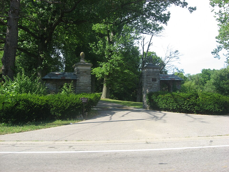
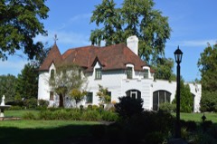
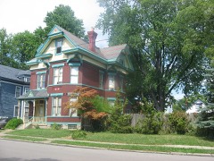
“Pine Meer, built in 1922-1924, is a historic site located in Green Township, Hamilton County, Ohio, United States. It received national exposure when it was the subject of a reality series that aired on TBS in late 2004 known as The Mansion.”
Wikipedia article Pine Meer, CC BY-SA 4.0.
one of 314 National Register listings in Hamilton County · listed in 1982 · category: Building · one of 9 National Historic Landmarks in Hamilton County.
National Register reference number.82001468- the number the National Park Service assigned this property when it was listed, and the key its nomination file is catalogued under at the National Archives.
What happened here
An account from the chapter on Green township, The inset identifies its exact
source book and publication year.
and a half years. He was also a member of the Walnut Hill school board, and laid the corner stone ffi the first school building built under the free school law. When the late war broke out he entered the army with four sons, two of whom were killed, one at Chancellorsville, the other murdered. He was in the first battle of the west at Vienna, and served, at one time, as a member of the staff.
Green is the most regular and symmetrical township in the county. It is a perfe'ct square - an even surveyed township of thirty-six sections, six miles on a side, such as is common in the newer western and northern States, but not in the older settled regions, and of which no other instance is presented in Hamilton county. It lies altogether in fractional range two, township two, and is precisely included between the range and township lines, which separate it from Cincinnati and Mill Creek township on the east, Delhi on the south, Miami on the west, and Colerain on the north. Its section lines are run with remarkable correctness, considering that it lies wholly within the Miami Purchase, and might have shared in the troubles caused by the carelessness of the earliest surveyors. Save for some eccentricity in the second meridian east of the township line, the sections are mostly exact square miles, a fact which can be stated, probably, of no other tract of equal size within the Purchase. Still, its total acreage amounts to but twenty-two thousand seven hundred and fourteen - about an even half-section short of what it should be were all the sections full.
Some of the most interesting and attractive drives in the county are through this township, upon the Cleves and Harrison turnpike, the Colerain pike, a mile of whose course lies through the northeastern corner, and other important roads, some of which lie, as in the newer States settled upon Congress lands, on the section lines. The Cincinnati & Westwood narrow-gauge railway lies mostly in Green township, and is at present the only iron road within its limits. Starting at Ernst Station, on the Cincinnati, Hamilton & Dayton railroad, in the city, it comes up the valley of Lick run, from which it soon diverges to reach the higher ground, across which it runs for more than three miles in a general northwesterly direction, stopping for the present at Robb's, near Bridgetown. The projected Cincinnati & Venice railway, if built upon the surveyed line, will enter the township from the north at St. Jacob's, proceed nearly due south four miles, and intersect this road just south of Cheviot.
Regional context, not property-specific
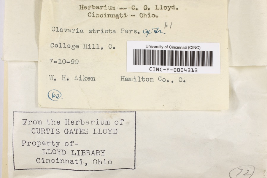
evidence. Museums hold 4,447 specimens
collected within 10 miles of Pine Meer between 1819 and
1975: 1,990 Fungi, 1,441 Animalia, 852 Plantae, 123 Protozoa, 21 Unrecorded, 19 Chromista, 1 Bacteria. 12 distinct Species records are shown.
Collected by A Schwartz, A. Braun, A. F. Braun and others. Each is a
physical object with a catalogue
number, and each entry opens the museum's record. This is what was
collected and kept, not a survey of what lives here - nothing can be
concluded from a species being absent.
Regional context, not property-specific
evidence. The federal mineral resources record lists
5 workings within 5 miles of Pine Meer: 3 past producers, 2 producers.
2 still produce. What was taken out: Salt, Stone, Crushed/Broken, Sand and Gravel, Construction. Distance is straight-line from the
map coordinates, so a quarry counted here may appear on a neighbouring
settlement's page as well.
Regional context, not property-specific
evidence. The National Weather Service names
Cincinnati, the town this property stands in, in 70 storm reports between 1994 and 2025: 25 thunderstorm wind, 17 hail, 14 flash flood, 7 flood.
The reports record 1 injury. Each account below is quoted exactly as the forecast office
filed it, from the NOAA Storm Events Database, and each date
opens the federal record of that event.
Numerous roads were flooded throughout the Cincinnati area and some basements were flooded. Flooding also caused some damage at Reading High School and Whitaker Elementary School.
Lightning struck a home causing a fire in the attic, which spread toward the second floor before being extinguished. Significant fire and water damage occurred to the home.
High water was reported on several roads in the downtown Cincinnati area and the near West Side. A retaining wall collapsed onto a roadway near the intersection of State Avenue and Ernst Street and a building was flooded on Poplar Street. Also, an apartment basement flooded on Linn Street and one resident needed to be rescued.
14 papers published in this town,
digitised by the Library of Congress and free to read: 0 issues,
0 pages. Every page is searchable, so a name or a street can be
looked for directly in what the town printed about itself at the time.
No historic map-sheet match is published
for this property yet. That does not mean no map exists. This record needs
a coordinate-quality review before it can be joined to a sheet boundary.
Browse the county's mapped places while that work is
pending.
From the nomination file
2,102 words on record
When this property was proposed for the
National Register, someone wrote the case for it: what the building is,
and why it matters. That document is a federal record in the public domain.
It is quoted below word for word, never summarised. The text was read off the scanned case file by machine, so the
occasional stray character is the recogniser's and the 1970s
typewriter's.
Description of the property
The second floor is composed of vertical timber and stucco wall to other gable ends. United States Department of the Interior Heritage Conservation and Recreation Service received OCT 1 8 1982 Pine Meer, Cincinnati, Hamilton County, Ohio Continuation sheet Item number plain wood paneling with rail and muntin, large compound tudor arch a perpendicular gothic ceiling treatment, and tudor arch decorative decorative balustrades.
roof, a steep gabled wall dormer with half timber, and stucco and direction approximately 500'; thence in a northeasterly direction approximately 180'; thence east southeast approximately 175'; thence Page Inventory-Nomination Form #10 Verbal boundary description and justification (cont.) stone fireplace with spandrels, decorative floral molding near ceiling date entered National Register of Historic Places a smaller steep gable roof over the main entrance which exhibits a southernly direction approximately 18o'; thence in a southwesterly hall exhibits decorative wood panels and wood balustrade with balustrade and newel post composed ofa semi-nude female figure atop For HCRS use only The first floor interior is composed of music room, living room, dining room, breakfast room, pantry, kitchen, maid's room, as bedrooms, three baths and two sleeping porches.
An interior tudor arch. composed of wood. and an additional level extends below the hillside. direction approximately 300' to the point of beginning. stone fireplace.
(in one paragraph) half timber/stucco wall treatment, multi-paned and grouped windøw treatments, decorative sandstone trim, large wall dormers and gable of casement windows and small panes. Occassionally, stone mullions The building was built for Mr. William C. Schott in-1926 and executive with the Cincinnati Galvanizing Company, a firm which galvanized buckets, cans, and barrels. During the 1920s the Grandin Road area was the "desireable" subdivision for dential architecture of the time and this neighborhood, located on the far eastern Township on the west side of Cincinnati where this property is located, was pre- as a distinctive and significant architectural element of the local township environ- 1700-1799 1800-1899 1600-1699 1400-1499 1926 1500-1599 commerce communications ment.
invention 8. Significance transportation politics/government industry theater engineering humanitarian education Period exploration/settlement literature science philosophy military style. sculpture Specific dates social/ The significant Tudor architecture is accentuated because of law The William C.Schott House is significant as a distinctive ex- embodies the distinctive architectural details associated with the _conservation a rural setting. The building is characterized by its random ashlar stone and Panzer and Martin who designed various styles and types of buildings.
ample of Tudor Revival Architecture in southwestern Ohio because it further articulates the Tudor Revival style through the use of tudor ends, tudor arch slate roof and decorative The building was designed by the Cincinnati firm of Rendigs, the complex massing of wall dormers, projecting angle sided bay and served as his home until his death in 1981.Mr.Schott was an _economics and paneled wall treatments. its location on a low use of open land and large lot which affords - - other (specify) - archeology-prehistoric community planning landscape architecture Cincinnati's wealthy industrialist families.
Quoted from the National Register nomination
for reference 82001468, 17 pages, held by the National Archives in Record
Group 79. See the
catalogue record.
Listed places nearby
6 within 8 miles
Other National Register properties close
enough to walk or drive between, ordered by distance from this one. Both
positions come from the same geocoding pass that matched these properties
to their map sheets.
Listing record. National Park Service National Register of Historic Places, listed-properties dataset, current to 2026-05-22.
Map join. Address geocoded through the United States Census geocoder, then tested against the published boundary of every sheet in the USGS Historical Topographic Map Collection.
How this page is made. Listing fields come from federal records; map-sheet coverage is a labelled coordinate-to-boundary calculation, not a source-field claim.
Specimens. Global Biodiversity Information Facility (GBIF), https://www.gbif.org/. Only records licensed CC0 or CC BY are used. Records licensed CC BY-NC are excluded because this site carries advertising. Images are checked individually and any whose licence is non-commercial, no-derivatives or unreadable is refused.
Mines and quarries. USGS Mineral Resources Data System (MRDS) https://mrdata.usgs.gov/mrds/ A work of the United States government, no copyright under 17 U.S.C. 105.
Storms. NOAA National Centers for Environmental Information, Storm Events Database https://www.ncei.noaa.gov/stormevents/ A work of the United States government, no copyright under 17 U.S.C. 105. Narratives are quoted verbatim from the National Weather Service report and are not edited or summarised.
 Block
Block