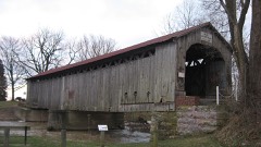
Listed on the National Register of Historic Places in
1977. A historic map-sheet match is not published yet. The record needs a coordinate-quality review before it can be joined to a sheet boundary.
From the record
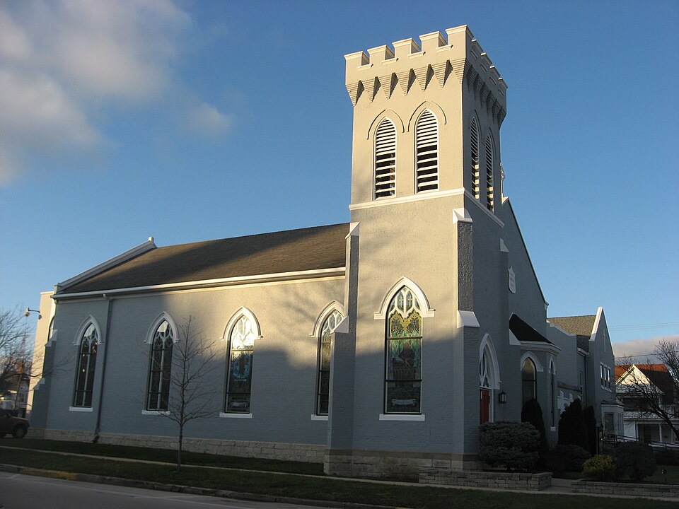
“Paul's Episcopal Church is a historic Episcopalian church in Fremont, a city in the northwestern part of the U.S. state of Ohio. Built in the 1840s and expanded multiple times in the following decades, it has been named a historic site for its distinctive architecture.”
Wikipedia article St. Paul's Episcopal Church (Fremont, Ohio), CC BY-SA 4.0.
one of 9 National Register listings in Sandusky County · listed in 1977 · category: Building.
National Register reference number.77001085- the number the National Park Service assigned this property when it was listed, and the key its nomination file is catalogued under at the National Archives.
Five hundred and fifty homes were flooded, fifty of them either totally destroyed or rendered uninhabitable. This created a problem to cope with for which there was no ready-made organization at hand. The way it was speedily met will stand for a long time as a significant testimony to some of Fremont's leading citizens as adequate leaders in time of need. To be caught in such a situation, unwarned and unprepared, is a real challenge to any man. More than one man has been well tried in this last month. This principle has been very manifest among the rank and file of the people. The readiness and willingness with which a man went about rehabilitating himself was a good sign of what he was worth. In all sections of the city the thrifty man was the first to find his shovel, and the last to ask or look for any help. It has been significant all through that those least willing to help themselves, were most willing to ask help of others. But I want to hasten to say that what has struck me all through my contact with the people in the inundated district, has been their undaunted courage. I think it has been really heroic the way some have faced the situation and recovered their home life.
On Tuesday, March 25, 1913, Fremont faced a calamity. The entire city was without gas or water. Down its main business street, and through a large portion of its residential section rushed a current of furious swiftness; dozens of homes were being swept away; hundreds of people were homeless and hundreds more marooned in their homes surrounded by the angry waters were facing possible death.
Regional context, not property-specific
evidence. The
federal wildfire occurrence database
lists 9 fires within 5 miles of St. Paul's Episcopal Church between
2002 and 2002, burning about 4 acres in total. None started naturally. 1 was recorded as arson.
Distance is straight-line from the map coordinates, so a fire counted
here may appear on a neighbouring settlement's page as well.
Reported cause
Fires
Smoking
4
Recreation and ceremony
3
Arson/incendiarism
1
Missing data/not specified/undetermined
1
The most recent of
them, most recent first, with the day each was reported and the service
that recorded it.
Regional context, not property-specific
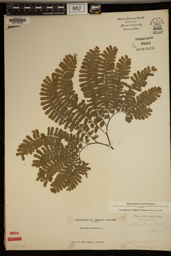
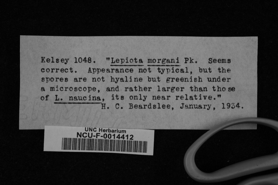
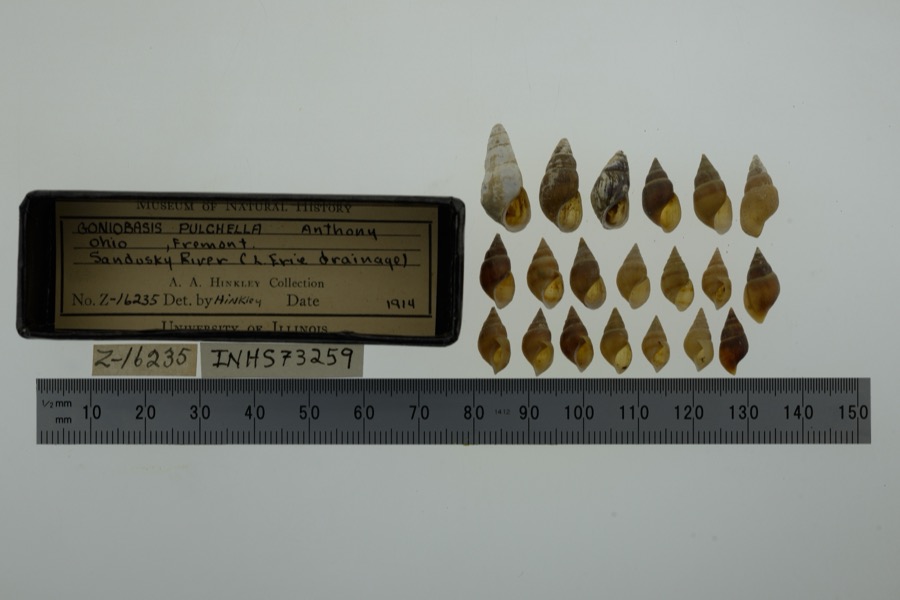
evidence. Museums hold 554 specimens
collected within 10 miles of St. Paul's Episcopal Church between 1880 and
1975: 510 Animalia, 24 Plantae, 20 Fungi. 12 distinct Species records are shown.
Collected by A. D. Selby, Adams J. M. B., Adams J. M. R. and others. Each is a
physical object with a catalogue
number, and each entry opens the museum's record. This is what was
collected and kept, not a survey of what lives here - nothing can be
concluded from a species being absent.
Regional context, not property-specific
evidence. The federal mineral resources record lists
2 workings within 5 miles of St. Paul's Episcopal Church: 1 past producer, 1 producer.
1 still produces. What was taken out: Limestone, General, Stone, Crushed/Broken. Distance is straight-line from the
map coordinates, so a quarry counted here may appear on a neighbouring
settlement's page as well.
Regional context, not property-specific
evidence. The National Weather Service names
Fremont, the town this property stands in, in 72 storm reports between 1995 and 2023: 52 thunderstorm wind, 17 hail, 2 flash flood, 1 tornado.
The reports record 1 injury. Each account below is quoted exactly as the forecast office
filed it, from the NOAA Storm Events Database, and each date
opens the federal record of that event.
Structural damage occurred at the Sandusky County Fairgrounds in Fremont. Three buildings had metal siding damaged. One of these buildings had its large metal door blown-in and half of its roof torn off. A barricade was blown into a car and injured the driver.
A tornado touched down just northwest of Fremont near the intersection of Shade Road and Four Mile House Road. A house was heavily damaged and a motor home destroyed near this location. From the initial touchdown site, the tornado traveled northeast for around three and a half miles and then dissipated east of State Route 19 just to the south of the Ohio Turnpike. A second home was heavily damaged near Booktown Road at State Route 19. Elsewhere along the damage path, a few homes sustained minor damage and seven barns were leveled. One of the barns contained a collection of antique cars which were destroyed. Many trees and power poles were also downed along the damage path which was generally no more than 50 yards in width.
Reports of impassable roadway flooding in and just north of Fremont, including flowing water over County Road 73 between Oak Harbor Road and Fangboner Road. Community building in the northern portion of Fremont experienced up to 5 feet of water in the basement of the building. Radar estimated rainfall of 3.25 to 4 inches fell in a 3 to 4 hour period, much of which fell in an initial 45 to 60 minute period, when 1.5 to 2 inches of rain fell in the hour leading up to the flash flood event.
Torrential rain with fell on July 10th over mainly southern portions of Sandusky County with radar estimates around 3 inches fell in 1.5 hours. Widespread rapidly developing flooding occurred. Bellevue Police reported most of the town was flooded with several cars stuck in the water. State RT 105, U.S. 6 between U.S. 23 and State Rt. 53, Route 53 near the Ohio Turnpike, and State Rt. 19 near County Road 213 were closed from the flooding.
A thunderstorm downburst with winds estimated at 70 mph caused considerable damage in Fremont. Dozens of trees were downed in the city. A few homes sustained roof damage from fallen trees.
Numerous trees, a few utility poles, and wires were reported down in the area. One tree fell onto a house, but the extent of the damage to the home was not known.
Numerous trees downed in Fremont. Four of these trees fell onto houses and one fell onto a car. A mesonet station in Fremont recorded a peak convective gust of 61 mph.
A complex of thunderstorms tracked across the county producing widespread wind damage. Several reports of downed large trees and branches came in to the office. Crop damage was also reported during this event.
A tractor trailer was blown-over by strong convective wind gusts about 1.2 miles-WNW of downtown Fremont. Business' signs were also damaged in the area.
5 papers published in this town,
digitised by the Library of Congress and free to read: 0 issues,
0 pages. Every page is searchable, so a name or a street can be
looked for directly in what the town printed about itself at the time.
No historic map-sheet match is published
for this property yet. That does not mean no map exists. This record needs
a coordinate-quality review before it can be joined to a sheet boundary.
Browse the county's mapped places while that work is
pending.
Named in the fire insurance atlases
Sanborn surveyors printed an index of the
town's establishments at the front of each atlas. This property is named in
one, read straight off the scanned sheet.
When this property was proposed for the
National Register, someone wrote the case for it: what the building is,
and why it matters. That document is a federal record in the public domain.
It is quoted below word for word, never summarised. The text was read off the scanned case file by machine, so the
occasional stray character is the recogniser's and the 1970s
typewriter's.
Description of the property
stone foundation the pointed arch, double door entry was centrally placed on the church was extended to the rear by 14' in 1872. A high pulpit of replaced by a three-sided bay. Each angle of the bay has a narrow, pointed Above the door is a pointed arch panel of tracery and stained glass. those installed in 1872. The corners of the tower have engaged buttresses. The upper portion of the tower has two pointed arch, louvered openings on is enclosed on the west end by a 1906 hip-roofed, one-story addition which CONDITION UNEXPOSED XEXCELLENT UNALTERED CHECK ONE The exterior and interior were painted. the east elevation flanked by simple windows.It remained this way from 1843 and choir completed the interior. tower.False buttresses were also added to the corners of the building.
facade windows and those on the north and south sides have wide wood hoodmolds When it was built St.Paul's Church in Fremont was a small, rectangular A wood hoodmold framed this panel.The south face has a window which matches attaches to the rear of the parish house and to the north side of the church. Gothic design and 52 pews were newly installed.A heavy gallery for the organ In 1956a 2-story rectangular parish house was built to the north of the lanterns were installed.In 1956 the parish house was built north of the -GOOD -RUINS at the southeast corner. The east face of the tower has a double, paneled each face.
A band of pyramidal corbeling and battlements complete the cloister.This passageway has four arched openings across the front.The have windows.Between the two buildings is an open courtyard.The courtyard church.
and is an interesting example of a simple, brick church being updated which provided 14 additional pews, a recessed chancel, vestry and organ parish house containing a large dining room, guild room, modern kitchen, and ten classrooms was built in 1956. In 1966 the chancel was torn down his law partner, Gen. Ralph Buckland. 1400-1499 1700-1799 EDUCATION RELIGION X1800-1899 ARCHEOLOGY-HISTORIC SIGNIFICANCE PERIOD ENGINEERING CONSERVATION PREHISTORIC ART COMMERCE THEATER AGRICULTURE INDUSTRY MILITARY LITERATURE state. _POLITICS/GOVERNMENT SCIENCE ARCHEOLUGY-PREHISTORIC _COMMUNICATIONS X1900- _EXPLORATION/SETTLEMENT _TRANSPORTATION and moved back five feet.The wiring was replaced. Stained glass windows were added and the ceiling was paneled.
St.Paul's Episcopal Church is the oldest church building in Fremont choir room and rector's office was built at the northwest corner of the Much of the original interior remains today.In 1844 the Sunday School _ECONOMICS to meet the demands of an enlarged congregation. Among the illustrious members of the church were Rutherford B. Hayes and was purchased in New York-it was one of the first in this area of the _1500-1599 cellar was excavated to provide a furnace room. INVENTION -1600-1699 -MUSIC - LAW The church congregation grew and in 1872 the church was enlarged by 14', In 1906 the square bell tower and octagonal baptistry were added. A BUILDER/ARCHITECT was organized as well as the Parish Aid Society.In 1855 a pipe organ 9
Quoted from the National Register nomination
for reference 77001085, 22 pages, held by the National Archives in Record
Group 79. See the
catalogue record.
Listed places nearby
5 within 8 miles
Other National Register properties close
enough to walk or drive between, ordered by distance from this one. Both
positions come from the same geocoding pass that matched these properties
to their map sheets.
Listing record. National Park Service National Register of Historic Places, listed-properties dataset, current to 2026-05-22.
Map join. Address geocoded through the United States Census geocoder, then tested against the published boundary of every sheet in the USGS Historical Topographic Map Collection.
How this page is made. Listing fields come from federal records; map-sheet coverage is a labelled coordinate-to-boundary calculation, not a source-field claim.
Wildfire. Short, Karen C. 2022. Spatial wildfire occurrence data for the United States, 1992-2020 [FPA_FOD_20221014]. 6th Edition. Fort Collins, CO: Forest Service Research Data Archive. https://doi.org/10.2737/RDS-2013-0009.6 Collected with United States Government funding and usable without additional permissions or fees.
Specimens. Global Biodiversity Information Facility (GBIF), https://www.gbif.org/. Only records licensed CC0 or CC BY are used. Records licensed CC BY-NC are excluded because this site carries advertising. Images are checked individually and any whose licence is non-commercial, no-derivatives or unreadable is refused.
Mines and quarries. USGS Mineral Resources Data System (MRDS) https://mrdata.usgs.gov/mrds/ A work of the United States government, no copyright under 17 U.S.C. 105.
Storms. NOAA National Centers for Environmental Information, Storm Events Database https://www.ncei.noaa.gov/stormevents/ A work of the United States government, no copyright under 17 U.S.C. 105. Narratives are quoted verbatim from the National Weather Service report and are not edited or summarised.
 Block
Block