Listed on the National Register of Historic Places in
1978. A historic map-sheet match is not published yet. The record needs a coordinate-quality review before it can be joined to a sheet boundary.
From the record
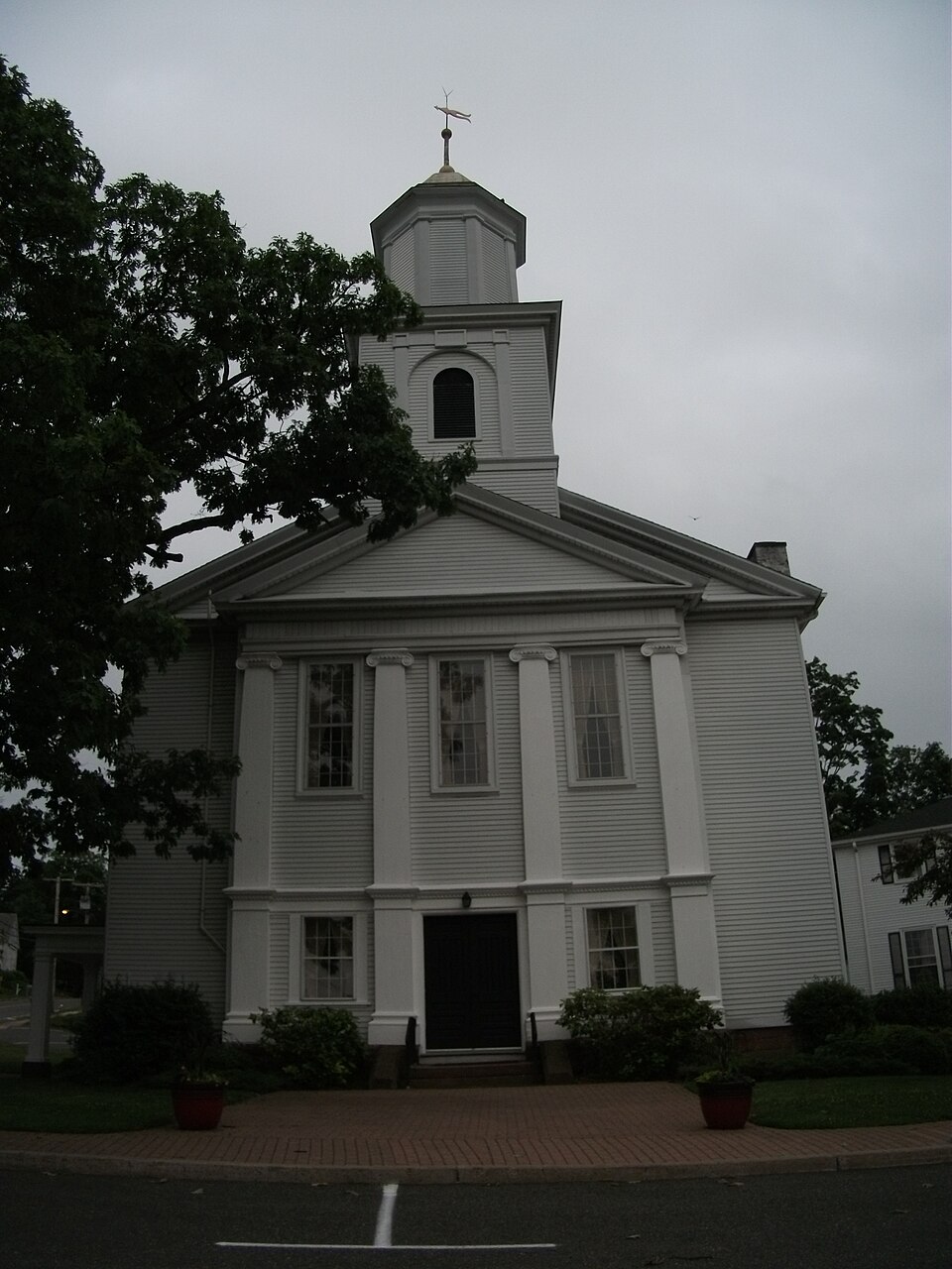
“First Congregational Church of East Longmeadow is a historic church in East Longmeadow, Massachusetts. Built in 1828, it is the oldest church building in East Longmeadow, and houses its oldest congregation.”
Wikipedia article First Congregational Church of East Longmeadow, CC BY-SA 4.0.
one of 123 National Register listings in Hampden County · listed in 1978 · category: Building.
National Register reference number.78000444- the number the National Park Service assigned this property when it was listed, and the key its nomination file is catalogued under at the National Archives.
Fires near this property
300 since 2002
Regional context, not property-specific
evidence. The
federal wildfire occurrence database
lists 300 fires within 5 miles of First Congregational Church of East Longmeadow between
2002 and 2020, burning about 231 acres in total. 24 started naturally. 1 was recorded as arson.
Distance is straight-line from the map coordinates, so a fire counted
here may appear on a neighbouring settlement's page as well.
Reported cause
Fires
Missing data/not specified/undetermined
157
Equipment and vehicle use
65
Natural
24
Recreation and ceremony
19
Smoking
19
Debris and open burning
13
Misuse of fire by a minor
2
Arson/incendiarism
1
The most recent of
them, most recent first, with the day each was reported and the service
that recorded it.
Regional context, not property-specific
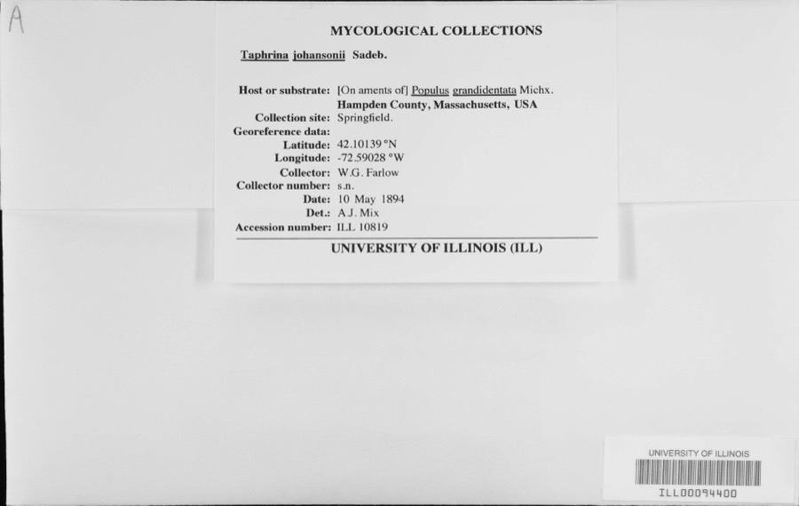
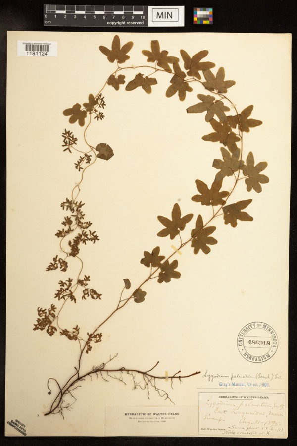
evidence. Museums hold 1,159 specimens
collected within 10 miles of First Congregational Church of East Longmeadow between 1845 and
1974: 550 Animalia, 296 Fungi, 287 Plantae, 18 Chromista, 8 Unrecorded. 12 distinct Species records are shown.
Collected by A. B. Seymour, A. E. Kirk, A. M. & D. P. Rogers and others. Each is a
physical object with a catalogue
number, and each entry opens the museum's record. This is what was
collected and kept, not a survey of what lives here - nothing can be
concluded from a species being absent.
Chicopee River, at Chicopee, Hampden County, Massachusetts; Locality according to historical catalogue: 'Chicopa River, Massachusetts'/erroneous, is Chicopee River, at Chicopee, Massachusetts (according to MCZ online fish catalogue).
Agawam River, at Agawam, Hampden County, Massachusetts; Locality according to historical inventory: 'Agawan River'/is Agawam River, at Agawam, Massachusetts, U.S.A. (according to MCZ online fish database).
Regional context, not property-specific
evidence. The federal mineral resources record lists
16 workings within 5 miles of First Congregational Church of East Longmeadow: 8 producers, 8 past producers.
8 still produce. What was taken out: Stone, Dimension, Flagstone, Brick Clay, Clay. Distance is straight-line from the
map coordinates, so a quarry counted here may appear on a neighbouring
settlement's page as well.
Regional context, not property-specific
evidence. The National Weather Service names
East Longmeadow, the town this property stands in, in 10 storm reports between 1995 and 2022: 7 thunderstorm wind, 3 hail.
No death or injury is recorded in these reports. Each account below is quoted exactly as the forecast office
filed it, from the NOAA Storm Events Database, and each date
opens the federal record of that event.
No historic map-sheet match is published
for this property yet. That does not mean no map exists. This record needs
a coordinate-quality review before it can be joined to a sheet boundary.
Browse the county's mapped places while that work is
pending.
From the nomination file
1,913 words on record
When this property was proposed for the
National Register, someone wrote the case for it: what the building is,
and why it matters. That document is a federal record in the public domain.
It is quoted below word for word, never summarised. The text was read off the scanned case file by machine, so the
occasional stray character is the recogniser's and the 1970s
typewriter's.
Description of the property
East Longmeadow's First Congregational Church is located on a triangular lot between Somers Road (Route 83) and Prospect Street (Route 186). The church faces north onto Center Square, which is the center of East Longmeadow. Erected in 1828, the church is a simple 45' x 55' rectangle with a ridge roof, Classical Revival in style. The gable faces Center Square. The side elevations are three bays deep. The building is sheathed in clapboards except for the facade which is match board. The facade is dominated by a smaller Ionic temple front, which projects out from the body of the church. Four pilasters are interrupted above the first floor entrance level by an entablature with a frieze and dentilated cornice. At the entrance-level are a center entry and two windows framed by the pilasters.
Above this entry level is the temple front proper. Between the pilasters are double hung multi-paned windows running 3/5th's of the way down from the entablature. The temple front is completed by a pedi- ment. Above the entrance is a square bell tower with round arched windows. Above this is an octagonal enclosed cupola with corner pilasters, topped by a small ridged dome 2223223 with a windvane. The side elevations have long, double hung, multi-pane windows framed by shutters and topped by round arched, louvered fans. Just north of the first bay of the west elevation is a small, square exterior chimney. The church rests on an almost completely exposed brick basement which has been painted white. In 1858 the building was moved 750' north to its present site.
Prior to 1911, two of the original three entrance doors were replaced by windows. A 30' x 45' addition was built at the southern end in 1926.
/ARCHITECT . First Congregational Church is significant as the oldest church and church building in the Town of East Longmeadow. It is also notable for the unique system used to finance its construction and for the role it has played in town matters. In 1827 the "Proprietors of the Meeting House of the Third. Religious Society on Longmeadow" was established. Shares in this corporation were sold at a fixed value of $10 per with a limit of ten shares to any one holder. This corporation built the present church. There was no third religious society or other organiza- tion extant. In 1829, the Second Congregational Church and Third Religious Society of Longmeadow was founded by 45 people from the area.
In 1858, after seven years of discussion, the Society bought the church building from Proprietors and moved it down the hill to its present location. Until 1882 and the erection of the Town Hall here in East Village, Town Meeting was held in this church, alternating yearly with West Village. In 1894 the community separated into two towns, Longmeadow and East Longmeadow. The ecclesiastical society was dissolvedin 1910 when the First Congregational Church of East Longmeadow was incorporated.
Quoted from the National Register nomination
for reference 78000444, 12 pages, held by the National Archives in Record
Group 79. See the
catalogue record.
Listed places nearby
6 within 8 miles
Other National Register properties close
enough to walk or drive between, ordered by distance from this one. Both
positions come from the same geocoding pass that matched these properties
to their map sheets.
Listing record. National Park Service National Register of Historic Places, listed-properties dataset, current to 2026-05-22.
Map join. Address geocoded through the United States Census geocoder, then tested against the published boundary of every sheet in the USGS Historical Topographic Map Collection.
How this page is made. Listing fields come from federal records; map-sheet coverage is a labelled coordinate-to-boundary calculation, not a source-field claim.
Wildfire. Short, Karen C. 2022. Spatial wildfire occurrence data for the United States, 1992-2020 [FPA_FOD_20221014]. 6th Edition. Fort Collins, CO: Forest Service Research Data Archive. https://doi.org/10.2737/RDS-2013-0009.6 Collected with United States Government funding and usable without additional permissions or fees.
Specimens. Global Biodiversity Information Facility (GBIF), https://www.gbif.org/. Only records licensed CC0 or CC BY are used. Records licensed CC BY-NC are excluded because this site carries advertising. Images are checked individually and any whose licence is non-commercial, no-derivatives or unreadable is refused.
Mines and quarries. USGS Mineral Resources Data System (MRDS) https://mrdata.usgs.gov/mrds/ A work of the United States government, no copyright under 17 U.S.C. 105.
Storms. NOAA National Centers for Environmental Information, Storm Events Database https://www.ncei.noaa.gov/stormevents/ A work of the United States government, no copyright under 17 U.S.C. 105. Narratives are quoted verbatim from the National Weather Service report and are not edited or summarised.
 Block
Block