Listed on the National Register of Historic Places in
1978. A historic map-sheet match is not published yet. The record needs a coordinate-quality review before it can be joined to a sheet boundary.
From the record
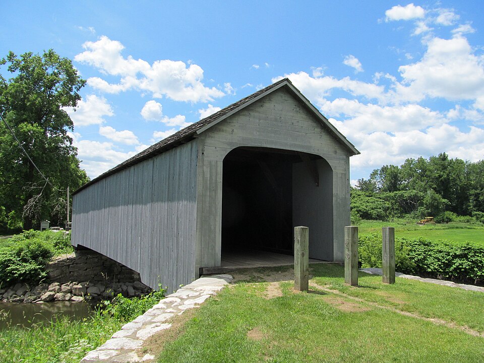
“The Old Covered Bridge, also known as the Upper Sheffield Covered Bridge, is a covered bridge on Covered Bridge Lane in Sheffield, Massachusetts. It is a replica of an 1837 lattice truss bridge that was destroyed by fire in 1994.”
Wikipedia article Old Covered Bridge, CC BY-SA 4.0.
one of 94 National Register listings in Berkshire County · listed in 1978 · category: Structure · one of 1 National Historic Landmarks in Berkshire County.
National Register reference number.78000445- the number the National Park Service assigned this property when it was listed, and the key its nomination file is catalogued under at the National Archives.
Fires near this property
28 since 2015
Regional context, not property-specific
evidence. The
federal wildfire occurrence database
lists 28 fires within 5 miles of Old Covered Bridge between
2015 and 2019, burning about 48 acres in total. None started naturally. 1 was recorded as arson.
Distance is straight-line from the map coordinates, so a fire counted
here may appear on a neighbouring settlement's page as well.
Reported cause
Fires
Debris and open burning
20
Missing data/not specified/undetermined
2
Equipment and vehicle use
2
Arson/incendiarism
1
Power generation/transmission/distribution
1
Recreation and ceremony
1
Railroad operations and maintenance
1
The most recent of
them, most recent first, with the day each was reported and the service
that recorded it.
Regional context, not property-specific
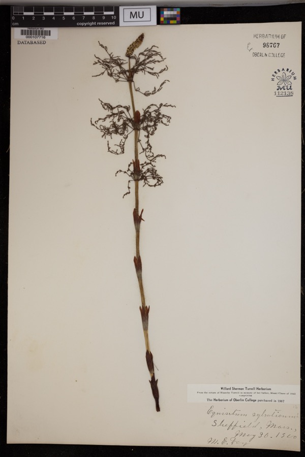
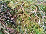
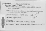
evidence. Museums hold 1,262 specimens
collected within 10 miles of Old Covered Bridge between 1860 and
1974: 1,047 Plantae, 160 Animalia, 53 Fungi, 1 Chromista, 1 Protozoa. 12 distinct Species records are shown.
Collected by A. Brown, A. L. Ericson, A. Lorenz and others. Each is a
physical object with a catalogue
number, and each entry opens the museum's record. This is what was
collected and kept, not a survey of what lives here - nothing can be
concluded from a species being absent.
Regional context, not property-specific
evidence. The federal mineral resources record lists
2 workings within 5 miles of Old Covered Bridge: 1 prospect, 1 past producer.
None of them still produces. What was taken out: Iron, Sand and Gravel, Construction. Distance is straight-line from the
map coordinates, so a quarry counted here may appear on a neighbouring
settlement's page as well.
Regional context, not property-specific
evidence. The National Weather Service names
Sheffield, the town this property stands in, in 21 storm reports between 1997 and 2025: 14 thunderstorm wind, 3 hail, 3 flash flood, 1 flood.
No death or injury is recorded in these reports. Each account below is quoted exactly as the forecast office
filed it, from the NOAA Storm Events Database, and each date
opens the federal record of that event.
Heavy rainfall led to flooding in portions of Berkshire county. This led to many road closures, including main roads in Sheffield, and several secondary roads in Egremont Plain and Richmond.||In addition, flooding was reported along the Green River near Great Barrington.
No historic map-sheet match is published
for this property yet. That does not mean no map exists. This record needs
a coordinate-quality review before it can be joined to a sheet boundary.
Browse the county's mapped places while that work is
pending.
From the nomination file
2,165 words on record
When this property was proposed for the
National Register, someone wrote the case for it: what the building is,
and why it matters. That document is a federal record in the public domain.
It is quoted below word for word, never summarised. The text was read off the scanned case file by machine, so the
occasional stray character is the recogniser's and the 1970s
typewriter's.
Description of the property
The Old Covered Bridge of Sheffield spans the Housatonic River in the Plains region of Sheffield. The surrounding area is predominantly rural; the immediate area is the flood plain of the river. The bridge, in 19th century fashion, is angled and runs southwest to northeast across the river. It is approached on either side by Covered Bridge Lane which runs approximately east to west. The easterly approach is from Boardman Street and is twenty-six hundred feet long. The six hundred foot long westerly approach begins at Main Street (U.S. 7). The bridge is ninety-three feet long with an outside width of fifteen feet, eleven inches. The interior width is eleven feet, eleven inches. The bridge has a shallow slope ridge roof with gables facing east and west.
The most arresting feature of the bridge is its structure. The bridge employs Town lattice trusses with secondary chords. Top and bottom chords are six inches by fourteen inches with four one and three-quarter inch trunnels to stabilize the lattice ends. Lattice members are three inches by ten inches and the secondary chords are six inches by ten inches. Timbers are principally hemlock; trunnels are oak, and the flooring is oak and elm. Exterior sheathingis vertical board with board and batten on the gable ends. There are single window openings near the apex. of each gable. The roof is covered with asphalt shingles. Bollard-like posts have been placed at the entrance to discourage vehicular traffic. The bridge sits on granite piers that have been seriously undermined by periodic flooding.
Statement of significance
/ARCHITECT Ithiel Town The Old Covered Bridge of Sheffield is significant as the oldest extant covered bridge in Massachusetts and as one of the earliest examples of a Town Lattice Truss bridge. Ithiel Town, New Haven architect, received his first patent for his lattice truss bridge design in 1820. The principal feature of the design was its ability to span great distances with its relatively simple engineering. In 1835 he modified his design with the addition of secondary chords for greater stability. This bridge was built between April 13, 1837 when Sheffield Selectmen advertised for its construction and April 2, 1938 when the bridge was accepted at town meeting. The bridge has been closed to vehicular traffic since 1970.
Quoted from the National Register nomination
for reference 78000445, 20 pages, held by the National Archives in Record
Group 79. See the
catalogue record.
Listed places nearby
6 within 8 miles
Other National Register properties close
enough to walk or drive between, ordered by distance from this one. Both
positions come from the same geocoding pass that matched these properties
to their map sheets.
Listing record. National Park Service National Register of Historic Places, listed-properties dataset, current to 2026-05-22.
Map join. Address geocoded through the United States Census geocoder, then tested against the published boundary of every sheet in the USGS Historical Topographic Map Collection.
How this page is made. Listing fields come from federal records; map-sheet coverage is a labelled coordinate-to-boundary calculation, not a source-field claim.
Wildfire. Short, Karen C. 2022. Spatial wildfire occurrence data for the United States, 1992-2020 [FPA_FOD_20221014]. 6th Edition. Fort Collins, CO: Forest Service Research Data Archive. https://doi.org/10.2737/RDS-2013-0009.6 Collected with United States Government funding and usable without additional permissions or fees.
Specimens. Global Biodiversity Information Facility (GBIF), https://www.gbif.org/. Only records licensed CC0 or CC BY are used. Records licensed CC BY-NC are excluded because this site carries advertising. Images are checked individually and any whose licence is non-commercial, no-derivatives or unreadable is refused.
Mines and quarries. USGS Mineral Resources Data System (MRDS) https://mrdata.usgs.gov/mrds/ A work of the United States government, no copyright under 17 U.S.C. 105.
Storms. NOAA National Centers for Environmental Information, Storm Events Database https://www.ncei.noaa.gov/stormevents/ A work of the United States government, no copyright under 17 U.S.C. 105. Narratives are quoted verbatim from the National Weather Service report and are not edited or summarised.
 Block
Block