Listed on the National Register of Historic Places in
1978. A historic map-sheet match is not published yet. The record needs a coordinate-quality review before it can be joined to a sheet boundary.
From the record
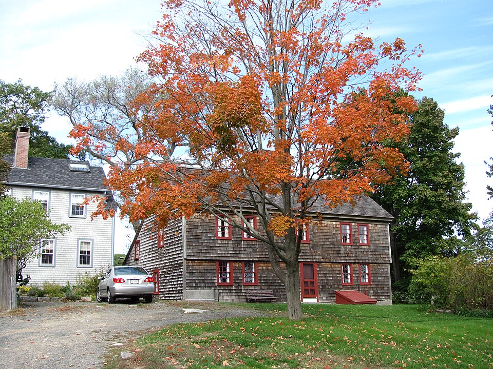
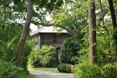
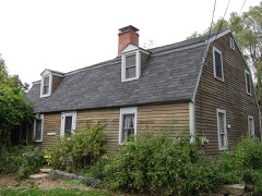
“The Old Castle is a historic First Period house located on Castle Lane in Rockport, Massachusetts. The wood-frame house was probably built c. 1712 by Jethro Wheeler, in whose family it remained for six generations.”
Wikipedia article Old Castle (Rockport, Massachusetts), CC BY-SA 4.0.
one of 350 National Register listings in Essex County · listed in 1978 · category: Building · one of 2 National Historic Landmarks in Essex County.
National Register reference number.78000466- the number the National Park Service assigned this property when it was listed, and the key its nomination file is catalogued under at the National Archives.
JOHN POOL was the second permanent settler of Rockport, finding upon his arrival there in the autumn of 1699, only the family of Richard Tarr, living in a log cabin. During the winter he took up a temporary residence in a small, vacant house, and in April of the following year purchased "a certain farme messuage" at a place commonly called "ye Cape," for one hundred and sixty pounds. Here he erected the first frame house of Rockport and settled with his family.
JOHN POOL, born in Taunton, Somerset, England, about 1670; died in Rockport, Massachusetts, May 19, 1727. He came to this country about 1690, or a little before, and married, first, Sarah Woodbury, nee Haskell, widow of Richard Woodbury and daughter of Roger Haskell. She died November 13, 1716, aged about 55.
Regional context, not property-specific
evidence. The
federal wildfire occurrence database
lists 15 fires within 5 miles of Old Castle between
2016 and 2020, burning about 11 acres in total. None started naturally. 2 were recorded as arson.
Distance is straight-line from the map coordinates, so a fire counted
here may appear on a neighbouring settlement's page as well.
Reported cause
Fires
Recreation and ceremony
7
Misuse of fire by a minor
2
Debris and open burning
2
Arson/incendiarism
2
Equipment and vehicle use
1
Smoking
1
The most recent of
them, most recent first, with the day each was reported and the service
that recorded it.
Regional context, not property-specific
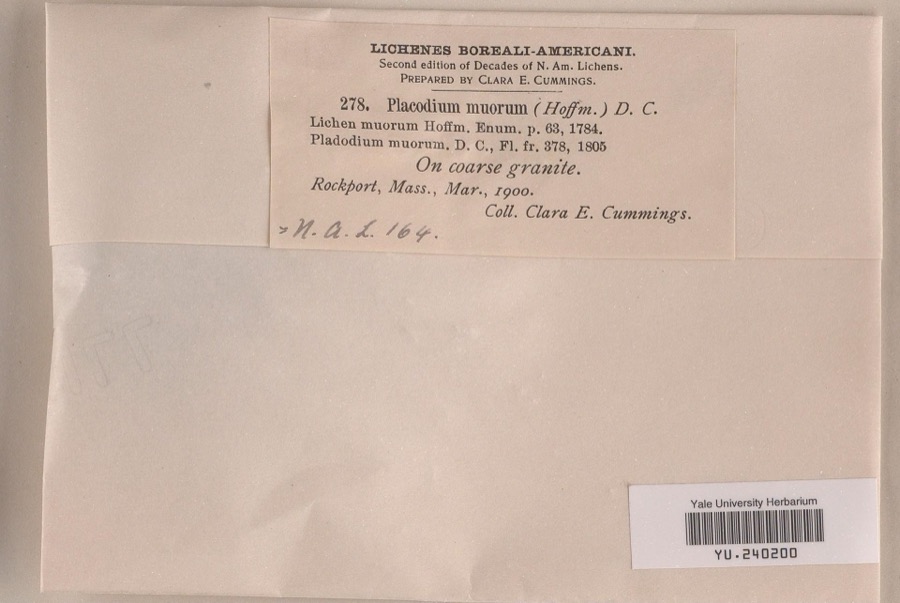
evidence. Museums hold 3,337 specimens
collected within 10 miles of Old Castle between 1817 and
1975: 1,243 Animalia, 1,183 Plantae, 505 Fungi, 300 Chromista, 60 Protozoa, 32 Unrecorded, 14 Bacteria. 12 distinct Species records are shown.
Collected by A Perlmutter, A. B. Seymour, A. B. Seymour and F. C. Seymour and others. Each is a
physical object with a catalogue
number, and each entry opens the museum's record. This is what was
collected and kept, not a survey of what lives here - nothing can be
concluded from a species being absent.
Regional context, not property-specific
evidence. The federal mineral resources record lists
8 workings within 5 miles of Old Castle: 8 past producers.
None of them still produces. What was taken out: Granite, Sand and Gravel, Construction. Distance is straight-line from the
map coordinates, so a quarry counted here may appear on a neighbouring
settlement's page as well.
Regional context, not property-specific
evidence. The National Weather Service names
Rockport, the town this property stands in, in 2 storm reports between 2000 and 2000: 1 waterspout, 1 funnel cloud.
No death or injury is recorded in these reports. Each account below is quoted exactly as the forecast office
filed it, from the NOAA Storm Events Database, and each date
opens the federal record of that event.
No historic map-sheet match is published
for this property yet. That does not mean no map exists. This record needs
a coordinate-quality review before it can be joined to a sheet boundary.
Browse the county's mapped places while that work is
pending.
From the nomination file
1,574 words on record
When this property was proposed for the
National Register, someone wrote the case for it: what the building is,
and why it matters. That document is a federal record in the public domain.
It is quoted below word for word, never summarised. The text was read off the scanned case file by machine, so the
occasional stray character is the recogniser's and the 1970s
typewriter's.
Description of the property
Ihe Old Castle occupies a high promontory and faces Pigeon Cove across its long lawn. The shingled 2½ story "saltbox" has a center chimney, an asphalt shingled roof and is two bays deep. Fenestration throughout is 6/6. A pronounced second story overhang and simple box cornice, each set upon fenestration lintels, accent the five bay wide facade which faces southeast towards the Atlantic Ocean. The end bays are paired and frame the wider central bay. On the ground floor of this bay is an off-center entry. On the eastern end of the facade is a basement backhead. The second story overhang continues for two bays on the east elevation. The lean-to is a single bay deep. The west elevation has a single bay on all three levels.
The slope of the lean-to shed roof is less than the original roof creating the house's unique section. The Old Castle is believed to have been built about 1715. Chamfered framing, low ceilings and bricks laid in clay suggest the house represents holdovers of 17th century building practices. The two room plan house was extensively restored in 1929 under the direction of ThomasWilliams when it was acquired by the Pigeon Cove Village Improvement Society. The restoration included removing later interior partitions, laying new floors in some rooms, removing and patching plaster and replacing window sashes. The kitchen lean-to is believed to have been built in 1792. A portion removed earlier was rebuilt in 1892.
Statement of significance
/ARCHITECT Jethro Wheeler The Old Castle is significant for its architecture and historical associations. The house is believed to have been built after Jethro Wheeler purchased the property from Joshua Norwood in 1712. Six successive generations of Wheelers occupied the house. The farm was subdivided in 1810 but Wheelers owned partial interest in the house until 1893 when it was purchased by Henry L. Story, a prominent Rockport resident. Mrs. Abbie F. Story was the founder of the Pigeon Cove Village Improvement Society in 1889. In 1929, after the death of their parents, the Story children presented the house to the Society. The house has always stood apart as a prominent landmark, particularly from the seaward side.
Its name is derived from its appearance to sailors rounding the tip of Cape Ann. The house is now maintained by the Village Improvement Society as a meeting place and as a museum open to the public during the summer months. The intent of the 1929 restorati)n was not to restore the house to any particular period but to represent various phases of its building history.
Quoted from the National Register nomination
for reference 78000466, 9 pages, held by the National Archives in Record
Group 79. See the
catalogue record.
Listed places nearby
6 within 8 miles
Other National Register properties close
enough to walk or drive between, ordered by distance from this one. Both
positions come from the same geocoding pass that matched these properties
to their map sheets.
Listing record. National Park Service National Register of Historic Places, listed-properties dataset, current to 2026-05-22.
Map join. Address geocoded through the United States Census geocoder, then tested against the published boundary of every sheet in the USGS Historical Topographic Map Collection.
How this page is made. Listing fields come from federal records; map-sheet coverage is a labelled coordinate-to-boundary calculation, not a source-field claim.
Wildfire. Short, Karen C. 2022. Spatial wildfire occurrence data for the United States, 1992-2020 [FPA_FOD_20221014]. 6th Edition. Fort Collins, CO: Forest Service Research Data Archive. https://doi.org/10.2737/RDS-2013-0009.6 Collected with United States Government funding and usable without additional permissions or fees.
Specimens. Global Biodiversity Information Facility (GBIF), https://www.gbif.org/. Only records licensed CC0 or CC BY are used. Records licensed CC BY-NC are excluded because this site carries advertising. Images are checked individually and any whose licence is non-commercial, no-derivatives or unreadable is refused.
Mines and quarries. USGS Mineral Resources Data System (MRDS) https://mrdata.usgs.gov/mrds/ A work of the United States government, no copyright under 17 U.S.C. 105.
Storms. NOAA National Centers for Environmental Information, Storm Events Database https://www.ncei.noaa.gov/stormevents/ A work of the United States government, no copyright under 17 U.S.C. 105. Narratives are quoted verbatim from the National Weather Service report and are not edited or summarised.
 Block
Block