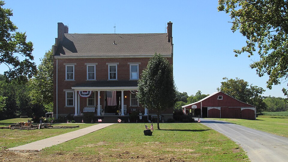
Listed on the National Register of Historic Places in
1978. A historic map-sheet match is not published yet. The record needs a coordinate-quality review before it can be joined to a sheet boundary.
From the record
one of 21 National Register listings in Brown County · listed in 1978 · category: Building · one of 3 National Historic Landmarks in Brown County.
National Register reference number.78002010- the number the National Park Service assigned this property when it was listed, and the key its nomination file is catalogued under at the National Archives.
Fires near this property
1 since 2020
Regional context, not property-specific
evidence. The
federal wildfire occurrence database
lists 1 fire within 5 miles of Buckner, Dr. Philip, House And Barn between
2020 and 2020, burning about 0 acres in total. None started naturally. None was recorded as arson.
Distance is straight-line from the map coordinates, so a fire counted
here may appear on a neighbouring settlement's page as well.
Reported cause
Fires
Debris and open burning
1
The most recent of
them, most recent first, with the day each was reported and the service
that recorded it.
Regional context, not property-specific
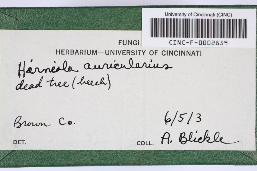
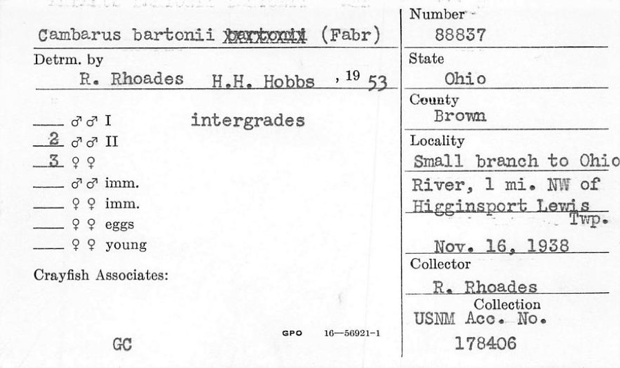
evidence. Museums hold 375 specimens
collected within 10 miles of Buckner, Dr. Philip, House And Barn between 1885 and
1974: 291 Animalia, 74 Fungi, 10 Plantae. 12 distinct Species records are shown.
Collected by A JOHN, A. Braun, Ahles, H.E. and others. Each is a
physical object with a catalogue
number, and each entry opens the museum's record. This is what was
collected and kept, not a survey of what lives here - nothing can be
concluded from a species being absent.
Regional context, not property-specific
evidence. The federal mineral resources record lists
6 workings within 5 miles of Buckner, Dr. Philip, House And Barn: 4 past producers, 1 producer, 1 plant.
2 still produce. What was taken out: Sand and Gravel, Construction, Limestone, General, Stone, Crushed/Broken. Distance is straight-line from the
map coordinates, so a quarry counted here may appear on a neighbouring
settlement's page as well.
Regional context, not property-specific
evidence. The National Weather Service names
Georgetown, the town this property stands in, in 39 storm reports between 1996 and 2025: 25 thunderstorm wind, 6 hail, 6 flood, 2 flash flood.
No death or injury is recorded in these reports. Each account below is quoted exactly as the forecast office
filed it, from the NOAA Storm Events Database, and each date
opens the federal record of that event.
Three to four feet of water was reported over Highway 52 between Higginsport and Ripley. Mud was covering the roadway near Free Soil Road. A tree was downed across A and P Road. Fire crews were working to clean up the roadways. This flooding occurred due to persistent heavy rainfall.
1 paper published in this town,
digitised by the Library of Congress and free to read: 0 issues,
0 pages. Every page is searchable, so a name or a street can be
looked for directly in what the town printed about itself at the time.
No historic map-sheet match is published
for this property yet. That does not mean no map exists. This record needs
a coordinate-quality review before it can be joined to a sheet boundary.
Browse the county's mapped places while that work is
pending.
From the nomination file
1,782 words on record
When this property was proposed for the
National Register, someone wrote the case for it: what the building is,
and why it matters. That document is a federal record in the public domain.
It is quoted below word for word, never summarised. The text was read off the scanned case file by machine, so the
occasional stray character is the recogniser's and the 1970s
typewriter's.
Description of the property
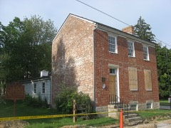
double hung sash, painted white, with one light over one light. The windows that in addition to a central entrance, a single doorway is situated at the The Interior remains unchanged except for necessary wiring, heating CONDITION DESCRIPTION UNALTERED DETERIORATED XEXCELLENT supporting an entablature decorated by dentils. roofing of composition shingles was added in recent years. perpendicular wall surface. The facade is divided into five bays by rigidly symmetrical rectangular openings consisting of a central ground level main entrance and windows of CHECK ONE The original sash and muntins appear in the attic windows and one east corner.
Nineteenth Century red barn with vertical siding and rectangular single Approximately fifty yards to the rear and west of the house stands a The Dr.Philip Buckner House, influenced by the Federal style of architec- XORIGINAL SITE about 1960. The gable ends, which are to the sides, are stepped with bridged chim- Frank Cahall about l940,stands directly behind the house.Immediately The basic design of the rear is similar to that of the facade, except into the walls of the sides of the house support the stepped gables, the The center hall has a curved stairway to the third floor.All of the wood- _UNEXPOSED -GOOD ture, is a two story rectangular block facing northward to the center of neys. work, mantels and doors appear to be handmade with pegs and handmade nalls.
second level rear window, all of which have six lights over six. The facade foundation stones.A smooth stone water table extends across the with & cement base, cinder block floor and modern ornamental iron posts, The cornices are boxed and projecting. Carved stone brackets set DATE 1890.
ner was the first president of the Adams, Brown and Clermont Counties Other noted occupants and owners of the house were Ben Sells, a ECONOMICS LAW SCIENCE RELIGION ARCHEOLOGY-HISTORIC PHILOSOPHY COMMERCE research. BUILDER/ARCHITECT PERIOD SIGNIFICANCE ART EXPLORATION/SETTLEMENT (newspaper) SCULPTURE INDUSTRY Century.
PREHISTORIC Philip Buckner MUSIC INVENTION _TRANSPORTATION His reports were highly regarded and were considered models of scientific LITERATURE Dr.Philip Buckner had the classically inspired house with Federal Medical College of Ohio at Cincinnati for his recognized skill.Dr.Buck- education in Ohio and surrounding states.Dr.Bu ckmer died at the age publisher of the West Union Defender in Adans Co.,Ohio.Eyler moved to _ENGINEERING The house stands today as a reminder of prominent local personal- MILITARY _1700-1799 -1400-1499 Georgetown in 189o and edited and published the News Democrat of George- Medical Association and in l85o was a member of and delegate to the Ohio _THEATER Well known gunsmith of the late l8oo'sand Joseph W.Eyler,founder and family in 1919.
influence built at a cost of 2,400 in 1845.Buckner came to George- - - 1600-1699 -1900- XEDUCATIONMedical _COMMUNITY PLANNING of fifty three, cutting short his remarkable career. ities and their contributions in education, medicine, crafts and journal- X ARCHITECTURE in Georgetown, Ohio,where he practiced for more than twenty five years. ARCHEOLOGY-PREHISTORIC Medical Society. It is also a well preserved representative of the more substantial Buckner became professor of obstectrics at the Medical College of In l837 he was awarded a honorary degree as a doctor of medicine by the domestic architecture of Southwest Ohio in the first half of the l9th town,until his death in l9o6.The house was acquired by the Cahill
Quoted from the National Register nomination
for reference 78002010, 12 pages, held by the National Archives in Record
Group 79. See the
catalogue record.
Listed places nearby
6 within 8 miles
Other National Register properties close
enough to walk or drive between, ordered by distance from this one. Both
positions come from the same geocoding pass that matched these properties
to their map sheets.
Listing record. National Park Service National Register of Historic Places, listed-properties dataset, current to 2026-05-22.
Map join. Address geocoded through the United States Census geocoder, then tested against the published boundary of every sheet in the USGS Historical Topographic Map Collection.
How this page is made. Listing fields come from federal records; map-sheet coverage is a labelled coordinate-to-boundary calculation, not a source-field claim.
Wildfire. Short, Karen C. 2022. Spatial wildfire occurrence data for the United States, 1992-2020 [FPA_FOD_20221014]. 6th Edition. Fort Collins, CO: Forest Service Research Data Archive. https://doi.org/10.2737/RDS-2013-0009.6 Collected with United States Government funding and usable without additional permissions or fees.
Specimens. Global Biodiversity Information Facility (GBIF), https://www.gbif.org/. Only records licensed CC0 or CC BY are used. Records licensed CC BY-NC are excluded because this site carries advertising. Images are checked individually and any whose licence is non-commercial, no-derivatives or unreadable is refused.
Mines and quarries. USGS Mineral Resources Data System (MRDS) https://mrdata.usgs.gov/mrds/ A work of the United States government, no copyright under 17 U.S.C. 105.
Storms. NOAA National Centers for Environmental Information, Storm Events Database https://www.ncei.noaa.gov/stormevents/ A work of the United States government, no copyright under 17 U.S.C. 105. Narratives are quoted verbatim from the National Weather Service report and are not edited or summarised.
 Block
Block