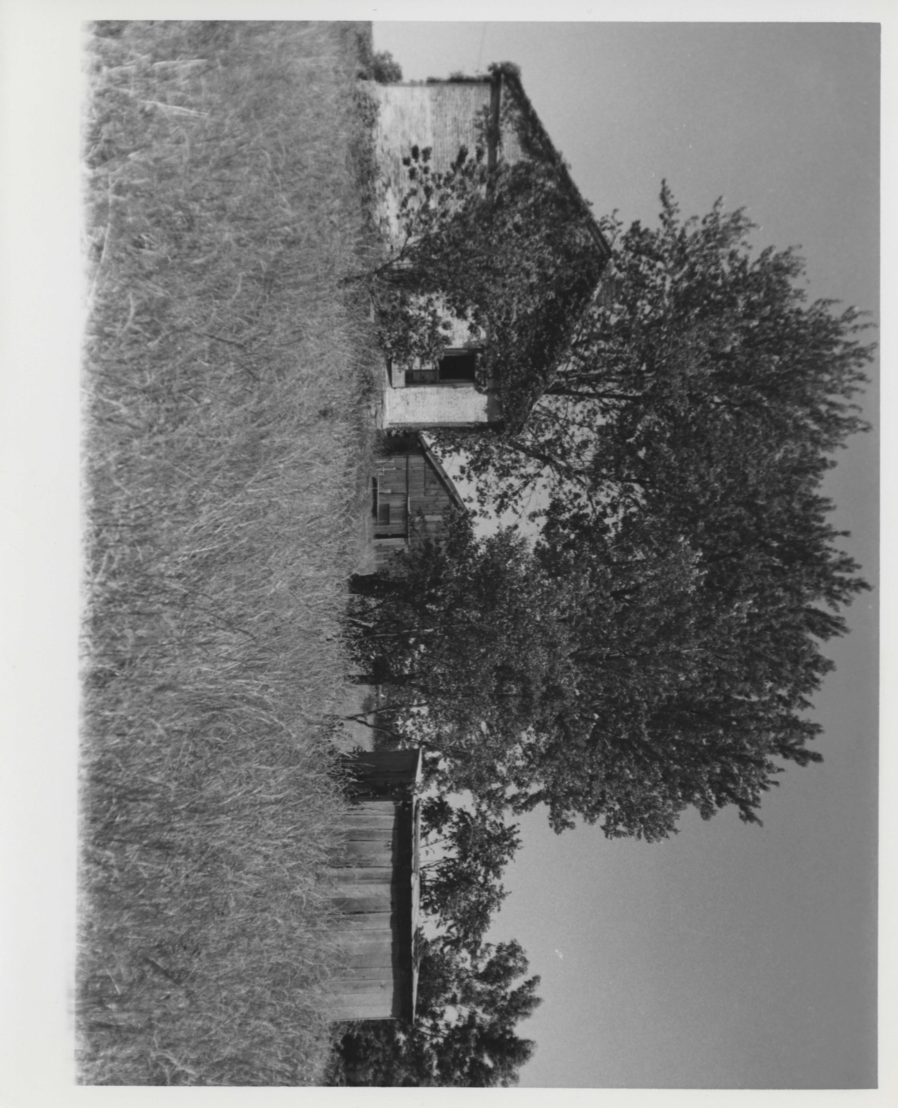
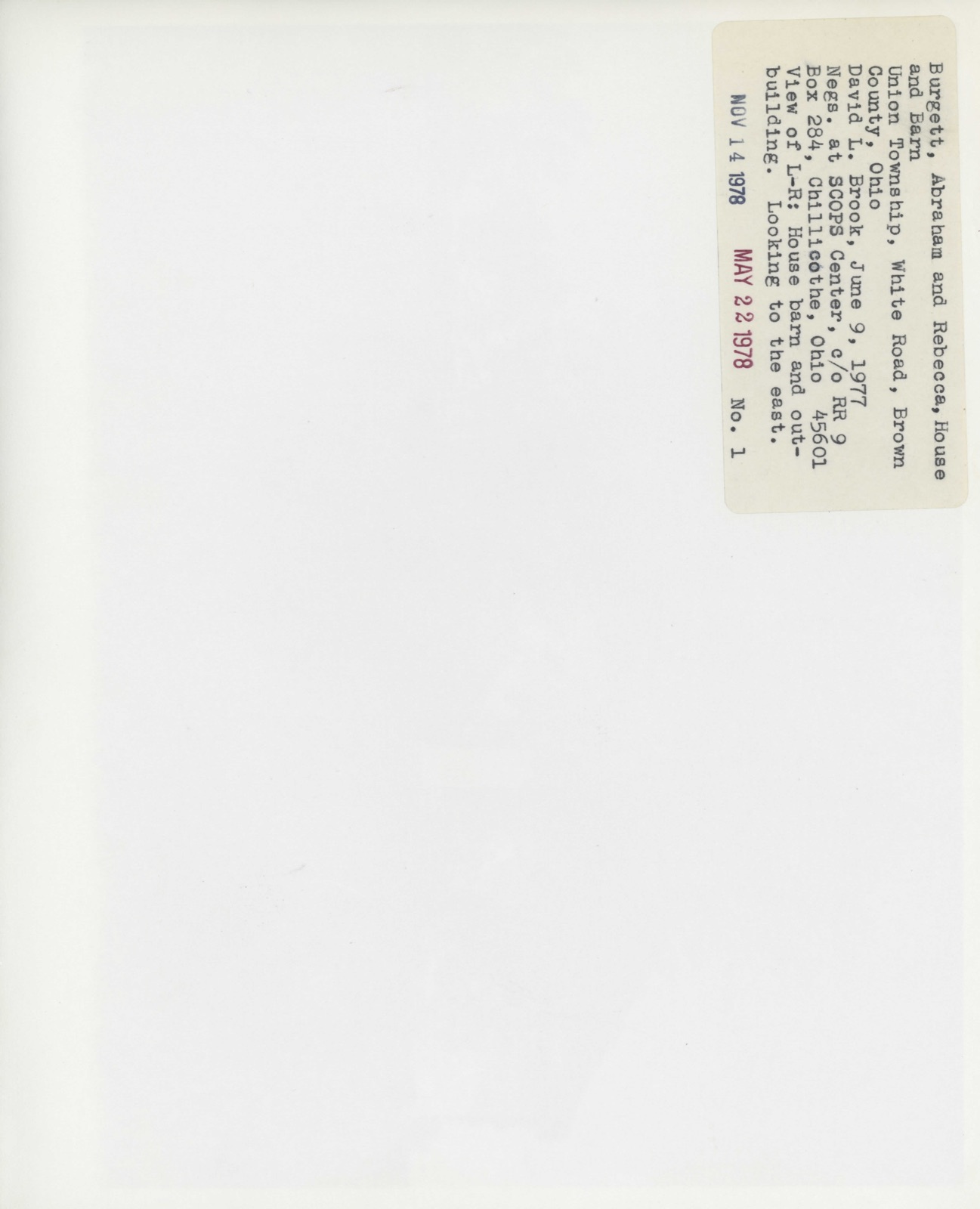
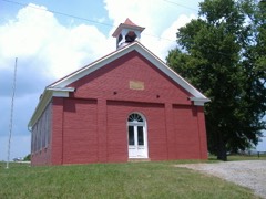
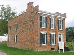
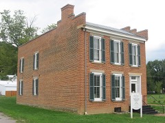
Photographs from the nomination case file, National Park Service records.
Burgett House And Barn
Listed on the National Register of Historic Places in
1978. A historic map-sheet match is not published yet. The record needs a coordinate-quality review before it can be joined to a sheet boundary.
From the record
“Levi, Sarah, Elizabeth, Pindell, Nancy, Henry and Jane. Roannn married Henry Straight, and they moved to Illinois, and there died.”
The History of Brown County, Ohio, Containing a History of the County ... General and Local Statistics; Portraits of Early Settlers and Prominent Men; History of the Northwest Territory; History of Ohio; Map of Brown County; Constitution of the United States .. (1883). Machine-read text.
one of 21 National Register listings in Brown County · listed in 1978 · category: Building · one of 3 National Historic Landmarks in Brown County.
National Register reference number.78002013- the number the National Park Service assigned this property when it was listed, and the key its nomination file is catalogued under at the National Archives.
The Political Examiner , a Georgetown paper, under date September 24, 1840, contains the following announcement : " Once more unto the breach, once more! Grand rally at Ripley, Ohio, on the 30th instant. Preparation is already made to keep thousands of freemen - yea, all that may come - ' without money and without price.' Gen. Harrison will most positively be there, among other invited guests, life and health permitting."
Gen. Harrison came to Ripley as advertised, and one of the largest conventions ever held in the county was the result. They came from every quarter - from Hillsboro and Highland County, from Clermont County, from every nook and corner of Brown County, and thousands from Kentucky - they came in large canoes on wheels, with casks representing hard cider barrels, and, in short, the people were ablaze.
Regional context, not property-specific
evidence. The
federal wildfire occurrence database
lists 2 fires within 5 miles of Burgett House And Barn between
1997 and 2012, burning about 4 acres in total. None started naturally. None was recorded as arson.
Distance is straight-line from the map coordinates, so a fire counted
here may appear on a neighbouring settlement's page as well.
Reported cause
Fires
Debris and open burning
2
The most recent of
them, most recent first, with the day each was reported and the service
that recorded it.
Regional context, not property-specific
evidence. Museums hold 278 specimens
collected within 10 miles of Burgett House And Barn between 1883 and
1974: 242 Animalia, 32 Fungi, 4 Plantae. 12 distinct Species records are shown.
Collected by A JOHN, Ahles, H.E., Bell E. W. and others. Each is a
physical object with a catalogue
number, and each entry opens the museum's record. This is what was
collected and kept, not a survey of what lives here - nothing can be
concluded from a species being absent.
Regional context, not property-specific
evidence. The federal mineral resources record lists
5 workings within 5 miles of Burgett House And Barn: 2 producers, 2 past producers, 1 plant.
3 still produce. What was taken out: Sand and Gravel, Construction, Limestone, General, Stone, Crushed/Broken. Distance is straight-line from the
map coordinates, so a quarry counted here may appear on a neighbouring
settlement's page as well.
Regional context, not property-specific
evidence. The National Weather Service names
Ripley, the town this property stands in, in 34 storm reports between 1994 and 2025: 17 thunderstorm wind, 7 hail, 7 flash flood, 2 flood.
No death or injury is recorded in these reports. Each account below is quoted exactly as the forecast office
filed it, from the NOAA Storm Events Database, and each date
opens the federal record of that event.
Four to five inches of rain produced widespread flash flooding across southeastern Brown County. Damage to several roads was reported throughout Huntington Township and a bridge at Stringtown and Flaugher Hill Roads sustained damage. One vehicle was washed down a creek and numerous vehicles were stranded in high water.
Three homes along US Routes 62 and 68 north of Ripley had their roofs either removed or damaged. Additional structural damage occurred to a motel, and apartment building and church near Aberdeen. A number of parked vehicles had windows damaged. Numerous trees were also uprooted or downed in the area. Damage was determined to be caused by straight-line winds estimated at 80-90 mph.
A residential structure on Scoffield Road, just west of Devore Road, sustained water damage with several inches of flowing water and mud moving through living spaces.
The tornado touched down between the AA Highway and Kentucky 435 in Mason County Kentucky. Some of the heaviest and most concentrated tree damage was found very near the Ohio River on South Ripley Road, and adjacent areas of Mary Ingles Highway (Highway 8). The survey team found tree and agricultural building damage along the length of the path in Mason County. The vast majority of structural damage in Mason County consisted of barns and outbuildings with roof panels removed. ||Across the Ohio River in the eastern side of Ripley, tree and shingle damage was found on Pearl Street, Kevin Drive, and portions of Elizabeth Street. There was little to no evidence of damage up the steep river bluff above the city of Ripley, suggesting the tornado was lifting as it moved into the city.
Two roads were flooded and closed to the east of Ripley. Significant flooding took place along Fishing Gut Creek near the intersection of State Routes 41 and 763 just north of Aberdeen.
A roof was blown off of the patio of a home along the Ohio River. The roof was carried 100 feet uphill and over US Route 52 before being dropped. Several trees were downed as well. The damage was caused by a possible microburst.
Several inches of water was reported to be covering Hamburg Street where it intersects with Governor Street. Some of this water entered a shed and garage on a residential property, causing water damage.
No historic map-sheet match is published
for this property yet. That does not mean no map exists. This record needs
a coordinate-quality review before it can be joined to a sheet boundary.
Browse the county's mapped places while that work is
pending.
From the nomination file
1,801 words on record
When this property was proposed for the
National Register, someone wrote the case for it: what the building is,
and why it matters. That document is a federal record in the public domain.
It is quoted below word for word, never summarised. The text was read off the scanned case file by machine, so the
occasional stray character is the recogniser's and the 1970s
typewriter's.
Description of the property
The facade has a central, recessed porch enclosed at an undetermined porch, reveals the outline of a stairway leading to the loft. A single Windows are of double hung sash,and one light over one, which indicates colonial styles. CONDITION FAIR EXCELLENT UNALTERED DESCRIPTION UNEXPOSED XALTERED XDETERIORATED Situated on a hilltop overlooking Rangle Run to the north and west, width door flanked by two windows on either side, making a total of rectangular attic windows flank the end chimney on the east wall. outbuilding of vertical wooden siding.
Century barn of peg construction and vertical wooden siding, and a The four room house retains its original woodwork, which includes bond brick walls l5 inches thick.It has a facade of Flemish bond Near the southwest corner of the house stands another small frame windows of the house have jack arches above and lugsills below.The head.The house has no basement.The gabled roof has modern sheet metal. small outbuilding of the same vintage, also of frame construction. base.Under the rooflines of the facade and rear north side are pro- doors individually appear near the south wall.
Two small The gable ends are on the sides of the house where single width wooden door protected by a small gabled hood is centered in the XORIGINAL SITE brick.The house rests upon a foundation of squared random rubble. CHECK ONE that the sash is not original. _RUINS weatherboard wall. Removal of wall paper in 1977, in the enelosed DATE enclosed porch. exquisite detailing on an apparently original mantel in the east room.
Victorian style of building, found in the river counties of Southwestern 1t appears on the 1826 tax duplicate at a value of $250.00. It appears F. Burgett (1819 - 1883) also lived in the house. Further history of unusual architectural features such as the finely carved mantel and the of Brown County buildings 1s tar from complete, it is only one of two 1975, in Brown County. 1825 1700-1799 1500-1599 1600-1699 INVENTION ARCHEOLOGY-HISTORIC ENGINEERING LAW EDUCATION ECONOMICS AGRICULTURE ART PERIOD SIGNIFICANCE THEATER PHILOSOPHY CONSERVATION INDUSTRY TRANSPORTATION BUILDER/ARCHITECT POLITICS/GOVERNMENT MILITARY SCIENCE LITERATURE PREHISTORIC XARCHITECTURE _COMMUNICATIONS Ohio.
X1800-1899 Census Records reveal that Valentine and Abraham Burgett resided in MUSIC The house is significant because of its early period and its is most important as a relatively unchanged survival of an early pre- shows the mark of a master builder and craftsman.Although the inventory The house is situated on land granted to Valentine Burgett by the The house is connected with early settlers of Brown County.Yet it grouping of l9th Century Ohio farm buildings,which retain their original molded exterior cornice of brick.It is a simple structure, yet it Tax records indicate that the house was probably built in l825 as fabric and character. -1400-1499 Today the house and its barn and outbuildings stand as a cohesive the Burgett family is unknown.
on an 88 acre tract of land owned by Abraham probably Brown County as early as l820. _COMMERCE - RELIGION Abraham Burgett married Rebecca Drake in 18l8.U.S. -1900- _COMMUNITY PLANNING had the house built. The son of Abraham and Rebecca Burgett, James ARCHEOLOGY-PREHISTORIC buildings of its type discovered in the course of the inventory since United States government for military service in the American Revolution.
Quoted from the National Register nomination
for reference 78002013, 14 pages, held by the National Archives in Record
Group 79. See the
catalogue record.
Listed places nearby
6 within 8 miles
Other National Register properties close
enough to walk or drive between, ordered by distance from this one. Both
positions come from the same geocoding pass that matched these properties
to their map sheets.
Listing record. National Park Service National Register of Historic Places, listed-properties dataset, current to 2026-05-22.
Map join. Address geocoded through the United States Census geocoder, then tested against the published boundary of every sheet in the USGS Historical Topographic Map Collection.
How this page is made. Listing fields come from federal records; map-sheet coverage is a labelled coordinate-to-boundary calculation, not a source-field claim.
Wildfire. Short, Karen C. 2022. Spatial wildfire occurrence data for the United States, 1992-2020 [FPA_FOD_20221014]. 6th Edition. Fort Collins, CO: Forest Service Research Data Archive. https://doi.org/10.2737/RDS-2013-0009.6 Collected with United States Government funding and usable without additional permissions or fees.
Specimens. Global Biodiversity Information Facility (GBIF), https://www.gbif.org/. Only records licensed CC0 or CC BY are used. Records licensed CC BY-NC are excluded because this site carries advertising. Images are checked individually and any whose licence is non-commercial, no-derivatives or unreadable is refused.
Mines and quarries. USGS Mineral Resources Data System (MRDS) https://mrdata.usgs.gov/mrds/ A work of the United States government, no copyright under 17 U.S.C. 105.
Storms. NOAA National Centers for Environmental Information, Storm Events Database https://www.ncei.noaa.gov/stormevents/ A work of the United States government, no copyright under 17 U.S.C. 105. Narratives are quoted verbatim from the National Weather Service report and are not edited or summarised.
 Block
Block