BlockBefore
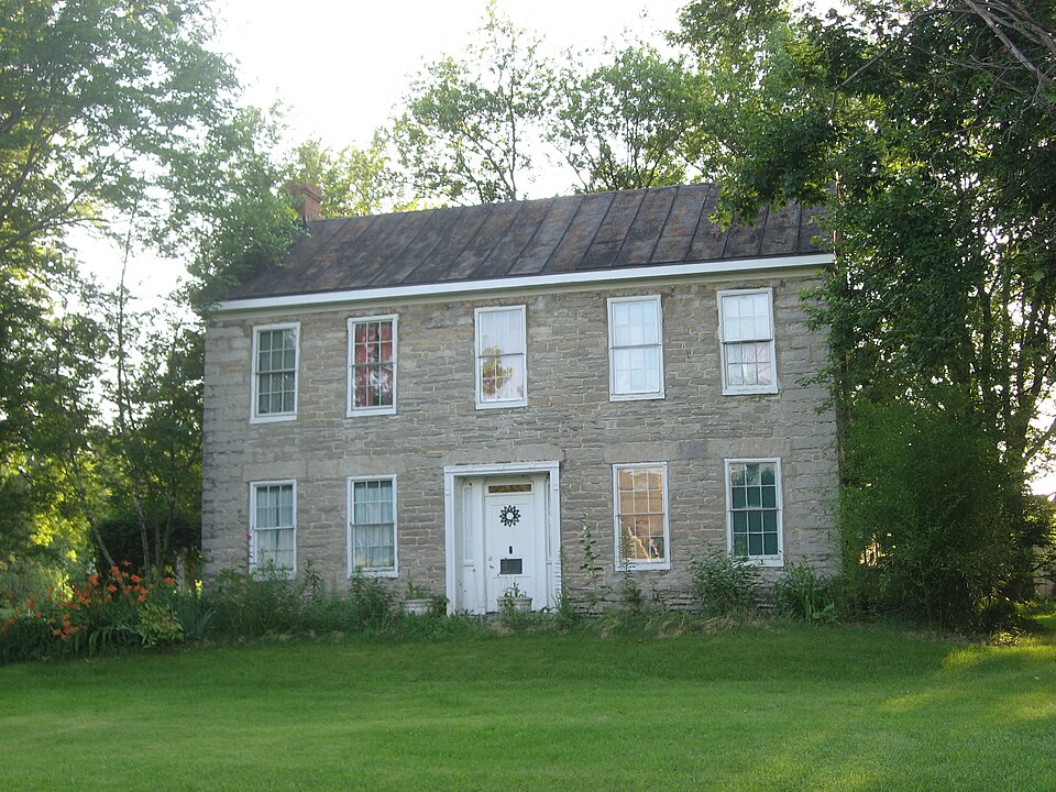
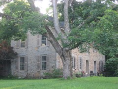
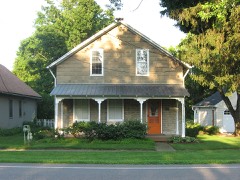
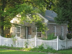
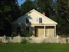
Photograph of Limestone Vale
Photograph by Nyttend, Public domain. Via Wikimedia Commons.

Limestone Vale

Listed on the National Register of Historic Places in 1978. A historic map-sheet match is not published yet. The record needs a coordinate-quality review before it can be joined to a sheet boundary.

From the record

one of 49 National Register listings in Delaware County · listed in 1978 · category: Building.

Sources: the case file at the National Archives · the National Register database, National Park Service

The listing

  • What is counted as historic. The nomination lists 2 buildingss as contributing to the listing.
  • Address. 3490 Olentangy River Rd., Delaware, 43015
  • When was it listed? 1978-10-02
  • Category. building
  • Township. Liberty township
  • National Register reference number. 78002055 - the number the National Park Service assigned this property when it was listed, and the key its nomination file is catalogued under at the National Archives.

Specimens collected near this property

12 of 2,756 shown

Regional context, not property-specific evidence. Museums hold 2,756 specimens collected within 10 miles of Limestone Vale between 1850 and 1975: 2,594 Animalia, 92 Plantae, 64 Fungi, 3 Unrecorded, 2 Protozoa, 1 Chromista. 12 distinct Species records are shown. Collected by A S BRADSHAW, A. P. Morgan, A. Spreitzer & K. Borror and others. Each is a physical object with a catalogue number, and each entry opens the museum's record. This is what was collected and kept, not a survey of what lives here - nothing can be concluded from a species being absent.

Image SpeciesYear Collected by Where, as recorded
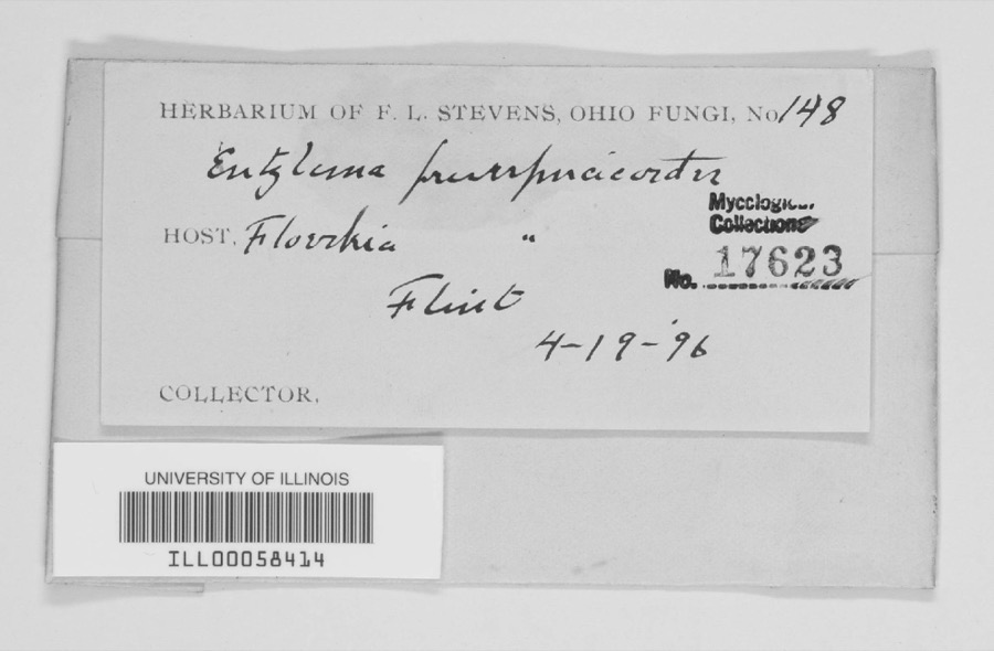
Specimen of unnamed1896F. L. StevensFlint.
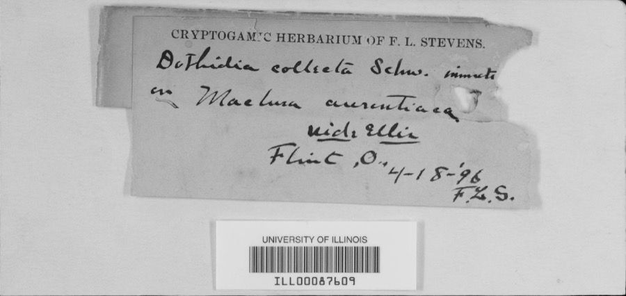
Specimen of Dothidea Fr., 1818Dothidea Fr., 18181896F.L. Stevens
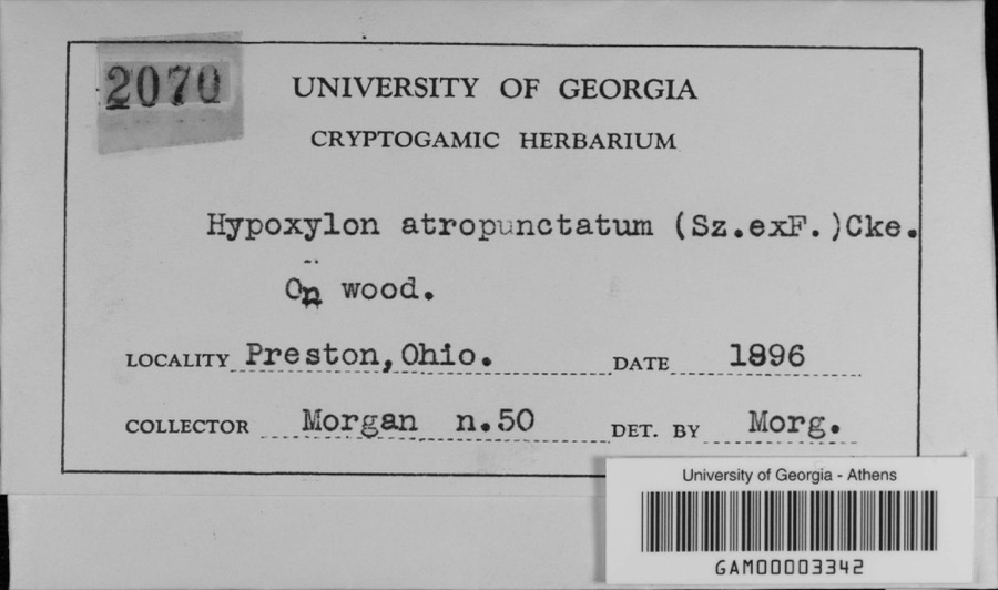
Specimen of Hypoxylon atropunctatum (Schwein.) CookeHypoxylon atropunctatum (Schwein.) Cooke1896A. P. MorganPreston
A photograph of the species Ectopistes migratorius, not of this specimenEctopistes migratorius (Linnaeus, 1766)1850Kugel, B. (Burt)near Selma, Ohio, USA
A photograph of the species Podiceps auritus, not of this specimenPodiceps auritus (Linnaeus, 1758)1860Ricke, A. S.Carlisle, Ohio, USA
Vernonia maxima Small1871Collector unspecifiedScioto
A photograph of the species Centronyx henslowii, not of this specimenCentronyx henslowii (Audubon, 1829)1872not recordedLicking Reservoir, Ohio, USA
A photograph of the species Ophioglossum vulgatum, not of this specimenOphioglossum vulgatum L.1873Hussey, J.
A photograph of the species Bonasa umbellus, not of this specimenBonasa umbellus (Linnaeus, 1766)1874not recordedSugar Grove, Ohio, USA
A photograph of the species Branta bernicla, not of this specimenBranta bernicla hrota (O.F.Müller, 1776)1874not recordedLake Erie, Ohio, USA
A photograph of the species Melospiza lincolnii, not of this specimenMelospiza lincolnii (Audubon, 1834)1874Wheaton, J. M. (John Maynard)Licking Reservoir, Ohio, USA
A photograph of the species Phalaropus lobatus, not of this specimenPhalaropus lobatus (Linnaeus, 1758)1874Jasper, T. (Theodore)Columbus, Scioto R., Ohio, USA

All 2,756 specimens within 10 miles, at the Global Biodiversity Information Facility.

Storms near this property

60 of 83 shown

Regional context, not property-specific evidence. The National Weather Service names Delaware, the town this property stands in, in 83 storm reports between 1994 and 2025: 52 thunderstorm wind, 19 hail, 6 flood, 4 flash flood. The reports record 1 injury. Each account below is quoted exactly as the forecast office filed it, from the NOAA Storm Events Database, and each date opens the federal record of that event.

WhenEvent Place namedHarm What the report says
July 1994Thunderstorm WindDelaware1 hurt, $5,000Trees and limbs were downed, at least one falling on a house. Outbuildings were damaged. A 36 year-old man had to be hospitalized after lightning hit the barn he was in as he sat in a metal chair.
July 1996LightningDelaware$620,000no account filed
June 2004Flash FloodDelaware$250,000As much as five inches of rain caused severe flooding in and around Delaware. 154 homes were damaged, many in subdivisions along State Route 257 northwest of Powell. 34 mobile homes in the Shroyers Mobile Home Park just north of Delaware sustained damage when the Olentangy River rose out of its banks, and forced a few evacuations. Numerous roads and bridges were damaged by high water and culvert washouts.
May 1997Thunderstorm WindDelaware$100,000Numerous trees downed. Six homes were damaged when trees fell on them.
June 2022Thunderstorm WindDelaware$50,000Numerous trees and power lines were downed throughout Delaware County.
April 2014Thunderstorm WindDelaware$25,000A roof was blown off of a structure in Delaware due to thunderstorm winds.
July 2013Thunderstorm WindDelaware$25,000Several large trees were downed due to thunderstorm winds. A dugout collapsed at Delaware Christian sporting fields.
August 2016Tornado (EF0)Delaware$20,000A weak tornado initially touched down just south of the Buckeye|Valley Middle School. The damage near the school was limited to|one tree with a limb down. The track continued north-northeast|into a residential area. In this residential area several 2 to 4|inch limbs were snapped and a few shallow-rooted trees were|uprooted. Roof damage was observed due to a fallen tree on Coover|Road and a barn had part of the roof cave in on its east side.||The tornado lifted until it crossed US-23 just west of Delaware|Dam. A small cluster of trees were twisted on the west side of the|highway.||The next location is Delaware State Park where the tornado was on|the ground for a few minutes. At Delaware State Park, a few|partially rotten large limbs were downed and numerous 2 to 3 inch|limbs were also downed. Also, several shallow rooted trees were|uprooted. A medium-sized dumpster near the marina was tipped and|moved about 20 feet. Three boats at the marina sustained minor|awning damage. A few 2 to 3 inch tree limbs around the marina were|snapped. Across the river from the marina, a snapped limb marked|the end of the tornado track.
September 2011Thunderstorm WindDelaware$20,000A two to three foot diameter tree was reported down. Several tree limbs fell on cars. Railroad crossing arm guard equipment was damaged. These occurrences were due to damaging thunderstorm winds.
July 1997Thunderstorm WindDelaware$20,000Roof peeled off a barn and numerous trees downed.
August 2010Thunderstorm WindDelaware$15,000Two tractor trailers were blown over and shingles were ripped off of a house due to damaging thunderstorm winds.
September 2020Thunderstorm WindDelaware$10,000Several trees and wires were downed in and near the city of Delaware.
June 2012Thunderstorm WindDelaware$10,000Trees and power lines were downed due to damaging thunderstorm winds.
July 2012Thunderstorm WindDelaware$10,000There were numerous reports of downed trees in Delaware County due to damaging thunderstorm winds.
May 2004HailDelaware$10,000Trees were also knocked down near the intersection of State Route 37 and Houk Road.
July 2023Thunderstorm WindDelaware$8,000Several trees were downed across mainly western portions of Delaware County.
January 2008Thunderstorm WindDelaware$8,000A street lamp was blown down. A house sustained siding damage and had roof shingles peeled off in the same neighborhood.
June 2006Thunderstorm WindDelaware$8,000Several tents were blown down at the Delaware County Fairgrounds. Trees were also downed.
June 2025Thunderstorm WindDelaware$6,000Several trees were downed in Delaware as well as in Concord Township.
August 2003Thunderstorm WindDelaware$6,000Several trees up to twelve inches in diameter were knocked down across the southern and central portions of the county.
August 2025Thunderstorm WindDelaware$5,000Several trees were downed in the city of Delaware, including in Mingo Park.
August 2019Thunderstorm WindDelaware$5,000Trees and power lines were knocked down.
June 2016Flash FloodDelaware$5,000There were numerous reports in the city of Delaware of roads closed due to high water. The city had high water throughout.
June 2013Thunderstorm WindDelaware$5,000There were several reports of trees down around Delaware County due to thunderstorm winds.
April 2006Thunderstorm WindDelaware$5,000Tiles were blown off the roof of a building in town.
July 2003Thunderstorm WindDelaware$5,000Numerous trees and powerlines downed.
July 2000Thunderstorm WindDelaware$5,000Trees and power lines downed.
July 1997Thunderstorm WindDelaware$5,000Several trees downed.
June 1994Thunderstorm WindDelaware$5,000Trees were downed.
August 1994Thunderstorm WindDelaware$5,000Large hail fell in Delaware and winds were reported at 75 mph in Ashley. Trees were downed in both locations.
July 1994HailDelaware$5,000no account filed
July 2023Thunderstorm WindDelaware$4,000A few trees were downed along U.S. 23 in Delaware.
August 2020Thunderstorm WindDelaware$4,000Several trees were reported knocked down throughout the county.
June 2009Thunderstorm WindDelaware$4,000An awning over a gas station collapsed.
June 2020Thunderstorm WindDelaware$3,000Wires were knocked down at multiple locations.
August 2019Thunderstorm WindDelaware$3,000Several large trees were knocked down in Mingo Park.
June 2012Thunderstorm WindDelaware$3,000Trees were down along Curve Road due to damaging thunderstorm winds.
February 2009Thunderstorm WindDelaware$3,000Trees were downed.
July 2008Thunderstorm WindDelaware$3,000Twelve to fifteen large tree limbs were downed across the Ohio Wesleyan University campus.
September 2003Thunderstorm WindDelaware$3,000A few trees and a power pole were downed.
June 2010Thunderstorm WindDelaware$2,000There were multiple reports of trees down from gust front winds.
May 2007Thunderstorm WindDelaware$2,000Large tree limbs were downed.
June 2007Thunderstorm WindDelaware$2,000Large tree limbs were knocked down.
June 2004Thunderstorm WindDelaware$2,000Two trees were downed.
November 2002Thunderstorm WindDelaware$2,000Powerlines were knocked down.
November 2017Thunderstorm WindDelaware$1,000A tree was downed along River Street.
June 2015Thunderstorm WindDelaware$1,000One tree was knocked down.
June 2010Thunderstorm WindDelaware$1,000Several five inch diameter trees snapped in half at their trunks.
May 2007HailDelaware$1,000no account filed
July 2022Thunderstorm WindDelaware$200A 4 inch diameter tree was downed.
June 2016Thunderstorm WindDelaware$100A two to three inch diameter tree branch broken from tree. Pea size hail also was reported, along with visibilities reduced to less than half a mile.
May 2020FloodDelaware-Northbound U.S. 42 was closed at Shortcut Road due to high water.
September 2020Thunderstorm WindDelaware-The wind gust was measured on the EMA weather station at the county courthouse.
July 2019FloodDelaware-High water was reported on Central Avenue.
July 2019FloodDelaware-Troy Road was closed south of Smith Park due to high water.
May 2018FloodDelaware-High water was reported on several streets in the city of Delaware.
November 2017Flash FloodDelaware-High water was reported over a portion of State Route 521.
November 2017Flash FloodDelaware-High water was reported throughout the city of Delaware with several roads closed.
November 2017FloodDelaware-About an inch of water was reported on a few roads in the Delaware area.
May 2016HailDelaware-Penny to half dollar size hail fell across the Delaware area.

Every storm recorded in Delaware County

Newspapers printed here

0 digitised pages

1 paper published in this town, digitised by the Library of Congress and free to read: 0 issues, 0 pages. Every page is searchable, so a name or a street can be looked for directly in what the town printed about itself at the time.

NewspaperPublished
Delaware Gazette1855 to 1886

Map coverage status

No historic map-sheet match is published for this property yet. That does not mean no map exists. This record needs a coordinate-quality review before it can be joined to a sheet boundary. Browse the county's mapped places while that work is pending.

From the nomination file

1,695 words on record

When this property was proposed for the National Register, someone wrote the case for it: what the building is, and why it matters. That document is a federal record in the public domain. It is quoted below word for word, never summarised. The text was read off the scanned case file by machine, so the occasional stray character is the recogniser's and the 1970s typewriter's.

Description of the property

Limestone Vale Farm is located along the Olentangy River, approximately1/2 mile southwest remain relatively unchanged today. south elevations. A 1-1/2 story stone and frame addition and porch are located to the rear. The simple, four panel door is flanked by pilasters and sidelights with a narrow transom above. Panels located below the sidelights are identical to those which line the recess. A deeply ridged measures approximately 100' x 50'. It was built with a great deal of care as evidenced by the cut elevations are covered with vertical wood siding. The firebay is flush with the stone ends of the barn and the gable roof is covered with tin. The barn is located to the southwest of the house.

Stone foundations have been located near the southeast corner of the barn and directly behind and to the south of the house.The buildings are located in close proximity to one another and are surrounded by fields, facing the river. Around the Stratford area, the remains of many stone CONDITION to the road. Chimneys, constructed of brick and stucco, are centrally located on the north and MOVED UNALTERED DETERIORATED Wooden cornices exist on the facade and rear elevation. They appear to have been denticular XALTERED The original portion of the house is t-shape in plan, constructed entirely of coursed rubble XEXCELLENT Large cut stones form the lintels above the openings and the quoins at the corners of the building. buildings including mills, farmhouses, and a church can be found today.

wide, fluted architrave frames the recess. It possesses seven corner blocks rather than the usual originally. The north and south elevations are identical. Two small, two over two windows are limestone and rises two stories in height. The ridgepole of the tin covered gable roof is parallel located under the gables.

Read the complete 1,695-word case file.

Statement of significance

The house and barn at Limestone Vale are excellent, well preserved examples of rural domestic architecture in the Delaware area.The barn is one of four surviving examples of stone-end Daniel Stout, builder of Limestone Vale, was born in Berks County, Pennsylvania of German similar to those he left behind in southeastern Pennsylvania. The Stout family lived and farmed at Limestone Vale until 1972. It is currently undergoing careful restoration by the present owners. 1500-1599 1400-1499 1700-1799 LAW ECONOMICS ART INVENTION CONSERVATION INDUSTRY SIGNIFICANCE PERIOD ARCHEOLOGY-HISTORIC BUILDER/ARCHITECT from a sensitivity to architectural details.

The quoins on both buildings, the handsome recessed AGRICULTURE RELIGION TRANSPORTATION MILITARY PREHISTORIC entrance and the original denticular cornice are indicative of this sensitivity. _PHILOSOPHY _POLITICS/GOVERNMENT XARCHITECTURE _COMMUNICATIONS _EXPLORATION/SETTLEMENT The house and barn are by no means pretentious, however, both exhibit characteristics resulting ancestry. Although he moved to Ohio at an early age, his house and barn are stylistically It is the only remaining barn which has a stone farmhouse. barns which were built along the Olentangy River south of Delaware probably prior to 1860. _SCULPTURE _SOCIAL/HUMANITARIAN _EDUCATION -1600-1699 -LITERATURE -THEATER - MUSIC -COMMERCE SPECIFIC DATES C. 1850 X1800-1899 9

The whole case file for this property - 1,695 words, 15 pages, reproduced complete.

Quoted from the National Register nomination for reference 78002055, 15 pages, held by the National Archives in Record Group 79. See the catalogue record.

Listed places nearby

6 within 8 miles

Other National Register properties close enough to walk or drive between, ordered by distance from this one. Both positions come from the same geocoding pass that matched these properties to their map sheets.

Photograph PropertyDistance Listed
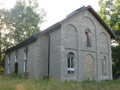
Crist Tavern Annex--Millworkers Boarding House0.6 miles1994
Stratford Methodist Episcopal Church0.6 miles1991
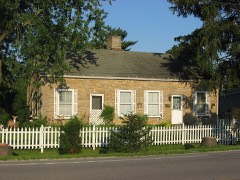
Mill Worker House No. 10.8 miles1991
Mill Worker House No. 30.9 miles1991
Mill Worker House No. 40.9 miles1991
Mill Worker House No. 50.9 miles1991

Sources for this property

National Archives recordThe nomination case file for reference 78002055 in Record Group 79.
Delaware CountyAll 49 listed properties in this county.

Provenance

  • Listing record. National Park Service National Register of Historic Places, listed-properties dataset, current to 2026-05-22.
  • Map join. Address geocoded through the United States Census geocoder, then tested against the published boundary of every sheet in the USGS Historical Topographic Map Collection.
  • How this page is made. Listing fields come from federal records; map-sheet coverage is a labelled coordinate-to-boundary calculation, not a source-field claim.
  • Specimens. Global Biodiversity Information Facility (GBIF), https://www.gbif.org/. Only records licensed CC0 or CC BY are used. Records licensed CC BY-NC are excluded because this site carries advertising. Images are checked individually and any whose licence is non-commercial, no-derivatives or unreadable is refused.
  • Storms. NOAA National Centers for Environmental Information, Storm Events Database https://www.ncei.noaa.gov/stormevents/ A work of the United States government, no copyright under 17 U.S.C. 105. Narratives are quoted verbatim from the National Weather Service report and are not edited or summarised.