Listed on the National Register of Historic Places in
1978. A historic map-sheet match is not published yet. The record needs a coordinate-quality review before it can be joined to a sheet boundary.
From the record
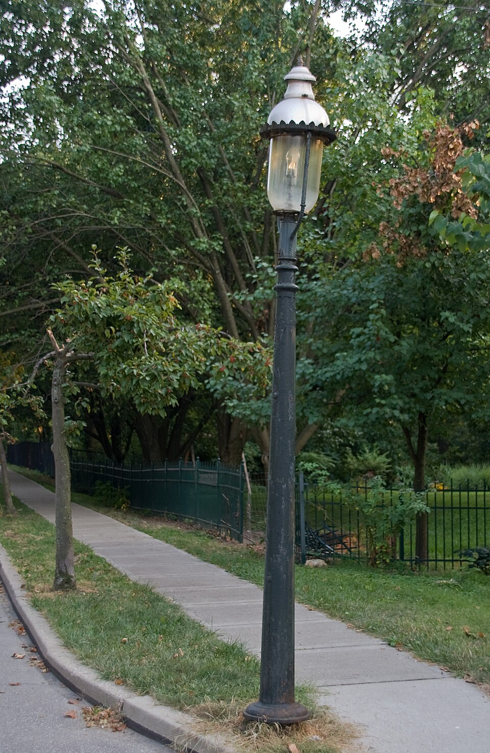
“The Cincinnati Street Gas Lamps are a historic district in Cincinnati, Ohio, United States. Composed of more than 1,100 street lamps scattered throughout the city, the district was added to the National Register of Historic Places in 1978.”
Wikipedia article Cincinnati Street Gas Lamps, CC BY-SA 4.0.
one of 314 National Register listings in Hamilton County · listed in 1978 · category: District · one of 9 National Historic Landmarks in Hamilton County.
National Register reference number.78002073- the number the National Park Service assigned this property when it was listed, and the key its nomination file is catalogued under at the National Archives.
What happened here
An account from the chapter on Norwood city, The inset identifies its exact
source book and publication year.
of Colerain township, was born on St. Patrick's day, the seventeenth of March, 1808; is of Welsh and English descent on his father's side and of French descent on that of his mother. Mason Jones Cloud, his grandfather, came from Virginia about the year 1778, and settled in Boone county, Kentucky. Unfortunately for the fate of Mason, he was required to return to Virginia for a sum of money there due him, and after only a three days' stay in his new home, in company with two others, set out on his perilous trip, and, with his companions, was massacred on Licking river by the hostile Indians.
This beautiful and noted suburb was formerly known in part as Sharpsburgh. It is on the Montgomery turnpike, and the Marietta & Cincinnati railroad, in the northwest part of section thirty-tour, near the west line of the township. Some of the ground near, as that upon which the celebrated mound is situated (Norwood Heights), is among the. most elevated in the county. It was projected in 1870 by some well-known residents and Cincinnatians - Colonel P. P. Lane, Judge James
This place, a mile and a half south-southwest of Norwood, and something less from the northwest corner of Cincinnati, being just a mile from the Observatory, began to be considered a suburb of considerable importance by 1867, soon after the completion of the Marietta & Cincinnati railroad. It was not regularly laid out, however, until-1870, when Mr. Theodore Drake had the place surveyed and platted. It is beautifully situated upon the railroad named, upon the margin of the great interior valley mentioned in our description of the township, and is also conveniently reached by the Madison pike, being only five miles from the county court house, in the city. Its site was formerly owned by Anthony Brown, who sold it to Paul Shuster. Among its flourishing institutions have been the Literary and Musical society, and the Oakley Coterie. By the census of 1880 the village had two hundred inhabitants.
Regional context, not property-specific
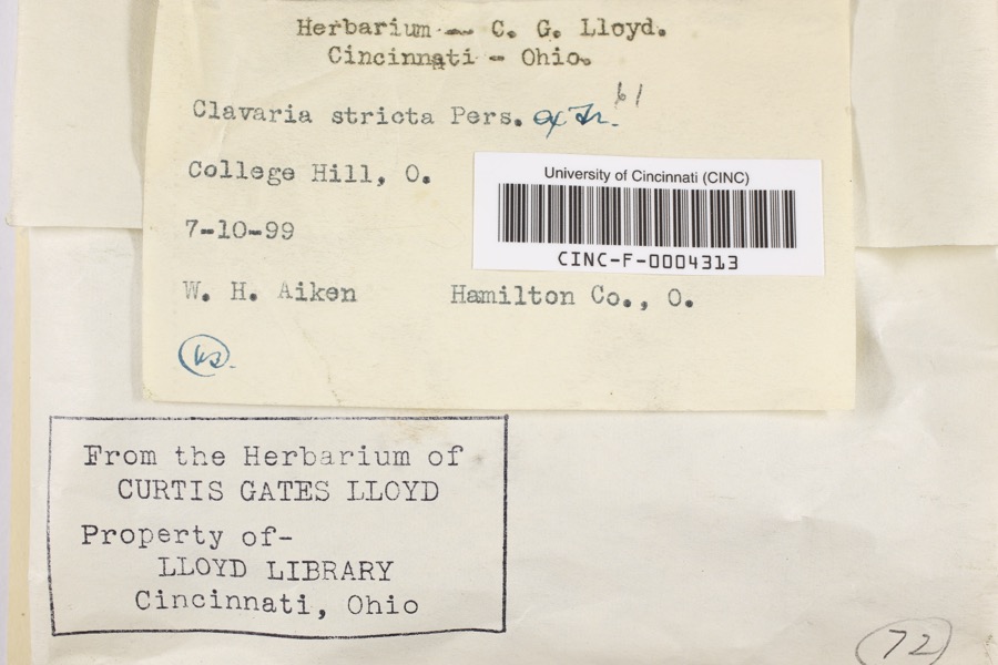
evidence. Museums hold 7,284 specimens
collected within 10 miles of Cincinnati Street Gas Lamps between 1819 and
1975: 3,913 Fungi, 1,929 Animalia, 954 Plantae, 434 Protozoa, 33 Unrecorded, 20 Chromista, 1 Bacteria. 12 distinct Species records are shown.
Collected by A Schwartz, A. Braun, A. F. Braun and others. Each is a
physical object with a catalogue
number, and each entry opens the museum's record. This is what was
collected and kept, not a survey of what lives here - nothing can be
concluded from a species being absent.
Regional context, not property-specific
evidence. The federal mineral resources record lists
5 workings within 5 miles of Cincinnati Street Gas Lamps: 3 unknowns, 1 past producer, 1 producer.
1 still produces. What was taken out: Sand and Gravel, Construction, Zirconium, Titanium, Tin, Lead, Antimony. Distance is straight-line from the
map coordinates, so a quarry counted here may appear on a neighbouring
settlement's page as well.
Regional context, not property-specific
evidence. The National Weather Service names
Cincinnati, the town this property stands in, in 70 storm reports between 1994 and 2025: 25 thunderstorm wind, 17 hail, 14 flash flood, 7 flood.
The reports record 1 injury. Each account below is quoted exactly as the forecast office
filed it, from the NOAA Storm Events Database, and each date
opens the federal record of that event.
Numerous roads were flooded throughout the Cincinnati area and some basements were flooded. Flooding also caused some damage at Reading High School and Whitaker Elementary School.
Lightning struck a home causing a fire in the attic, which spread toward the second floor before being extinguished. Significant fire and water damage occurred to the home.
High water was reported on several roads in the downtown Cincinnati area and the near West Side. A retaining wall collapsed onto a roadway near the intersection of State Avenue and Ernst Street and a building was flooded on Poplar Street. Also, an apartment basement flooded on Linn Street and one resident needed to be rescued.
14 papers published in this town,
digitised by the Library of Congress and free to read: 0 issues,
0 pages. Every page is searchable, so a name or a street can be
looked for directly in what the town printed about itself at the time.
No historic map-sheet match is published
for this property yet. That does not mean no map exists. This record needs
a coordinate-quality review before it can be joined to a sheet boundary.
Browse the county's mapped places while that work is
pending.
From the nomination file
12,367 words on record
When this property was proposed for the
National Register, someone wrote the case for it: what the building is,
and why it matters. That document is a federal record in the public domain.
It is quoted below word for word, never summarised. The text was read off the scanned case file by machine, so the
occasional stray character is the recogniser's and the 1970s
typewriter's.
Description of the property
form, material of construction, and overall design. Upon close examination variations The_poles are found either in a heterogeneous manner on the street with various styles being found in close association to one another, or can be found in a The light produced from the burner castsa yellow-white illumination approximately Chimney - made of glass. Additionally, some fixtures exhibit a metal reflector used to prevent light from shining, CONDITION forth. UNALTERED FAIR _UNEXPOSED The resources of the Cincinnati Street Gas Lamps thematic group is composed of two hundred feet in diameter. XEXCELLENT Almost all posts exhibit the Boulevard fixture. Exhibiting different designs of the post resulting from different local and out of state foundries manufacturing them.
Approximately eight feet in height and measuring three inches in diameter at the _DETERIORATED CHECK ONE homogeneous fashion with similarly designed poles adjacent to eachother, design and material composition.
invention that have been applied to illuminating urban streets. Additionally, Cincinnati York (1823) and Cincinnati (1837). In Cincinnati, a William Green used gas lighting to illuminate his flour mill in 1816, and Thomas Lawson, a tin smith, designed some exterior gas lamps in 1825. The burners were shop and also were erected as street lamps and interior gas lights for his neighbors. privelege ot using streets, lanes, alleys, etc., of Cincinnati, Ohio for purpose of conveying a part of this the first Gas Works were constructed in1842 at Front and Rose Streets. 1ight emmitted by gas through McHenry's patent burner and white glass lantern is 33 1/3% more in repairing the lanterns I.would recommend that white glass be used, that eventually we may 1Taken from CITY ANNUAL REPORT, 1857, P.
15-16. 1500-1599 1600-1699 1700-1799 ENGINEERING LAW ARCHEOLOGY-HISTORIC PERIOD ART INVENTION AGRICULTURE RELIGION THEATER ARCHITECTURE BUILDER/ARCHITECT X1900- PREHISTORIC SIGNIFICANCE SCIENCE TRANSPORTATION PHILOSOPHY SCULPTURE INDUSTRY LITERATURE _COMMUNICATIONS X1800-1899 as well as exterior fixtures. Technology _EXPLORATION/SETTLEMENT The Cincinnati Street Gas Lamp thematic historic district is composed of approximately Initially the burner device was rather simple and contained within a four sided glass _POLITICS/GOVERNMENT his utilization and experimentation with gas lamps.
Legislature for the incorporation of the Cincinnati Gas Light and Coke Co.,which was to gas lighting with the City as the active participant.Up to the present the fundamental SOCIAL/HUMANITARIAN The significance of the gas street lamps is that they are an example of technology and fixture.In 1857,a report concerning a new burner from the City Engineer to the City Council In 1843,gas lighting was introduced into the city as a result of the franchise issued become a prime supplier of gas to the city. intense than through the burner and green glass lantern heretofore commonly used by the City.
Quoted from the National Register nomination
for reference 78002073, 77 pages, held by the National Archives in Record
Group 79. See the
catalogue record.
Listed places nearby
6 within 8 miles
Other National Register properties close
enough to walk or drive between, ordered by distance from this one. Both
positions come from the same geocoding pass that matched these properties
to their map sheets.
Listing record. National Park Service National Register of Historic Places, listed-properties dataset, current to 2026-05-22.
Map join. Address geocoded through the United States Census geocoder, then tested against the published boundary of every sheet in the USGS Historical Topographic Map Collection.
How this page is made. Listing fields come from federal records; map-sheet coverage is a labelled coordinate-to-boundary calculation, not a source-field claim.
Specimens. Global Biodiversity Information Facility (GBIF), https://www.gbif.org/. Only records licensed CC0 or CC BY are used. Records licensed CC BY-NC are excluded because this site carries advertising. Images are checked individually and any whose licence is non-commercial, no-derivatives or unreadable is refused.
Mines and quarries. USGS Mineral Resources Data System (MRDS) https://mrdata.usgs.gov/mrds/ A work of the United States government, no copyright under 17 U.S.C. 105.
Storms. NOAA National Centers for Environmental Information, Storm Events Database https://www.ncei.noaa.gov/stormevents/ A work of the United States government, no copyright under 17 U.S.C. 105. Narratives are quoted verbatim from the National Weather Service report and are not edited or summarised.
 Block
Block