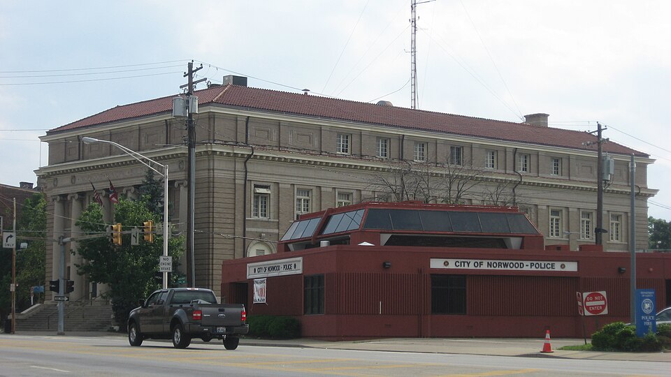
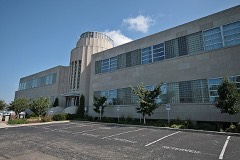
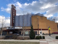
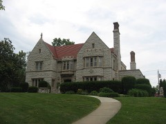
Built in 1915. Listed on the National Register of Historic Places in
1980. A historic map-sheet match is not published yet. The record needs a coordinate-quality review before it can be joined to a sheet boundary.
From the record
“The Norwood Municipal Building, also known as Norwood City Hall, is a historic government building at 4645 Montgomery Road in Norwood, Ohio. The building was constructed in 1914-16 on the site of Norwood's first city hall, which was built in 1881.”
Wikipedia article Norwood Municipal Building, CC BY-SA 4.0.
one of 314 National Register listings in Hamilton County · listed in 1980 · category: Building · built in 1915 · one of 9 National Historic Landmarks in Hamilton County.
National Register reference number.80003093- the number the National Park Service assigned this property when it was listed, and the key its nomination file is catalogued under at the National Archives.
What happened here
An account from the chapter on Norwood city, The inset identifies its exact
source book and publication year.
of Colerain township, was born on St. Patrick's day, the seventeenth of March, 1808; is of Welsh and English descent on his father's side and of French descent on that of his mother. Mason Jones Cloud, his grandfather, came from Virginia about the year 1778, and settled in Boone county, Kentucky. Unfortunately for the fate of Mason, he was required to return to Virginia for a sum of money there due him, and after only a three days' stay in his new home, in company with two others, set out on his perilous trip, and, with his companions, was massacred on Licking river by the hostile Indians.
This beautiful and noted suburb was formerly known in part as Sharpsburgh. It is on the Montgomery turnpike, and the Marietta & Cincinnati railroad, in the northwest part of section thirty-tour, near the west line of the township. Some of the ground near, as that upon which the celebrated mound is situated (Norwood Heights), is among the. most elevated in the county. It was projected in 1870 by some well-known residents and Cincinnatians - Colonel P. P. Lane, Judge James
For many years Judge McCullough was accustomed, with the annual recurrence of Independence day, to invite large parties to the free use of his house and beautiful grounds at Norwood, serving them also a generous and gratuitous collation.
Regional context, not property-specific
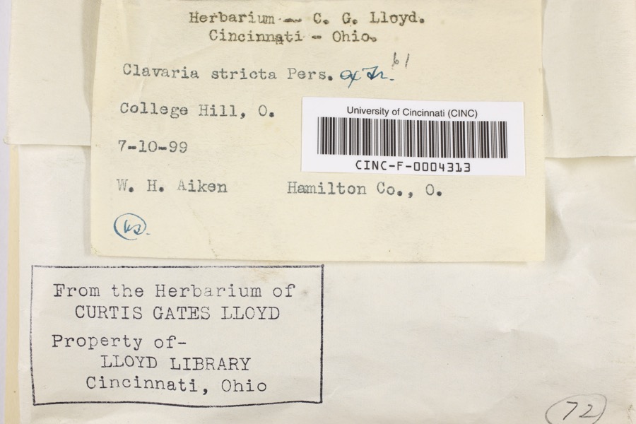
evidence. Museums hold 7,379 specimens
collected within 10 miles of Norwood Municipal Building between 1819 and
1975: 4,006 Fungi, 1,928 Animalia, 956 Plantae, 434 Protozoa, 34 Unrecorded, 20 Chromista, 1 Bacteria. 12 distinct Species records are shown.
Collected by A Schwartz, A. Braun, A. F. Braun and others. Each is a
physical object with a catalogue
number, and each entry opens the museum's record. This is what was
collected and kept, not a survey of what lives here - nothing can be
concluded from a species being absent.
Regional context, not property-specific
evidence. The federal mineral resources record lists
5 workings within 5 miles of Norwood Municipal Building: 3 unknowns, 1 past producer, 1 producer.
1 still produces. What was taken out: Sand and Gravel, Construction, Zirconium, Titanium, Tin, Lead, Antimony. Distance is straight-line from the
map coordinates, so a quarry counted here may appear on a neighbouring
settlement's page as well.
Regional context, not property-specific
evidence. The National Weather Service names
Norwood, the town this property stands in, in 17 storm reports between 1996 and 2024: 8 thunderstorm wind, 4 flash flood, 4 hail, 1 flood.
No death or injury is recorded in these reports. Each account below is quoted exactly as the forecast office
filed it, from the NOAA Storm Events Database, and each date
opens the federal record of that event.
No historic map-sheet match is published
for this property yet. That does not mean no map exists. This record needs
a coordinate-quality review before it can be joined to a sheet boundary.
Browse the county's mapped places while that work is
pending.
From the nomination file
1,744 words on record
When this property was proposed for the
National Register, someone wrote the case for it: what the building is,
and why it matters. That document is a federal record in the public domain.
It is quoted below word for word, never summarised. The text was read off the scanned case file by machine, so the
occasional stray character is the recogniser's and the 1970s
typewriter's.
Description of the property
bond, and is embellished with Bedford limestone trim and glazed terra cotta. The fenestration is generally symmetrical throughout, and surmounting the building is a Florentine style hip tile roof. The front facade displays the traditional balanced use of elements, most notable the below the water table balances the verticality of the pilasters. The entire building The north facade, except for a classical entrance with terra cotta trim and cartouche, ex- of the offices on the first and second floors have been modernized to meet safety codes and personal tastes. Overall, the building is among the strongest focal points in the City of A small bronze plaque carries the inscription: "George Hafer, to the City of Norwood. Norwood. 1977 Condition rests on a Dayton limestone foundation.
fair been removed.The Hafer Fountain, because of its public ownership, symbolism, and visual Check one building's numerous Doric pilasters and effectively separates the paired six-over-one base- The Hafer Fountain, originally located at the southwest corner of Elm Avenue and juxtaposition to City Hall, should be incorporated into the nomination. Above the projecting cornice and block modillions is the attic story, which displays both Montgomery Road (see photo#lo), is today the focal point of the city's small pork. The hibits identical fenestration as does the south facade.The rear facade is quite subdued fountain, nine feet high and six feet in diameter, was constructed of concrete in 1916.
Both side facades exhibit the same general fenestration as does the front facade.Sur- through the utilization of horizontal brick quoins and the wide three part entablature. blind frieze panels and squat doric pilasters.
/Architect Weber, Werner & Adkins Statement of Significance (in one paragraph) The Norwood Municipal Building is a significant example of classically influenced architec- ture which embodies the distinctive characteristics of the Second Renaissance Revival point that has become symbolic of independent Norwood. Designed by the Cincinnati architec- tural firm of Weber, Werner and Adkins, who also designed the Clinton County Courthouse in Advanced ideas in architecture and construction will be carried out in the Norwood City Hall, which is to be erected at a cost The building's site has been the location of Norwood's municipal activity since 1881, the Red Cross, for theatrical productions, fund raising, church groups, and as a relief center during the 1937 flood.
Most recently it has been the site of receptions awarded 1800-1899 1700-1799 1500-1599 1400-1499 economics industry engineering education humanitarian military art Period theater literature prehistoric science law sculpture of $90,000.1 -politics/government 8.
Significance classical entablature that are particularly well executed.Completed in 1915 and dedicated when a frame, Eastlake style town hall designed by Charles Crapsey was completed.The style.It is probably the finest example of civic architecture in this industrial community the Municipal Building's interior are symbolic of Norwood's resurgent civic pride.It social/ - other(specify) _conservation would be fitting that these two focal points become the city's first structures listed ties,has also served asa center for civic and social functions.It has been used by on January l,19l6,the design was described by the Cincinnati Enquirer as one where: - archeology-prehistoric community planning - landscape architecture - philosophy communications metrical in plan and fenestration, the front facade displays a hexastyle portico and Land was deeded to Norwood by George Hafer, who was the last Mayor of independent Avondale to visiting dignitaries.
The relocation of the Hafer Fountain and the restoration of Wilmington, Ohio.
Quoted from the National Register nomination
for reference 80003093, 17 pages, held by the National Archives in Record
Group 79. See the
catalogue record.
Listed places nearby
6 within 8 miles
Other National Register properties close
enough to walk or drive between, ordered by distance from this one. Both
positions come from the same geocoding pass that matched these properties
to their map sheets.
Listing record. National Park Service National Register of Historic Places, listed-properties dataset, current to 2026-05-22.
Map join. Address geocoded through the United States Census geocoder, then tested against the published boundary of every sheet in the USGS Historical Topographic Map Collection.
How this page is made. Listing fields come from federal records; map-sheet coverage is a labelled coordinate-to-boundary calculation, not a source-field claim.
Specimens. Global Biodiversity Information Facility (GBIF), https://www.gbif.org/. Only records licensed CC0 or CC BY are used. Records licensed CC BY-NC are excluded because this site carries advertising. Images are checked individually and any whose licence is non-commercial, no-derivatives or unreadable is refused.
Mines and quarries. USGS Mineral Resources Data System (MRDS) https://mrdata.usgs.gov/mrds/ A work of the United States government, no copyright under 17 U.S.C. 105.
Storms. NOAA National Centers for Environmental Information, Storm Events Database https://www.ncei.noaa.gov/stormevents/ A work of the United States government, no copyright under 17 U.S.C. 105. Narratives are quoted verbatim from the National Weather Service report and are not edited or summarised.
 Block
Block