Listed on the National Register of Historic Places in
1978. A historic map-sheet match is not published yet. The record needs a coordinate-quality review before it can be joined to a sheet boundary.
From the record
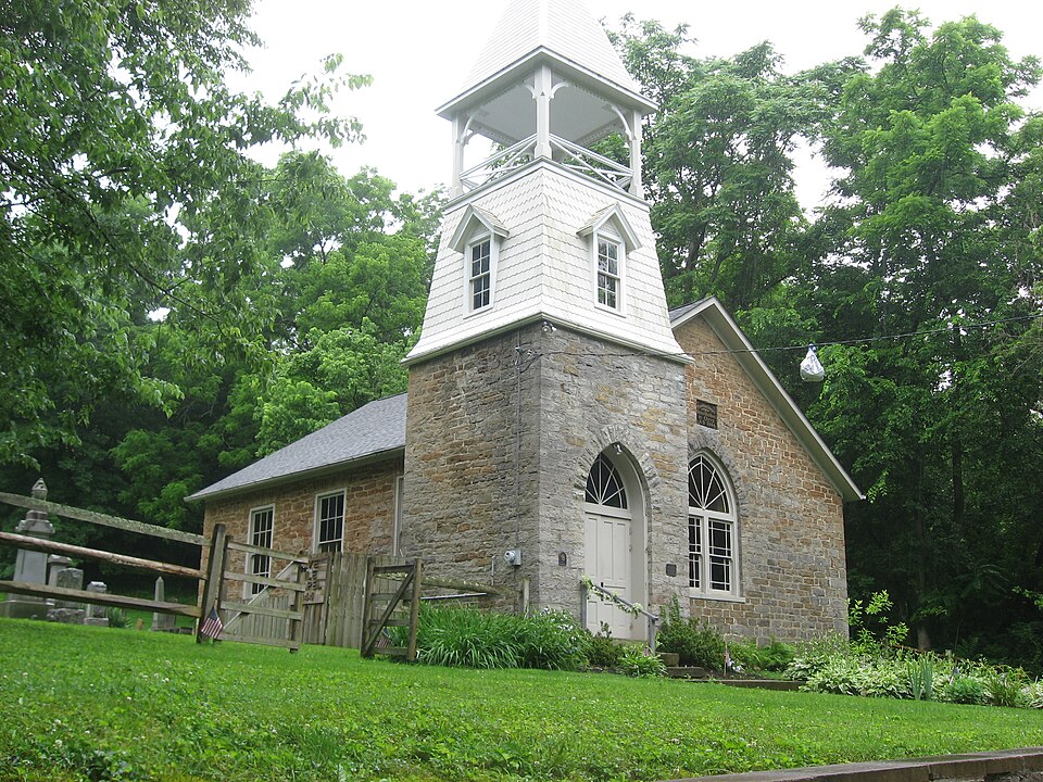
“The United Brethren in Christ Church, also known as "Five Mile Chapel", is a historic church building located southeast of Cincinnati in Anderson Township, Hamilton County, Ohio, United States. Built in 1844, it is a stone building with a stone foundation and a slate roof.”
Wikipedia article United Brethren in Christ (Cincinnati, Ohio), CC BY-SA 4.0.
one of 314 National Register listings in Hamilton County · listed in 1978 · category: Building · one of 9 National Historic Landmarks in Hamilton County.
National Register reference number.78002082- the number the National Park Service assigned this property when it was listed, and the key its nomination file is catalogued under at the National Archives.
Besides the natural features of Anderson which vary its topography, its broad surface is further intersected by the Batavia turnpike in the northern part, which takes Union bridge and Newtown on its way; the Richmond turnpike on the extreme south, passing California and hugging the river closely until its exit from the county, shortly after which it trends rapidly northeastward; the Salem and Ohio turnpikes, also in the southern half of the township, the latter passing through Mount Washington and Cherry Grove; a number of other good wagon roads; the Cincinnati & Eastern narrow-guage railway, along the valley of the Little Miami, by Newtown, in the north part; with a branch from a point a mile and a half east of Newtown, running up the valley of Dry run, to a point due east of Mount Washington, where it leaves the township; and the Cincinnati & Portsmouth narrow-guage railway, cutting the southern and eastern parts in an exceedingly tortuous line, as compelled by the broken country, from the crossing of the Little Miami southwest of Mount Washington to the departure from the township and county considerably to the northward, near Mount Carmel, in Clermont county. As well as the nature and demands of the township will permit at present, it is served with means of transportation; but other railroads have been projected, as that already mentioned along the Ohio.
At present the circular wall is almost leveled, but can be readily traced by the color of the soil and the large number of flat river-stones. The ditches can be easily recognized. The mound is still prominent. It measures now in height five and one-half feet, diameter twenty-five yards, circumference seventy-five yards. The causeway is cut through by the Cincinnati & Eastern railroad, the forest cut away, and the soil cultivated annually.
Regional context, not property-specific
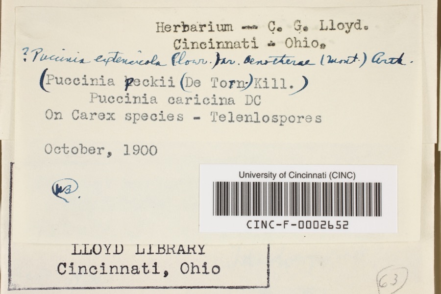
evidence. Museums hold 4,682 specimens
collected within 10 miles of United Brethren in Christ between 1827 and
1975: 2,608 Fungi, 1,173 Animalia, 564 Plantae, 299 Protozoa, 27 Unrecorded, 11 Chromista. 12 distinct Species records are shown.
Collected by A. Braun, A. F. Braun, A. Gaufin and others. Each is a
physical object with a catalogue
number, and each entry opens the museum's record. This is what was
collected and kept, not a survey of what lives here - nothing can be
concluded from a species being absent.
Regional context, not property-specific
evidence. The federal mineral resources record lists
1 working within 5 miles of United Brethren in Christ: 1 past producer.
None of them still produces. What was taken out: Sand and Gravel, Construction. Distance is straight-line from the
map coordinates, so a quarry counted here may appear on a neighbouring
settlement's page as well.
Regional context, not property-specific
evidence. The National Weather Service names
Cincinnati, the town this property stands in, in 70 storm reports between 1994 and 2025: 25 thunderstorm wind, 17 hail, 14 flash flood, 7 flood.
The reports record 1 injury. Each account below is quoted exactly as the forecast office
filed it, from the NOAA Storm Events Database, and each date
opens the federal record of that event.
Numerous roads were flooded throughout the Cincinnati area and some basements were flooded. Flooding also caused some damage at Reading High School and Whitaker Elementary School.
Lightning struck a home causing a fire in the attic, which spread toward the second floor before being extinguished. Significant fire and water damage occurred to the home.
High water was reported on several roads in the downtown Cincinnati area and the near West Side. A retaining wall collapsed onto a roadway near the intersection of State Avenue and Ernst Street and a building was flooded on Poplar Street. Also, an apartment basement flooded on Linn Street and one resident needed to be rescued.
14 papers published in this town,
digitised by the Library of Congress and free to read: 0 issues,
0 pages. Every page is searchable, so a name or a street can be
looked for directly in what the town printed about itself at the time.
No historic map-sheet match is published
for this property yet. That does not mean no map exists. This record needs
a coordinate-quality review before it can be joined to a sheet boundary.
Browse the county's mapped places while that work is
pending.
From the nomination file
2,206 words on record
When this property was proposed for the
National Register, someone wrote the case for it: what the building is,
and why it matters. That document is a federal record in the public domain.
It is quoted below word for word, never summarised. The text was read off the scanned case file by machine, so the
occasional stray character is the recogniser's and the 1970s
typewriter's.
Description of the property
ted of native field stone gathered from the creek, and hand cut and treasurer's records. In 1868, the $139.75 collected for putting on a adding the belfry entrance, blocking in a door on the southwest The cemetery surrounds three sides of the church in a shape. It WPA in 1939. CONDITION church. EXCELLENT UNALTERED DESCRIPTION A plain gable on the slate roof has eaves projecting. XALTERED diagonally of the northwest corner of the rectangular church. The XFAIR plan with an extended entrance belfry in the northwest corner.A Gothic window on the front and six rectangular windows (three on solid stone walls with plaster applied on the two foot thick inside The date plate set into the front of the church reads as follows: stone lug sills on all windows with voussoirs above the side windows.
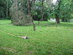
CHECK ONE The entrance through the vestibule of the belfry cuts the corner Mile Creek runs between the church and Five Mile Road with access The church and cemetery site contains.668 acres of land.Five hills around the church. The entrance belfry of stone contains double wooden doors with a -GOOD bought for $72.00 at the time of remodelling, according to the over a small bridge. The church sits on level ground about 75 feet shingle roof is itemized in the church records. Then in 1902, The remodelling begun in 1896 resulted in raising the roof line, "Five Mile Chapel United Brethren in Christ A.D. 1844." contains approximately 110 graves according to a survey made by the serene setting.
1s historically signi ficant as a manifestation of the Christian faith to the nearby communities, and it was the spiritual home of an early a beautiful and lasting monument to their God. and Joseph Mathews, were neighbors in Westmoreland County in Pena- in the founding and building of the Five Mile Chapel. was donated in 1844 and the church was built in the same year, although John Markley had seven children, and the Markley name appears in all 1700-1799 1844 ART X1800-1899 PERIOD ECONOMICS EXPLORATION/SETTLEMENT SIGNIFICANCE COMMERCE BUILDER/ARCHITECT ARCHEOLOGY-HISTORIC THEATER All of Anderson Township was first surveyed in a Military Survey.
MILITARY AGRICULTURE XARCHITECTURE SCULPTURE SOCIAL/HUMANITARIAN _COMMUNICATIONS United Brethren Bishop, the son of one of the builders of the church. the old church records as the largest contributors, officers and workers. -1400-1499 the pioneers who built the church and rest in its peaceful graves.
_POLITICS7GOVERNMENT history, preserving for their descendants the Christian heritage of a mid-nineteenth century church built by its own members, using _PREHISTORIC - ENGINEERING _TRANSPORTATION -CONSERVATION -1500-1599 - INVENTION -1600-1699 _SCIENCE The cemetery was commonly known as the Markley there are _INDUSTRY _PHILOSOPHY War.However,it was the turn of the century before most of it was The Five Mile on three sides by-its old graveyard, - EDUCATION the spread of the United Brethren Church toward the West as well as _1900- the land on which to build the church to the - MUSIC -LAW _COMMUNITY PLANNING -LANDSCAPE ARCHITECTURE It is significant to local who were Jacob himself, his brother Henry, and Lewis Coon.
Quoted from the National Register nomination
for reference 78002082, 23 pages, held by the National Archives in Record
Group 79. See the
catalogue record.
Listed places nearby
6 within 8 miles
Other National Register properties close
enough to walk or drive between, ordered by distance from this one. Both
positions come from the same geocoding pass that matched these properties
to their map sheets.
Listing record. National Park Service National Register of Historic Places, listed-properties dataset, current to 2026-05-22.
Map join. Address geocoded through the United States Census geocoder, then tested against the published boundary of every sheet in the USGS Historical Topographic Map Collection.
How this page is made. Listing fields come from federal records; map-sheet coverage is a labelled coordinate-to-boundary calculation, not a source-field claim.
Specimens. Global Biodiversity Information Facility (GBIF), https://www.gbif.org/. Only records licensed CC0 or CC BY are used. Records licensed CC BY-NC are excluded because this site carries advertising. Images are checked individually and any whose licence is non-commercial, no-derivatives or unreadable is refused.
Mines and quarries. USGS Mineral Resources Data System (MRDS) https://mrdata.usgs.gov/mrds/ A work of the United States government, no copyright under 17 U.S.C. 105.
Storms. NOAA National Centers for Environmental Information, Storm Events Database https://www.ncei.noaa.gov/stormevents/ A work of the United States government, no copyright under 17 U.S.C. 105. Narratives are quoted verbatim from the National Weather Service report and are not edited or summarised.
 Block
Block