Listed on the National Register of Historic Places in
1974. A historic map-sheet match is not published yet. The record needs a coordinate-quality review before it can be joined to a sheet boundary.
From the record
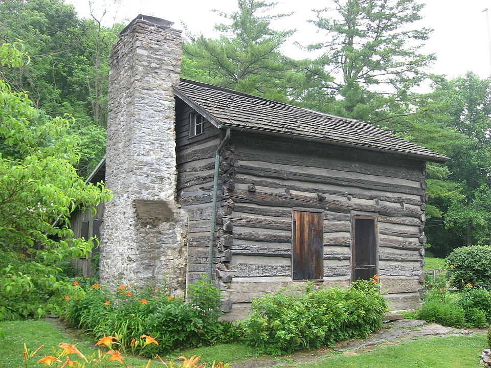
“The Miller-Leuser Log House is a historic eighteenth-century log cabin near the city of Cincinnati in Hamilton County, Ohio, United States. One of the oldest houses in the area, it has been named a historic site.”
Wikipedia article Miller-Leuser Log House, CC BY-SA 4.0.
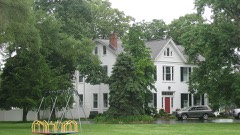
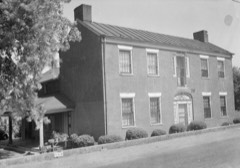
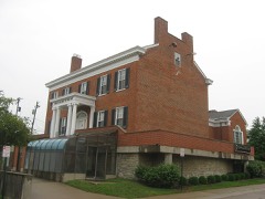
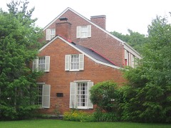
one of 314 National Register listings in Hamilton County · listed in 1974 · category: Building · one of 9 National Historic Landmarks in Hamilton County.
National Register reference number.74001511- the number the National Park Service assigned this property when it was listed, and the key its nomination file is catalogued under at the National Archives.
Besides the natural features of Anderson which vary its topography, its broad surface is further intersected by the Batavia turnpike in the northern part, which takes Union bridge and Newtown on its way; the Richmond turnpike on the extreme south, passing California and hugging the river closely until its exit from the county, shortly after which it trends rapidly northeastward; the Salem and Ohio turnpikes, also in the southern half of the township, the latter passing through Mount Washington and Cherry Grove; a number of other good wagon roads; the Cincinnati & Eastern narrow-guage railway, along the valley of the Little Miami, by Newtown, in the north part; with a branch from a point a mile and a half east of Newtown, running up the valley of Dry run, to a point due east of Mount Washington, where it leaves the township; and the Cincinnati & Portsmouth narrow-guage railway, cutting the southern and eastern parts in an exceedingly tortuous line, as compelled by the broken country, from the crossing of the Little Miami southwest of Mount Washington to the departure from the township and county considerably to the northward, near Mount Carmel, in Clermont county. As well as the nature and demands of the township will permit at present, it is served with means of transportation; but other railroads have been projected, as that already mentioned along the Ohio.
At present the circular wall is almost leveled, but can be readily traced by the color of the soil and the large number of flat river-stones. The ditches can be easily recognized. The mound is still prominent. It measures now in height five and one-half feet, diameter twenty-five yards, circumference seventy-five yards. The causeway is cut through by the Cincinnati & Eastern railroad, the forest cut away, and the soil cultivated annually.
Regional context, not property-specific
evidence. Museums hold 5,490 specimens
collected within 10 miles of Miller-Leuser Log House between 1820 and
1975: 2,906 Fungi, 1,420 Animalia, 798 Plantae, 328 Protozoa, 27 Unrecorded, 11 Chromista. 12 distinct Species records are shown.
Collected by A. Braun, A. F. Braun, A. Gaufin and others. Each is a
physical object with a catalogue
number, and each entry opens the museum's record. This is what was
collected and kept, not a survey of what lives here - nothing can be
concluded from a species being absent.
Regional context, not property-specific
evidence. The federal mineral resources record lists
6 workings within 5 miles of Miller-Leuser Log House: 4 past producers, 1 unknown, 1 producer.
1 still produces. What was taken out: Sand and Gravel, Construction, Zirconium. Distance is straight-line from the
map coordinates, so a quarry counted here may appear on a neighbouring
settlement's page as well.
Regional context, not property-specific
evidence. The National Weather Service names
Cincinnati, the town this property stands in, in 70 storm reports between 1994 and 2025: 25 thunderstorm wind, 17 hail, 14 flash flood, 7 flood.
The reports record 1 injury. Each account below is quoted exactly as the forecast office
filed it, from the NOAA Storm Events Database, and each date
opens the federal record of that event.
Numerous roads were flooded throughout the Cincinnati area and some basements were flooded. Flooding also caused some damage at Reading High School and Whitaker Elementary School.
Lightning struck a home causing a fire in the attic, which spread toward the second floor before being extinguished. Significant fire and water damage occurred to the home.
High water was reported on several roads in the downtown Cincinnati area and the near West Side. A retaining wall collapsed onto a roadway near the intersection of State Avenue and Ernst Street and a building was flooded on Poplar Street. Also, an apartment basement flooded on Linn Street and one resident needed to be rescued.
14 papers published in this town,
digitised by the Library of Congress and free to read: 0 issues,
0 pages. Every page is searchable, so a name or a street can be
looked for directly in what the town printed about itself at the time.
No historic map-sheet match is published
for this property yet. That does not mean no map exists. This record needs
a coordinate-quality review before it can be joined to a sheet boundary.
Browse the county's mapped places while that work is
pending.
From the nomination file
1,422 words on record
When this property was proposed for the
National Register, someone wrote the case for it: what the building is,
and why it matters. That document is a federal record in the public domain.
It is quoted below word for word, never summarised. The text was read off the scanned case file by machine, so the
occasional stray character is the recogniser's and the 1970s
typewriter's.
Description of the property
The Miller--Leuser house, a one and & half story structure, Despite the rather rough exterior appearance of the logs, the Ior the plaster lath is made of split saplings fastened by determined, in the way of dating, by the method of construction certainly suggest an early building date, also. MAY 1 3 1974 CONDITION Excellent REGISTER corners. NATIONAL DESCRIPTION interior of the house remains in fairly sound condition. Moved wrought nails.
except to say that the use of the steeple-notch on houses had corner ladder-staircase beside the fireplace leads from the possible there was an interior wood partition wall downstairs, The southwest front facade of the house has an the log house terminating at the main fireplace hearth.A chimney,the cellar,and the lean-to and porch--the basic log large fireplace/chimmey and the unusually large floorboards Stylistically, the log house is typical of the earliest there was a bake oven to the right of the offset fireplace.
there is no evidence that this house was ever sided.The is built ofhewed and round logs steeple-notched at the (Check One) Good There is a very small window on each side of the the northeast back of the house, connected by the original A large porch is 5' 4" x 3' 10" and a rear window, but this cannot be determined without structures built in southwestern Unio. X) Fair - Unexposed house. contains a second fireplace/chimney. connected to the lean-to. back door. This porch is now enclosed and serves as a kitchen.
preferably an original USGS, which allows us to check latitude-longitude. of our professional review. Correction of these technical errors does not Map Coverage. Please use a map bearing an identified system of coordinates, NAME OF PROPERTY 390 061 45:" WITHANSVILLE, OHIO-KY DEPARTMENT OF THE INTERIOR WITHAMSVILLE QUADRANGLE GEOLOGICAL SURVEY 8415 UNITED STATES Kentucky area mapped in cooperation with the OHIO-KENTUCKY Longitude ': 0 res UNITED STATES DEPARTMENT OF THE INTERIOR (July 1968) NATIONAL PARK SERVICE 1. NAME AUG 3 2. LOCATION STREET AND NUMBER Corner of Clough Pike and Newtown Road, Anderson Iwp 3.
MAP REFERENCE REQUIREMENTS: PROPERTY BOUNDARIES, WHERE REQUIRED, AND NORTH ARROW: MAY 1 3 1974 GPO 932-010 1961 Hamilton STATE Log House COUNTY Cincinnati vicinity TOWN Miller--Leuser DATE SOURCE REGISTER COMMON NATIONAL SCALE Form 10-301 RECEIVED AND/OR HISTORIC NATIONAL REGISTER OF HISTORIC PLACES Ohio Quad PROPERTY MAP FORM 1"/2000 (Type all entries -attach to or enclose with map) USGS 7.5' NUMERIC CODE (Assigned by NPS) AUG 3 0 1974 Hon. Howard M. Metzenbaum Mr. Daniel R, Porter Regional Director, Midwest Region Location STATE MMott/row 8/30/74 Name Director Cincinnati vicinity ENTRIES IN THE NATIONAL REGISTER Date Entered State Historic Preservation Officer Interstate #7l at 17th Ave. Miller-Leuser Log House Hon, Robert Taft, Jz.
Columbus, Ohio 43211 Also Notified Hamilton County The Ohio Historical Soeiety
Quoted from the National Register nomination
for reference 74001511, 10 pages, held by the National Archives in Record
Group 79. See the
catalogue record.
Listed places nearby
6 within 8 miles
Other National Register properties close
enough to walk or drive between, ordered by distance from this one. Both
positions come from the same geocoding pass that matched these properties
to their map sheets.
Listing record. National Park Service National Register of Historic Places, listed-properties dataset, current to 2026-05-22.
Map join. Address geocoded through the United States Census geocoder, then tested against the published boundary of every sheet in the USGS Historical Topographic Map Collection.
How this page is made. Listing fields come from federal records; map-sheet coverage is a labelled coordinate-to-boundary calculation, not a source-field claim.
Specimens. Global Biodiversity Information Facility (GBIF), https://www.gbif.org/. Only records licensed CC0 or CC BY are used. Records licensed CC BY-NC are excluded because this site carries advertising. Images are checked individually and any whose licence is non-commercial, no-derivatives or unreadable is refused.
Mines and quarries. USGS Mineral Resources Data System (MRDS) https://mrdata.usgs.gov/mrds/ A work of the United States government, no copyright under 17 U.S.C. 105.
Storms. NOAA National Centers for Environmental Information, Storm Events Database https://www.ncei.noaa.gov/stormevents/ A work of the United States government, no copyright under 17 U.S.C. 105. Narratives are quoted verbatim from the National Weather Service report and are not edited or summarised.
 Block
Block