BlockBefore
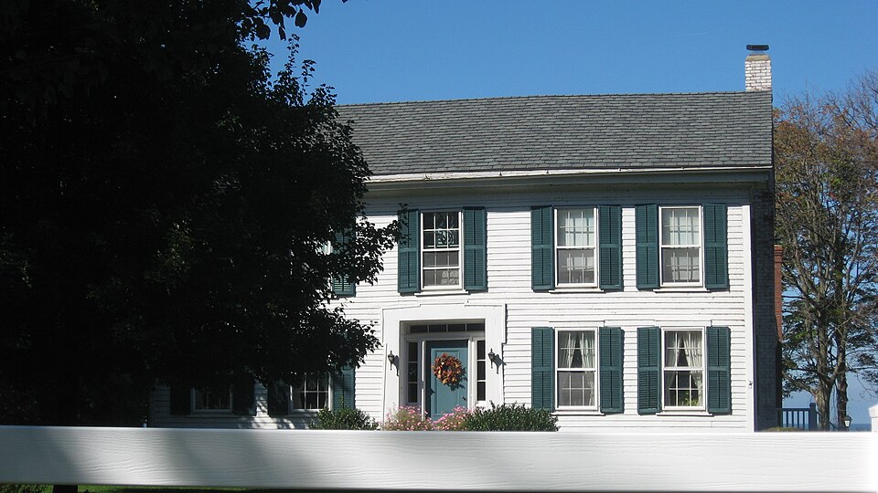
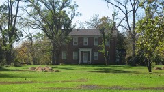
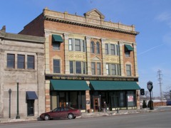
Photograph of William H. Root House
Photograph by Nyttend, Public domain. Via Wikimedia Commons.

Root, William H., House

Listed on the National Register of Historic Places in 1978. A historic map-sheet match is not published yet. The record needs a coordinate-quality review before it can be joined to a sheet boundary.

From the record

“Jedediah, second son of Captain Samuel, was born at Westbrook, October 9, 1703. He married Miss Hester Kirkland June 5, 1723, and there were eight children.”

A Standard History of Lorain County Ohio (1916). Machine-read text.

one of 113 National Register listings in Lorain County · listed in 1978 · category: Building · one of 2 National Historic Landmarks in Lorain County.

Sources: the county history on the Internet Archive · the case file at the National Archives · the National Register database, National Park Service

The listing

  • What is counted as historic. The nomination lists 1 building as contributing to the listing.
  • Address. 3535 E. Erie Ave., Lorain, 44052
  • When was it listed? 1978-09-20
  • Category. building
  • Township. Lorain city
  • Architectural style. Greek Revival architecture
  • National Register reference number. 78002110 - the number the National Park Service assigned this property when it was listed, and the key its nomination file is catalogued under at the National Archives.

What happened here

An account from the chapter on Lorain city, The inset identifies its exact source book and publication year.

From History of Lorain County, Ohio, published 1879 - Lorain City

Game

Game of the smaller kinds was very abundant before the hunters became too numerous. It cannot be positively stated that any old bears were killed in the township after the settlement was begun; but there is a vague tradition to the effect that Solomon Root and Joseph Ross once found two in a whitewood tree in the southwest part of the town, and killed them.

Read the rest of this passage

The ground it stands on

1,223,411 words

The chapter on Lorain City in History of Lorain County, Ohio, published 1879 names Lorain. This is what it says, exactly as the scans read.

Hitherto the publishers have had their county histories published in Philadelphia, by J. B. LiPPiNCOTT & Co., but this volume is from the press of the Leader Printing Company, Cleveland, who have done themselves credit by the high degree of typographical excellence shown in the printing of this book. Every inhabitant of the Western Reseiwe has cause for congratulation in the fact, - of which this Histoi-y of Lorain County is proof, - that Cleveland is al)le to maintain successful rivalry with Philadelphia, New York and Boston, in the publication of books whose beauty of typography is of the highest standard attained by the " art preservative."

Passage source: History of Lorain County, Ohio, published 1879.

The Western Reserve of Connecticut lies l)etwecn the panillels of 11'" and 12° 2' of north latitude, commencing with the western boundary line of Pennsylvania, and extending thence one hundred and twenty miles westward. The entire tract embraces an area of seven thousand four hundred and forty square miles, nearly one-third of which is water. If the whole were land, there would be four million seven hundred and sixty-one thousand six hundred acres. It is composed of the counties of Ashtabula, Trumbull, Portage, Geauga, Lake, Cu3'ahoga, Medina, Lorain, Huron, Erie, Summit (except the townships of Franklin and Green), the two northern tiers of townships in Mahoning, the townships of Sullivan, Troy, and Ruggles, in Ashland, and several islands lying north of Sandusky, including Kelly's and Put-in-Bay. This is the land portion of the Reserve. The portion consisting of water lies between the southern shore of Lake Erie and the forty-second degree of north latitude, and is bounded on the east and west by the same parallels of longitude that form the east and west boundaries of the land ])ortion.

Passage source: History of Lorain County, Ohio, published 1879.

Machine-read from a century-old scan, so expect the errors a machine makes: misspelled names, dropped words, stray characters.

Read the whole chapter on Lorain City - 1,223,411 words on its settlement, mills, schools and churches.

Specimens collected near this property

12 of 990 shown

Regional context, not property-specific evidence. Museums hold 990 specimens collected within 10 miles of Root, William H., House between 1853 and 1975: 672 Animalia, 263 Fungi, 45 Plantae, 6 Unrecorded, 4 Protozoa. 12 distinct Species records are shown. Collected by ?, A. A. Wright, A. E. Ricksecker and others. Each is a physical object with a catalogue number, and each entry opens the museum's record. This is what was collected and kept, not a survey of what lives here - nothing can be concluded from a species being absent.

Image SpeciesYear Collected by Where, as recorded
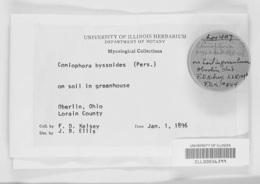
Specimen of Coniophora byssoides (Pers.) P.Karst.Coniophora byssoides (Pers.) P.Karst.1896F. D. KelseyOberlin.
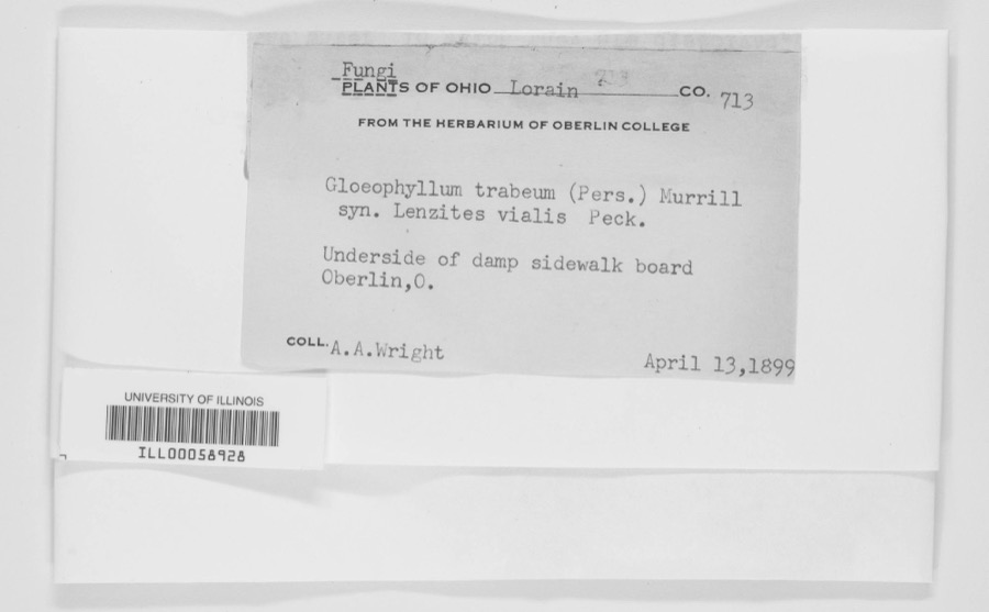
Specimen of Gloeophyllum trabeum (Pers.) MurrillGloeophyllum trabeum (Pers.) Murrill1899A. A. WrightOberlin.
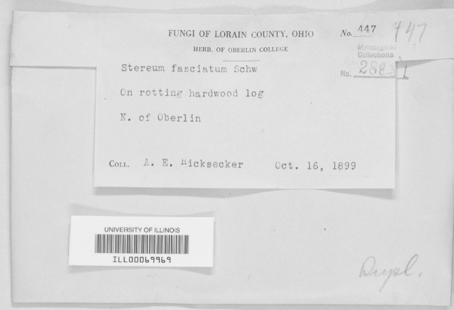
Specimen of Stereum fasciatum (Schwein.) Fr.Stereum fasciatum (Schwein.) Fr.1899A. E. RickseckerN. of Oberlin
A photograph of the species Ammocrypta pellucida, not of this specimenAmmocrypta pellucida (Putnam, 1863)1853Baird, Spencer FullertonBlack River, below falls at Elyria, Ohio
A photograph of the species Etheostoma blennioides, not of this specimenEtheostoma blennioides Rafinesque, 18191853S. BairdBlack River Elgria Ohio (above falls)
A photograph of the species Etheostoma caeruleum, not of this specimenEtheostoma caeruleum Storer, 18451853S. BairdElyria, Ohio
A photograph of the species Etheostoma maculatum, not of this specimenEtheostoma maculatum Kirtland, 18401853S. BairdElyria, Ohio
Aecidium nesaeae W.R.Gerard1894Kelsey, F.D.Lorain County, Ohio
A photograph of the species Ammodramus savannarum, not of this specimenAmmodramus savannarum pratensis (Vieillot, 1818)1894Jones, L. (Lynds)Oberlin Field W of Athletic Park, Lorain, Ohio, USA
A photograph of the species Aulacomnium palustre, not of this specimenAulacomnium palustre (Hedw.) Schwägr.1894F. D. Kelsey
Carpodacus purpureus purpureus (J.F.Gmelin, 1789)1894Jones, L. (Lynds)Morgan's Woods, NW Oberlin, Lorain, Ohio, USA
Catharus ustulatus (Nuttall, 1840)1894Jones, L. (Lynds)Morgan's Woods, NW Oberlin, Lorain, Ohio, USA

All 990 specimens within 10 miles, at the Global Biodiversity Information Facility.

Mines and quarries near this property

7 within 5 miles

Regional context, not property-specific evidence. The federal mineral resources record lists 7 workings within 5 miles of Root, William H., House: 3 past producers, 3 producers, 1 plant. 4 still produce. What was taken out: Sand and Gravel, Construction, Iron, Gypsum-Anhydrite. Distance is straight-line from the map coordinates, so a quarry counted here may appear on a neighbouring settlement's page as well.

Where SiteCommodity StatusRecorded
Lorain Plant-National GypsumGypsum-AnhydritePlant
Lorain Plant - Marathon SteelIronProducer
Lorain Plant - U.S. SteelIronProducer
Lorain Elyria Sand Company, Inc PitSand and Gravel, ConstructionPast ProducerSedimentary
Lorain Elyria Sand Company, Inc PitSand and Gravel, ConstructionPast Producer
Loraine Loading DockSand and Gravel, ConstructionProducer
National Sand & Gravel Co DredgeSand and Gravel, ConstructionPast Producer

Every working recorded in Lorain County

Storms near this property

60 since 1994

Regional context, not property-specific evidence. The National Weather Service names Lorain, the town this property stands in, in 60 storm reports between 1994 and 2024: 35 thunderstorm wind, 11 hail, 10 flash flood, 2 waterspout. The reports record 2 deaths. Each account below is quoted exactly as the forecast office filed it, from the NOAA Storm Events Database, and each date opens the federal record of that event.

WhenEvent Place namedHarm What the report says
July 2005Flash FloodLorain2 killed, $1,200,000Thunderstorms dumped very heavy rains on the City of Lorain. The heaviest rains fell on the northeastern quadrant of the city where extensive flash flooding occurred. As much as three inches of rain fell between 3 and 4:30 pm as thunderstorms trained over the same small area. An elderly couple was killed around 4:15 pm after they drove their automobile into a flooded underpass on State Route 611 (Henderson Road) just a couple blocks east of State Route 57 (Broadway). The underpass filled with more than 12 feet of water in just a few minutes. Efforts to rescue the couple were unsuccessful. An automated rain gage just south of the underpass recorded 2.56 inches of rain between 3 and 4 pm and a total of 2.76 inches by 4:30 pm. A second underpass on State Route 57 (East 28th Street) was flooded by as much as ten feet of water. Much of Broadway Road was reported to be flowing "like a river" during the peak of the storm. Severe flooding was reported on most of the major thoroughfares in the northeastern portion of Lorain including Elyria Road, North Ridge Road, Martin Luther King Jr. Boulevard and Oberlin Avenue. Flood waters on Elyria Road were as much as six feet deep with two to three feet of flowing water reported at other locations. Dozens of vehicles became stranded in the flood waters and rescue efforts were severely hampered by the widespread nature of the flooding. Industrial areas south and west of the Black River were inundated by flood waters. Damage to homes and business in the City of Lorain and Sheffield Township from both flash flooding and basement flooding was extensive. At least 14 families were displaced by flooding. At least five City of Lorain police cars were destroyed by flooding. Flooding also was reported along Beaver Creek on the west side of Lorain. The creek left it's bank and damaged several homes.
November 2002Thunderstorm WindLorain$2,400,000Thunderstorm winds well in excess of 60 mph caused extensive damage in the City of Lorain and Sheffield Lake. A school in Sheffield Lake lost a large section of roof and suffered extensive water damage. 46 homes in the area were damaged by the strong winds, flying debris and fallen trees. Of this total, eight homes were beyond repair and classified as being destroyed. Several homes in Lorain and surrounding areas were also damaged by fallen trees. Hundreds of trees were downed in the county.
August 2007Flash FloodLorain$1,500,000Heavy rain developed across the county during the morning hours of the 7th, and flash flooding quickly developed across northern portions of Lorain County. In the City of Lorain, one report described a man driving down East 28th Street and quickly turning around to avoid becoming stranded in the high water. Shortly after he turned around, he saw cars that continued down the street begin to float in the high water. Floodwaters quickly affected other streets throughout the City of Lorain with numerous reports of stranded cars and vehicle rescues. With conditions deteriorating, roads and underpasses throughout the city were closed. Heavy rainfall also caused flooding of a nursing home and damage to at least forty homes. ||In Sheffield Township several rescues were performed on people stranded in the quickly rising waters. Newspaper articles indicate that flooding of buildings also took place in Avon and Vermilion.||Rainfall reports in Lorain County include 1.66 inches at the Lorain-Elyria Airport and 3.77 inches in Sheffield Lake.
September 2005Flash FloodLorain$1,100,000no account filed
October 2000Thunderstorm WindLorain$300,000A 68 mph thunderstorm wind gust was measured in Avon Lake. Thunderstorm winds downed dozens of trees in Lorain and Avon Lake. A large tree fell on a house in Avon Lake and caused unrepairable structural damage. The house and its contents were a total loss. An adjacent garage was also blown down and destroyed.
June 2014Flash FloodLorain$120,000Heavy rainfall around 2 to 4 inches fell over Lorain County on the evening of June 25th. The first round of showers began from 3 to 5 p.m. and was the heaviest from 7 to 9 p.m. The highest amount measured was 3.72 inches in Elyria. This resulted in significant flooding to the area with numerous homes inundated. In Elyria about 8:55 p.m., a manhole cover popped off on Gulf Road, leaving a hole big enough for a submarine, a dispatchers transmission said. At 9:20 p.m., state Route 57 north between state Route 254 and Schadden Road in Elyria was blocked off, said police Lt. Lee Frank. Martin's Run Creek in Lorain caused flooding of several streets between West 35th Street and Oberlin Avenue. The Oberlin Police Department confirmed there were areas of flooding all throughout the city of Oberlin. Oberlin streets were blocked in many areas because of high water, including Prospect Street, North Main Street and South Professor Street.
June 2011HailLorain$100,000Nickel to golf ball sized hail was observed. Many vehicles were damaged by the hail.
August 2018Thunderstorm WindLorain$75,000A line of thunderstorms moved off of Lake Erie and caused damage from Lorain east along the lake shore to Sheffield Lake. Many trees were down, including some on houses. Power outages were reported across the area. Wind gusts were estimated to be at least 60 mph.
July 1998Thunderstorm WindLorain$50,000Trees and power lines were downed. One large limb fell on a house. Wind gusts were estimated at 60 miles per hour.
September 1994Thunderstorm WindLorain$50,000Trees and large limbs were downed, some on power lines. At least one home was damaged by a fallen tree.
March 1998Storm Surge/TideLorain$50,000no account filed
July 2002Thunderstorm WindLorain$35,000Thunderstorm winds toppled a large tree on top of two cars. One car was destroyed, the second heavily damaged.
January 2008Thunderstorm WindLorain$25,000Three power poles were reported down, and wires were in the road. Also, a large limb was reported down.
April 2023Thunderstorm WindLorain$20,000Large tree downed onto a house in Lorain. Visible damage to house.
October 1999Thunderstorm WindLorain$20,000Around a dozen trees were downed in and around Lorain. One tree landed on the roof of a house in Lorain and caused some damage.
July 1999Thunderstorm WindLorain$15,000A 61 mph wind gust was measured in Lorain and many trees were knocked down in Amherst and Lorain.
July 2018Thunderstorm WindLorain$10,000Thunderstorm winds downed a tree in the City of Lorain. The tree landed on a parked car causing considerable damage.
July 2016Thunderstorm WindLorain$10,000Thunderstorm winds downed at least three trees and several large limbs.
July 2011Thunderstorm WindLorain$10,000Thunderstorm winds downed several trees.
June 2008Thunderstorm WindLorain$10,000Several trees were reported down from the City of Lorain to Grafton. A tree was also reported down in Lagrange Township.
July 2005Thunderstorm WindLorain$10,000Several large trees and power lines were reported down.
July 2003Thunderstorm WindLorain$10,000Thunderstorm winds downed a few trees.
July 1998Flash FloodLorain$10,000Heavy thunderstorm rain caused flooding of many roads.
October 2010Thunderstorm WindLorain$5,000Thunderstorm winds downed a couple trees near the intersection of State Route 57 and East 36th Street. One of the trees blocked a portion of State Route 57.
January 2008Thunderstorm WindLorain$5,000A wind gust of 65 mph was measured by a trained spotter. Also, trees and large limbs were reported down from the thunderstorm wind gusts.
May 2002HailLorain$5,000Dime size hail was reported three miles east of Lorain.
June 2001Thunderstorm WindLorain$5,000Thunderstorm winds downed a few trees.
May 1998Thunderstorm WindLorain$5,000Trees and power lines were downed.
June 2014Thunderstorm WindLorain$3,000Thunderstorm winds downed a few large tree limbs which blocked roads.
August 2009Thunderstorm WindLorain$3,000Several trees and large limbs were reported down in Lakeview Park in Lorain.
June 2006Thunderstorm WindLorain$3,000Two trees were reported down in Lorain and Avon Lake.
August 2024Thunderstorm WindSouth Lorain$2,000Gazebo was damaged in the 1800 block of East 33rd Street of Lorain. Numerous trees were downed in the same area.
July 2011Thunderstorm WindLorain$2,000Thunderstorm winds downed numerous large tree branches in the area.
July 2011Thunderstorm WindLorain$2,000Thunderstorm winds downed a few large tree limbs.
August 2005HailLorain$2,000Nickel size hail was observed.
July 2003Thunderstorm WindLorain$2,000Thunderstorm winds downed a tree.
August 2001Thunderstorm WindLorain$2,000Thunderstorm winds downed two large tree limbs.
May 2018Thunderstorm WindLorain$1,000Thunderstorm winds downed a tree.
August 2024Thunderstorm WindSouth Lorain-About 25 trees downed in and near Oakwood Park in Lorain.
August 2023HailLorain-Hail up to quarter-size in Lorain.
June 2022HailSouth Lorain-Hail up to nickel-size at Elyria Avenue and North Ridge Road in Elyria.
July 2022Thunderstorm WindLorain-Utility pole snapped in Lorain.
July 2020Thunderstorm WindLorain-Numerous trees and power poles down in Lorain and two miles north of Lorain. Time estimated via radar.
May 2014HailLorain-Penny sized hail was observed.
July 2011HailLorain-Nickel sized was reported.
August 2011HailLorain-Penny sized hail was observed.
May 2011Flash FloodLorain-Multiple thunderstorms move over Lorain County between the 25th and 26th of May. The storms on the 25th saturated the ground, allowing for rapid runoff from storms on the 26th. A storm moved over Lorain County late on the 26th with rainfall rates over an inch per hour. Numerous roads were flooded and several were closed. In the hardest hit city of Lorain there was waist deep flooding in Gulf Street and Ohio Street near the elementary school.
May 2011Flash FloodLorain-Lorain County experienced their third straight day of flooding on the 14th. Storms brought around an inch of additional rainfall, but this in addition to already swollen streams and saturated ground cover was enough to trigger additional flooding. Several creeks came out of their banks and water was running across several roads. The speed that the water rose caught motorists by surprise as many cars stalled in high water.
May 2010HailLorain-Penny sized hail was observed.
August 2001WaterspoutLorain-A large waterspout was observed on Lake Erie approximately four miles offshore of Lorain. No damage occurred.
September 2001WaterspoutLorain-Three waterspouts were observed on Lake Erie just northeast of Lorain. No damage occurred.
October 1999Flash FloodLorain-Thunderstorms dumped 1.6 inches of rain on the City of Lorain in less than one hour. Over a foot of standing water was reported on many streets and East 28th Street had to be closed for a period of time. Other streets with flooding included Popular, Olive, Oakdale and West 17th.
August 1997Tornado (F0)Lorain-A tornado briefly touched down near the intersection of Leavitt and Skyline Roads one mile south of Lake Erie. No damage was reported.
August 1997Flash FloodLorain-Heavy thunderstorm rain caused flooding of roads, underpasses and low lying areas. Some roads were impassable and closed to traffic.
September 2019Thunderstorm WindLorain-no account filed
July 1999Thunderstorm WindLorain-no account filed
July 1999HailLorain-no account filed
January 1998Flash FloodLorain-no account filed
May 1998HailLorain-no account filed
November 1996Thunderstorm WindLorain-no account filed

Every storm recorded in Lorain County

Map coverage status

No historic map-sheet match is published for this property yet. That does not mean no map exists. This record needs a coordinate-quality review before it can be joined to a sheet boundary. Browse the county's mapped places while that work is pending.

From the nomination file

1,773 words on record

When this property was proposed for the National Register, someone wrote the case for it: what the building is, and why it matters. That document is a federal record in the public domain. It is quoted below word for word, never summarised. The text was read off the scanned case file by machine, so the occasional stray character is the recogniser's and the 1970s typewriter's.

Description of the property

This is a large, rectangular two story building in the Greek Revival Style. It is constructed out of wood timbers and is covered by clapboard siding. The front of the building has five bays and features a central entranceway. This entrance is windows are large, six over six double hung sash, typical for-the Greek Revival tures a smaill doorway, enframed in a similar fashion as the front door: The gable is accented by a strong cornice with partial returns. A rectangular attic window, southwest parlor has highly elaborate: wood trim around the doors and windows. articulated entablature. In the southeast parlor, fluted wood strips with curved corner blocks surround the door and window openings. The other rooms have simpler woodwork, but a variety of designs are employed.

In plan, this house ing originatly, although d federal.style fireplace was installed in a recent only midway through the attic where they are carbelled into the attic structure. This house was recently rehabitated. The front portion was restored with new wiring of rooms, including a 1920's kitchen. This space was extensively remodeled into cleaned and repainted.The building occupies a large wooded lakefront lot. of the house, but dates from about the turn of the century. A large wooden fence, which is painted white, enclose the property. CONDITION DATE RUINS XEXCELLENT FAIR CHECK ONE a single large space kitchen area and family room.The exterior was simply baluster railing is located in this hallway.No fireplaces were in this build- and heating was being added.

Read the complete 1,773-word case file.

Statement of significance

number of ways,lts an excellent example of the Greek Revival style, éxhibiting time craftmanship and distinctive ornamental features. Its large size is unusual testifying fo the prosperity of its ori- ginal owner. The Root House was one of only a handfull of pre-Civil War farm- ing lakefront farmhouses. Finally, the house is notable in that it has been able to pioneer. Henry Root, who came to this area in 18l6 from Sheffield, Massachusetts. ran a steam sawmill on the Black River and owned considerable acreage around This house remained in the Root family until 1976 when the last local descendant died.It was then acquired and extensively rehabilitated by its present owners. which is also located in what was once Sheffield Township.

This house, which could become a focal point for historical activities in Lorain. ARCHITECTURE ARCHEOLOGY-HISTORIC EDUCATION PHILOSOPHY PREHISTORIC INVENTION PERIOD THEATER EXPLORATION/SETTLEMENT 1900- ARCHEOLOGY-PREHISTORIC AGRICULTURE ENGINEERING SIGNIFICANCE INDUSTRY LITERATURE _CONSERVATION _COMMUNICATIONS SOCIAL/HUMANITARIAN Sheffield Township. William beca me active in farming and local business.He his home. Root was also active in local politics serving as the justice of peace. lake.

William Henry was born in Massachusetts but accompanied his parents to POLITICS/GOVERNMENT -1600-1699 shoreline from development.While no museum use is being contemplated for -1500-1599 piece of shaded lakefront property, thereby preserving a part of the Lake Erie _1700-1799 -SCIENCE -1400-1499 houses that were built along the lakefront in Lorain County.lt is the best surviv- The William H.

Read the complete 1,773-word case file.

The whole case file for this property - 1,773 words, 10 pages, reproduced complete.

Quoted from the National Register nomination for reference 78002110, 10 pages, held by the National Archives in Record Group 79. See the catalogue record.

Listed places nearby

6 within 8 miles

Other National Register properties close enough to walk or drive between, ordered by distance from this one. Both positions come from the same geocoding pass that matched these properties to their map sheets.

Photograph PropertyDistance Listed
Burrell, Jabez and Robbins, House and Cheese Factory2.4 miles1976
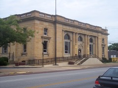
U.S. Post Office2.6 miles1982
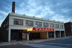
Palace Theatre Building2.6 miles1978
Eagles Building2.6 miles1986
Lorain YMCA Building2.6 miles1992
Duane Block2.6 miles1987

Sources for this property

National Archives recordThe nomination case file for reference 78002110 in Record Group 79.
Lorain CountyAll 113 listed properties in this county.

Provenance

  • Listing record. National Park Service National Register of Historic Places, listed-properties dataset, current to 2026-05-22.
  • Map join. Address geocoded through the United States Census geocoder, then tested against the published boundary of every sheet in the USGS Historical Topographic Map Collection.
  • How this page is made. Listing fields come from federal records; map-sheet coverage is a labelled coordinate-to-boundary calculation, not a source-field claim.
  • Specimens. Global Biodiversity Information Facility (GBIF), https://www.gbif.org/. Only records licensed CC0 or CC BY are used. Records licensed CC BY-NC are excluded because this site carries advertising. Images are checked individually and any whose licence is non-commercial, no-derivatives or unreadable is refused.
  • Mines and quarries. USGS Mineral Resources Data System (MRDS) https://mrdata.usgs.gov/mrds/ A work of the United States government, no copyright under 17 U.S.C. 105.
  • Storms. NOAA National Centers for Environmental Information, Storm Events Database https://www.ncei.noaa.gov/stormevents/ A work of the United States government, no copyright under 17 U.S.C. 105. Narratives are quoted verbatim from the National Weather Service report and are not edited or summarised.