| April 1965 | Tornado (F4) | not stated | 17 killed, 100 hurt, $25,000,000 | no account filed |
| July 2005 | Flash Flood | Lorain | 2 killed, $1,200,000 | Thunderstorms dumped very heavy rains on the City of Lorain. The heaviest rains fell on the northeastern quadrant of the city where extensive flash flooding occurred. As much as three inches of rain fell between 3 and 4:30 pm as thunderstorms trained over the same small area. An elderly couple was killed around 4:15 pm after they drove their automobile into a flooded underpass on State Route 611 (Henderson Road) just a couple blocks east of State Route 57 (Broadway). The underpass filled with more than 12 feet of water in just a few minutes. Efforts to rescue the couple were unsuccessful. An automated rain gage just south of the underpass recorded 2.56 inches of rain between 3 and 4 pm and a total of 2.76 inches by 4:30 pm. A second underpass on State Route 57 (East 28th Street) was flooded by as much as ten feet of water. Much of Broadway Road was reported to be flowing "like a river" during the peak of the storm. Severe flooding was reported on most of the major thoroughfares in the northeastern portion of Lorain including Elyria Road, North Ridge Road, Martin Luther King Jr. Boulevard and Oberlin Avenue. Flood waters on Elyria Road were as much as six feet deep with two to three feet of flowing water reported at other locations. Dozens of vehicles became stranded in the flood waters and rescue efforts were severely hampered by the widespread nature of the flooding. Industrial areas south and west of the Black River were inundated by flood waters. Damage to homes and business in the City of Lorain and Sheffield Township from both flash flooding and basement flooding was extensive. At least 14 families were displaced by flooding. At least five City of Lorain police cars were destroyed by flooding. Flooding also was reported along Beaver Creek on the west side of Lorain. The creek left it's bank and damaged several homes. |
| June 1953 | Tornado (F4) | not stated | 1 killed, 47 hurt | no account filed |
| June 2006 | Flood | Countywide | 1 killed, $4,500,000 | Runoff from heavy thunderstorm rains earlier in the night caused streams and rivers in Lorain County to rapidly rise. By mid-morning evacuations were conducted along the East Branch of the Black River in both Lagrange and Carlisle Townships. A total of ten homes were evacuated. In Lagrange Township, four people had to be rescued by boat from their Vermont Road home. Evacuations were conducted later in the morning in Elyria as the Black River flooded the Greenview Drive area. Water rose to the second floors of 13 homes in this neighborhood. At least one person had to be rescued by boat from the roof of his home. The Black River later crested at 16.9 feet, well above the flood stage of 9.5 feet. Tragically, a 47 year old rescue diver was killed while trying the rescue two teenagers who drove their vehicle into an area flooded by the West Branch of the Black River. This occurred just northwest of Wellington along Pitts Road just after noon. The firefighter was swept off his feet while wading through three to four feet of swift moving water. The firefighter was tethered by a safety line, but died before he could pulled be from the water by fellow rescuers. Around 25 homes were heavily damaged by flooding in the county with several dozen more sustaining lesser damages. One home in Carlisle Township sustained enough damage to be classified as destroyed. Twenty eight apartments, mostly in Carlisle Township, were also damaged by the flooding. State Routes 18, 511, 58 and 303 all had to be closed because of flooding. A couple dozen other roads and streets also had to be closed. Hundreds of homes sustained damage from basement flooding. Crop losses in Lorain County are also expected to be substantial as standing water was observed over much of the county. |
| July 1992 | Tornado (F2) | not stated | 3 hurt, $2,500,000 | no account filed |
| June 1958 | Tornado (F1) | not stated | 3 hurt, $25,000 | no account filed |
| July 1992 | Tornado (F0) | not stated | 2 hurt, $2,500,000 | no account filed |
| August 1986 | Tornado (F2) | not stated | 2 hurt, $2,500,000 | no account filed |
| September 1970 | Tornado | not stated | 2 hurt, $25,000 | no account filed |
| May 1988 | Thunderstorm Wind | not stated | 2 hurt | no account filed |
| June 1994 | Thunderstorm Wind | Countywide | 1 hurt, $50,000 | Trees were downed in numerous locations. Winds were measured at 68 mph at Elyria. Funnel clouds were reported, but no touchdown occurred. A roof was blown off a house in LaGrange. An Elyria woman was hurt when a tree fell onto her home and she was struck by debris. |
| October 1971 | Tornado (F1) | not stated | 1 hurt, $25,000 | no account filed |
| June 2006 | Thunderstorm Wind | Avon Lake | 1 hurt, $8,000 | A few trees and utility wires were reported down. In Avon Lake, a large tree limb fell on a bicyclist. The bicyclist sustained minor injuries and was transported to the hospital. |
| July 1999 | Lightning | Elyria | 1 hurt | A 40 year old woman working inside was injured when electricity from a lightning strike traveled through the fan she was using. The woman was taken to a local hospital and treated for minor injuries. |
| June 1996 | Lightning | Sheffield Township | 1 hurt | no account filed |
| June 1996 | Lightning | Grafton | 1 hurt | no account filed |
| July 1992 | Thunderstorm Wind | not stated | 1 hurt | no account filed |
| May 2014 | Flash Flood | Shawville | $25,000,000 | The City of North Ridgeville sustained significant and widespread damage from a flash flood on the evening of May 12th. An estimated 300 homes and 1,000 businesses sustained damage from the flood waters. Heavy rain, measured at 6 in two locations in town, fell within two hours. The intensity and magnitude of the rain has a return frequency of every 500 years. The storm drains were overwhelmed leading to backwater into area basements. The sewage plant on the French Creek sustained $20,000 in damages. The Mill Creek flooded condos on Mill Creek Boulevard resulting in 15 people rescued from the second floor or their homes. The Mill Creek shopping plaza was inundated from backup on storm drainage backups. The local schools sustained flood damage along with many recreational parks in low lying areas. The worst of the flooding occurred around 1030 pm through midnight. Several structures sustained major damage. |
| May 2004 | Flash Flood | Countywide | $12,400,000 | Thunderstorms dumped torrential rains on Lorain County during the early morning hours of May 21st resulting in the worst flooding seen in the county since 1969. The southern portion of the county and especially the Wellington, Oberlin and Lagrange areas were very hard hit. Heavy rain between 2 and 5 a.m. caused the west branch of the Black River and it's tributaries to leave their banks. Rainfall rates were in excess of two inches per hour during the peak of the storm. Just over five inches of rain was measured at the water treatment plant in Lagrange with numerous three inch reports received from both the Wellington and Oberlin areas. Bucket surveys from the area indicate that as much as six inches of rain may have fallen in some parts of the county. This rainfall combined with ground already saturated from heavy rains the previous few days led to widespread flooding. Dozens of roads in southern Lorain County had to be closed. State Route 18 near Wellington was under as much as three feet of water at times. Dozens of people had to be evacuated from their homes along the Black River due to the rapidly rising water levels. Several residents had to be evacuated from their homes along Baumhart Road near Amherst. Just over 500 homes were damaged by flooding in the county. Major damage occurred to 27 homes with six others damaged enough to be declared destroyed. Hundreds of additional homes suffered basement flooding. Many roads and culverts were washed out and at least three school buildings sustained flood damage. The worst damaged of the schools was Firelands High School which had part of it's roof collapse. |
| June 2015 | Flash Flood | Avon Lake | $4,000,000 | A series of thunderstorms rolled in off Lake Erie during the early morning hours of June 23. Between 5 am and 6 am three separate storms hit northeast Lorain and northwest Cuyahoga Counties with heavy rain and strong winds. The radar estimates rainfall amounts of around 2.5 to 3 inches in a little less than two hours. The rainfall rates spiked to over 5 inches per hour during the height of the storm dropping 2.5 inches in 30 minutes. This intense rainfall overwhelmed storm drainage systems resulting in widespread basement flooding which started before widespread power outages. Some homes on Lake Road had up to five feet of water in their basements. Bay Village received between 2.8 to 3.5 of rain during about a two hour time period which resulted in over 400 homes with basement flooding. The heavy rain fell on ground that was already saturated which exasperated the flooding conditions. The Water Treatment Plant was forced to dump untreated sewage directly into Lake Erie in order alleviate flooding into residences. Interstate 90 in Rocky River was closed in both directions due to flooding and standing water. There were no official rain gauges located in the band of heaviest rainfall. The nearby gauges at Westlake and Sheffield Lake reported 1.80 and 1.90 respectively. |
| August 2023 | Flash Flood | Amherst | $3,000,000 | Widespread flash flooding across northern Lorain County due to heavy rainfall. Widespread basement and isolated first floor flooding reported in Lorain, Elyria, Amherst, Avon Lake, Avon, and North Ridgeville. Widespread flooded roadways reported. Post event damage assessments reported hundreds of homes and businesses flooded. Radar estimated rainfall of 3 to 4 inches falling in a three hour period, which matched several measured rain gauge reports from the area. |
| July 1992 | Tornado (F1) | not stated | $2,500,000 | no account filed |
| November 2002 | Thunderstorm Wind | Lorain | $2,400,000 | Thunderstorm winds well in excess of 60 mph caused extensive damage in the City of Lorain and Sheffield Lake. A school in Sheffield Lake lost a large section of roof and suffered extensive water damage. 46 homes in the area were damaged by the strong winds, flying debris and fallen trees. Of this total, eight homes were beyond repair and classified as being destroyed. Several homes in Lorain and surrounding areas were also damaged by fallen trees. Hundreds of trees were downed in the county. |
| August 2005 | Flash Flood | North Portion | $2,000,000 | Severe thunderstorms tracked over the northern portions of Lorain County during the afternoon hours of the 20th. By late afternoon, another band of thunderstorms developed and tracked over this same area. Heavy rain was associated with both rounds of thunderstorms. Streets, parking lots, fields and homes quickly flooded. Some roads were reported to have a foot and a half of water flowing down them causing cars to float. By the end of the event, some roads had around three feet of standing water on them. Small streams left their banks leaving the standing water in the streets and yards no place to flow. Hundreds of homes and apartment units suffered from flooding. Basements of homes quickly filled up with water and apartment buildings with either ground floor or sub-ground floor units experienced extensive flood damage. Water began receeding during the overnight hours of the 20th. North Ridgeville was hit hard with numerous reports of flooded homes and streets. By the end of this event, 5.80 inches of rain had fallen there. Elyria picked up 5.14 inches, and Grafton received 2.88 inches. In Avon, 4.5 inches of rain fell in around 90 minutes with a storm total of 3.27 inches in Vermilion. |
| August 2007 | Flash Flood | Lorain | $1,500,000 | Heavy rain developed across the county during the morning hours of the 7th, and flash flooding quickly developed across northern portions of Lorain County. In the City of Lorain, one report described a man driving down East 28th Street and quickly turning around to avoid becoming stranded in the high water. Shortly after he turned around, he saw cars that continued down the street begin to float in the high water. Floodwaters quickly affected other streets throughout the City of Lorain with numerous reports of stranded cars and vehicle rescues. With conditions deteriorating, roads and underpasses throughout the city were closed. Heavy rainfall also caused flooding of a nursing home and damage to at least forty homes. ||In Sheffield Township several rescues were performed on people stranded in the quickly rising waters. Newspaper articles indicate that flooding of buildings also took place in Avon and Vermilion.||Rainfall reports in Lorain County include 1.66 inches at the Lorain-Elyria Airport and 3.77 inches in Sheffield Lake. |
| September 2005 | Flash Flood | Lorain | $1,100,000 | no account filed |
| May 2014 | Flash Flood | Sheffield | $1,000,000 | On the evening of May 12th torrential rainfall dropped an estimated 5 inches of rainfall in 90 minutes over Avon in northern Lorain County. The French Creek flooded from local runoff and routed water from upstream North Ridgeville where the heaviest rain fell. The French Creek, which runs from southeast to northwest through town, flooded several roads and damaged the Mill Road with a washout. 50 to 75 homes sustained basement flooding. |
| August 2022 | Flash Flood | Elyria Wallhead Arpt | $800,000 | Widespread flash flooding across the southern portion of Elyria. Local officials reported that police and fire responded to over 80 residences that were experiencing basement flooding. One housing complex experienced first floor flooding. The majority of the reports came from the Eastern Heights and southern portion of Elyria near the east and west branches of the Black River. Dozens of vehicles became stranded in high water. Most roadways across the southern portion of Elyria has 1 to 3 feet of standing water on them, making them impassable. A gas station awning collapsed from the weight of the water at 9th and Middle Avenue. A swath of 1.5 to 2.5 inches fell in a 30 to 90 minute period across the southern portion of Elyria based on radar estimates. Rainfall rates of 4 to 5 inches per hour immediately preceded the flash flooding, with a peak 30 minute rainfall during this time achieving a 50 year recurrence interval. Storm total rainfall amounts of 3.5 to 4.5 inches were recorded. |
| February 2011 | Flood | Vermilion On The Lk | $750,000 | Heavy rain and rapid snow melt led to widespread flooding across Lorain County. Rainfall totals across the county ranged from one to three inches on February 27th and 28th. Up to ten inches of heavy snow was on the ground at the onset of the rain. This snow rapidly melted as temperatures warmed into the 50s on the 28th. Up to an additional inch of water equivalent rainfall was released from the melted snow. Several people had be rescued from stranded vehicles. At least 100 people were evacuated from around 50 homes in North Ridgeville and Avon Lake. Hundreds of homes in the county sustained damage, mainly from basement flooding. Many roads had to be closed because of the flooding. Officially 2.24 inches of rain was measured at the Lorain County Airport. |
| May 2004 | Flash Flood | Countywide | $750,000 | During the early morning hours of May 22nd, heavy rain producing thunderstorms moved across Lorain County for the the third time in less than 24 hours. Rainfall totals of one to two inches were common across the county. Rainfall rates with the stronger storms were well in excess of an inch per hour. This rain combined with ground already saturated from earlier storms led to the renewal of widespread flooding in the county. Dozens of roads and streets once again became flooded and had to be closed. Several more cars became stranded in the flood waters. Damage to roads and other government property from the storms on the 21st and 22nd topped $500,000. Dozens of homes, businesses and vehicles sustained flood damage. |
| June 2006 | Flash Flood | Countywide | $600,000 | Thunderstorms dumped torrential rains on Lorain County during the late evening hours of June 21st and early morning hours of the 22nd. Rainfall rates with the stronger storms approached 3 inches per hour. A peak rainfall total of 6.5 inches was reported in Vermilion with 4 inches of this total falling between 9 and 11 p.m. Other rainfall totals from across the county included: 5.12 inches at Findlay State Park south of Wellington, 4.65 inches in Canton Township and 3.42 at the Lorain County Airport near Elyria. Flash flooding occurred as runoff from this rain made it's way into the area streams and rivers. Many roads had be closed because of flooding. Over three feet of fast flowing water was reported on State Route 511 just south of Rochester. Other streets and roads in the county had to be closed as well, especially in the northwest corner of the county. Dozens of homes sustained damaged from basement or nuisance flooding. |
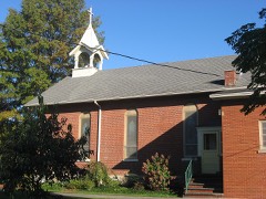
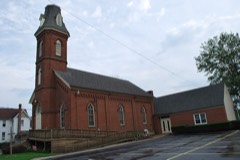
| July 1998 | Lightning | Camden | $600,000 | Lightning struck and the ensuing fire destroyed a church. |
| August 2023 | Flash Flood | Brighton | $500,000 | Flash flooding in and around Wellington. Lorain County Fairgrounds inundated with more than a foot of standing water, flooding cars and livestock trailers in the fairgrounds parking area, and several barns on the fairground property. Some basement flooding reported in Wellington. OH-18 closed west of Wellington between Oh-511 and Quarry Road and east of Wellington between Hawley Road and West Road. Radar estimated 3 to 4 inches of rainfall in a three hour period. |
| June 1994 | Tornado (F1) | Wellington | $500,000 | A tornado touched down just south of Wellington at the intersection of Pitts and Jones Road. One home suffered significant damage and two barns were destroyed as the tornado moved almost due north. Nine other homes suffered minor damage and trees, utility poles, and power lines were downed. Two dogs in dog boxes that were kept in one of the destroyed barns were found 5 to 15 yards away from the site still in their boxes and unhurt. |
| March 2007 | Tornado (EF0) | Elyria | $400,000 | A weak tornado briefly touched down along Griswold Road. The tornado traveled east toward the Midway Mall and created an intermittent damage path approximately two miles long. The tornado caused damage to several structures along its path. A florist/greenhouse suffered extensive damage as much of its roof was torn off. A garage was destroyed, and the car inside sustained severe damage. Newspaper articles also indicated that vinyl siding was torn from the side of an office supply store, and a shopping cart was blown and shattered a window of a store. Numerous trees and power lines were also taken down. No injuries were reported from this tornado. |
| July 1995 | Thunderstorm Wind | Countywide | $400,000 | no account filed |
| November 2017 | Thunderstorm Wind | La Grange | $350,000 | A fast moving line of thunderstorms produced significant straight line wind damage across southeastern Lorain County. Maximum wind gust speeds were estimated to be at least 85 mph. A lot damage was reported in the LaGrange area with dozens of trees downed and many homes and buildings damaged. Most of the building damage was from lost roofing or siding but one business had an exterior wall collapse. A home along Main Street in Lagrange was heavily damaged by a fallen tree. A school building also sustained some roof damage. A whole row of utility poles was snapped south of Lagrange along State Route 301. Many trees, limbs and utility poles were also reported down in the Grafton, Eaton Estates and Columbia Station areas. State Routes 83, 301 and 303 had to be closed because of fallen trees and downed power lines. Many other county roads and streets were also blocked. Over 10,000 electric customers lost power from the storm with full restoration taking over two days. There were reports of many vehicles being damaged by flying debris and fallen trees and limbs. Some of the school districts in the county closed on November 6th. |
| May 2011 | Hail | Vermilion On The Lk | $300,000 | Thunderstorms produced a large swath of hail ranging in size from nickels to golf balls. Locations across Lorain county, including Vermilion, Elyria, and North Ridgeville were hit hardest. Many vehicles and some homes were damaged by the hail. |
| October 2000 | Thunderstorm Wind | Lorain | $300,000 | A 68 mph thunderstorm wind gust was measured in Avon Lake. Thunderstorm winds downed dozens of trees in Lorain and Avon Lake. A large tree fell on a house in Avon Lake and caused unrepairable structural damage. The house and its contents were a total loss. An adjacent garage was also blown down and destroyed. |
| April 1996 | Thunderstorm Wind | Countywide | $300,000 | no account filed |
| April 2008 | Thunderstorm Wind | Amherst | $250,000 | A thunderstorm downburst with winds of 80 to 90 mph moved across portions of Lorain County. The downburst began near the intersection of the Ohio Turnpike and State Route 58 and continued east northeast to near the Midway Mall in Elyria. Pockets of downed trees were observed in several locations just to the north of the Turnpike. The Ohio turnpike was closed near Exit 140 for several hours after a high tension power pole partially collapsed causing a power line to fall onto the road surface. |
| May 2004 | Flash Flood | Countywide | $250,000 | A line of severe thunderstorms moved across Lorain County and dumped an inch or more of rain on already saturated ground. For the second time in twelve hours, flash flooding occurred in the county as streams and rivers once again quickly rose. Dozens of roads were flooded and had to be closed. Over a dozens of vehicles were stranded in the flood waters and hundreds of homes sustained damage from lowland or basement flooding. |
| July 2003 | Thunderstorm Wind | Countywide | $250,000 | A line of severe thunderstorms moved across Lorain County before daybreak causing widespread damage and power outages. The Elyria and Lorain areas were very hard hit with dozens of trees downed in both cities. A 65 mph thunderstorm gust was measured at Elyria at 5:00 a.m. Many trees were also downed elsewhere in the county. A home was heavily damaged in Avon with several other buildings in the county sustaining minor damage. Dozens of cars were damaged and as many as 26,000 customers lost power during the storm. |
| July 1975 | Tornado (F2) | not stated | $250,000 | no account filed |
| August 1972 | Tornado (F1) | not stated | $250,000 | no account filed |
| July 1999 | Lightning | Elyria | $225,000 | A church was struck by lightning and caught fire. |
| August 2023 | Flash Flood | Oberlin | $200,000 | Flash flooding reported in Oberlin and Pittsfield Township due to heavy rainfall. Several reports of flooded basements. OH-303 closed between Pitts Road and Quarry Road due to flash flooding. Radar estimated 2.5 to 3.5 inches of rainfall in a three hour period. |
| November 2017 | Thunderstorm Wind | Brighton | $200,000 | Thunderstorm downburst winds estimated to be at least 75 mph caused extensive damage across southwestern Lorain County. Damage was observed from the Huron County line east across Rochester, Brighton and Cambden Townships. Damage was observed as far north as Kipton. The damage was most concentrated along and west of State Route 511 from near Brighton north to State Route 303. Six homes and buildings on Gore-Orphanage, Baird and Betts roads were damaged by the strong winds. All of these buildings had west facing overhead garage doors which were blown in. Significant roof and tree damage was also observed. Nearly every property along State Route 511 north from Brighton to near Bronson Road had visible storm damage. At least one farm building was leveled and all of the homes in the area had missing siding, missing roofing or both. Dozens of trees were downed and unharvested cornfields along State Route 511 between Peck Wadsworth and Betts Roads were flattened. |
| January 2007 | Flood | Elyria | $200,000 | Runoff from heavy rains on January 5th caused the Black River in Elyria to go above the flood stage of 9.5 feet during the evening hours of January 5th. The river crested at 15.21 feet around 4 a.m on January 7th and went out of flood during the early morning hours of January 8th. Significant flooding occurred in the Cascade Park area in Elyria. Several roads and streets in the area had to be closed because of flooding. |
| October 1996 | Thunderstorm Wind | Countywide | $200,000 | no account filed |
| September 1996 | Flash Flood | Northern Half | $200,000 | no account filed |
| April 2017 | Thunderstorm Wind | Avon | $150,000 | Thunderstorm wind gusts toppled several utility poles along Nagel Road in Avon. |
| May 2014 | Flash Flood | Sheffield | $150,000 | Heavy rainfall, measured at 6.5 inches in 3.5 hours was measured by the Sheffield Village service department on the evening of May 12th. Runoff combined with routed water upstream from North Ridgeville and Avon caused the French Creek to rise 10 to 15 feet above flood stage in Sheffield Village. A half dozen buildings were flooded form the French Creek along with eight homes. The creek crested around 1230 am. State Route 201 was closed for eight hours. There were no water rescues and the infrastructure did not sustain any notable damages. |
| June 2014 | Thunderstorm Wind | Sheffield | $150,000 | Thunderstorm winds downed over a dozen trees and large limbs. Scattered power outages were reported. |
| August 2011 | Thunderstorm Wind | East Carlisle | $150,000 | A thunderstorm downburst with winds estimated to be at least 75 mph produced a three mile long damage path south and southeast of Elyria. Dozens of trees were toppled along the damage path. |
| May 2004 | Thunderstorm Wind | Countywide | $150,000 | A line of severe thunderstorms moved across Lorain County and downed downed trees and large limbs countywide. A spotter measured a 61 mph gusts in Amherst. Scattered power outages occurred. |
| May 2011 | Thunderstorm Wind | North Ridgeville | $125,000 | Thunderstorm winds toppled eight utility poles and several trees in North Ridgeville. Scattered power outages were reported throughout the area. |
| June 2014 | Flash Flood | Lorain | $120,000 | Heavy rainfall around 2 to 4 inches fell over Lorain County on the evening of June 25th. The first round of showers began from 3 to 5 p.m. and was the heaviest from 7 to 9 p.m. The highest amount measured was 3.72 inches in Elyria. This resulted in significant flooding to the area with numerous homes inundated. In Elyria about 8:55 p.m., a manhole cover popped off on Gulf Road, leaving a hole big enough for a submarine, a dispatchers transmission said. At 9:20 p.m., state Route 57 north between state Route 254 and Schadden Road in Elyria was blocked off, said police Lt. Lee Frank. Martin's Run Creek in Lorain caused flooding of several streets between West 35th Street and Oberlin Avenue. The Oberlin Police Department confirmed there were areas of flooding all throughout the city of Oberlin. Oberlin streets were blocked in many areas because of high water, including Prospect Street, North Main Street and South Professor Street. |
| June 2013 | Thunderstorm Wind | Sheffield Lake | $110,000 | Trained spotters and the Mayor reported half a dozen trees down in the city of Sheffield Lake and along East River Rd. One tree fell on a house on Lake Rd. Downed trees and limbs continued southeast to Avon where a large branch fell on a fruit stand. Spotters in Avon estimated wind gusts of 60-70 mph. First Energy reported at least 14000 customers lost power. |
| September 2005 | Lightning | Elyria | $110,000 | Lightning struck a transformer and caught it on fire. The fire spread to an industrial building nearby catching the building on fire. There was major structural damage as a result of the fire. |
 Block
Block