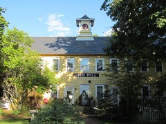
Listed on the National Register of Historic Places in
1979. A historic map-sheet match is not published yet. The record needs a coordinate-quality review before it can be joined to a sheet boundary.
From the record
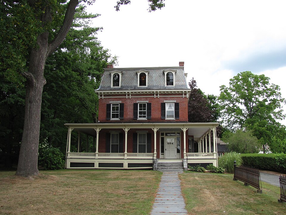
“The Conkey-Stevens House is a historic brick house located at 664 Main Street in Amherst, Massachusetts. Built in 1840 and remodeled in 1870, it exhibits a well-preserved combination of Greek Revival and Second Empire features.”
Wikipedia article Conkey-Stevens House, CC BY-SA 4.0.
one of 32 National Register listings in Hampshire County · listed in 1979 · category: Building.
Architectural style. Second Empire architecture in the United States and Canada
National Register reference number.79000352- the number the National Park Service assigned this property when it was listed, and the key its nomination file is catalogued under at the National Archives.
Fires near this property
51 since 2003
Regional context, not property-specific
evidence. The
federal wildfire occurrence database
lists 51 fires within 5 miles of Conkey-Stevens House between
2003 and 2020, burning about 42 acres in total. 3 started naturally. None was recorded as arson.
Distance is straight-line from the map coordinates, so a fire counted
here may appear on a neighbouring settlement's page as well.
Reported cause
Fires
Missing data/not specified/undetermined
26
Equipment and vehicle use
8
Recreation and ceremony
7
Debris and open burning
6
Natural
3
Railroad operations and maintenance
1
The most recent of
them, most recent first, with the day each was reported and the service
that recorded it.
Regional context, not property-specific
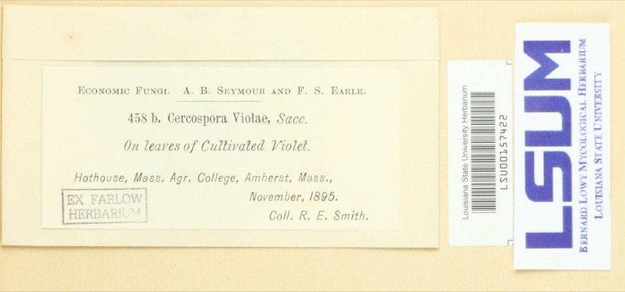
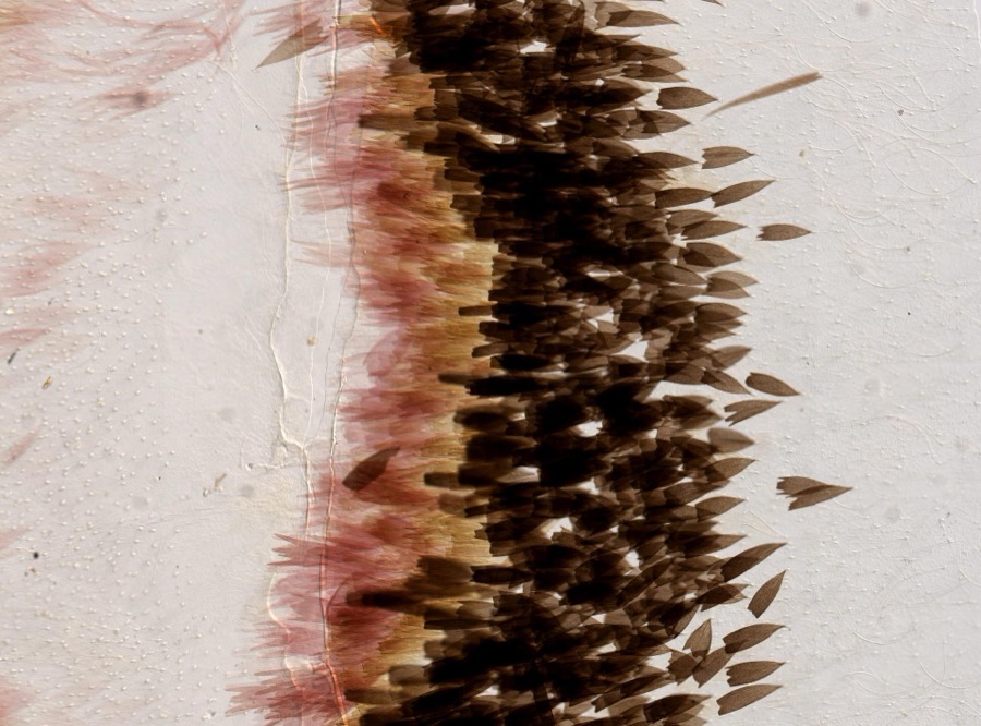
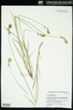
evidence. Museums hold 10,139 specimens
collected within 10 miles of Conkey-Stevens House between 1781 and
1975: 4,217 Animalia, 3,522 Plantae, 2,175 Fungi, 132 Chromista, 80 Protozoa, 12 Unrecorded, 1 Bacteria. 12 distinct Species records are shown.
Collected by A V Osmun, A. Albee, A. Allen and others. Each is a
physical object with a catalogue
number, and each entry opens the museum's record. This is what was
collected and kept, not a survey of what lives here - nothing can be
concluded from a species being absent.
Regional context, not property-specific
evidence. The federal mineral resources record lists
11 workings within 5 miles of Conkey-Stevens House: 6 past producers, 4 producers, 1 occurrence.
4 still produce. What was taken out: Sand and Gravel, Construction, Brick Clay, Clay, Asbestos. Distance is straight-line from the
map coordinates, so a quarry counted here may appear on a neighbouring
settlement's page as well.
Regional context, not property-specific
evidence. The National Weather Service names
Amherst, the town this property stands in, in 42 storm reports between 1995 and 2023: 26 thunderstorm wind, 12 hail, 3 lightning, 1 flash flood.
The reports record 6 injuries. Each account below is quoted exactly as the forecast office
filed it, from the NOAA Storm Events Database, and each date
opens the federal record of that event.
Five solar panels were blown from the roof of the three story Knowles Engineering Building at the University of Massachusetts at Amherst. In addition, six people were injured when two event tents were blown down at a barbeque at the university. Construction fences and a tree were also downed.
Lightning struck a home on Ridgecrest Road, setting a fire. Much of the home was damaged by the fire and the resulting smoke and water. Firefighters were able to put out the blaze, but the home is unlivable.
Trees, large tree limbs, and wires were downed by thunderstorm winds. Multiple roads were closed in Granby due to downed trees blocking them. One tree was downed onto a house along Route 202 in Granby.
In Amherst, trees and wires on North and East Pleasant Streets and Sandhill and Sunderland Roads were downed by thunderstorm winds. Trees and wires on Route 9 and Hartness Road in Pelham also were downed by thunderstorm winds.
At 9:24 AM EST, the Hadley Police Department closed the eastbound lanes of State Route 9 near the University of Massachusetts due to flooding. Local media also reported that University Drive in the adjacent part of Amherst was flooded.
No historic map-sheet match is published
for this property yet. That does not mean no map exists. This record needs
a coordinate-quality review before it can be joined to a sheet boundary.
Browse the county's mapped places while that work is
pending.
From the nomination file
2,405 words on record
When this property was proposed for the
National Register, someone wrote the case for it: what the building is,
and why it matters. That document is a federal record in the public domain.
It is quoted below word for word, never summarised. The text was read off the scanned case file by machine, so the
occasional stray character is the recogniser's and the 1970s
typewriter's.
Description of the property
The Conkey-Stevens House is located at the corner of Main and Salem Streets in East Am- herst. Its treed two acre lot is set off from the street by a decorative cast iron fence. The two story brick structure was built in 1840 and originally had a hipped roof. It was remodeled in the 1880's with the addition of a bracketted mansard roof, a rear brick and frame ell and a one story verandah extending around its east, south and west elevations. The facade which faces south is three bays wide with the entrance located in the eastern bay. Approached by a flight of three granite steps with low curved side walls, the six paneled door (upper two panels blocked in) was flanked by side lights and carried a rectangular transom.
Although these have been sealed with plywood, it is believed that 1880's etched glass remains. Full length windows with shutters are located in the other two bays. These openings have also been temporarily sealed with plywood. Fenestration on the second floor consists of three windows with 2/2 double hung sash and shutters. The windows and doot ate all headed by granite"lintels. Three dormers with round-arched openings and alterhating triangülar-segmental-triangular pediments light the third story mansard. The bracketted cornice is severely deteriorated and some of the slate shingles, which are laid in an imbricated pattern are missing.
The side elevations, also three bays wide, are treated in the same manner as the facade with the exception of the first floor windows which are not full length. Also, a bay window was added to the east elevation in the 1880's remodeling. The one story verandah which extends around the facade and side elevations has an almost flat roof supported by square chamfered columns with bracketted heads above their capitals.
/ARCHITECT Robert Cutler STATEMENT OF SIGNIFICANCE The Conkey-Stevens House, despite its current deterioration, retains integrity of design, location, setting, materials, and association. It is associated with lives of persons prominent in Amherst's past, and it embodies the distinctive characteristics of the Victorian period which are not usually found in East Amherst. LTC: The house, in its,originalGreek Revivalform, was builtforIthmar,Conkey (1788-1862). in 1840, by Robert Cutler.Born, in neighboring Pelham, Conkey studied law, under 20101 Noah Dickinson Mattoon in Amherst, then returned to Pelham to open his own office in Conkey remained in Pelham, where he served as town clerk, until 1818 when his former teacher moved west and he took over Mattoon's practice.
While in Amherst Conkey served as Justice of the Peace (1819), special commissioner for Hampshire County (1828), County Commissioner (1830), and was finally appointed Judge of the Probate Court by Governor Armstrong (1834). He became a director of the Amherst and Belchertown Railway Company when it was organized in 1851, and in 1854 became one of the incorporators of the Amherst Savings, Bank.: In 1861 he was named to serve on the Convention to revise the State constitution. Following Conkey's death in 1862 the thirty acre property passed briefly to William Barrows who then sold the house with seven acres to Abiel Stevens in 1868. Steven's wife was the sister-in-law of Sidney Dillon, a railroad builder, the president of the Union Pacific Railroad and a millionaire..
Abiel and Maria Steven's son, Albert, pursued a lucrative career with his uncle Sidney before returning to Amherst to farm. It was the money Albert made in the railroad business which enabled him to remodel the original Greek Revival structure in the currently fashionable Second Empire stylè.
Quoted from the National Register nomination
for reference 79000352, 13 pages, held by the National Archives in Record
Group 79. See the
catalogue record.
Listed places nearby
6 within 8 miles
Other National Register properties close
enough to walk or drive between, ordered by distance from this one. Both
positions come from the same geocoding pass that matched these properties
to their map sheets.
Listing record. National Park Service National Register of Historic Places, listed-properties dataset, current to 2026-05-22.
Map join. Address geocoded through the United States Census geocoder, then tested against the published boundary of every sheet in the USGS Historical Topographic Map Collection.
How this page is made. Listing fields come from federal records; map-sheet coverage is a labelled coordinate-to-boundary calculation, not a source-field claim.
Wildfire. Short, Karen C. 2022. Spatial wildfire occurrence data for the United States, 1992-2020 [FPA_FOD_20221014]. 6th Edition. Fort Collins, CO: Forest Service Research Data Archive. https://doi.org/10.2737/RDS-2013-0009.6 Collected with United States Government funding and usable without additional permissions or fees.
Specimens. Global Biodiversity Information Facility (GBIF), https://www.gbif.org/. Only records licensed CC0 or CC BY are used. Records licensed CC BY-NC are excluded because this site carries advertising. Images are checked individually and any whose licence is non-commercial, no-derivatives or unreadable is refused.
Mines and quarries. USGS Mineral Resources Data System (MRDS) https://mrdata.usgs.gov/mrds/ A work of the United States government, no copyright under 17 U.S.C. 105.
Storms. NOAA National Centers for Environmental Information, Storm Events Database https://www.ncei.noaa.gov/stormevents/ A work of the United States government, no copyright under 17 U.S.C. 105. Narratives are quoted verbatim from the National Weather Service report and are not edited or summarised.
 Block
Block