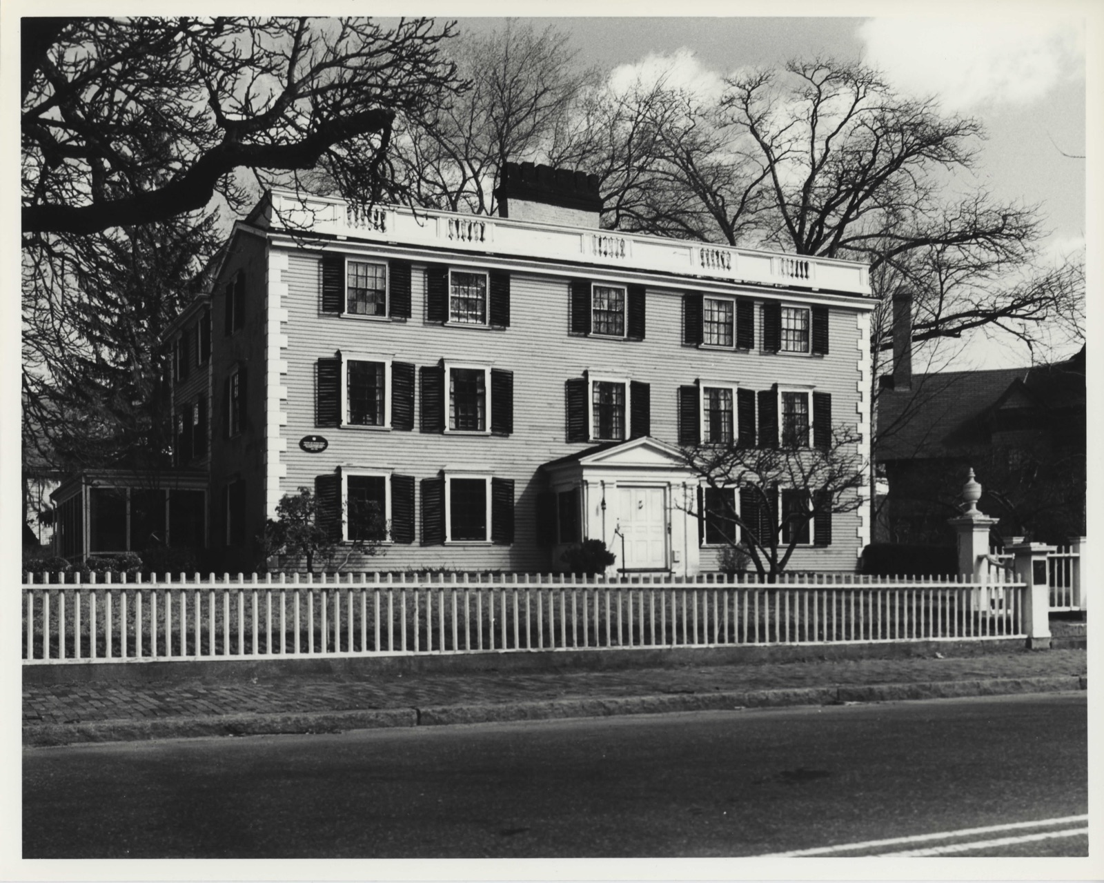
Photographs from the nomination case file, National Park Service records.
Hooper-Lee Nichols House
Listed on the National Register of Historic Places in
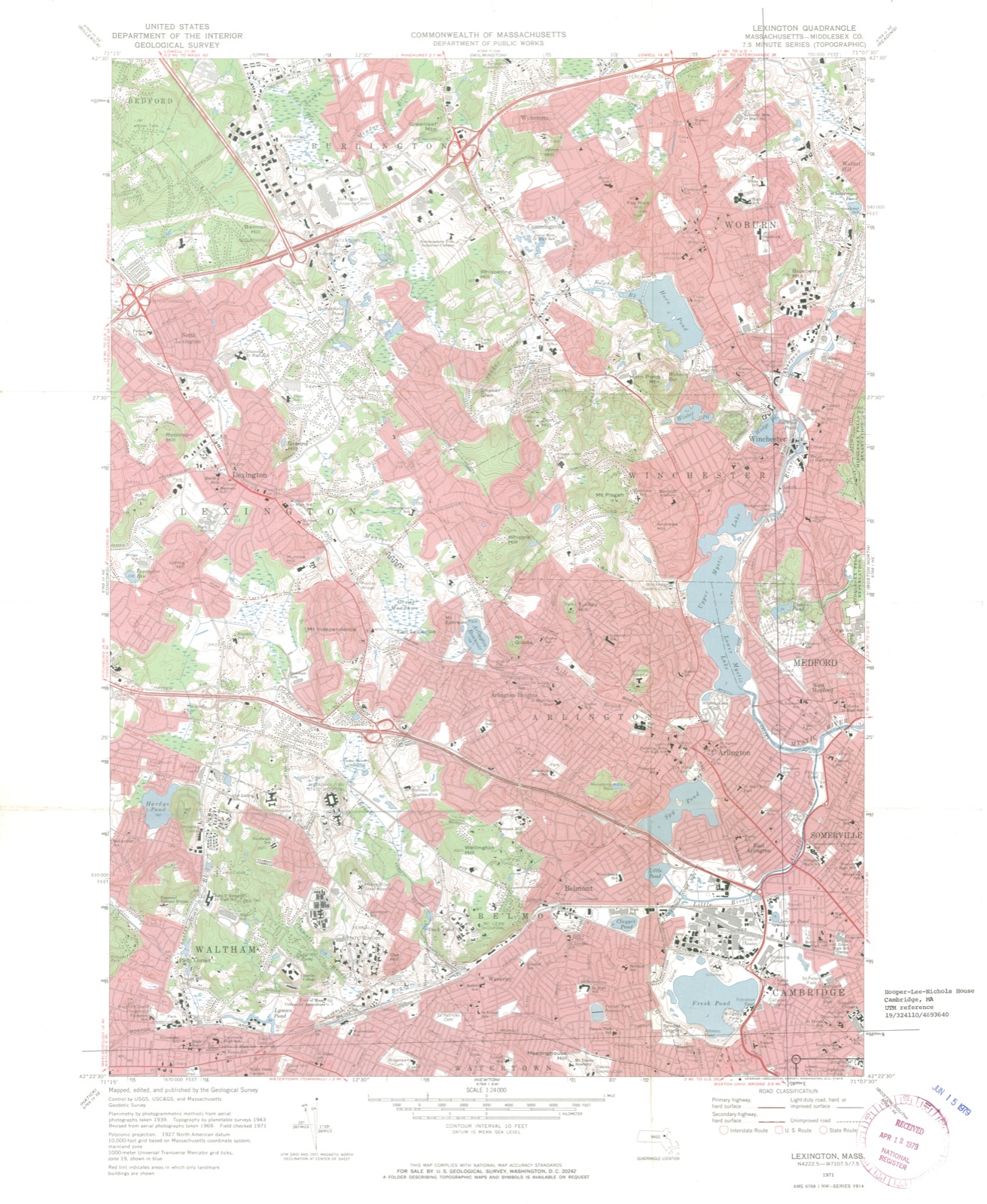
1979. A historic map-sheet match is not published yet. The record needs a coordinate-quality review before it can be joined to a sheet boundary.
From the record
“Richard Henry (1787-1879) was the author, poet and essayist. He was one of the founders of the North American Review.”
A History of Cambridge, Massachusetts, 1630-1913 (1913). Machine-read text.
one of 1100 National Register listings in Middlesex County · listed in 1979 · category: Building · one of 3 National Historic Landmarks in Middlesex County.
National Register reference number.79000355- the number the National Park Service assigned this property when it was listed, and the key its nomination file is catalogued under at the National Archives.
In October, 1660, the County Court ordered, that the House of Correction, or Bridewell, should be used as a prison for the County, until further provision be made. Such provision was made by the erection of a jail l before Aug. 26, 1692, when it was ordered by the Court, " that the County Treasurer take care that their majesties Goal at Cambridge be repaired, for the comfortable being of what persons may be committed forthwith." 2 It was also ordered, Dec. 14, 1703, " that an addition be made to the prison at the west end thereof, of eighteen foot square, with studs conformable to the old house." A dozen years later, the old part of the prison became so unsatisfactory, that the Court appointed " a committee to agree with carpenters and other workmen to erect and build a good well-timbered house in Cambridge for a Prison, for the accommodation of a keeper, to be thirty-six foot long, and for width agreeable to the foundation of the old Goal or Prison, two storeys high, fifteen foot stud, with a stack of chyrnneys in the middle, to be done and finished workmanlike, as soon as may be conveniently effected Further
Until 1720, the " Common " extended to Linnaean Street, and included also a few acres, lying in a nearly square form, at the northwesterly corner of Linnaean Street and North Avenue.1 This extreme point of the Common was set apart as a " Place of Execution," or " Gallows Lot," as it was more familiarly called. And after the Common was reduced to its present size, and the lots in this square fronting on the streets, had been granted to individuals, about one acre in its extreme northwesterly corner was reserved for its former use, until trials, and imprisonments, and executions were transferred to East Cambridge.2 It was entered from North Avenue through a bridleway or passage, between Lancaster Place and Arlington Street, now called Stone Court.
Regional context, not property-specific
evidence. The
federal wildfire occurrence database
lists 65 fires within 5 miles of Hooper-Lee Nichols House between
2015 and 2020, burning about 107 acres in total. None started naturally. 25 were recorded as arson.
Distance is straight-line from the map coordinates, so a fire counted
here may appear on a neighbouring settlement's page as well.
Reported cause
Fires
Arson/incendiarism
25
Missing data/not specified/undetermined
17
Debris and open burning
9
Recreation and ceremony
6
Smoking
5
Misuse of fire by a minor
2
Equipment and vehicle use
1
The most recent of
them, most recent first, with the day each was reported and the service
that recorded it.
Regional context, not property-specific
evidence. Museums hold 2,217 specimens
collected within 10 miles of Hooper-Lee Nichols House between 1898 and
1975: 972 Animalia, 690 Plantae, 488 Fungi, 29 Protozoa, 17 Bacteria, 12 Chromista, 9 Unrecorded. 12 distinct Species records are shown.
Collected by ?, A B Seymour, A B. Proper and others. Each is a
physical object with a catalogue
number, and each entry opens the museum's record. This is what was
collected and kept, not a survey of what lives here - nothing can be
concluded from a species being absent.
Regional context, not property-specific
evidence. The federal mineral resources record lists
11 workings within 5 miles of Hooper-Lee Nichols House: 9 plants, 2 past producers.
9 still produce. What was taken out: Iron, Lead, Tantalum, Niobium (Columbium). Distance is straight-line from the
map coordinates, so a quarry counted here may appear on a neighbouring
settlement's page as well.
Regional context, not property-specific
evidence. The National Weather Service names
Cambridge, the town this property stands in, in 16 storm reports between 2006 and 2023: 7 thunderstorm wind, 3 flood, 3 flash flood, 2 lightning.
No death or injury is recorded in these reports. Each account below is quoted exactly as the forecast office
filed it, from the NOAA Storm Events Database, and each date
opens the federal record of that event.
No historic map-sheet match is published
for this property yet. That does not mean no map exists. This record needs
a coordinate-quality review before it can be joined to a sheet boundary.
Browse the county's mapped places while that work is
pending.
From the nomination file
1,787 words on record
When this property was proposed for the
National Register, someone wrote the case for it: what the building is,
and why it matters. That document is a federal record in the public domain.
It is quoted below word for word, never summarised. The text was read off the scanned case file by machine, so the
occasional stray character is the recogniser's and the 1970s
typewriter's.
Description of the property
The Hooper-Lee-Nichols House was constructed in c. 1685 and has undergone major alterations. The seventeenth century character of the house is immediately apparent only in the massive central chimney, a huge construction twelve feet square with six flues protruding above the roof. The house was remodelled in the Georgian style in c. 1745, at which time the roof was raised, the vestibule shutters and quoins added to the exterior, and one wall stuccoed. The pedimented gable of the strongly projecting vestibule is supported by paired pilasters flanking an unusually wide and low single door of ie mankingoan thg nine panels.
The window frames project strongly from the facade with heavy cornices and moulded sills; the shutters are in the heavy scale of the eighteenth century and have fixed louvers. Windows are eight over twelve in the first two stories, and eight over eight in the main house, which is covered in roughcast scored to resemble ashlar masonry. The low pitched roof is screened by a wooden parapet added in 1860. The solid panels of the parapet alternate with balusters to emphasize the spacing of the bays. The interior of the house reflects the extensive remodellings that were carried out in the eighteenth and twentieth centuries. Both the east and west first floor rooms have panelling, mantels, and window'seats added between 1745 and 1760.
The boxed summer beams run longitudinally in the east room and transversely in the west room. The 'paper in the west first floor front room shows views of the Bosphorus and perhaps Istanbul, and may have been the work of Dufour of Paris. The "Bay of Naples" paper in the west front room on the second floor is better known, and is definitely a Dufour creation, printed in France c. 1820.
c. 1680, c= 1745 BUILDER/ARCHITECT Various The Hooper-Lee-Nichols House is the oldest of seven mansions on Brattle Street in Cambridge associated with Tory figures of the pre-Revolutionary period. It is one of three houses originally constructed in the seventeenth century remaining in Cambridge and, although altered numerous times in the eighteenth, nineteenth and twentieth centuries, it retains its importance as a largely eighteenth century mansion. The property is currently operated as an historic house museum by the Cambridge Historical Society. The house was constructed c. 1685 on a farm in what was then Watertown by Dr. Richard Hooper. Dr.
Hooper died in 1691, and by this time the house had already been seriously damaged by fire and "wormes." The earliest existing element of the house, its great central chimney stack twelve feet square built of granite and brick, dates fnom this period. r. Hooper's widow, who had a license to operate an inn, thoroughly repaired and altered the house in 1716-1717 before passing it to her son, Dr. Henry Hooper; the present stairs and a fragment of panelling under the present fireplace wall in the left chamber date from this remodelling. In 1733, a Boston merchant, Cornelius Waldo, became owner of the house and after unsuccessfully advertising it for rent "to a Gentleman for a Country Seat", apparently occupied it himself.
The present third story and much of the present panelling and interior trim were added about 1745. In 1748, the house was purchased by Joseph Lee, a Judge in the Court of Common Pleas of Middlesex County, a Iounder of Christ Church, Cambriage, in 1159, and a Mandamus Councillor in 1774.
Quoted from the National Register nomination
for reference 79000355, 10 pages, held by the National Archives in Record
Group 79. See the
catalogue record.
Listed places nearby
6 within 8 miles
Other National Register properties close
enough to walk or drive between, ordered by distance from this one. Both
positions come from the same geocoding pass that matched these properties
to their map sheets.
Listing record. National Park Service National Register of Historic Places, listed-properties dataset, current to 2026-05-22.
Map join. Address geocoded through the United States Census geocoder, then tested against the published boundary of every sheet in the USGS Historical Topographic Map Collection.
How this page is made. Listing fields come from federal records; map-sheet coverage is a labelled coordinate-to-boundary calculation, not a source-field claim.
Wildfire. Short, Karen C. 2022. Spatial wildfire occurrence data for the United States, 1992-2020 [FPA_FOD_20221014]. 6th Edition. Fort Collins, CO: Forest Service Research Data Archive. https://doi.org/10.2737/RDS-2013-0009.6 Collected with United States Government funding and usable without additional permissions or fees.
Specimens. Global Biodiversity Information Facility (GBIF), https://www.gbif.org/. Only records licensed CC0 or CC BY are used. Records licensed CC BY-NC are excluded because this site carries advertising. Images are checked individually and any whose licence is non-commercial, no-derivatives or unreadable is refused.
Mines and quarries. USGS Mineral Resources Data System (MRDS) https://mrdata.usgs.gov/mrds/ A work of the United States government, no copyright under 17 U.S.C. 105.
Storms. NOAA National Centers for Environmental Information, Storm Events Database https://www.ncei.noaa.gov/stormevents/ A work of the United States government, no copyright under 17 U.S.C. 105. Narratives are quoted verbatim from the National Weather Service report and are not edited or summarised.
 Block
Block