Photographs from the nomination case file, National Park Service records.
Castle, The
Listed on the National Register of Historic Places in
1979. A historic map-sheet match is not published yet. The record needs a coordinate-quality review before it can be joined to a sheet boundary.
From the record
“The tax upon the town for the support of tbe Great Bridge was probably .beginning to be onerous, and the people evidently began to be a little restive under it, for in March, 1788, a committee reported verbally tlmt they were unable to find any grant of land made for its support in which Waltham or Weston liad any interest. Abner Sanderson was, in May, again elected representative, a position which he continued to fill until 1802.”
History of Middlesex County, Massachusetts (1880). Machine-read text.
one of 1100 National Register listings in Middlesex County · listed in 1979 · category: Building · one of 3 National Historic Landmarks in Middlesex County.
National Register reference number.79000359- the number the National Park Service assigned this property when it was listed, and the key its nomination file is catalogued under at the National Archives.
On the ]-"5th of May, 1715, the town passed a vote " to build a meeting-house for the accommodation of tlir inhabitants of the most westerly part of the town." The former West or Farmers' Precinct having been incor])oratcd as Weston, that part of the town now called Waltham had become the most western division. The vote was not, however, carried into effect, and in Si|)l( inbrr of the same year the Eastern Precind priiiioiiiii the (ienernl Court for separation.
Leaving now the (piarivl of the eliurehes, we eoiiie to the third, the final, and on that aeeonnt perhaps the principal, cause of the complete with- drawal of the West Precinct, and its formation into a distinct town. As early as January 1720-21 tlie precinct in many things assumed almost complete municipal powers. On the 30th of January, 1720-21, a meeting was held, at which Isaac Mixer was chosen clerk, Joseph Mixer treasurer, and Lieutenant Jonathan Smitli, Sergeant Jonathan Sanderson, Ensign Samuel Garfield, Captain Samuel Harrington, John Cutting, Sergeant Joseph Pierce, and Daniel Benjamin were chosen precinct committee. Votes were passed to carry into effect the order of the General Court of December 17, 1720, in regard to the meeting-house, and in October, 1722, it was voted to "sell what was left of the old meeting-house." On the 7th of April, 1729, a meeting was held to see, among other things, about a location for a school-liouse. Allen Flagg agreed to give a piece of land at the north end of his orchard for that purpose, and the precinct agreed to accept it. On the 1th of February, 1729-30, Znchariah Smith, Allen Flagg, Thomas Harrington, Thomas Bigelow, Jonas Smith, John C'hilds, and John Cutting were appointed a committee to wait upon the selectmen, and have inserted in the warrant for the next town-meeting an article requesting the town to grant a sum of money to build a school-house on the land of Mr. Flagg. The town, however, refused to accept the site or vote the money, and on this school cjuestion came tlie tug of war, which resulted in the West Precinct becoming Waltham. The town-meeting at which the request of the western people was refused was held in March. On the 1st of May, 1 730, Thomas Bigelow, Zachariah Smith, Allen Flagg, Elisha Smith, and John Child were appointed a committee at a meeting of the West Precinct, to take measures to have that portion set off as a separate town, "and take Effectual care that the same may be Established that Learning may be Advanced amongst us or some other proper methods whareby to obtain the same." A petition signed by Anthony Conady (Caverly ?) and others, representing the difficulties in the way of schools, and the " impositions" of the East Precinct, and praying for a separate township, had already been prepared and sent for the consideration of the General Court, and the town was served with a copy of the j^etition, and cited to show cause why it should not be granted. Li February, 1730-31, Deacon William Brown, Anthony Cau [v] erly. Deacon Thomas Livennore, Thomas Bigelow, and Jonas Smith were chosen a committee to attain the coveted separation. At a regular meeting held April 19, 1731, the town, or practically the East Precinct, appointed Lieutenant Samuel Stearns, Joseph Nason, and Jonas Bond a committee to appear in behalf of the town, and probably in opposition to the division. What action the court took is not plain, but one of the recommendations was that the town provide two school-houses, with two duly qualified schoolmasters, - one of each for each precinct. These recommendations the town (August 16, 1731) refused to accept. The assessors of the West Precinct, - Nathaniel Harris and Deacon William Brown, - acting under a sense of gross injustice practised by the East Precinct majority, refused to assess for the grant made by the town for the support of schools. Something of the spirit of opposition to taxation without representation asserted itself here.
Regional context, not property-specific
evidence. The
federal wildfire occurrence database
lists 77 fires within 5 miles of Castle, The between
2015 and 2020, burning about 50 acres in total. None started naturally. 3 were recorded as arson.
Distance is straight-line from the map coordinates, so a fire counted
here may appear on a neighbouring settlement's page as well.
Reported cause
Fires
Missing data/not specified/undetermined
25
Recreation and ceremony
24
Debris and open burning
16
Arson/incendiarism
3
Railroad operations and maintenance
3
Other causes
2
Power generation/transmission/distribution
2
Smoking
1
Equipment and vehicle use
1
The most recent of
them, most recent first, with the day each was reported and the service
that recorded it.
Regional context, not property-specific
evidence. Museums hold 2,248 specimens
collected within 10 miles of Castle, The between 1898 and
1975: 1,107 Animalia, 643 Plantae, 437 Fungi, 29 Protozoa, 13 Bacteria, 10 Chromista, 9 Unrecorded. 12 distinct Species records are shown.
Collected by ?, A B Seymour, A. B. Seymour and others. Each is a
physical object with a catalogue
number, and each entry opens the museum's record. This is what was
collected and kept, not a survey of what lives here - nothing can be
concluded from a species being absent.
Regional context, not property-specific
evidence. The federal mineral resources record lists
7 workings within 5 miles of Castle, The: 5 past producers, 1 producer, 1 plant.
2 still produce. What was taken out: Sand and Gravel, Construction, Stone, Crushed/Broken, Tantalum, Niobium (Columbium). Distance is straight-line from the
map coordinates, so a quarry counted here may appear on a neighbouring
settlement's page as well.
Regional context, not property-specific
evidence. The National Weather Service names
Waltham, the town this property stands in, in 17 storm reports between 1996 and 2019: 9 flash flood, 3 flood, 2 thunderstorm wind, 1 heavy rain.
No death or injury is recorded in these reports. Each account below is quoted exactly as the forecast office
filed it, from the NOAA Storm Events Database, and each date
opens the federal record of that event.
No historic map-sheet match is published
for this property yet. That does not mean no map exists. This record needs
a coordinate-quality review before it can be joined to a sheet boundary.
Browse the county's mapped places while that work is
pending.
From the nomination file
4,053 words on record
When this property was proposed for the
National Register, someone wrote the case for it: what the building is,
and why it matters. That document is a federal record in the public domain.
It is quoted below word for word, never summarised. The text was read off the scanned case file by machine, so the
occasional stray character is the recogniser's and the 1970s
typewriter's.
Description of the property
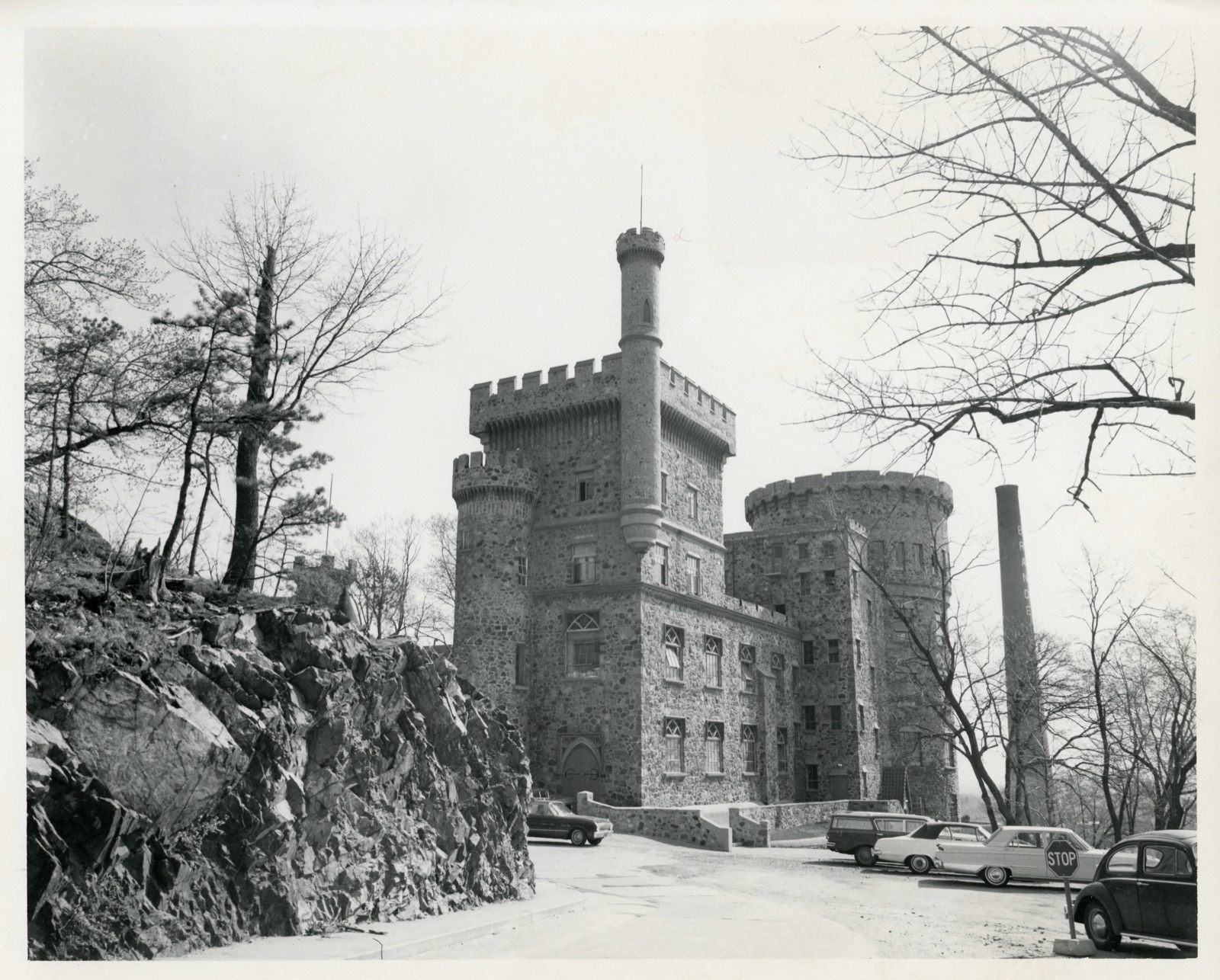
The Castle, built in the Norman-Gothic style in 1928, consists of six interconnected structures of varying heights,arranged to create an enclosed courtyard area. A seventh structure of three stories is located outside of this grouping, although sufficiently close (25') to appear a definite part of the total composition. Dr. John Smith, the architect, originally had plans to extend the complex by constructing a 5-story addition containing an auditorium and offices. Although World War II interrupted his plans, the fragmented wall from which this extension was to emerge is still evident. The Castle was built of fieldstone and quarried rock from Boston with green and red concrete blocks interspersed. The Castle's seven structural elements are identified by letter.
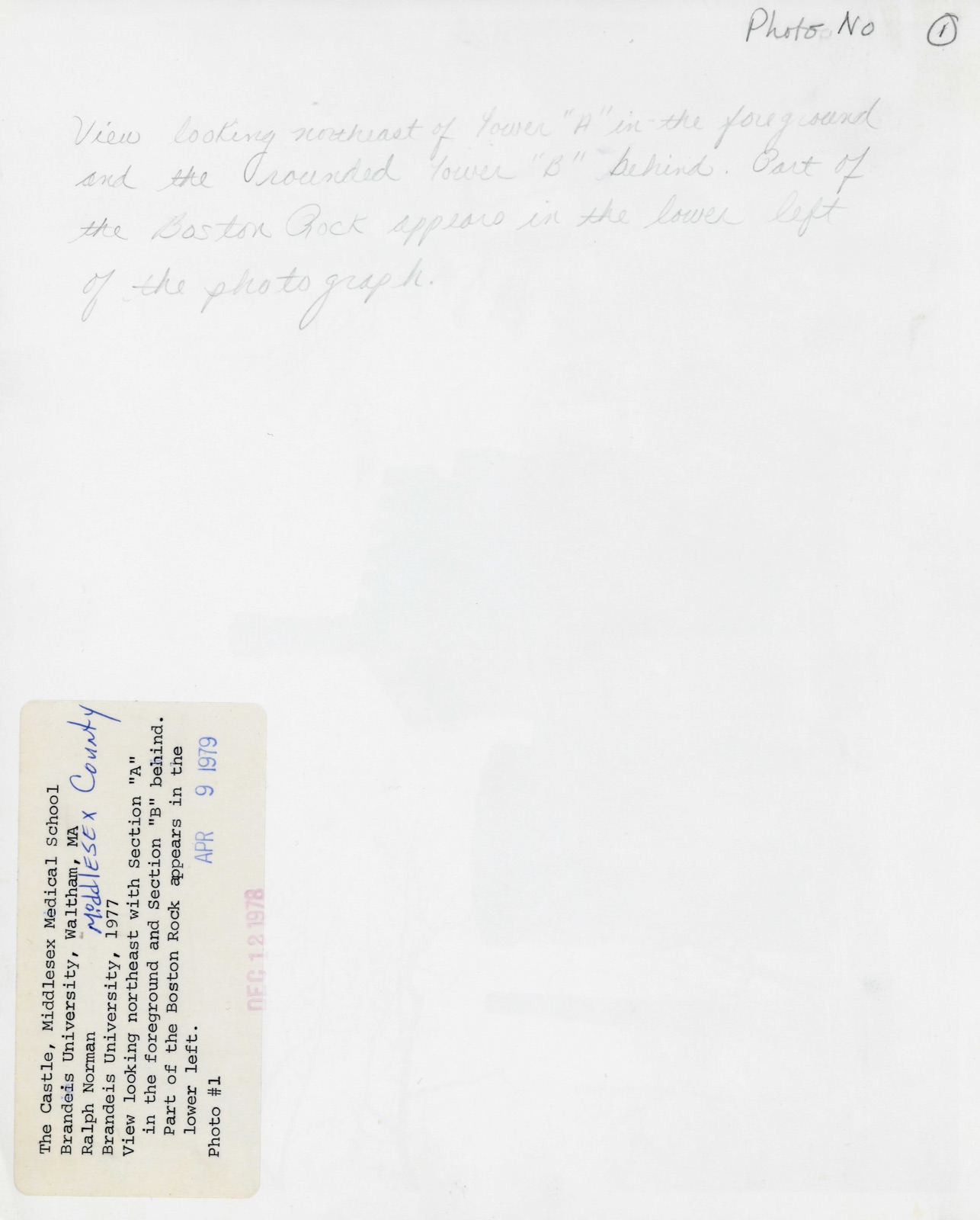
Section "A" is a four-story square tower reminiscent of Ireland's Lismore Castle. It is topped by a battlement. A circular stair tower projects from the north side of Section "A" while a bartizan is attached to its northwest corner. The ground level of "A" boasts an ornamented wooden entrance portal with a pointed arch. Fenestration on the first two floors consists of 6/3 awning sash with bar tracery in the transom. In the upper stories there is casement sash with fixed lights in the transom. The watch tower has a gothic window filled with glass block. Attached to Section "A" by a two-story and a five-story section, section "B" is a round five-story tower on the south-east of the complex. It is topped by a heavy corbelled battlement. Section "B" is connected to "C" by an arched bridge.
Section "C" is a two-story structure with Tudor arched windows between stepped buttresses. Section "D" is a round, two-story structure, similar to Britain's Windsor Castle in detail and proportión.
/ARCHITECT John H. Smith STATEMENT OF SIGNIFICANCE The Castle, a most unusual and historic bullding, was begun in 1928 by Dr. John Hall Smith, founder of the Middlesex Medical School. It was erected during a period of national austerity and Dr. Smith, a successful Boston surgeon, relied largely on personal funds. He purchased the 125 acre Baker Estate in Waltham, and established the Middlesex Medical School as the first non-quota, non-sectarian medical institution. This liberal philosophy evidently provoked some animosity from neighboring medical colleges and was probably the cause of Middlesex' precarious relationship with the American Medical Association. Finally, in 1945, the Middlesex Medical School could no longer meet the stringent American Medical Assoc. certification requirements.
Facing the immediate prospect of closing, school officials decided to pass its property and charter on to a group who in 1948 founded Brandeis University. The structure is one of two buildings on the Brandeis campus surviving from the former college. Dr. Smith had assumed the roles of designer,architect, and general contractor in order to bring the cost of building such an elaborate structure within reach. He economized in ingenious ways by acquiring many materials secondhand or even at no cost at all. Most of the fieldstone used in construction was removed from old stone walls which divided the grazing fields of the Baker Estate. Dr. Smith employed local labor and used second- hand windows and mechanical fixtures, bits of mosaic and painted decorations in the construction.
The Castle sits atop Boston Rock,one of the highest elevation points on the campus and in the entire Boston area. It was from this point that Colonel William Bradford was said to have first surveyed Boston in the mid-17th century.
Quoted from the National Register nomination
for reference 79000359, 19 pages, held by the National Archives in Record
Group 79. See the
catalogue record.
Listed places nearby
6 within 8 miles
Other National Register properties close
enough to walk or drive between, ordered by distance from this one. Both
positions come from the same geocoding pass that matched these properties
to their map sheets.
Listing record. National Park Service National Register of Historic Places, listed-properties dataset, current to 2026-05-22.
Map join. Address geocoded through the United States Census geocoder, then tested against the published boundary of every sheet in the USGS Historical Topographic Map Collection.
How this page is made. Listing fields come from federal records; map-sheet coverage is a labelled coordinate-to-boundary calculation, not a source-field claim.
Wildfire. Short, Karen C. 2022. Spatial wildfire occurrence data for the United States, 1992-2020 [FPA_FOD_20221014]. 6th Edition. Fort Collins, CO: Forest Service Research Data Archive. https://doi.org/10.2737/RDS-2013-0009.6 Collected with United States Government funding and usable without additional permissions or fees.
Specimens. Global Biodiversity Information Facility (GBIF), https://www.gbif.org/. Only records licensed CC0 or CC BY are used. Records licensed CC BY-NC are excluded because this site carries advertising. Images are checked individually and any whose licence is non-commercial, no-derivatives or unreadable is refused.
Mines and quarries. USGS Mineral Resources Data System (MRDS) https://mrdata.usgs.gov/mrds/ A work of the United States government, no copyright under 17 U.S.C. 105.
Storms. NOAA National Centers for Environmental Information, Storm Events Database https://www.ncei.noaa.gov/stormevents/ A work of the United States government, no copyright under 17 U.S.C. 105. Narratives are quoted verbatim from the National Weather Service report and are not edited or summarised.
 Block
Block