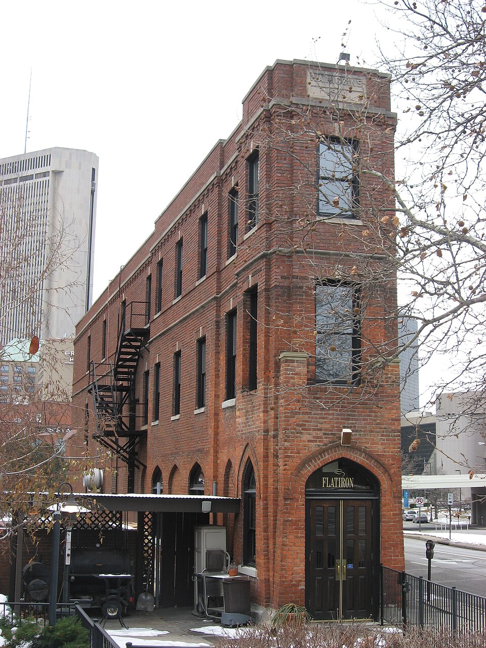
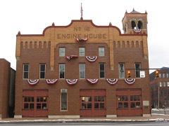
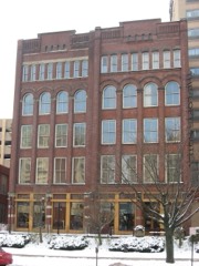
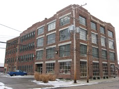
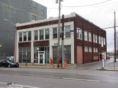
Built in 1914. Listed on the National Register of Historic Places in
1979. A historic map-sheet match is not published yet. The record needs a coordinate-quality review before it can be joined to a sheet boundary.
From the record
“Higgins Building, also known as the Flatiron Building, is a historic building in Downtown Columbus, Ohio. It was listed on the National Register of Historic Places in 1979 and Columbus Register of Historic Properties in 1984.”
Wikipedia article H.A. Higgins Building, CC BY-SA 4.0.
one of 295 National Register listings in Franklin County · listed in 1979 · category: Building · built in 1914 · one of 3 National Historic Landmarks in Franklin County.
National Register reference number.79001836- the number the National Park Service assigned this property when it was listed, and the key its nomination file is catalogued under at the National Archives.
What happened here
An account from the chapter on Columbus city, The inset identifies its exact
source book and publication year.
The Mound Builders and Indians - First White Settlements and Struggle for Possession - Indian Village at the Forks of the Scioto Attacked by Crawford and Dispersed - The Ohio Company, the Scioto Company and Symmes Purchase - Indian Power Broken and British Hopes Blasted - First Surveys - Topography, Geology and Soil of Franklin County.
The chapter on Columbus City in History of Franklin County [Ohio]:, published 1858 names Columbus. This is what it says, exactly as the scans read.
From the first organization of the State government in 1803, until 1816, there was no permanent seat of State government. The sessions of the Legislature were held at Chillicothe until 1810, and the sessions of 1810-11, and 1811-12, were held at Zanesville, and from thence they were removed back to Chillicothe, and there remained until December, 1816, when the first session commenced in Columbus.
No further definite action, however, was had on the subject until February, 1812, when the law was passed establishing it at Columbus. Various proposals were received, offering inducements for its establishment at different points, and amongst the rest were the proposals of Lyne Starling, James Johnston, Alexander McLaughlin and John Kerr, for establishing it on the '-' high bank of the Scioto River, opposite Franklinton," which site was principally a native forest. Franklinton was then at its apex, and a town of considerably more consequence than it now is, and was one of the sites proposed ; but the plan upon which it was laid out, and more particularly its low situation, were considered sufficient objections to its adoption. Worthington and Delaware were also among the sites proposed.
Regional context, not property-specific
evidence. The
federal wildfire occurrence database
lists 1 fire within 5 miles of Higgins, H. A., Building between
2011 and 2011, burning about 0 acres in total. None started naturally. None was recorded as arson.
Distance is straight-line from the map coordinates, so a fire counted
here may appear on a neighbouring settlement's page as well.
Reported cause
Fires
Missing data/not specified/undetermined
1
The most recent of
them, most recent first, with the day each was reported and the service
that recorded it.
Regional context, not property-specific
evidence. Museums hold 9,877 specimens
collected within 10 miles of Higgins, H. A., Building between 1804 and
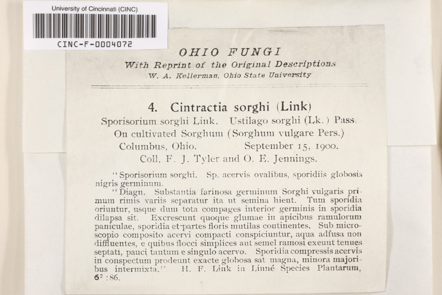
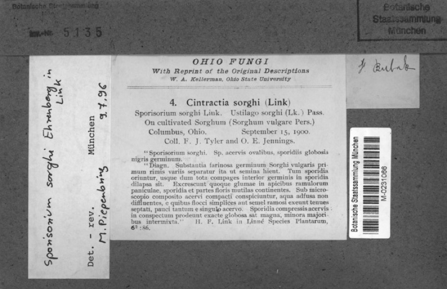
1975: 7,904 Animalia, 1,269 Fungi, 559 Plantae, 117 Chromista, 27 Unrecorded, 1 Protozoa. 12 distinct Species records are shown.
Collected by 19 V 1938 in original publication, Knull, =, ? and others. Each is a
physical object with a catalogue
number, and each entry opens the museum's record. This is what was
collected and kept, not a survey of what lives here - nothing can be
concluded from a species being absent.
Regional context, not property-specific
evidence. The federal mineral resources record lists
4 workings within 5 miles of Higgins, H. A., Building: 2 past producers, 2 plants.
2 still produce. What was taken out: Sand and Gravel, Construction, Sand and Gravel, Construction, Stone, Crushed/Broken, Zinc, Sulfur, Sulfuric Acid. Distance is straight-line from the
map coordinates, so a quarry counted here may appear on a neighbouring
settlement's page as well.
Regional context, not property-specific
evidence. The National Weather Service names
Columbus, the town this property stands in, in 107 storm reports between 1993 and 2026: 56 thunderstorm wind, 26 hail, 13 flash flood, 11 flood.
The reports record 9 injuries. Each account below is quoted exactly as the forecast office
filed it, from the NOAA Storm Events Database, and each date
opens the federal record of that event.
Trees were downed, some on power lines. Four golfers were injured after lightning struck the shelter house they entered to take shelter from the storm.
Trees were downed at several locations. Winds were measured at 59 mph at Port Columbus Airport. Four men were injured at an outdoor amphitheater when the tent they occupied was blown over.
A microburst, with winds estimated to be between 80 and 100 mph, struck the west side of Columbus, destroying roofs of two industrial buildings. The debris from the roofs stretched 600 yards. A tractor-semitrailer was also blown over, injuring one male.
Damage was first observed on Deserette Court. The west-facing|side of several housing units had shutters torn off and also|experienced minor siding damage. This is where it appears the|tornado first touched down.||On the opposite side of Deserette Court, additional shutter and|siding damage was observed, and primarily affected the east-facing|side of the housing units.||Damage continued to the east onto Boyleston Boulevard, with the|garage door of one home completely destroyed and walls of the|garage experiencing significant damage. Siding and roof damage was|also observed on this home, and damage is assessed to be in the|EF0 category, with winds around 80 mph. An eyewitness also stated|that she was looking west and saw a tornado moving toward|Boyleston Boulevard.||A swath of damage continued to the east, affecting homes along|Niantic Drive and Hingham Lane. Much of the damage was associated|with trees, where large tree branches in the back yards of|several homes on both Niantic Drive and Hingham Lane were snapped.|A convergent pattern was observed from 10 to 12 inch diameter tree|branches. Some damage to homes was also observed, including a|large portion of siding being stripped off the east-facing side of|a two story home. Minor roof damage was also noted on several|homes.||Damage became more sparse further east along Hingham Lane and was|confined to a few large hardwood tree branches being snapped off.
Two to three feet of water on some roads submerged some cars and caused others to float. On Leonard Street and 5th Avenue, a foot of water was entering the main level of some homes.
Roofing materials were removed from several buildings, a gutter was blown down, power lines were downed, and fencing was partially blown over in northeastern Columbus due to damaging thunderstorm winds. These winds also blew a large tree down onto a house on Schleppi Road.
10 papers published in this town,
digitised by the Library of Congress and free to read: 0 issues,
0 pages. Every page is searchable, so a name or a street can be
looked for directly in what the town printed about itself at the time.
No historic map-sheet match is published
for this property yet. That does not mean no map exists. This record needs
a coordinate-quality review before it can be joined to a sheet boundary.
Browse the county's mapped places while that work is
pending.
From the nomination file
1,336 words on record
When this property was proposed for the
National Register, someone wrote the case for it: what the building is,
and why it matters. That document is a federal record in the public domain.
It is quoted below word for word, never summarised. The text was read off the scanned case file by machine, so the
occasional stray character is the recogniser's and the 1970s
typewriter's.
Description of the property
Architecturally unique in Columbus, the Flatiron Building is named for its by a parapet. The building is small in scale. At one time, it was surrounded by large CONDITION UNEXPOSED EXCELLENT facade. UNALTERED RUINS CHECK ONE double hung windows are used elsewhere.Light colored stone is employed nineteenth century brick warehouses.Some have been demolished recently.
for the beltcourse, keystones, window sills and parapet coping.A stone three stories in height.The roof is flat and built up.It is surrounded building, which measures approximately eight feet at the east elevation, twenty five feet at the west elevation and thiry five feet in length, rises XALTERED - DETERIORATED triangular shape.It is constructed of brick on a stone foundation.The The entrance is located on the east elevation.It is in the shape ofa plaque which reads "H.A.Higgins 1914"is located in the parapet on the AREAS OF
Statement of significance
quite simple in design, the details such as the stone beltcourses and a well known local entrepeneur in 1914. Higgins' bar was located on 1400-1499 1700-1799 1800-1899 LAW RELIGION EDUCATION ARCHEOLOGY-HISTORIC SCIENCE ART BUILDER/ARCHITECT AGRICULTURE PERIOD THEATER SIGNIFICANCE _ENGINEERING CONSERVATION little structure. MILITARY quite handsome.
INDUSTRY _POLITICS/GOVERNMENT LITERATURE ARCHEOLOGY-PREHISTORIC number of these buildings have been lost.The Flatiron Building is _COMMUNICATIONS XARCHITECTURE keystones and the brickwork around the first floor windows are The area where the building is located was once filled with brick The Flatiron Building is significant as the only example of this fortunate to have new owners that plan to preserve this remarkable were designed as efficiency apartments. _TRANSPORTATION -SCULPTURE X1900- designed to fit the pie-shaped lot on which it is located.Although _PHILOSOPHY -1600-1699 -1500-1599 -COMMERCE - MUSIC the first floor along with a grocery in the rear.
The upper floors INVENTION type of building in the city.It is diminutive in scale and was The building was designed and built by Herbert Aloysius Myrt" Higgins, 9
Quoted from the National Register nomination
for reference 79001836, 13 pages, held by the National Archives in Record
Group 79. See the
catalogue record.
Listed places nearby
6 within 8 miles
Other National Register properties close
enough to walk or drive between, ordered by distance from this one. Both
positions come from the same geocoding pass that matched these properties
to their map sheets.
Listing record. National Park Service National Register of Historic Places, listed-properties dataset, current to 2026-05-22.
Map join. Address geocoded through the United States Census geocoder, then tested against the published boundary of every sheet in the USGS Historical Topographic Map Collection.
How this page is made. Listing fields come from federal records; map-sheet coverage is a labelled coordinate-to-boundary calculation, not a source-field claim.
Wildfire. Short, Karen C. 2022. Spatial wildfire occurrence data for the United States, 1992-2020 [FPA_FOD_20221014]. 6th Edition. Fort Collins, CO: Forest Service Research Data Archive. https://doi.org/10.2737/RDS-2013-0009.6 Collected with United States Government funding and usable without additional permissions or fees.
Specimens. Global Biodiversity Information Facility (GBIF), https://www.gbif.org/. Only records licensed CC0 or CC BY are used. Records licensed CC BY-NC are excluded because this site carries advertising. Images are checked individually and any whose licence is non-commercial, no-derivatives or unreadable is refused.
Mines and quarries. USGS Mineral Resources Data System (MRDS) https://mrdata.usgs.gov/mrds/ A work of the United States government, no copyright under 17 U.S.C. 105.
Storms. NOAA National Centers for Environmental Information, Storm Events Database https://www.ncei.noaa.gov/stormevents/ A work of the United States government, no copyright under 17 U.S.C. 105. Narratives are quoted verbatim from the National Weather Service report and are not edited or summarised.
 Block
Block