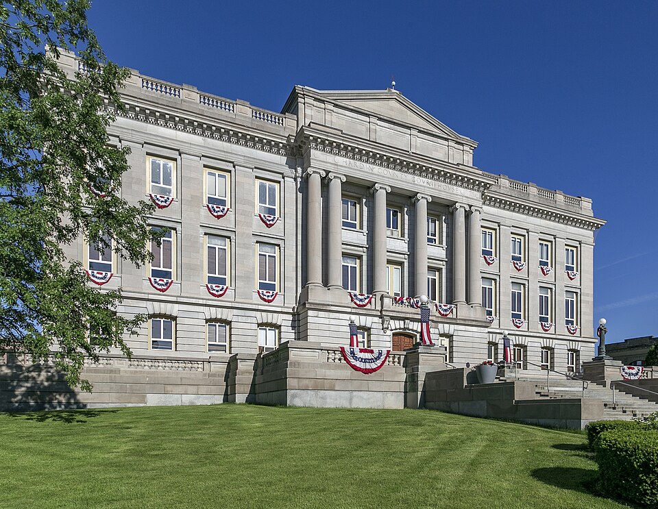
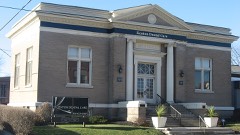
Built in 1915 in the Neoclassical architecture. Listed on the National Register of Historic Places in
1979. A historic map-sheet match is not published yet. The record needs a coordinate-quality review before it can be joined to a sheet boundary.
From the record
“The Hardin County Courthouse is one of Ohio's courthouses. Located in Kenton, Ohio, United States, it was completed in 1915 at a cost of $275,000.”
Wikipedia article Hardin County Courthouse (Ohio), CC BY-SA 4.0.
one of 3 National Register listings in Hardin County · listed in 1979 · category: Building · built in 1915, Neoclassical architecture, by Richards, McCarty & Bulford.
National Register reference number.79001863- the number the National Park Service assigned this property when it was listed, and the key its nomination file is catalogued under at the National Archives.
The ground it stands on
23,391 words
The chapter on Pleasant Township in The History of Hardin County, Ohio, published 1883 names Kenton. This is what it says, exactly as the scans read.
JACOB FOBBING, manufacturer, Kenton, was born near Fort Wayne, Ind., September 19, 1841. He lived in his birthplace until the breakingout of the war, when, in September, 1881, he enlisted in Company E, Tliirtieth Indiana Volunteer Infantry. He enlisted as Sergeant and seiwed three years, participating in the engagements at Pittsburg Landing, Shiloh, Triune, Stone River and Chickamauga, in which latter battle he was wounded and confined for six weeks in a hospital at Nashville, Tenn. After a furlough of sixty days, he rejoined his troops and was in the battles of Chattanooga, Atlanta, Resaca and all the engagements of the Atlanta campaign. Returning to Indiana, he followed his trade of carpenter and builder in Fort Wayne, coming to Ada, Ohio, in 1869. The same year he became associated with the Young Brothers in the scroll and lumber business, the firm dissolving in 1873, after which he came to Kenton and built a mill, carrying it on in partnership with his brother Peter for three years. The building was destroyed by fire, and Mr. Forbing then erected his present mill, in which he has since been successfully engaged. He employs on an average a force of twenty men, the work all being sawed from black walnut, for chair stock, and shipped wholly to the Eastern markets. Mr. Forbing was married in Fort Wayne, Ind. , February 14, 1865, to Miss Anna M., daughter of George J. find Anna M. Young. She was born in Allen County, Ind., and has reared a family of six children, viz. : Irvin, Cecilia, Earl B, A., Guy, John W. and Leo V. Mr. Forbing has also an adopted daughter, Addie. The family belong to the Catholic Church. Mr. Forbing has filled the office of City Councilman for two terms, and is one of the progressive citizens of Kenton, thoroughly identified with the interests of Hardin County.
E. K. GEAVELL, carriage manufacturer, Kenton, was born in Upper Sandusky, Ohio, in 1848. He is a son of Thomas and Mary (Keyes) Gravell (both deceased), natives of Pennsylvania, who came to Ohio in 1842, settling in Upper Sandusky. In 1864, when fifteen years of age, our subject enlisted in the ranks of the Union army as private in Company A, One Hundred and Forty- fourth Ohio Volunteer Infantry, in the four months' service. Serving this call, he again enlisted in Company I, of the One Hundred and Ninety-first Eegiment, serving to the close of the war. He participated only in the engagement at Perry vi lie, the regiment prefer-, ring detailed service most of the time. At the close of the war, our subject learned the trade of blacksmith. In 1871, he established business in Kenton, under the firm name of Schrader & Gravel 1, and was located on the corner of Ohio and Maine streets. This firm built up a large trade, and were the most extensive manufacturers of light work, but were obliged to succumb to the hard times of ' 1874, when they dissolved. Mr. Gravell, by dint of energy and perseverance, rented a fire of Magoy and began ironing some work, commencing at the forge himself. His brother O. E. came to Kenton at this time and assisted him in his work, soon becoming proprietor of a new establishment, our subject continuing in work for him. O. E. Gravell subsequently removed to Bucyrus, and E. K. Gravell succeeded him in the business. He occupied his present premises in 1875, which was then an old livery stable, occupying one -half of the present building, which was erected in 1880. The building is two stories high, the upper floor being used for painting and trimming. Here he carefully superintends all the work, and is making a specialty of spring wagons. In 1876, Mr. Gravell was married to Miss Letty Einehart, a native of Hardin County, and who died in 1878, after one year and a half of wedded life. She was a daughter of Adam E. Einehart, who was a pioneer of Hardin County. Mr. Gravell chose for his second wife Miss Jennie Maddux, to whom he was married June 6, 1883. She is a native of Upper Sandusky, Ohio, and only child of the late Henry Maddux, who, in his lifetime, was a prominent attorney of Upper Sandusky, and one of the most substantial business men of that State. Mr. Gravell is among the active business men of Kenton.
Regional context, not property-specific
evidence. The
federal wildfire occurrence database
lists 7 fires within 5 miles of Hardin County Courthouse between
2002 and 2002, burning about 3 acres in total. None started naturally. None was recorded as arson.
Distance is straight-line from the map coordinates, so a fire counted
here may appear on a neighbouring settlement's page as well.
Reported cause
Fires
Recreation and ceremony
3
Missing data/not specified/undetermined
2
Debris and open burning
1
Equipment and vehicle use
1
The most recent of
them, most recent first, with the day each was reported and the service
that recorded it.
Regional context, not property-specific
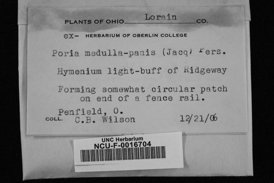
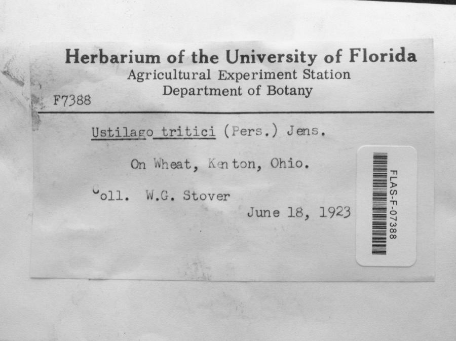
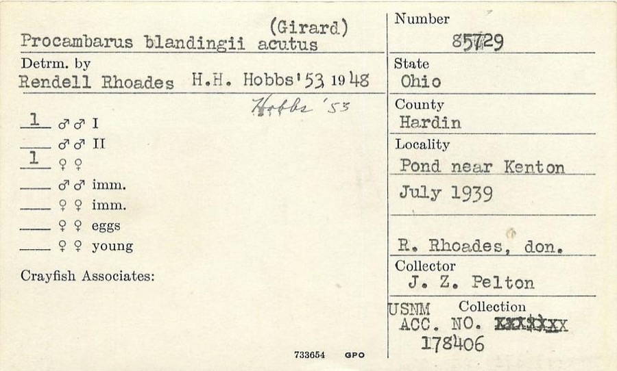
evidence. Museums hold 150 specimens
collected within 10 miles of Hardin County Courthouse between 1882 and
1973: 129 Animalia, 20 Fungi, 1 Plantae. 12 distinct Species records are shown.
Collected by ?, Angle, E. (Eric), Anson A. Hinkley and others. Each is a
physical object with a catalogue
number, and each entry opens the museum's record. This is what was
collected and kept, not a survey of what lives here - nothing can be
concluded from a species being absent.
Regional context, not property-specific
evidence. The federal mineral resources record lists
1 working within 5 miles of Hardin County Courthouse: 1 past producer.
None of them still produces. What was taken out: Limestone, General. Distance is straight-line from the
map coordinates, so a quarry counted here may appear on a neighbouring
settlement's page as well.
Regional context, not property-specific
evidence. The National Weather Service names
Kenton, the town this property stands in, in 58 storm reports between 1994 and 2026: 29 thunderstorm wind, 11 flood, 10 hail, 3 flash flood.
The reports record 1 death. Each account below is quoted exactly as the forecast office
filed it, from the NOAA Storm Events Database, and each date
opens the federal record of that event.
The tornado first touched down in the vicinity of west Espy Street and Robinson Avenue. Some minor tree limb damage was noted, with some sheet metal damage to buildings in this area, including roof damage to one structure between west Espy Street and U.S. Route 68. Damage was more significant and concentrated in a neighborhood near Detroit Street and Main Street, especially between Railroad Street and Letson Street. Numerous trees and large limbs were downed and numerous homes and garages had at least some minor roof or fascia damage. The winds were likely the strongest just north of Letson Street, where one garage was flattened and another outbuilding had its roof and second floor removed. Debris from these structures could be found at least a quarter mile downstream. Winds at this location were estimated to be about 90 mph. Additional tree damage and minor structural damage was noted on the east side of Main Street, extending from near the Hardin County Sheriff's Office through Brumm Street.||Additional tree damage was observed on the north side of the Scioto River, near and south of Lick Street. This includes one grove of trees south of the end of Stevens Street, with several tree tops snapped off. The tornado then traversed an uninhabited area but minor tree damage was noted near the intersection of Bales Road and County Road 175. In addition, small pieces of insulation were found near this intersection and in the field to the east. This is where the tornado ended.
The first tornadic damage was observed at the Hardin County Fairgrounds, just south of County Road 140, where minor roof damage occurred. Several wooden power poles were damaged and snapped in half. On the northern side of the fairgrounds, a hardwood tree was snapped and a building sustained a major loss of its metal roofing panels. An additional building had its concrete block siding blown out, which caused a partial roof collapse. An open-ended barn structure was lifted, causing the support poles to be lifted and shifted. The final damage associated with this tornado was on the eastern side of the fairgrounds, where additional power poles were snapped and minor roof damage was observed to fairground buildings.
Numerous trees and large trees were downed due to damaging thunderstorm winds. Some of the trees fell on cars. Siding was reported off some of the homes in the area.
Numerous trees and power poles were downed on the northeast side of Kenton due to thunderstorm winds. Shingle and other roof damage occurred to a church.
A couple of trees and power lines were reported down in the area due to thunderstorm winds. A power pole was also blown over along State Route 31 south of Route 190.
Numerous trees and powerlines were downed across the town, including several that fell on houses and vehicles. Seventeen streets were blocked by fallen trees.
Numerous roads were underwater during the event due to heavy rain and previous snow melt. Flooding began around 0811 EST on February 28th and ended around 1100 EST on March 1st. Damages estimates from February were around five-thousand dollars.
Numerous roads were underwater during the event due to heavy rain and previous snow melt. Flooding began around 0811 EST on February 28th and ended around 1100 EST on March 1st. Damage estimates from March were around five-thousand dollars.
No historic map-sheet match is published
for this property yet. That does not mean no map exists. This record needs
a coordinate-quality review before it can be joined to a sheet boundary.
Browse the county's mapped places while that work is
pending.
From the nomination file
4,611 words on record
When this property was proposed for the
National Register, someone wrote the case for it: what the building is,
and why it matters. That document is a federal record in the public domain.
It is quoted below word for word, never summarised. The text was read off the scanned case file by machine, so the
occasional stray character is the recogniser's and the 1970s
typewriter's.
Description of the property
the center of the building. Three netal chandeliers hang from the skylight. Murals DESCRIPTION OVED DETERIORATED Doric pilasters separate the seven bays on the north and south sides. The end four entrances on the east and west side of the first floor have bracketed projecting archi- The main The brick terraces at the entrance way are enclosed by stone balusters end pediment. The dentils that are part of the entablature design encircle the building. Windows on this floor have segmental arches first floor,has coffering from the pilasters to the pillars surrounding the central well.
symmetrical with the east and west sides identical and the north and south sides identical Indians and whites meeting.The murals were done by the Schachne Studios of Dayton; they Each of the three floors on the interior is different although all have ilasters.The coffered ceiling has the coffers much closer together than on the other allway have composite capitals with festoons or swegs used on the frieze between the There are large wood double exterior doors to the building on the cast and west sides. There is a skylight in the court room and a large leaded architecture in the early twentieth century.
Third= NATIONAL REGISTER OF HISTORIC PLACES INVENTORY - NOMINATION FORM PATE ENTERED , Hardin County, Ohio ITEM NUMBER building terrace and entrance ways, patch and repair the stone nnits, and waterproof the columns support a three-part entablature with a frieze and dentil work. The stairway to the third floor is on the cast side of the building end is very incon- NATIONAL PARK SIRVICE a vood balustrade. (sandblast) the exterior of the building, repoint and patch the masonry, repoint the with ashlar stone pillars with composite capitals around the well.The pillars and Recent repairs on the building have been well-cocunented by the commissioners.
special election in May 1912. Service Office, a Veterans Hall on the north end, and a Daughters of the Anerican And all the hopes that free souls prize For weal or woe betide COMMUNICATIONS PHILOSOPHY MILITARY TRANSPORTATION SCULPTURE have quarters on the third floor. XPOLITICS/GOVERNMENT ART LITERATURE LAW 1700-1799 MUSIC THEATER OTHER (SPECIFY) RELIGION Are building with thee there. RCHITECTURE Upon that cherished square. SPECIFIC DATES We watch thy massive walls arise 1913-1915 in Hardin County was built in 183h and the second in 1880; both kere located on this PREHISTORIC 1400 1499 Vomissioners decided to build a new court "and when Revolution Relic Room at the northwest corner.
Thou art of us, and what in thee _ INVENTION ENGINEERING The second floor houses the Auditor, 1800-1899 EXPLORATION/SETTLEMENT SCIENCE ECONOMICS Eliza Wallace Durbin once wrote a poen to the new court house: ATION Ohio's Covemor Janes NATIONAL PARK SERVICE NATIONAL REGISTER OF HISTORICPLACES INVENTORY -- NOMINATION FORM CONTINUATION SHEET when crime goes up thy; stately stair That he who leaves they door, May greed within thy splendid halls Thou art of us, faith cong'ring fears, No bias save sweet mercy's plea, Shrink in their grandeur's sweep Hay self to hiding creep. Into her balance throw But strong to pay life's score. And justice waiting calmly there, Ve build ourselves in thee; DATE ENTERED May rancor stay below; And shamed.
by love built in thy walls "'Their souls were high, and frce." PAGE May go,not filled with hate toward thee Take thou this message to the years, Shall mark for Hardin's sons to be VERBAL BOUNDARY DESCRIPTION 1
Quoted from the National Register nomination
for reference 79001863, 53 pages, held by the National Archives in Record
Group 79. See the
catalogue record.
Listed places nearby
1 within 8 miles
Other National Register properties close
enough to walk or drive between, ordered by distance from this one. Both
positions come from the same geocoding pass that matched these properties
to their map sheets.
Listing record. National Park Service National Register of Historic Places, listed-properties dataset, current to 2026-05-22.
Map join. Address geocoded through the United States Census geocoder, then tested against the published boundary of every sheet in the USGS Historical Topographic Map Collection.
How this page is made. Listing fields come from federal records; map-sheet coverage is a labelled coordinate-to-boundary calculation, not a source-field claim.
Wildfire. Short, Karen C. 2022. Spatial wildfire occurrence data for the United States, 1992-2020 [FPA_FOD_20221014]. 6th Edition. Fort Collins, CO: Forest Service Research Data Archive. https://doi.org/10.2737/RDS-2013-0009.6 Collected with United States Government funding and usable without additional permissions or fees.
Specimens. Global Biodiversity Information Facility (GBIF), https://www.gbif.org/. Only records licensed CC0 or CC BY are used. Records licensed CC BY-NC are excluded because this site carries advertising. Images are checked individually and any whose licence is non-commercial, no-derivatives or unreadable is refused.
Mines and quarries. USGS Mineral Resources Data System (MRDS) https://mrdata.usgs.gov/mrds/ A work of the United States government, no copyright under 17 U.S.C. 105.
Storms. NOAA National Centers for Environmental Information, Storm Events Database https://www.ncei.noaa.gov/stormevents/ A work of the United States government, no copyright under 17 U.S.C. 105. Narratives are quoted verbatim from the National Weather Service report and are not edited or summarised.
 Block
Block