BlockBefore
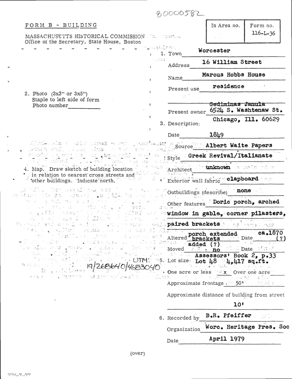
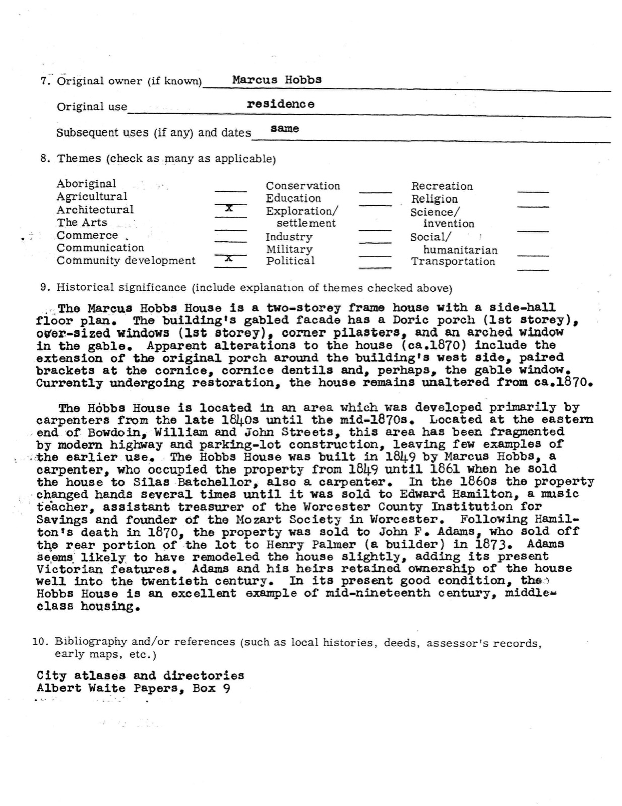
Hobbs, Marcus, House, photograph from the federal nomination

Photographs from the nomination case file, National Park Service records.

Hobbs, Marcus, House

Listed on the National Register of Historic Places in 1980. A historic map-sheet match is not published yet. The record needs a coordinate-quality review before it can be joined to a sheet boundary.

From the record

“A respected fellow-townsman, whose memory of Blackstone Village dates back to the year 182u, gives the following description of it as it was at that date. A street, corresponding to our present Main Street, crossed the mill-trench to the north of the site of the iron bridge, passing through the lower ground.”

History of Worcester County, Massachusetts (1889). Machine-read text.

one of 500 National Register listings in Worcester County · listed in 1980 · category: Building · one of 1 National Historic Landmarks in Worcester County.

Sources: the county history on the Internet Archive · the case file at the National Archives · the National Register database, National Park Service

The listing

  • What is counted as historic. The nomination lists 1 building as contributing to the listing.
  • Address. 16 William St., Worcester, 01609
  • When was it listed? 1980-03-05
  • Category. building
  • Also known as. Worcester MRA
  • Township. Worcester city
  • National Register reference number. 80000582 - the number the National Park Service assigned this property when it was listed, and the key its nomination file is catalogued under at the National Archives.

What happened here

An account from the chapter on Worcester city, The inset identifies its exact source book and publication year.

From History of Worcester County, Massachusetts, published 1889 - Worcester City

History Op W0R0E3Ter County, Massachusetts

of war, generally proved faithful to the English, and their services as scouts were invaluable. Among these none deserves better to be honored in Lancaster story than James Wiser, alias Quanapaug or Quanapohit, whose courage and fidelity would have saved the town from the massacre of 1676, had not his timely warning been unwisely discredited by the apparently lethargic Governor and his slumberous Council.

Read the rest of this passage

The ground it stands on

920,394 words

The chapter on Worcester City in History of Worcester County, Massachusetts : with Biographical Sketches of Many of Its Pioneers and Prominent Men., published 1889 names Worcester. This is what it says, exactly as the scans read.

The business of Isaiah Thomas as printer and publisher in Worcester had become of considerable consequence. The Kev. Peter Whitney stated that no person had added more to the consequence and advantages of the town and county of Worcester than Isaiah Thomas. The publishing of the Spy was only a part of his business. After the war, in 1788, he conducted a printing-office in Boston and in Worcester, and carried on a large business as printer, publisher, bookseller and bookbinder.

Passage source: History of Worcester County, Massachusetts : with Biographical Sketches of Many of Its Pioneers and Prominent Men., published 1889.

It was here at this mill that Mr. Zenas Crane, a native of Dorchester, toiled at the trade of papermaking for several years previous to the summer of 1799, when he set out from Worcester to establish, in company with Henry Wiswell and Daniel Gilbert, a paper-mill in the western portion of Massachusets, and succeeded so admirably in laying the foundations for a business that, through the careful and skillful management of Mr. Crane and his descendants, has assumed the most flattering proportions, and whose trade-marks, known as " The Old Berkshire," " Old Bed Mill," "Pioneer Mill" and "Government Mill," stand for as good an article of paper as can be found in this country or perhaps any other.

Passage source: History of Worcester County, Massachusetts : with Biographical Sketches of Many of Its Pioneers and Prominent Men., published 1889.

Machine-read from a century-old scan, so expect the errors a machine makes: misspelled names, dropped words, stray characters.

Read the whole chapter on Worcester City - 920,394 words on its settlement, mills, schools and churches.

Fires near this property

63 since 2015

Regional context, not property-specific evidence. The federal wildfire occurrence database lists 63 fires within 5 miles of Hobbs, Marcus, House between 2015 and 2020, burning about 56 acres in total. None started naturally. 8 were recorded as arson. Distance is straight-line from the map coordinates, so a fire counted here may appear on a neighbouring settlement's page as well.

Reported cause Fires
Debris and open burning23
Smoking11
Missing data/not specified/undetermined9
Recreation and ceremony9
Arson/incendiarism8
Railroad operations and maintenance1
Power generation/transmission/distribution1
Equipment and vehicle use1

The most recent of them, most recent first, with the day each was reported and the service that recorded it.

DateCause SizeReported by Name on the report
3 September 2018Debris and open burningunder an acreMassachusetts Bureau of Forest Fire Controlnot named
14 September 2016Debris and open burningunder an acreMassachusetts Bureau of Forest Fire Controlnot named
13 August 2020Missing data/not specified/undeterminedunder an acreMassachusetts Bureau of Forest Fire Controlnot named
24 July 2018Debris and open burningunder an acreMassachusetts Bureau of Forest Fire Controlnot named
21 July 2020Smokingunder an acreMassachusetts Bureau of Forest Fire Controlnot named
5 June 2020Debris and open burningunder an acreMassachusetts Bureau of Forest Fire Controlnot named
26 June 2016Recreation and ceremonyunder an acreMassachusetts Bureau of Forest Fire Controlnot named

Every fire recorded in Worcester County

Specimens collected near this property

12 of 1,700 shown

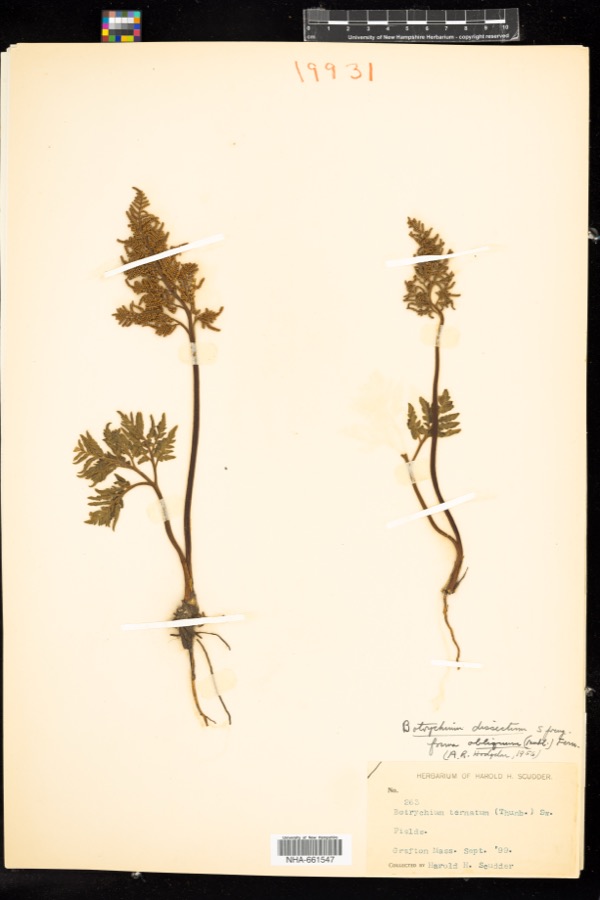
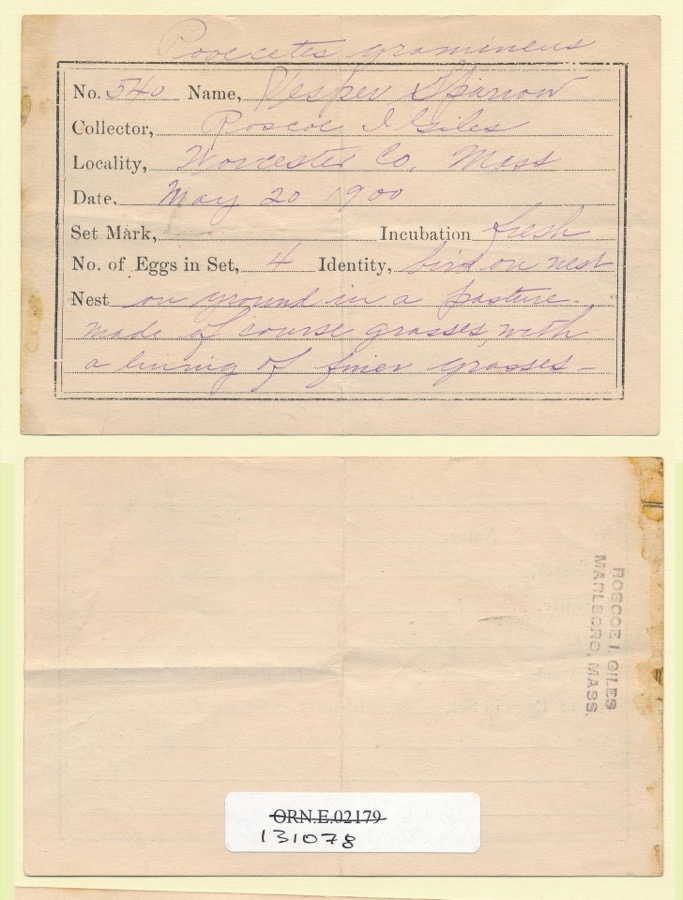
Regional context, not property-specific evidence. Museums hold 1,700 specimens collected within 10 miles of Hobbs, Marcus, House between 1839 and 1974: 972 Plantae, 437 Animalia, 268 Fungi, 15 Unrecorded, 6 Protozoa, 2 Chromista. 12 distinct Species records are shown. Collected by A E WOODHEAD, A. A. Eaton, A. B. Seymour and others. Each is a physical object with a catalogue number, and each entry opens the museum's record. This is what was collected and kept, not a survey of what lives here - nothing can be concluded from a species being absent.

Image SpeciesYear Collected by Where, as recorded
Specimen of Sceptridium dissectum (Spreng.) LyonSceptridium dissectum (Spreng.) Lyon1899H. H. Scudder
Specimen of Pooecetes gramineus gramineus (J.F.Gmelin, 1789)Pooecetes gramineus gramineus (J.F.Gmelin, 1789)1900Roscoe I. Giles
A photograph of the species Ochrolechia tartarea, not of this specimenOchrolechia tartarea (L.) A.Massal.1839E. Tuckerman
A photograph of the species Carex laxiflora, not of this specimenCarex laxiflora Lam.1840Thomas NuttallCambridge.
A photograph of the species Carex vestita, not of this specimenCarex vestita Willd.1840Thomas NuttallCambridge.
A photograph of the species Mycobilimbia hypnorum, not of this specimenMycobilimbia hypnorum (Lib.) Kalb & Hafellner1848E. Tuckerman
A photograph of the species Tamias striatus, not of this specimenTamias striatus lysteri (Richardson, 1829)1848L AgassizPARSONS ISLAND
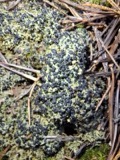
A photograph of the species Cladonia cornucopioides, not of this specimenCladonia cornucopioides F.Wilson1850J. L. RussellLeicester
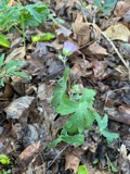
A photograph of the species Geranium maculatum, not of this specimenGeranium maculatum L.1850not recorded
A photograph of the species Packera aurea, not of this specimenPackera aurea (L.) Á.Löve & D.Löve1850not recorded
Elymus repens (L.) Gould1892Arthur B. SeymourCambridge.
Festuca pratensis Huds.1892Arthur B. SeymourCambridge.

All 1,700 specimens within 10 miles, at the Global Biodiversity Information Facility.

Mines and quarries near this property

10 within 5 miles

Regional context, not property-specific evidence. The federal mineral resources record lists 10 workings within 5 miles of Hobbs, Marcus, House: 6 past producers, 3 producers, 1 plant. 4 still produce. What was taken out: Sand and Gravel, Construction, Lead, Stone. Distance is straight-line from the map coordinates, so a quarry counted here may appear on a neighbouring settlement's page as well.

Where SiteCommodity StatusRecorded
Bd Bloomfield Co--Worcester, Ma.LeadPlant
Shrewsbury Trap RockStoneProducer
30 Southwest Cutoff PlantSand and Gravel, ConstructionProducer
Capa CorporationSand and Gravel, ConstructionPast Producer
F Ang G Sand and GravelSand and Gravel, ConstructionPast ProducerSedimentary
F and G PitSand and Gravel, ConstructionProducer
Sewall PitSand and Gravel, ConstructionPast Producer
Shrewsbury PitSand and Gravel, ConstructionPast Producer
Town of BoylstonSand and Gravel, ConstructionPast ProducerSedimentary
Worcester Sand and GravelSand and Gravel, ConstructionPast ProducerSedimentary

Every working recorded in Worcester County

Storms near this property

60 of 74 shown

Regional context, not property-specific evidence. The National Weather Service names Worcester, the town this property stands in, in 74 storm reports between 1994 and 2025: 36 thunderstorm wind, 11 flood, 10 flash flood, 9 hail. The reports record 9 injuries. Each account below is quoted exactly as the forecast office filed it, from the NOAA Storm Events Database, and each date opens the federal record of that event.

WhenEvent Place namedHarm What the report says
July 2006LightningWorcester9 hurtno account filed
May 1998Thunderstorm WindWorcester$10,000,000no account filed
August 1994Thunderstorm WindWorcester$500,000Trees were blown down near Rutledge/Granite/Loxwood Streets and insulation was torn from the roof of an apartment building and blown several hundred yards away. A microburst associated with a severe thunderstorm likely caused this damage.
August 2014Tornado (EF0)South Worcester$100,000A tornado touchdown occurred near the intersection of Perry Avenue and Fairfax Road. A narrow well-defined damage path extended past Saint Vincent Hospital to Gordon Street. The most significant damage was to trees, some of which were uprooted or snapped. Some trees landed on cars causing significant damage to the cars. A couple of trees landed on houses, but there was little structural damage to the houses. A few windows were broken by tree branches.
February 2016Thunderstorm WindWorcester$75,000Traffic light poles on Lincoln Street and Westland Street, trees on Pinecrest Drive, Sunny Hill Drive, and Hudson Street, a light pole on Millbrook Street, and numerous large tree branches on Russell Street, Crestland Circle, Paine Street, Sarrar Avenue, and Rexham Road were all downed by thunderstorm winds.
June 2008Thunderstorm WindWorcester$75,000The Automated Surface Observing System at Worcester Regional Airport (KORH) recorded a wind gust of 68 mph. Damage around Worcester was substantial. St. John's Cemetary was closed after 30 to 40 trees two and a half to three feet in diameter were downed by thunderstorm winds. In the midst of this there were also a number of gravestones that were knocked over or damaged in some other way. Other trees in the cemetary had their tops sheared off or were completely stripped of leaves. Numerous trees were downed across the city of Worcester. A garage door was blown out of a building on Pleasant Street and wind blown debris shattered several of the windows of a Sovereign Bank Branch. Four inch diameter branches were downed by these winds at the Worcester Polytechnic Institute. In addition, trees were downed in Leicester. Much of the damage information included here was taken from local newspaper articles. The newspaper didn't identify a specific time when the damage occurred; however, it is assumed from radar observations and ASOS observations that the bulk of the damage occurred around the time of this 68 mph wind gust.
July 2014Flash FloodWorcester$50,000Southgate, Bellevue, Austin, and Southbridge Streets were flooded and impassable. Grafton Street was flooded with 8 inches of water from Barclay Street to Interstate 290 with numerous manhole covers popped off. Harding Street and West Boylston Street were flooded with up to 8 inches of water. Cars were stuck in flood waters on Quinsigamond Avenue and Plantation Street. Numerous basements were flooded on Water Street. Several lanes of Interstate 290 were flooded at Lincoln Square.
June 2012LightningWorcester$45,000Lightning struck a tree on 4th Street in Worcester, igniting a fire to the house next to the tree. Six adults were displaced by the fire.
June 2008Thunderstorm WindWorcester$25,000Numerous trees and tree limbs were downed throughout Worcester, including on Salisbury Street. In addition, two utility poles on Route 122 were downed by thunderstorm winds.
July 2021Flash FloodSouth Worcester$20,000In Worcester, flash flood waters were up to car windshields on Dale Street.
July 2010LightningWorcester$20,000Lightning struck a power substation in Worcester Square, knocking out power to 27,000 people.
July 2006FloodWorcester$20,000Urban flood
June 2006Thunderstorm WindWorcester$20,000no account filed
February 2016Thunderstorm WindWorcester$15,000Multiple trees and wires were downed throughout Worcester.
August 2015Thunderstorm WindSouth Worcester$15,000Trees on Randolph Road, Monadnock Road, and Winifred Avenue were downed by thunderstorm winds.
June 2010Thunderstorm WindWorcester$15,000Trees and wires on Heard and Whipple Streets were downed by thunderstorm winds.
August 2015Thunderstorm WindSouth Worcester$10,000Trees on Burncoat, Mason, and King Streets were downed by thunderstorm winds.
August 2010LightningSouth Worcester$10,000Lightning struck a building on Gold Street, blowing out the electrical panels of the building and starting a small fire.
February 2008FloodWorcester$10,000Basements were flooded on North Fitzwilliam Road in Boylston. May and Flag Streets and Richmond Avenue were flooded in Worcester. In addition, the Western Worcester District Court was closed because of roof leaks caused by the heavy snow and rain. Chapel Street in Holden was closed due to flooding. Route 140 near Route 170 was flooded in Royalston. The Huckleberry Brook near Milford flooded over its banks. In addition, the Charles River at Dilla Street in Milford went over its banks. Champlain Street in Blackstone was closed due to flooding.
August 2006Thunderstorm WindWorcester$10,000no account filed
August 2002LightningWorcester$10,000no account filed
April 1995Thunderstorm WindWorcester$9,000The National Weather Service recorded a wind gusts to 64 mph at the Municipal Airport, where a mobile home was blown up against a fence. In Spencer, $9,000 worth of aluminum roof panels were blown off a building and two motor vehicles were damaged by the falling panels.
July 2021Flash FloodSouth Worcester$8,000In Worcester, five cars were stuck in flood waters at Dewey Street and Parker Street.
May 2020Thunderstorm WindWorcester$5,000Multiple trees were down across the city of Worcester. Law enforcement reported trees down on Maywood Street, Barnard Road, Revere Street, Perrot Street, Grafton Street, and Pioneer Road.
August 2020Flash FloodWorcester$5,000In Worcester, a car was stuck in flooding on the Rt 146 offramp to I-290. The Franklin St Train Bridge was impassable due to flash flooding.
March 2016Thunderstorm WindWorcester$5,000A tree on Mill Street in Worcester was downed onto wires by thunderstorm winds.
August 2016Thunderstorm WindWorcester$5,000Power lines on Johnson Street were downed by thunderstorm winds.
July 2016Thunderstorm WindWorcester$5,000Power lines on Burncoat Street were downed by thunderstorm winds.
July 2016Thunderstorm WindWorcester$5,000A tree on Russell Avenue was downed by thunderstorm winds.
August 2015Thunderstorm WindSouth Worcester$5,000A tree on Clarkson Street was downed by thunderstorm winds, blocking the street.
September 2015FloodSouth Worcester$5,000The Southgate Street underpass was flooded. A car was stuck in the floodwaters.
May 2012Thunderstorm WindWorcester$5,000Trees and wires on Sunny Hill Drive were downed by thunderstorm winds.
June 2011Thunderstorm WindWorcester$5,000Large branches on Columbus Street were downed by thunderstorm winds.
July 2008FloodWorcester$5,000Heavy rain resulted in street flooding on Southgate Street. One car was flooded out by these waters.
October 2006FloodWorcester$5,000Significant urban flooding was reported in and around Worcester.
July 2005Thunderstorm WindWorcester$5,000no account filed
June 2008Thunderstorm WindWorcester$3,000Sixteen inch diameter trees on the west side of town were downed by thunderstorm winds.
July 2008Thunderstorm WindWorcester$3,000Several three inch diameter branches and a tree on Bancroft Tower Road were downed by thunderstorm winds.
September 2025Thunderstorm WindWorcester$2,000In Worcester, trees were downed on Chandler St.
July 2019Thunderstorm WindWorcester$2,000Tree down on a car on Hooper Street in Worcester.
July 2002Thunderstorm WindWorcester$2,000no account filed
August 2021Thunderstorm WindSouth Worcester$1,300In Worcester, trees and wires were down on Ferdinand St.
June 2010Thunderstorm WindWorcester$1,000Large limbs and wires were downed by thunderstorm winds at Clark University in Worcester and along Route 20 in Auburn.
August 2008Thunderstorm WindWorcester$1,000Ten inch diameter limbs in the Salisbury area were downed by thunderstorm winds.
September 2025Thunderstorm WindWorcester$300In Worcester, a tree was down with partial road blockage.
June 2024Flash FloodSouth Worcester-In Worcester, Rt 20 near Grafton St was flooded with vehicles stranded in flood water.
July 2023Flash FloodWorcester-In Worcester, the area of 86 Southwest was flooded with 4 cars stuck in flood waters.
July 2023FloodWorcester-In Worcester, Franklin St by the railroad tracks was flooded.
July 2021Flash FloodSouth Worcester-In Worcester, Cambridge St from Quinsigamond Ave to McKeon Rd was closed due to urban flash flooding.
July 2021FloodSouth Worcester-In Worcester, a section of Grafton St was closed due to flooding. Report forwarded by amateur radio.
July 2021Flash FloodSouth Worcester-In Worcester, there was urban flash flooding at the intersection of Southbridge and Southgate Streets. Water was observed to be bubbling up out of manhole covers.
March 2020HailWorcester-Golf ball size hail was reported via amateur radio at 756 PM EST in Worcester. It began with dime size hail at 753 PM EST.
August 2020HailWorcester-In Worcester, quarter sized hail was reported.
August 2020FloodWorcester-In Worcester, Washington Square was flooded to an unknown depth.
July 2019FloodSouth Worcester-Flooding was reported on Armory Street in South Worcester with water flowing over the curb.
August 2019FloodSouth Worcester-In the southern portion of Worcester, the Southbridge Street exit ramp off of I-290 eastbound had substantial flooding at the bottom of the ramp.
July 2018Flash FloodWorcester-At 2:55 PM EST, heavy rain in Worcester brought street flooding to a depth of one foot at the intersection of Chandler Street and Murray Avenue.
July 2018Flash FloodWorcester-At 3:48 PM EST, heavy rain flooded Pelham Street in Worcester to a depth of three feet.
June 2017HailWorcester-At 318 PM EST, an amateur radio operator reported nickel-size hail at Worcester.
July 2008HailWorcester-Penny size hail fell near College of the Holy Cross and Vernon Hill Hospital.

Every storm recorded in Worcester County

Newspapers printed here

0 digitised pages

11 papers published in this town, digitised by the Library of Congress and free to read: 0 issues, 0 pages. Every page is searchable, so a name or a street can be looked for directly in what the town printed about itself at the time.

Map coverage status

No historic map-sheet match is published for this property yet. That does not mean no map exists. This record needs a coordinate-quality review before it can be joined to a sheet boundary. Browse the county's mapped places while that work is pending.

From the nomination file

799 words on record

When this property was proposed for the National Register, someone wrote the case for it: what the building is, and why it matters. That document is a federal record in the public domain. It is reproduced in full on its own page, word for word and never summarised. The text was read off the scanned case file by machine, so the occasional stray character is the recogniser's and the 1970s typewriter's.

The whole case file for this property - 799 words, 5 pages, reproduced complete.

Quoted from the National Register nomination for reference 80000582, 5 pages, held by the National Archives in Record Group 79. See the catalogue record.

Listed places nearby

6 within 8 miles

Other National Register properties close enough to walk or drive between, ordered by distance from this one. Both positions come from the same geocoding pass that matched these properties to their map sheets.

Photograph PropertyDistance Listed
Cobb, George, Houseunder 500 feet1980
Doran, Thomas F., Three-Deckerunder 500 feet1990
Bannister, Emory, Houseunder 500 feet1980
Lincoln, Gov. Levi, House0.1 miles1980
Hastins, John, Cottage0.1 miles1980
Davis, Joseph, House0.1 miles1980

Sources for this property

National Archives recordThe nomination case file for reference 80000582 in Record Group 79.
Worcester CountyAll 500 listed properties in this county.

Provenance

  • Listing record. National Park Service National Register of Historic Places, listed-properties dataset, current to 2026-05-22.
  • Map join. Address geocoded through the United States Census geocoder, then tested against the published boundary of every sheet in the USGS Historical Topographic Map Collection.
  • How this page is made. Listing fields come from federal records; map-sheet coverage is a labelled coordinate-to-boundary calculation, not a source-field claim.
  • Wildfire. Short, Karen C. 2022. Spatial wildfire occurrence data for the United States, 1992-2020 [FPA_FOD_20221014]. 6th Edition. Fort Collins, CO: Forest Service Research Data Archive. https://doi.org/10.2737/RDS-2013-0009.6 Collected with United States Government funding and usable without additional permissions or fees.
  • Specimens. Global Biodiversity Information Facility (GBIF), https://www.gbif.org/. Only records licensed CC0 or CC BY are used. Records licensed CC BY-NC are excluded because this site carries advertising. Images are checked individually and any whose licence is non-commercial, no-derivatives or unreadable is refused.
  • Mines and quarries. USGS Mineral Resources Data System (MRDS) https://mrdata.usgs.gov/mrds/ A work of the United States government, no copyright under 17 U.S.C. 105.
  • Storms. NOAA National Centers for Environmental Information, Storm Events Database https://www.ncei.noaa.gov/stormevents/ A work of the United States government, no copyright under 17 U.S.C. 105. Narratives are quoted verbatim from the National Weather Service report and are not edited or summarised.