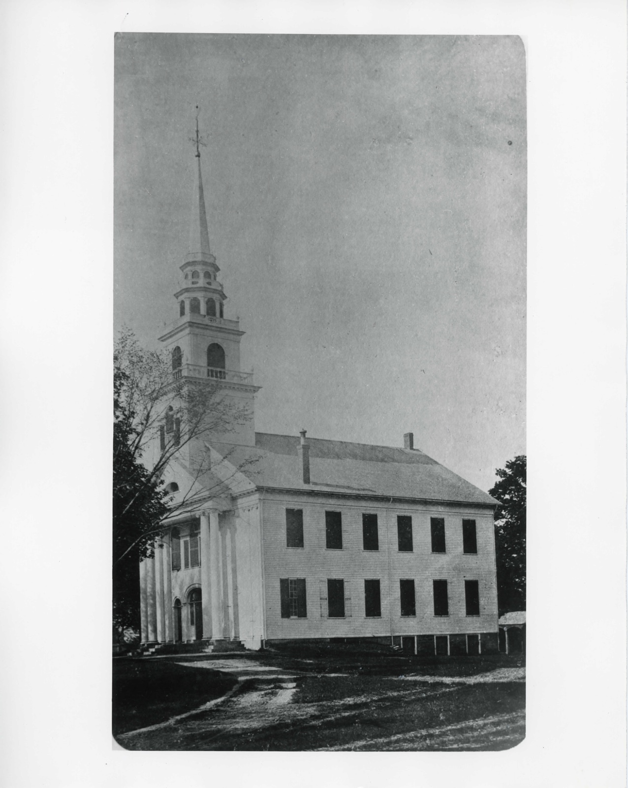
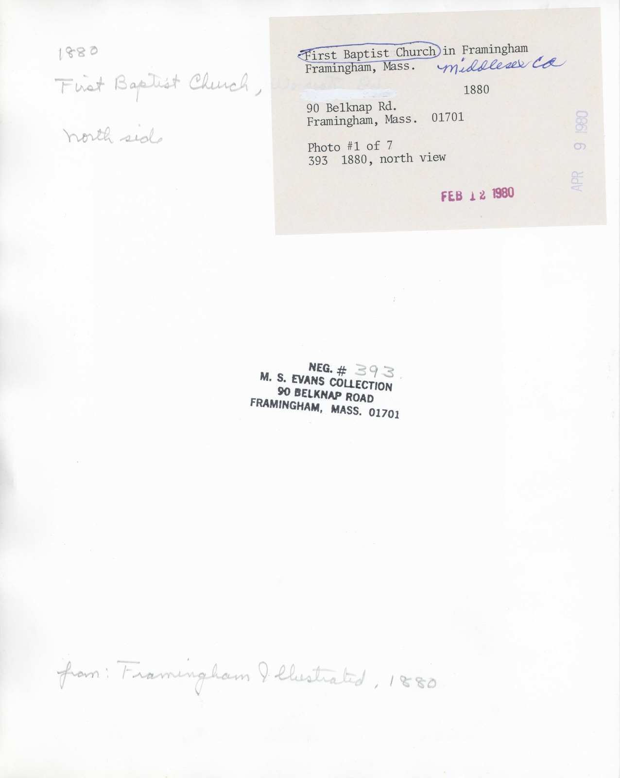
Photographs from the nomination case file, National Park Service records.
First Baptist Church
Listed on the National Register of Historic Places in
1980. A historic map-sheet match is not published yet. The record needs a coordinate-quality review before it can be joined to a sheet boundary.
From the record
one of 1100 National Register listings in Middlesex County · listed in 1980 · category: Building · one of 3 National Historic Landmarks in Middlesex County.
National Register reference number.80000642- the number the National Park Service assigned this property when it was listed, and the key its nomination file is catalogued under at the National Archives.
'^ Capt. Jabez Pnfferoi Sudbury, first son of Jabez, b. Braintree, 1705 ; d. Sudbury, June 21, 17S9; bur. in the cemetery at Sudbury Center (formerly the Rocky plains or the West precin(5l of Sudbury); m. first, July 24, 1731, Thankful Haynes (d. June 24, 1737 "in 30th year"); m. second, Oct. 18, 1738, Hannah Treadway (b. Mar. 19, 1715, d. July 28, 1777), dau. of Benjamin and Mary (Maynard) Treadway of Framingham, and also the heroine of Indian captivity - a tradition preserved in the family Bible of a Gibson descendant, written in his own hand as follows: "Our grandmother Puffer was taken captive by the Indians at the age of 18, she was with them
Regional context, not property-specific
evidence. The
federal wildfire occurrence database
lists 61 fires within 5 miles of First Baptist Church between
2015 and 2020, burning about 102 acres in total. None started naturally. 23 were recorded as arson.
Distance is straight-line from the map coordinates, so a fire counted
here may appear on a neighbouring settlement's page as well.
Reported cause
Fires
Arson/incendiarism
23
Missing data/not specified/undetermined
15
Debris and open burning
9
Recreation and ceremony
7
Smoking
5
Equipment and vehicle use
1
Misuse of fire by a minor
1
The most recent of
them, most recent first, with the day each was reported and the service
that recorded it.
Regional context, not property-specific
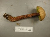
evidence. Museums hold 2,032 specimens
collected within 10 miles of First Baptist Church between 1898 and
1975: 894 Animalia, 629 Plantae, 445 Fungi, 27 Protozoa, 17 Bacteria, 12 Chromista, 8 Unrecorded. 12 distinct Species records are shown.
Collected by ?, A B Seymour, A B. Proper and others. Each is a
physical object with a catalogue
number, and each entry opens the museum's record. This is what was
collected and kept, not a survey of what lives here - nothing can be
concluded from a species being absent.
Regional context, not property-specific
evidence. The federal mineral resources record lists
12 workings within 5 miles of First Baptist Church: 10 plants, 2 past producers.
10 still produce. What was taken out: Iron, Lead, Tantalum, Niobium (Columbium). Distance is straight-line from the
map coordinates, so a quarry counted here may appear on a neighbouring
settlement's page as well.
Regional context, not property-specific
evidence. The National Weather Service names
Framingham, the town this property stands in, in 30 storm reports between 1993 and 2024: 10 thunderstorm wind, 9 flood, 6 hail, 2 lightning.
The reports record 1 injury. Each account below is quoted exactly as the forecast office
filed it, from the NOAA Storm Events Database, and each date
opens the federal record of that event.
Numerous trees and limbs were downed by thunderstorm winds on the south side of Framingham. A tree fell on a person on Beaver Street. The person sustained minor injuries.
Pearl, Sanger, Waverly, Beech, Henry and Thompson Streets and Union Avenue were all flooded and impassable. Cars were stuck in flood waters on Union Avenue. Waverly Street was closed near Marble Street where several cars were stuck. Cars were stuck in flood waters on Route 9, Union Avenue, Beech Street, and Henry Street. The intersection of Bishop Street and Lawrence Street was closed. Several cars were stuck in flood waters. Parts of Route 9 were flooded with four to five feet of water.
Another round of heavy rain resulted in renewed flooding across Wellesley and Natick. Information on flooding in Wellesley can be found in a similar report for Norfolk County. In Natick, a car became stuck in flood waters on South Main Street. Flooding occurred under the Willow Bridge. Route 9 near the Natick Police Department, Pearl Street, and Plain Streets were all flooded and impassable.
Route 9 was flooded in both directions at Route 126, making Route 9 impassable. Speen Street at Cochituate Road was also flooded with a car stuck in the flood waters there.
In Framingham, Rt 9 (Worcester Rd) at Rt 126, as well as the ramps on Rt 126 were closed due to flooding. A car was stuck at this intersection. Also, Gates St at Parker Rd was impassable.
Thunderstorms produced weak wet microbursts across the Southern portion of Middlesex County on the afternoon on the 29th. Trees were downed in Framingham where a tree split a car in half. Trees were also downed in Sherborn and Ashland which resulted in power outages.
Numerous wires and trees down in Framingham...especially the south side of town. Lightning caused a fire resulting in extensive damage to a home. Additionally, there were unconfirmed funnel cloud sightings this evening in Arlington Heights, Concord and Stoneham and in all of Boston's north and northwest suburbs. There were numerous reports of pea- to marble-size hail from southeast Middlesex and southern Essex Counties between 1744 EST and approximately 1945 EST, mainly from the northwest to northeast of Boston. Lightning caused numerous power outages and fires but were unable to be detailed due to unknown times and lack of detailed data. Torrential rains fell in parts of Boston's northern suburbs near Route 128.
No historic map-sheet match is published
for this property yet. That does not mean no map exists. This record needs
a coordinate-quality review before it can be joined to a sheet boundary.
Browse the county's mapped places while that work is
pending.
From the nomination file
2,621 words on record
When this property was proposed for the
National Register, someone wrote the case for it: what the building is,
and why it matters. That document is a federal record in the public domain.
It is quoted below word for word, never summarised. The text was read off the scanned case file by machine, so the
occasional stray character is the recogniser's and the 1970s
typewriter's.
Description of the property
The First Baptist Church at Framingham Centre is a Federalist style building of timber- frame construction. At its east end, the structure rests on a foundation of hammered granite, while its west-end foundation is made of squared granite rubble which dates from 1856 when this end of the foundation was enclosed. Except for the facade which is covered with matched boarding, the church is covered with clapboards and is trimmed on all elevations with frieze and modillioned cornice. The main body of the church (54'X64') and a west end ell (32'X 12'), are enclosed by pitched roofs covered with slate.
Projecting out from the symmetrical facade (5'-9") and set on a base of two granite steps is an Ionic portico, consisting of two pairs of Ionic columns supporting a frieze, modillioned cornice and a pediment with a semi-elliptical fanlight. The,main body of the facade is framed by four pairs of Ionic pilasters, one pair at each corner and two pairs set behind 'the portico in positions corresponding to the portico's columns. These also support an entabulature and pediment. Beneath the portico, at the first story, is a wide- center entry flanked by two narrower entries, all with panelled doors. . The center door . is framed by an elliptical arch beneath which are a fanlight and sidelights while the narrower entries are framed by semi-circular arches with fanlights only.
At the center of the second story is a Palladian window framed by pilasters which support a frieze and modillioned cornice. Flanking this central window or two windows with semi-circular arched heads. Above the facade is a tower which rises in five stages, the last of which is a steeple, 19'7" high.
/Architect Solomon Willard, Architect Colonel David Harrington, Builder Statement of Significance (in one paragraph) The First Baptist Church of Framingham possesses integrity of location, design materials and workmanship, as well as historical association with the brief develop- ment of old Framingham Centre in the early nineteenth century and with a prominent Boston architect. Now the oldest church building extant in Framingham, the First Baptist Church is an especially sophisticated local example of Federalist architecture, one which retains nearly all of the original decorative details of its neo-classical facade.
Planned to replace a smaller Baptist church, the present church was designed by Solomon Willard of Boston and built on a prominent site facing the Boston-Worcester Turnpike (Route 9). Opened in the early nineteenth century, this turnpike encouraged the commercial devel- opment of Framingham Center, until the Turnpike Corp. was dissolved in 1843 and the area was by-bassed by train lines in 1853. During its major period of growthy Fram- ingham Centre became built-up with a number of Federalist buildings, of which the First Baptist Church is the finest example. The present church was begun in 1825 and the cornerstone was laid on November 17, 1825 at a ceremony which included Masonic rites.
Completed in 1826, the building was dedicated on January 1, 1827 and has remained in use by the same congregation since then. Trained as a carpenter and cabinet-maker, the church's architect, Solomon Willard (1788-1862) is known for his wood and stone-carving in Boston as well as for the con- struction of a spiral staircase in Boston's Exchange Coffee House of 1808. Willard is thought to have studied architecture in Boston with Asher Benjamin, after which he maintained his own architecture office and architectural school between ca.
Quoted from the National Register nomination
for reference 80000642, 18 pages, held by the National Archives in Record
Group 79. See the
catalogue record.
Listed places nearby
6 within 8 miles
Other National Register properties close
enough to walk or drive between, ordered by distance from this one. Both
positions come from the same geocoding pass that matched these properties
to their map sheets.
Listing record. National Park Service National Register of Historic Places, listed-properties dataset, current to 2026-05-22.
Map join. Address geocoded through the United States Census geocoder, then tested against the published boundary of every sheet in the USGS Historical Topographic Map Collection.
How this page is made. Listing fields come from federal records; map-sheet coverage is a labelled coordinate-to-boundary calculation, not a source-field claim.
Wildfire. Short, Karen C. 2022. Spatial wildfire occurrence data for the United States, 1992-2020 [FPA_FOD_20221014]. 6th Edition. Fort Collins, CO: Forest Service Research Data Archive. https://doi.org/10.2737/RDS-2013-0009.6 Collected with United States Government funding and usable without additional permissions or fees.
Specimens. Global Biodiversity Information Facility (GBIF), https://www.gbif.org/. Only records licensed CC0 or CC BY are used. Records licensed CC BY-NC are excluded because this site carries advertising. Images are checked individually and any whose licence is non-commercial, no-derivatives or unreadable is refused.
Mines and quarries. USGS Mineral Resources Data System (MRDS) https://mrdata.usgs.gov/mrds/ A work of the United States government, no copyright under 17 U.S.C. 105.
Storms. NOAA National Centers for Environmental Information, Storm Events Database https://www.ncei.noaa.gov/stormevents/ A work of the United States government, no copyright under 17 U.S.C. 105. Narratives are quoted verbatim from the National Weather Service report and are not edited or summarised.
 Block
Block