Photographs from the nomination case file, National Park Service records.
Lane, David, House
Listed on the National Register of Historic Places in
1980. A historic map-sheet match is not published yet. The record needs a coordinate-quality review before it can be joined to a sheet boundary.
From the record
“In 1789 the Legislature provided for districting the towns, and Bedford undertook the task, which proved to be a difficult one. Forsixty years the only accommodations for schools in the " quarters " were in private houses; but in 1792 a long and trying experience resulted in a vote to raise £100 with which to build a school-house in each quarter and made provision for a school to be taught in each.”
History of the Town of Bedford, Middlesex County, Massachusetts, from Its Earliest Settlement to the Year of Our Lord 1891 ... with a Genealogical Register of Old Families (1891). Machine-read text.
one of 1100 National Register listings in Middlesex County · listed in 1980 · category: Building · one of 3 National Historic Landmarks in Middlesex County.
National Register reference number.80000644- the number the National Park Service assigned this property when it was listed, and the key its nomination file is catalogued under at the National Archives.
What happened here
An account from the chapter on Bedford town, The inset identifies its exact
source book and publication year.
The subject of this sketch was born in Salem, Mass., May 7, 1820, in a house on the opposite corner to the one in which White was murdered by the Kuappa and Crowninshield. In 1821 his parents removed to Moultonborough, N. H., where they lived a few years, and William was sent to the village school for a brief term.
The Trinitarian Congregational Society immediately erected a house of worship on land given by Mr. Jeremiah Fitch, of Boston, a native of Bedford. The building-lot was directly opposite the Stearns mansion, and was given in consideration of the regard of the donor for his neighbor, teacher, pastor and friend.
Ofthirteen children born toRev.Sarauel Stearns and Abigail French, eleven reached maturity. No other Bedford family has exerted so great an influence in the world of letters. They all received the highest advantages for education that the schools aflbrded. The five sons were all educated at Phillips Academy, Andover, and at Harvard College, and the four who became clergymen attended Andover Theological Seminary. Of thirty one grandchildren twenty-three are living. Almost all have received a liberal education. Of the grandsons, two are professional men and one an artist of rare ability ; five granddaughters became teachers, four married professional men ; a number are authors of books or writers for leading periodicals. The
Regional context, not property-specific
evidence. The
federal wildfire occurrence database
lists 36 fires within 5 miles of Lane, David, House between
1992 and 2020, burning about 26 acres in total. 1 started naturally. None was recorded as arson.
Distance is straight-line from the map coordinates, so a fire counted
here may appear on a neighbouring settlement's page as well.
Reported cause
Fires
Debris and open burning
18
Missing data/not specified/undetermined
14
Recreation and ceremony
3
Natural
1
The most recent of
them, most recent first, with the day each was reported and the service
that recorded it.
Regional context, not property-specific
evidence. Museums hold 1,106 specimens
collected within 10 miles of Lane, David, House between 1898 and
1975: 494 Animalia, 357 Plantae, 236 Fungi, 7 Chromista, 6 Unrecorded, 4 Protozoa, 2 Bacteria. 12 distinct Species records are shown.
Collected by ?, A. B. Seymour, A. B. Seymour & M. D. Feigley and others. Each is a
physical object with a catalogue
number, and each entry opens the museum's record. This is what was
collected and kept, not a survey of what lives here - nothing can be
concluded from a species being absent.
Regional context, not property-specific
evidence. The federal mineral resources record lists
10 workings within 5 miles of Lane, David, House: 6 past producers, 2 producers, 1 occurrence, 1 plant.
3 still produce. What was taken out: Sand and Gravel, Construction, Copper, Titanium. Distance is straight-line from the
map coordinates, so a quarry counted here may appear on a neighbouring
settlement's page as well.
Regional context, not property-specific
evidence. The National Weather Service names
Bedford, the town this property stands in, in 5 storm reports between 1999 and 2020: 3 thunderstorm wind, 2 lightning.
No death or injury is recorded in these reports. Each account below is quoted exactly as the forecast office
filed it, from the NOAA Storm Events Database, and each date
opens the federal record of that event.
A powerful microburst occurred in Bedford with estimated 90 to 100 mph wind gusts. Approximately 50 to 70 trees were blown down, most of them healthy pine trees 100 feet tall. The trees were blown down, snapped at least halfway up, or uprooted. Eight trees fell onto houses causing significant damage. On Hilltop Drive and Hemlock Lane alone, more than two dozen pine trees were knocked down.
No historic map-sheet match is published
for this property yet. That does not mean no map exists. This record needs
a coordinate-quality review before it can be joined to a sheet boundary.
Browse the county's mapped places while that work is
pending.
From the nomination file
2,194 words on record
When this property was proposed for the
National Register, someone wrote the case for it: what the building is,
and why it matters. That document is a federal record in the public domain.
It is quoted below word for word, never summarised. The text was read off the scanned case file by machine, so the
occasional stray character is the recogniser's and the 1970s
typewriter's.
Description of the property
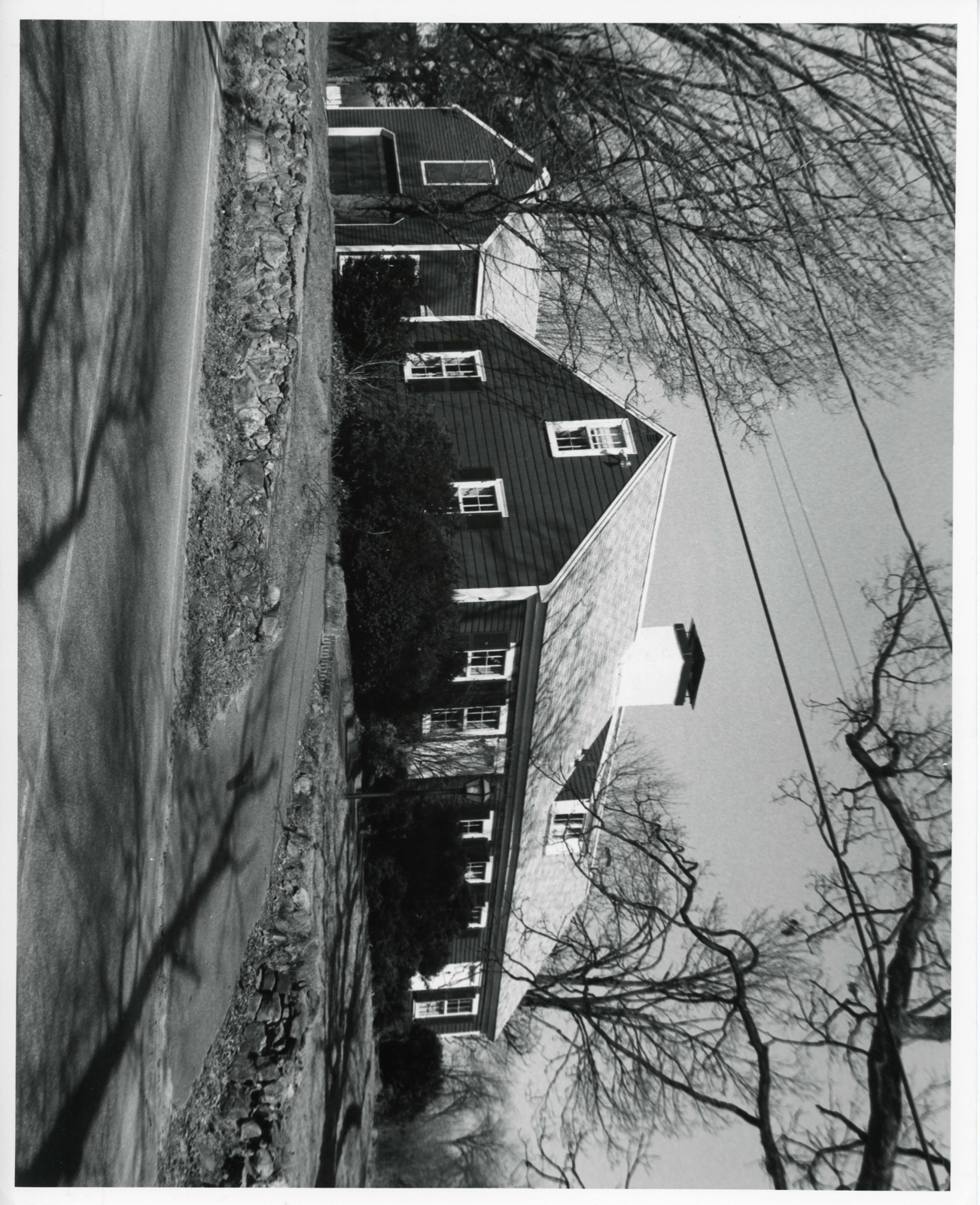
TheDavid Lane House stands on the east side of North Road at the crest of a low hill, a site from which its comnon name of "House on the Hill" is partially derived. The house is made up of a one-and-half story main house, a two story main house, a two-story rear wing, a one story connector and a two-story garage, all of which are enclosed by pitched roofs. The garage and facade (south elevation) of the main house are covered with clap- board, while all other elevations are covered with wooden shingles. Windows throughout the house consist of 6/6 sash set in moulded surrounds with louvred blinds, except where noted otherwise. The main house is rectangular in plan and rests on a dry wall foundation of granite fieldstone.
Slightly west of center is a central chimney, which rests on a fieldstone base. The facade (south elevation) is asymmetrical; from west to east, it contains two windows, a six panel door, one 4/4 window, two windows, a six panel door and one window, above which is a boxed cornice. Centered on the south slope of the roof is a shed dormer containing two four-pane lights. The house's end walls (east and west elevations) are identred in ace gonteininhe eastern end of aced wiad (noat televastontis b anded by ine ell; the western end of the rear elevation contains three windows at the first story and a shed dormer with three windows at the attic. The rear ell has exposed elevations on its east and west sides only.
The west elevation is asymmetrical, consisting of an entry and two windows at the first story and two windows at the second story.
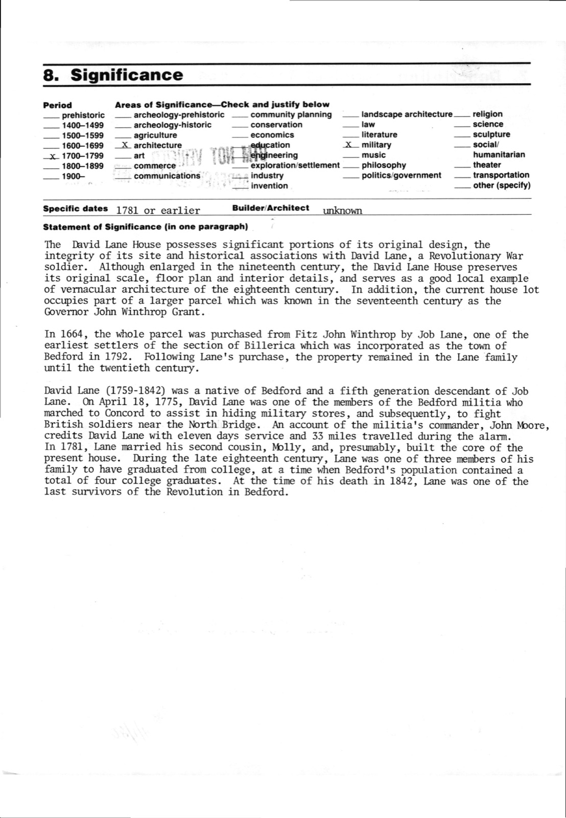
/Architect unknown Statement of Significance (in one paragraph) The David Lane House possesses significant portions of its original design, the integrity of its site and historical associations with David Lane, a Revolutionary War soldier. Although enlarged in the nineteenth century, the David Lane House preserves its original scale, floor plan and interior detalls, and serves as a good local example of vernacular architecture of the eighteenth century. In addition, the current house lot occupies part of a larger parcel which was known in the seventeenth century as the Governor John Winthrop Grant. In 1664, the whole parcel was purchased from Fitz John Winthrop by Job Lane, one of the earliest settlers of the section of Billerica which was incorporated as the town of Bedford in 1792.
Following Lane's purchase, the property remained in the Lane family until the twentieth century. David Lane (1759-1842) was a native of Bedford and a fifth generation descendant of Job On April 18, 1775, David Lane was one of the members of the Bedford militia who marched to Concord to assist in hiding military stores, and subsequently, to fight British soldiers near the North Bridge. An account of the militia's commander, John Moore, credits David Lane with eleven days service and 33 miles travelled during the alarm. In 1781, Lane married his second cousin, Molly, and, presumably, built the core of the present house.
During the late eighteenth century, Lane was one of three members of his family to have graduated from college, at a time when Bedford's population contained a total of four college graduates. At the time of his death in 1842, Lane was one of the last survivors of the Revolution in Bedford.
Quoted from the National Register nomination
for reference 80000644, 14 pages, held by the National Archives in Record
Group 79. See the
catalogue record.
Listed places nearby
6 within 8 miles
Other National Register properties close
enough to walk or drive between, ordered by distance from this one. Both
positions come from the same geocoding pass that matched these properties
to their map sheets.
Listing record. National Park Service National Register of Historic Places, listed-properties dataset, current to 2026-05-22.
Map join. Address geocoded through the United States Census geocoder, then tested against the published boundary of every sheet in the USGS Historical Topographic Map Collection.
How this page is made. Listing fields come from federal records; map-sheet coverage is a labelled coordinate-to-boundary calculation, not a source-field claim.
Wildfire. Short, Karen C. 2022. Spatial wildfire occurrence data for the United States, 1992-2020 [FPA_FOD_20221014]. 6th Edition. Fort Collins, CO: Forest Service Research Data Archive. https://doi.org/10.2737/RDS-2013-0009.6 Collected with United States Government funding and usable without additional permissions or fees.
Specimens. Global Biodiversity Information Facility (GBIF), https://www.gbif.org/. Only records licensed CC0 or CC BY are used. Records licensed CC BY-NC are excluded because this site carries advertising. Images are checked individually and any whose licence is non-commercial, no-derivatives or unreadable is refused.
Mines and quarries. USGS Mineral Resources Data System (MRDS) https://mrdata.usgs.gov/mrds/ A work of the United States government, no copyright under 17 U.S.C. 105.
Storms. NOAA National Centers for Environmental Information, Storm Events Database https://www.ncei.noaa.gov/stormevents/ A work of the United States government, no copyright under 17 U.S.C. 105. Narratives are quoted verbatim from the National Weather Service report and are not edited or summarised.
 Block
Block